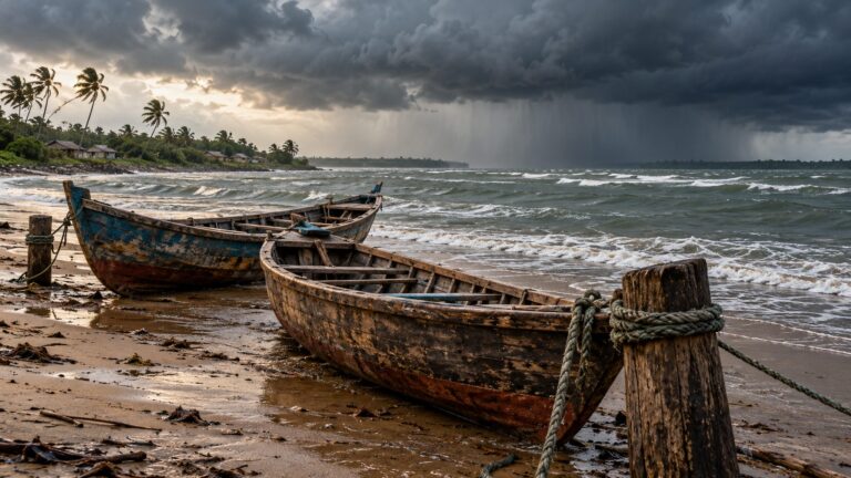
Context – Context – The India Meteorological Department (IMD) has issued a red warning for the coasts of Andhra Pradesh, Odisha and Yanam as the cyclonic storm ‘Montha’ over west central Bay of Bengal has intensified into Severe Cyclonic Storm.
UPSC PYQ:
2024: What is sea surface temperature rise? How does it affect the formation of tropical cyclones?
2022: Discuss the meaning of colour-coded weather warnings for cyclone-prone areas given by the India Meteorological Department.
2014: Tropical cyclones are largely confined to the South China Sea, Bay of Bengal and Gulf of Mexico. Why?
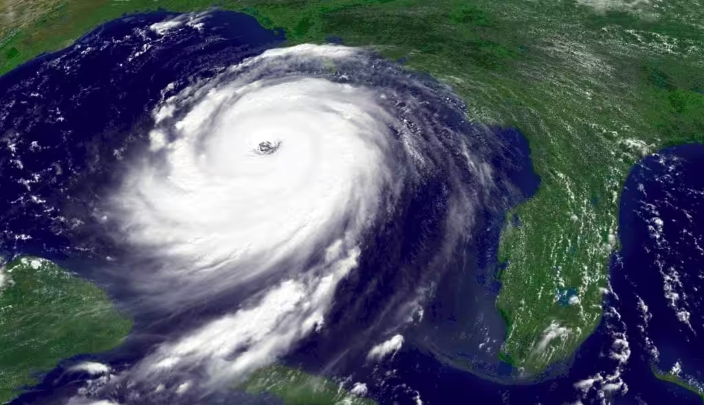
What are Tropical Cyclones?
- It is a type of low-pressure weather system that forms over tropical waters.
- They are surrounded by closed isobars having increasing pressure outward.
- The winds move anti-clockwise in northern hemisphere and clockwise in southern hemisphere.
- They are characterized by strong winds, heavy rainfall.
- Tropical cyclones are known by different names depending on their location, such as hurricanes in the Atlantic and north-eastern Pacific, Willy-willy in North West Australia, typhoons in the northwest Pacific, and cyclones in the South Pacific and Indian Ocean.
What are the conditions required for the formation of Tropical Cyclones?
| Conditions | Function |
| Warm water (more than 27 degree celsius) | Warm water → rapid evaporation → moisture-rich air rises → cloud formation. |
| Abundant supply of moisture | When that moist air rises and condenses into clouds, it releases latent heat — this is the fuel of the cyclone. |
| Low wind shear | It keeps the cyclone structure vertical / aligned and hence it allows the stable eye formation and continuous convection. |
| Pre-existing low pressure | It starts rising motion of air and creates a centre for wind to spiral into. |
| Converging winds | It pushes the warm air upwards |
| Coriolis force | It develops cyclonic vorticity and creates cyclone’s spiral shape. |
How the naming of the cyclones is done?
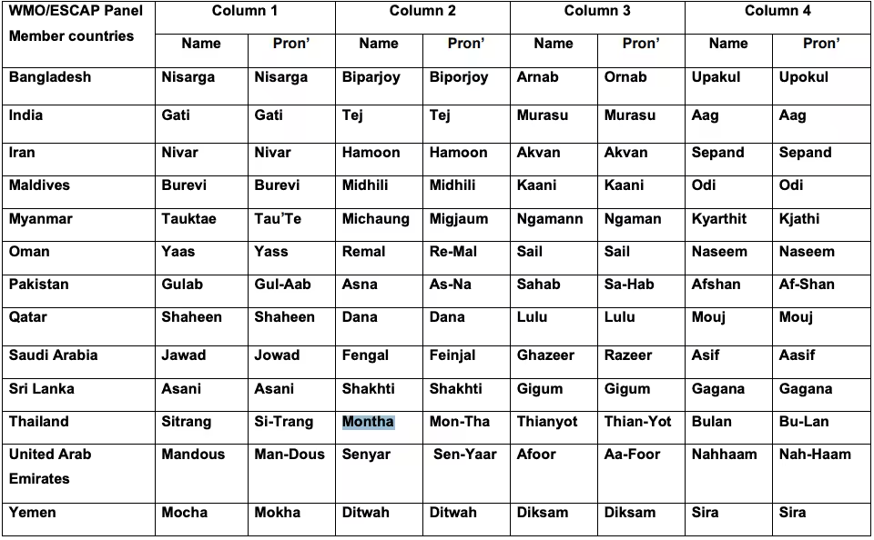
Tropical cyclones are named by regional specialized meteorological centers under the coordination of WMO (World Meteorological Organization). See details.
In the North Indian Ocean Region (India, Bangladesh, Pakistan, Sri Lanka, etc.)
- 13 member countries (India, Pakistan, Bangladesh, Sri Lanka, Maldives, Myanmar, Thailand, Oman, UAE, Yemen, Saudi Arabia, Iran, Qatar)
- Each country submits a list of names in advance.
- These names are used sequentially, one after another.
- Once a name is used, it is not repeated again.
When selecting a new name, consideration is given to certain factors:
- The name should be new. It should not be there in the already existing list of any of the RSMCs worldwide including RSMC New Delhi.
- The proposed name should be neutral to (a) politics and political figures (b) religious believes, (c) cultures and (d) gender
- Name should be chosen in such a way that it does not hurt the sentiments of any group of population over the globe
- It should not be very rude and cruel in nature
- It should be short, easy to pronounce and should not be offensive to any member
- The maximum length of the name will be eight letters
- The proposed name should be provided along with its pronunciation, meaning and voice over
- The Panel reserves the right to reject any name, if any of the criteria above is not satisfied.
Why the East coast of India is more vulnerable to Tropical Cyclones than West coast?
| Factor | East Coast (Bay of Bengal) | West Coast (Arabian Sea) |
| Sea Surface Temperature | Warmer & stable SST → high evaporation | Cooler SST → less evaporation |
| Surrounding Landmasses | Enclosed basin → moisture trapped → cyclones intensify | Open basin → winds disperse → cyclones weaken |
| Freshwater Inflow | Major rivers (Ganga, Godavari etc.) keep surface warm → insulation | Less river inflow → saline mixing → less cyclone support |
| Vertical Wind Shear | Low wind shear → stable cyclone structure | Higher wind shear → cyclone disruption |
| Cyclone Track | Most cyclones move west/northwest → direct India landfall | Many cyclones move toward Oman/Pakistan → avoid India |
| Coastal Shelf | Wide, shallow shelf → high storm surge & flooding | Narrow, steep shelf → lower storm surge impact |
| Frequency | 4–6 cyclones/year (High) | 1–2 cyclones/year (Low) |
“Recent studies by IMD and IITM show that the Arabian Sea is warming faster than the Bay of Bengal — turning into a high-energy heat reservoir due to climate-change–induced heat trapping. This rapid ocean warming, combined with the delayed withdrawal of the southwest monsoon (now extending into October–November), has created ideal conditions for more frequent post-monsoon cyclones. Earlier, strong vertical wind shear in the Arabian Sea used to weaken cyclone formation, but recent research by the IPCC and Nature Climate Change indicates that wind shear has been weakening, allowing cyclones to intensify rapidly into extremely severe categories — as seen in Cyclones Tauktae and Biparjoy. Atmospheric interaction between western disturbances and Arabian Sea cyclones is also shifting landfall zones closer to Gujarat and Maharashtra.”
What are the NDMA Guidelines in this regard?
| Component | Specific NDMA Guidelines |
| Risk Assessment & Mapping | • Coastal districts must have multi-hazard vulnerability maps • Use IMD, INCOIS, NRSC satellite + storm surge modelling • Creation of district-wise Cyclone Risk Atlas |
| Early Warning System (EWS) | • Green / Yellow / Orange / Red alerts • Warning must reach village within 15 minutes • SMS, Sirens, TV, AIR, SATPHONES |
| Evacuation & Shelters | • Zero-fatality policy, forced evacuation allowed • Cyclone shelters every 10 km along coast • Priority: elderly, pregnant, disabled, livestock • Mock drills twice a year |
| Infrastructure & Building Norms | • CRZ norms strictly enforced • Infrastructure must resist 250+ kmph winds • Underground cabling encouraged |
| Preparedness & Capacity Building | • Panchayat-level Disaster Management Committees • Cyclone safety education in schools & communities • Pre-positioning of NDRF, SDRF, Medics |
| Response & Relief | • 72-hour Golden Response Window • Safe water, ORS, sanitation within 24 hrs • Livestock fodder & veterinary support • Damage & Needs Assessment within 48 hrs |
| Post-Cyclone Recovery | • Follow Build Back Better policy • Insurance + crop compensation within 7–10 days • Mangrove & shelterbelt restoration compulsory |
What is the colour coded warning system used by IMD in this regard?
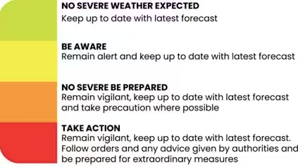
- Green: This color is used for cyclones that are not expected to cause significant damage. The IMD issues a “Green” warning for cyclones that are likely to cause light to moderate rainfall and winds of up to 40 km/h.
- Yellow: This color is used for cyclones that are expected to cause moderate damage. The IMD issues a “Yellow” warning for cyclones that are likely to cause heavy rainfall and winds of 40-60 km/h.
- Orange: This color is used for cyclones that are expected to cause substantial damage. The IMD issues an “Orange” warning for cyclones that are likely to cause very heavy to extremely heavy rainfall and winds of 60-100 km/h.
- Red: This color is used for cyclones that are expected to cause severe damage. The IMD issues a “Red” warning for cyclones that are likely to cause extremely heavy rainfall and winds of more than 100 km/h.
Odisha – A Case Study:
- UN has officially praised Odisha for “World’s Best Practice in Disaster Risk Reduction”. From 10,000 deaths (1999) to nearly 0 deaths today — a revolution in disaster governance. Now being replicated in Bangladesh, Sri Lanka, Myanmar, and Indian coastal states.
- What Odisha Actually Did?
- Built 800+ cyclone shelters along the coast (strong, safe concrete buildings).
- Developed massive evacuation capability — sometimes 10 to 15 lakh people in less than 24 hours
- Created a strong early warning system — alerts reach every village via SMS, sirens, radio, loudspeakers.
- Trained local volunteers (youth, women, fishermen) — called ODRAF & community task forces
- Conducted regular mock drills — so people already knew where to go & what to do.
- Protected natural barriers like mangroves (Bhitarkanika forest) to reduce storm surge.
- Used technology — IMD radar, satellite tracking, control rooms working 24×7
Tell Google you want more of this.
Add Anantam IAS as a preferred sourceOne tap, and this site shows up more often in your own Top Stories, AI Overviews and AI Mode. Remove it any time.