Disclosure: this guide contains Amazon affiliate links. As an Amazon Associate, Anantam IAS earns from qualifying purchases — at no extra cost to you.
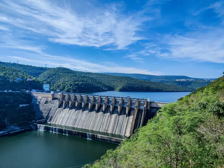
The Indus river map traces one of the world's longest and most historically significant river systems, spanning China (Tibet), India and Pakistan over a length of roughly 3,180 km. Known in Sanskrit as the Sindhu, the river gave its name to the Indian subcontinent and nurtured the Indus Valley Civilisation more than four millennia ago. For UPSC aspirants, mastering the Indus river map means understanding its source, course, major tributaries, the five Punjab rivers, the Indus Waters Treaty, and the river's strategic relevance in Indo-Pakistan relations.
Origin and Source
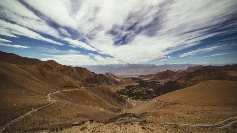
The Indus rises in the Tibetan plateau, near Lake Mansarovar and the sacred Mount Kailash in the Ngari region of China. Its traditional source is the Sênggê Kanbab spring (meaning "lion's mouth") at an elevation of around 5,500 metres. From here, the river flows north-west through Ladakh before taking a dramatic southward turn around the Nanga Parbat massif.
Course of the Indus
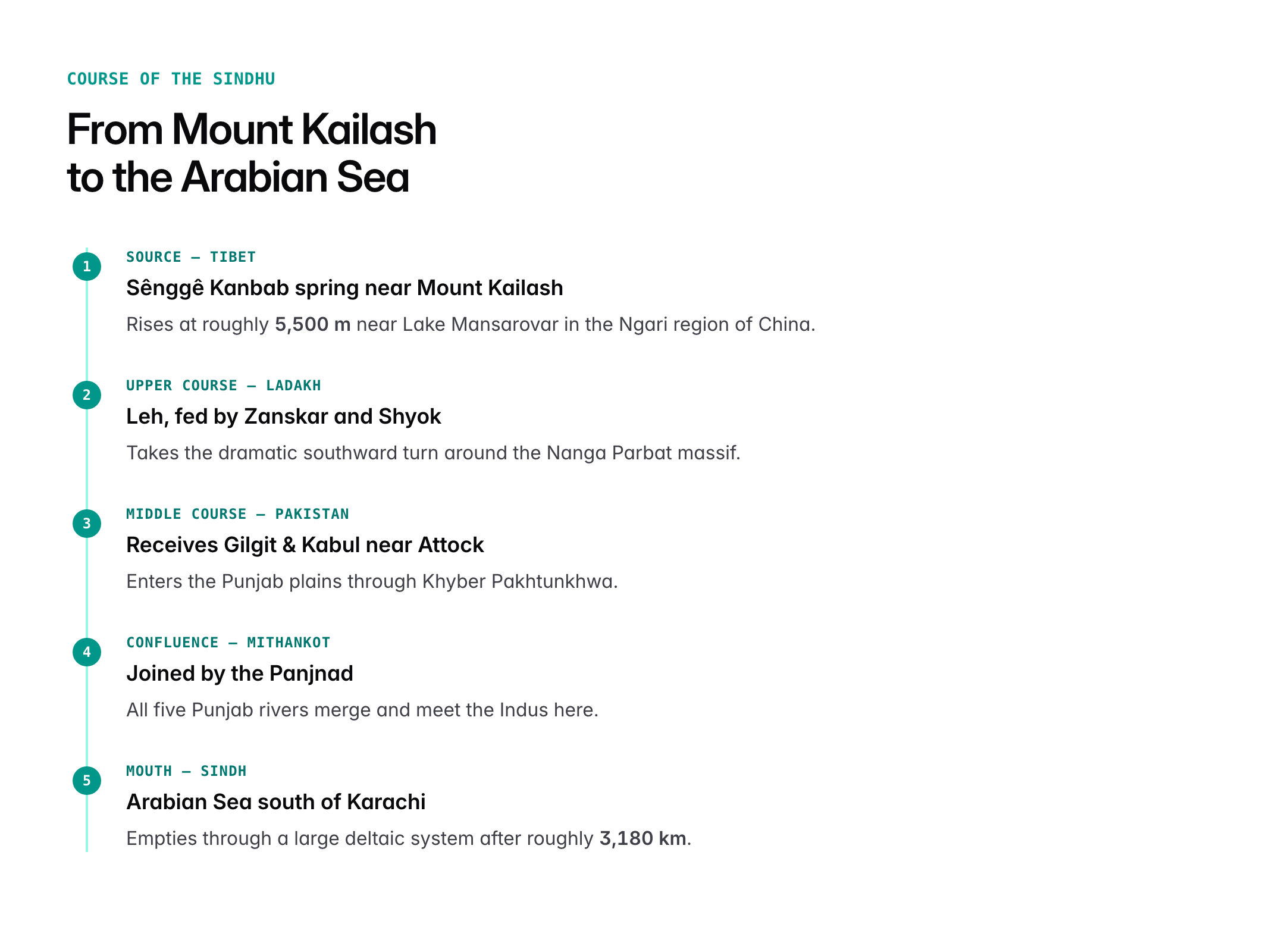
The Indus can be studied in three broad stages.

Oxford Student Atlas for India — 7th Edition
- 160 pages, Oxford University Press, the current edition
- India-focused thematic maps: physical, political, rivers, climate, soils, vegetation, plus world maps
- Made for UPSC and state PSC map work; slim enough to stay open beside the textbook
Upper course (Tibet and Ladakh)
- Flows north-west through the Ladakh range
- Passes through Leh; fed by Zanskar and Shyok
- Enters Gilgit-Baltistan after the Nanga Parbat bend
Middle course (Pakistan's mountains and plains)
- Receives Gilgit and Kabul rivers near Attock
- Flows through Khyber Pakhtunkhwa and into the Punjab plains
Lower course (Sindh and delta)
- Joined by the Panjnad (confluence of five Punjab rivers) near Mithankot
- Flows through the Sindh province
- Empties into the Arabian Sea south of Karachi through a large delta
The Five Tributaries of Punjab
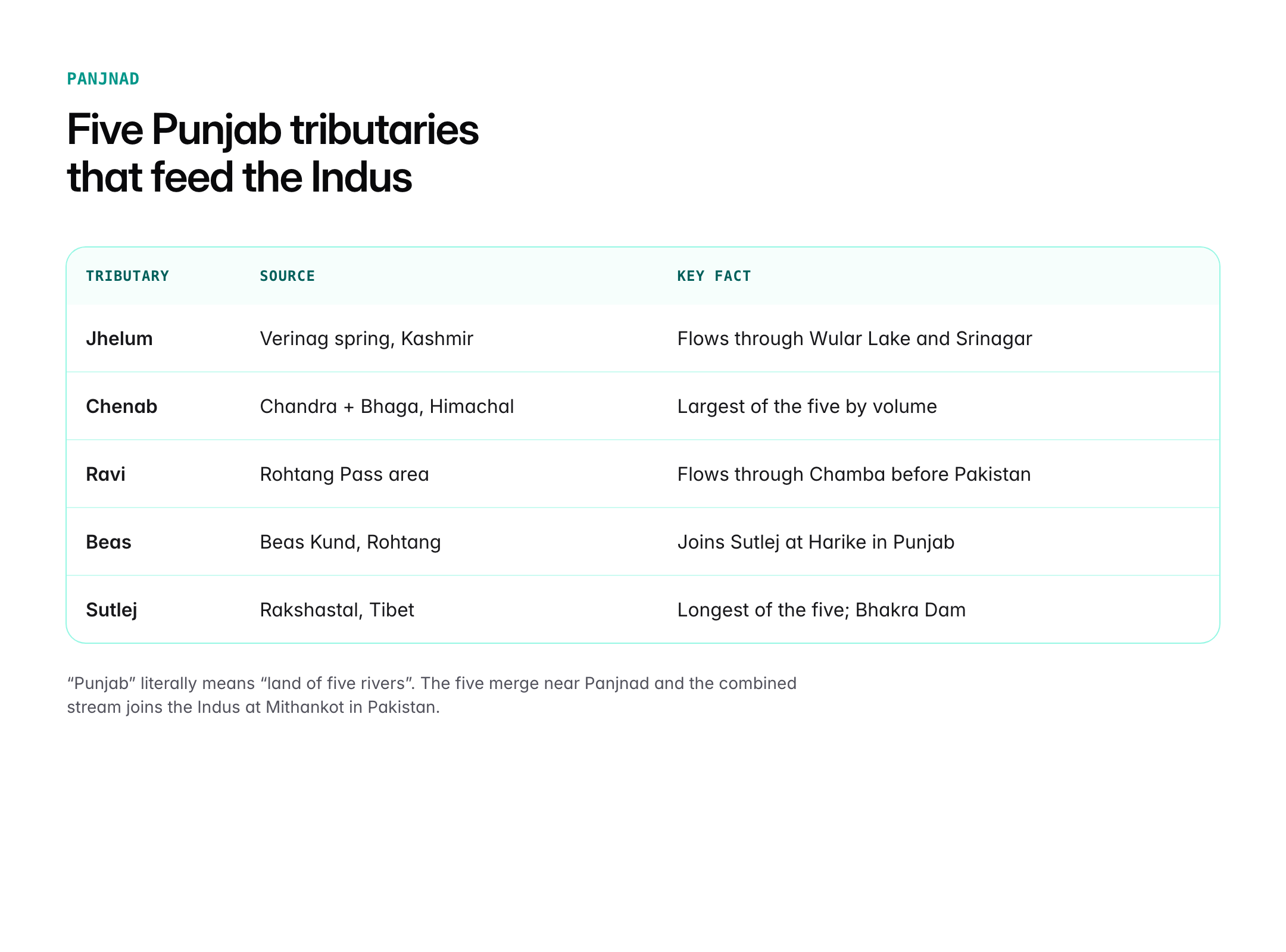
The Indus is joined by five major Himalayan tributaries, known collectively as the Panjnad. The word "Punjab" itself means "land of five rivers".
| Tributary | Source | Key Facts |
|---|---|---|
| Jhelum | Verinag spring, Kashmir | Flows through Wular Lake, Srinagar |
| Chenab | Confluence of Chandra and Bhaga (Himachal) | Largest of the five by volume |
| Ravi | Rohtang Pass area (Himachal) | Flows through Chamba and into Pakistan |
| Beas | Beas Kund (Rohtang) | Joins Sutlej at Harike in Punjab |
| Sutlej | Rakshastal (Tibet) | Longest of the five; Bhakra dam on it |
These five rivers merge near Panjnad and the combined stream joins the Indus at Mithankot in Pakistan.
Other Important Tributaries
Apart from the five Punjab rivers, several right-bank tributaries rise in Afghanistan and the Hindu Kush.
- Shyok (Karakoram; joins Indus in Ladakh)
- Zanskar (joins at Nimmu)
- Gilgit (from the Pamir / Karakoram ranges)
- Kabul (from Afghanistan, joins near Attock)
- Kurram, Tochi, Gomal (from the Sulaiman range)
Key Geographical Features on the Indus
- Nanga Parbat Bend: One of the most spectacular features in global physiography; the Indus carves a deep gorge around Nanga Parbat.
- Tarbela Dam (Pakistan): Among the largest earth-filled dams in the world.
- Bhakra-Nangal Dam: On the Sutlej, a key multipurpose project in India.
- Indus Delta: Extends over the Arabian Sea coast; home to mangroves and Ramsar-listed wetlands in Pakistan.
The Indus Waters Treaty, 1960
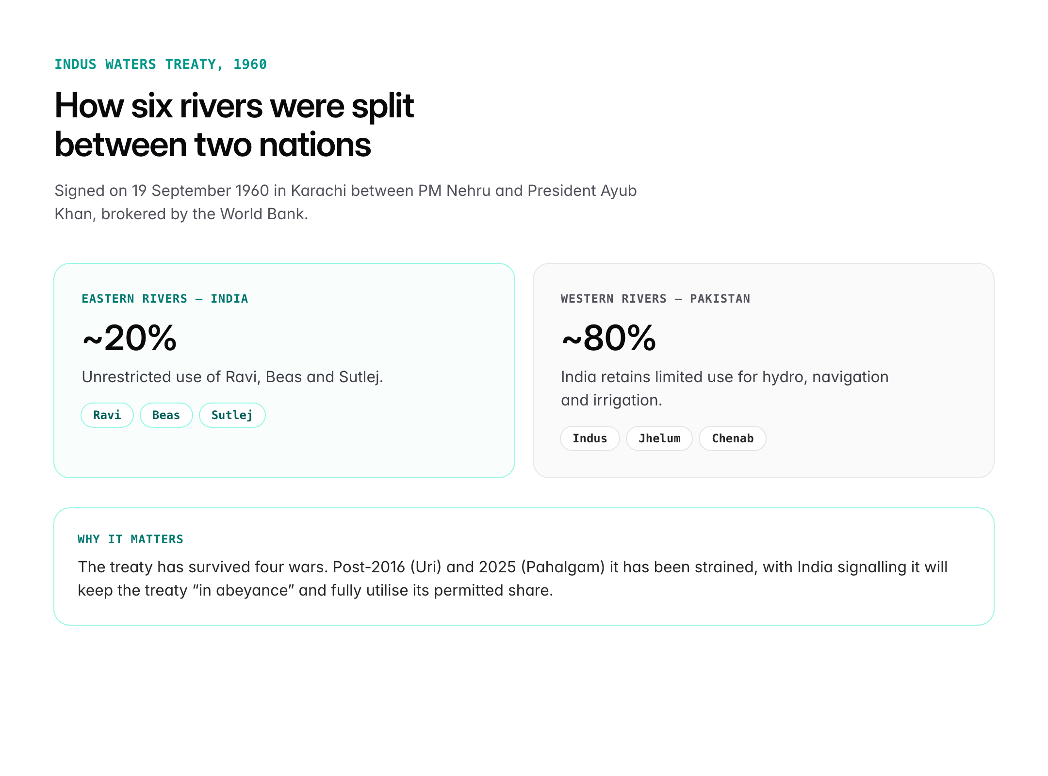
Brokered by the World Bank, the Indus Waters Treaty was signed in Karachi on 19 September 1960 between Prime Minister Jawaharlal Nehru and President Ayub Khan. It divides the six rivers of the Indus system:
| Waters | Rivers | Allotted To |
|---|---|---|
| Eastern Rivers | Ravi, Beas, Sutlej | India (unrestricted use) |
| Western Rivers | Indus, Jhelum, Chenab | Pakistan (with limited Indian use for hydro, navigation, irrigation) |
India is entitled to around 20 per cent of the total waters, Pakistan to roughly 80 per cent. Despite four wars, the treaty has survived, but after the Uri and Pahalgam terror attacks India has signalled a tougher approach, including a move to keep the treaty "in abeyance" and fully utilise its permitted share.
Significance of the Indus System
Civilisational
- Cradle of the Harappan / Indus Valley Civilisation (c. 3300–1300 BCE) at sites such as Harappa, Mohenjo-daro, Dholavira and Rakhigarhi.
- Named in the Rig Veda as the "Sindhu"; source of the words India, Hindu and Hindustan.
Hydrological and economic
- Supports the Indus Basin Irrigation System, one of the largest contiguous irrigation networks in the world.
- Hydropower potential on Indian tributaries (Baglihar, Kishanganga, Ratle, Sawalkot projects).
- Lifeline of Ladakh, Himachal, Punjab (both sides), Sindh.
Ecological
- Habitat of the Indus River Dolphin (Platanista gangetica minor), a critically endangered freshwater cetacean.
- Rich delta ecosystem, though threatened by upstream diversion and climate change.
Strategic
- A cornerstone of India-Pakistan relations; increasingly linked to counter-terrorism diplomacy.
- Lies close to the China-Pakistan Economic Corridor (CPEC) zone in Gilgit-Baltistan, raising strategic concerns for India.
Environmental Challenges
- Glacial retreat in the Karakoram-Himalaya due to climate change.
- Heavy sediment load; the Indus is among the world's most sediment-charged rivers.
- Over-extraction of water for agriculture leading to saline intrusion in the delta.
- Biodiversity loss, particularly of the Indus River Dolphin.
UPSC Relevance
Prelims focus
- Source, length, mouth, states/countries it passes through
- Five Punjab rivers and their individual sources
- Indus Waters Treaty: year, mediator, allocation
- Indus River Dolphin, Indus delta Ramsar sites, major dams
Mains GS-I angle
- Distribution of key natural resources across India and South Asia
- Geographical features and their relationship with settlement patterns
Mains GS-II angle
- India and its neighbourhood: water diplomacy; role of the World Bank in transboundary treaties
Mains GS-III angle
- Conservation of rivers; climate change and Himalayan cryosphere
Sample PYQ-style question
"Discuss the significance of the Indus Waters Treaty, 1960, and examine the challenges to its continuance in the current strategic environment." (GS-II, 15 marks)
Tell Google you want more of this.
Add Anantam IAS as a preferred sourceOne tap, and this site shows up more often in your own Top Stories, AI Overviews and AI Mode. Remove it any time.