Disclosure: this guide contains Amazon affiliate links. As an Amazon Associate, Anantam IAS earns from qualifying purchases — at no extra cost to you.
Introduction
The Indus River System is one of the longest and most historically significant river systems of South Asia. Rising in the Tibetan plateau near Lake Mansarovar, the Indus and its tributaries drain parts of China, India, and Pakistan, nourishing the Indus Valley Civilisation for five millennia and underpinning the modern economies of the region. For UPSC aspirants, mastering the Indus system is essential for Indian geography, water resources, and international relations (the Indus Waters Treaty).
This guide covers the river's origin, course, major tributaries, basin characteristics, the Indus Waters Treaty, economic importance, and UPSC relevance.
Origin and Course
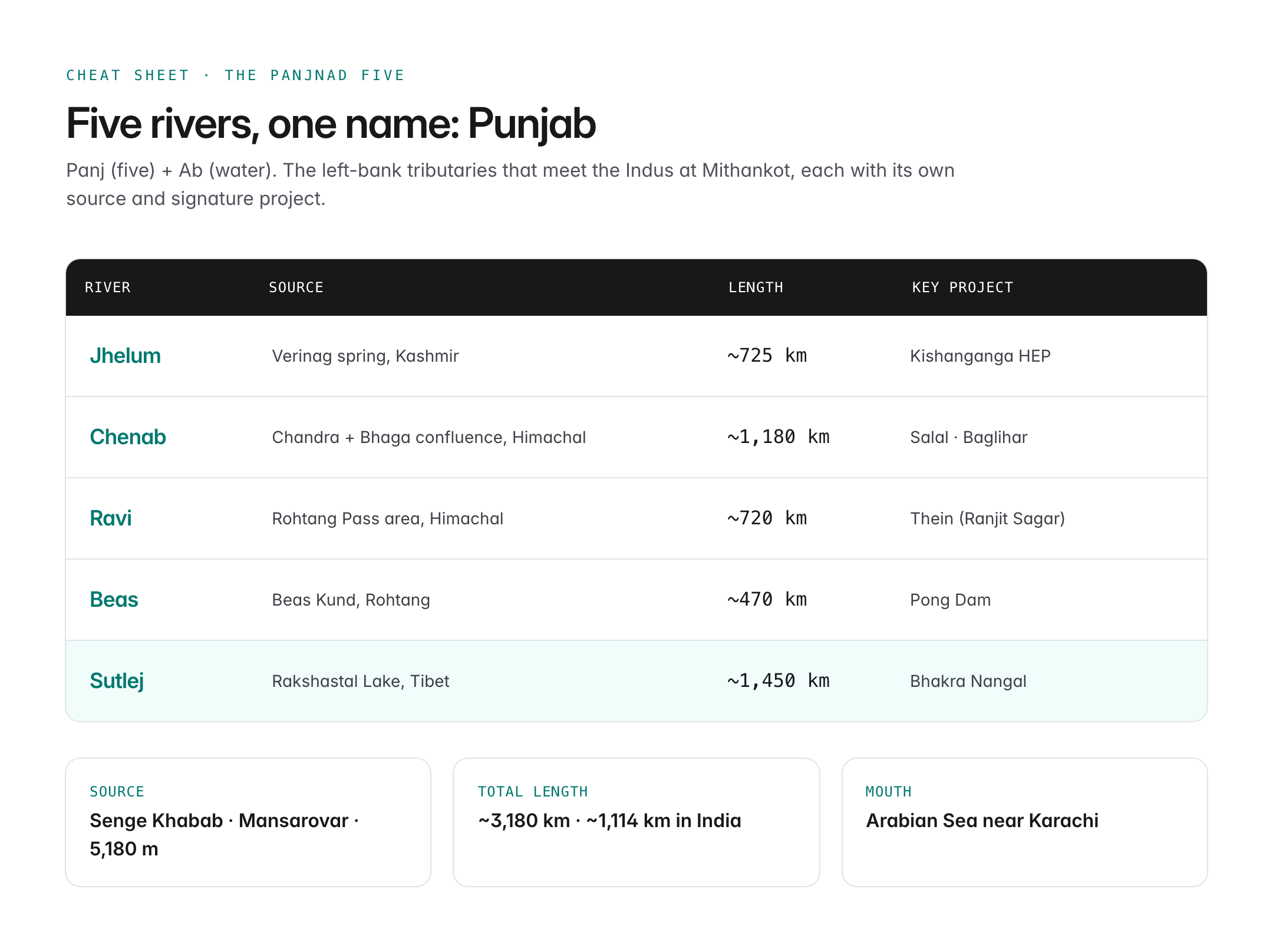
- Source: A glacial spring known as Senge Khabab near Lake Mansarovar and Mount Kailash in the Tibetan Plateau, at about 5,180 m elevation.
- Total length: Approximately 3,180 km, of which roughly 1,114 km lie in India (across Ladakh and Punjab).
- Basin area: About 1,165,000 sq km; India accounts for around 321,000 sq km.
- Mouth: Discharges into the Arabian Sea near Karachi, Pakistan, forming a large delta.
The Indus enters India through Ladakh, flowing northwest between the Ladakh and Zaskar ranges. It is joined by the Zaskar near Leh, cuts a deep gorge around Nanga Parbat (8,126 m) — one of the deepest gorges on Earth at over 5 km deep — and then flows south into Pakistan.

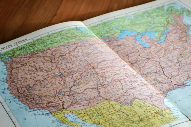
Oxford Student Atlas for India — 7th Edition
- 160 pages, Oxford University Press, the current edition
- India-focused thematic maps: physical, political, rivers, climate, soils, vegetation, plus world maps
- Made for UPSC and state PSC map work; slim enough to stay open beside the textbook
Major Tributaries
The Indus is fed by two sets of tributaries — right-bank (mostly Afghan-origin) and left-bank (the classic Panjnad rivers of Punjab).
Right-Bank Tributaries
- Shyok — rises in the Karakoram; joins near Keris.
- Gilgit — drains Gilgit-Baltistan.
- Kabul — enters from Afghanistan; joins at Attock.
- Kurram, Gomal, Tochi — drain the North-West Frontier region.
Left-Bank Tributaries — The Panjnad Five
| River | Source | Length |
|---|---|---|
| Jhelum | Verinag spring, Kashmir | ~725 km |
| Chenab | Confluence of Chandra and Bhaga rivers (Himachal) | ~1,180 km |
| Ravi | Rohtang Pass area, Himachal | ~720 km |
| Beas | Beas Kund, Rohtang | ~470 km |
| Sutlej | Rakshastal Lake, Tibet | ~1,450 km |
These five rivers give Punjab its name — Panj (five) + Ab (water). They merge in Pakistan before joining the Indus at Mithankot.
Notable Features
- Wular Lake (Jhelum): India's largest freshwater lake; a Ramsar site.
- Bhakra Nangal Dam (Sutlej): One of the tallest gravity dams in the world.
- Pong Dam (Beas) and Thein Dam (Ravi) — major storage reservoirs.
- Salal, Baglihar, Kishanganga projects — key hydropower plants on Chenab and Jhelum.
The Indus Waters Treaty, 1960
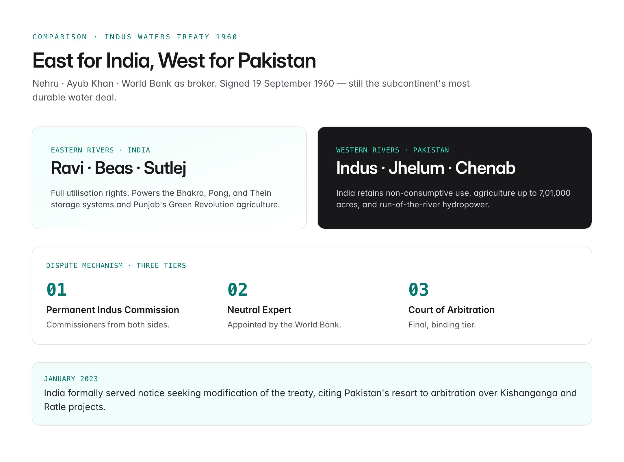
Signed on 19 September 1960 by Prime Minister Jawaharlal Nehru and Pakistani President Ayub Khan, with the World Bank as broker, the Indus Waters Treaty (IWT) allocates river waters between India and Pakistan.
Allocation
| Rivers | Allocated to | Notes |
|---|---|---|
| Ravi, Beas, Sutlej (Eastern rivers) | India | Full utilisation rights |
| Indus, Jhelum, Chenab (Western rivers) | Pakistan | India has limited non-consumptive use |
India can use the western rivers for:
- Domestic use, non-consumptive use (navigation, flood control).
- Agriculture up to 7,01,000 acres.
- Run-of-the-river hydropower without altering flow significantly.
Dispute Mechanism
The treaty has a three-tier graded mechanism:
- Permanent Indus Commission with commissioners from both sides.
- Neutral Expert appointed by the World Bank.
- Court of Arbitration.
India formally served notice in January 2023 seeking modification of the treaty, citing Pakistan's resort to arbitration over the Kishanganga and Ratle projects.
Economic and Ecological Importance
- Supports the world's largest contiguous irrigation system.
- Drives Punjab's Green Revolution agriculture — wheat, rice, cotton, sugarcane.
- Provides hydropower via Bhakra, Pong, Salal, Dulhasti, Baglihar, Kishanganga, and Ratle projects.
- Sustains wetlands such as Harike and Wular (Ramsar sites).
- Supports fisheries including the endangered Indus River dolphin.
Historical Significance
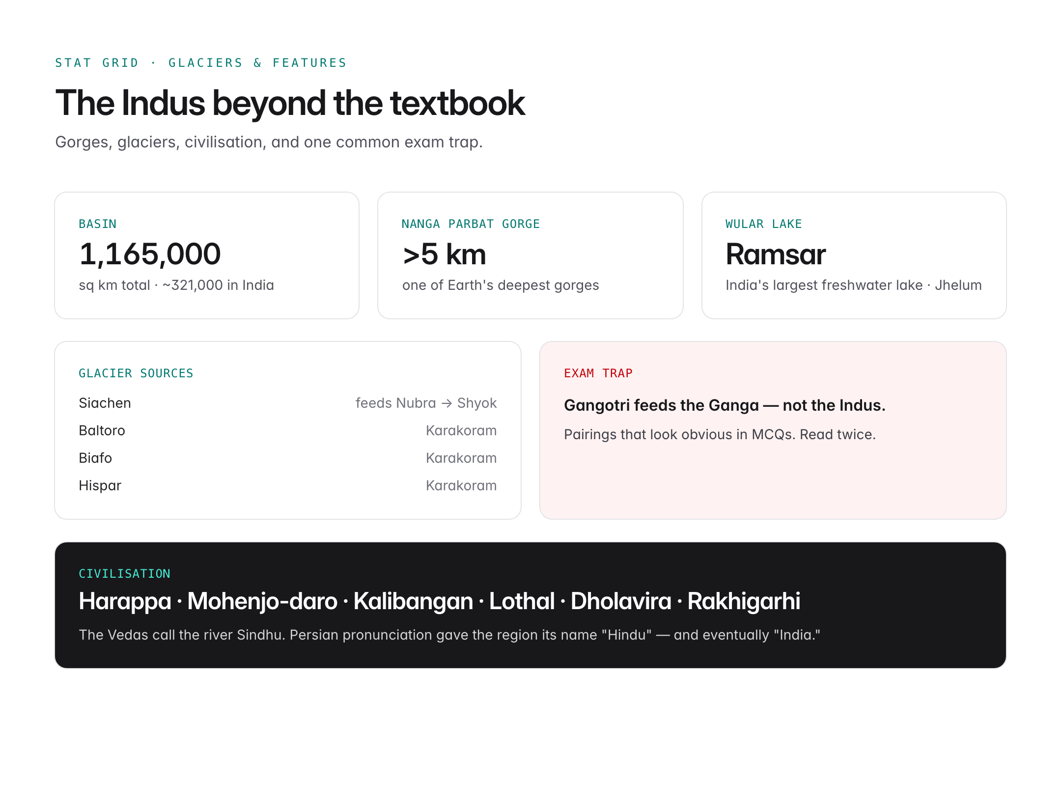
The Indus basin cradled the Indus Valley Civilisation (c. 3300–1300 BCE) — Harappa, Mohenjo-daro, Kalibangan, Lothal, Dholavira, Rakhigarhi. The Vedas refer to the Indus as Sindhu; Persian pronunciation gave the region its name "Hindu" and eventually "India."
Environmental Challenges
- Climate change threatens the Himalayan and Karakoram glaciers that feed the Indus.
- Groundwater depletion in Punjab (Haryana/Rajasthan on adjoining rivers).
- Pollution from industrial effluents and pesticide runoff.
- Declining fish populations and dolphin habitat fragmentation.
- Upstream dams in China on the Tibetan reaches raise long-term concerns.
Glacier Sources
Major glaciers feeding the Indus system include:
- Siachen Glacier — feeds the Nubra (tributary of Shyok).
- Baltoro, Biafo, Hispar glaciers in the Karakoram.
- Gangotri is part of the Ganga system, not Indus — a common exam trap.
UPSC Relevance
Prelims angle: Memorise the source (Mansarovar), mouth (Arabian Sea near Karachi), total length (~3,180 km), and the five Punjab tributaries. Know that India gets the Eastern rivers (Ravi, Beas, Sutlej) and Pakistan gets the Western rivers (Indus, Jhelum, Chenab) under the IWT. Expect MCQs pairing dams to rivers — Bhakra (Sutlej), Pong (Beas), Thein/Ranjit Sagar (Ravi), Salal/Baglihar (Chenab), Kishanganga (Jhelum).
Mains GS I and GS II angle: Use Indus in answers on Himalayan geography, Indian rivers, interlinking of rivers, Indo-Pak relations, and climate change impact on water security. Link to the IWT modification notice and strategic water diplomacy.
PYQ angle:
- "How will the melting of the Himalayan glaciers have a far-reaching impact on the water resources of India?" (Mains 2020)
- Prelims 2020: Match the rivers with the tributaries.
- Prelims 2021: MCQ on Indus Waters Treaty provisions.
The Indus system is a high-yield topic across Prelims, Mains, and Essay — build a mental map of its tributaries and projects.
Tell Google you want more of this.
Add Anantam IAS as a preferred sourceOne tap, and this site shows up more often in your own Top Stories, AI Overviews and AI Mode. Remove it any time.