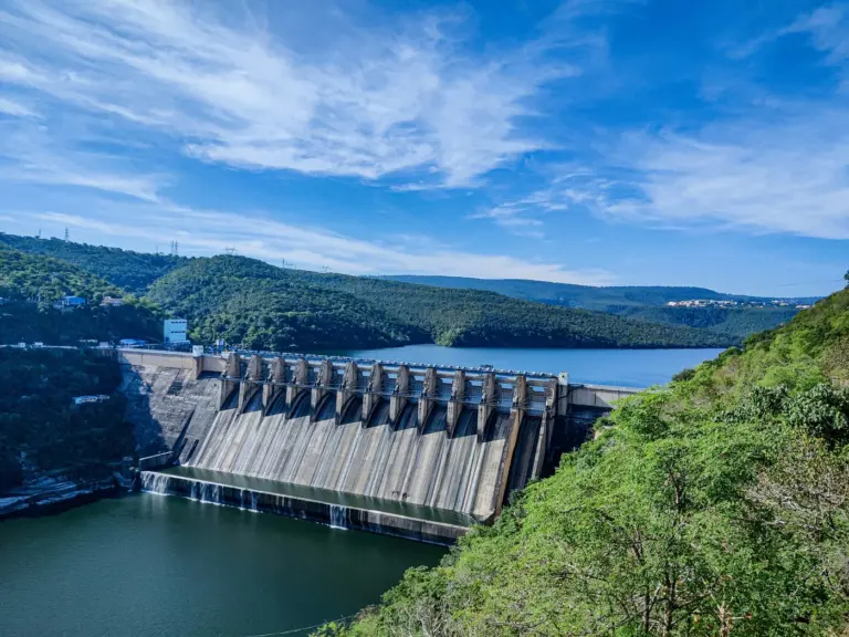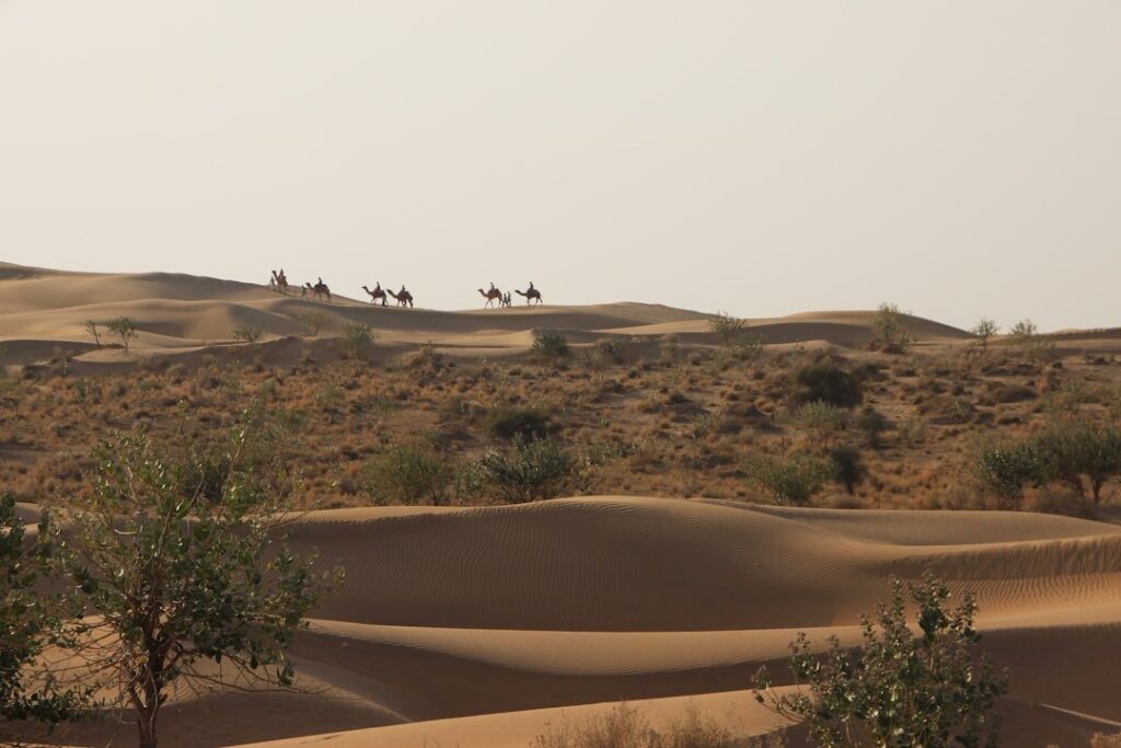
Rajasthan is the largest state in India by area, covering 342,239 square kilometres. Uttar Pradesh is the largest state by population in the latest completed Census, with 199.8 million people in 2011.
The two answers differ because area is a fixed geographical measure while population changes over time. Treat post-2011 population figures as estimates until a newer completed Census supplies the next official state ranking.
The tables below compare area, Census population and density without mixing their reference years. Use the Census of India tables for official population data.
Quick Facts About the Largest State in India
- Largest state in India by area: Rajasthan, 3,42,239 sq km (10.4% of India’s land area)
- Largest state in India by population: Uttar Pradesh, projected 24+ crore (around 16.5% of India)
- Smallest state by area: Goa, 3,702 sq km
- Smallest state by population: Sikkim, around 6.8 lakh
- Total Indian states: 28
- Total Union Territories: 8 (after J&K and Ladakh reorganization 2019)
- Largest Union Territory by area: Ladakh, 59,146 sq km
- Smallest Union Territory by area: Lakshadweep, 32 sq km
- Country area: 32,87,263 sq km (seventh largest in the world)
What Counts as a “State” in India
A state under the Indian Constitution is a federating unit with its own legislature, elected government, and high court, listed in the First Schedule. Union Territories are administered directly by the Centre through Lieutenant Governors or Administrators, though Delhi, Puducherry, and Jammu & Kashmir have elected assemblies. The Constitution under Article 1 calls India a “Union of States” — Dr B.R. Ambedkar deliberately chose “Union” over “Federation” to signal indissolubility.
Boundaries change. The 2000 reorganization carved out Chhattisgarh, Uttarakhand, and Jharkhand. Telangana split from Andhra Pradesh in 2014. Jammu and Kashmir was reorganized into two UTs (J&K and Ladakh) in 2019. The largest state in India by area title belonged to Madhya Pradesh until Chhattisgarh was created in 2000 — Rajasthan has held the position ever since. Read the related explainer on states of India and union territories of India for full context.
Background and Historical Context of Indian State Boundaries
State boundaries in India weren’t drawn on a clean slate. The Government of India Act 1935 created provinces. After Independence, the Constituent Assembly grouped them into Part A, B, C, and D states based on the pre-1947 political status. The first major reorganization came with the States Reorganisation Act 1956, following the Fazl Ali Commission’s recommendations to redraw boundaries on linguistic lines.
That linguistic principle shaped today’s map. Andhra State was carved from Madras Presidency in 1953 after Potti Sriramulu’s fast unto death. Bombay State split into Gujarat and Maharashtra in 1960. Punjab was trifurcated in 1966 into Punjab, Haryana, and the UT of Chandigarh. The northeast was reorganized between 1972 and 1987 to create Meghalaya, Manipur, Tripura, Arunachal Pradesh, and Mizoram. Goa became a state in 1987. The 2000 trio (Chhattisgarh, Uttarakhand, Jharkhand) and the 2014 creation of Telangana followed sub-regional movements. Each redrawing has changed which state held the title of “largest state in India.”
Largest State in India by Area: Top 10 Ranking
The order below uses official state area figures published by the Survey of India and the Ministry of Home Affairs.
| Rank | State | Area (sq km) | Share of India |
|---|---|---|---|
| 1 | Rajasthan | 3,42,239 | 10.41% |
| 2 | Madhya Pradesh | 3,08,252 | 9.38% |
| 3 | Maharashtra | 3,07,713 | 9.36% |
| 4 | Uttar Pradesh | 2,40,928 | 7.33% |
| 5 | Gujarat | 1,96,244 | 5.97% |
| 6 | Karnataka | 1,91,791 | 5.83% |
| 7 | Andhra Pradesh | 1,62,968 | 4.96% |
| 8 | Odisha | 1,55,707 | 4.74% |
| 9 | Chhattisgarh | 1,35,192 | 4.11% |
| 10 | Tamil Nadu | 1,30,058 | 3.96% |
Rajasthan covers the Thar Desert in the west, the Aravalli range cutting diagonally, and fertile zones in the east. Its sheer area shapes everything from solar capacity to drought management to border security with Pakistan. Madhya Pradesh and Maharashtra are nearly tied, separated by barely 500 sq km — Madhya Pradesh edged ahead after Chhattisgarh’s separation in 2000 redistributed area.
Largest State in India by Population: Top 10 Ranking
The latest completed Census is 2011, so this table uses official Census totals rather than presenting a projection as a new count. Andhra Pradesh is shown on its current post-bifurcation boundary.
| Rank | State | Census 2011 population | Share of India |
|---|---|---|---|
| 1 | Uttar Pradesh | 199,812,341 | 16.50% |
| 2 | Maharashtra | 112,374,333 | 9.28% |
| 3 | Bihar | 104,099,452 | 8.60% |
| 4 | West Bengal | 91,276,115 | 7.54% |
| 5 | Madhya Pradesh | 72,626,809 | 6.00% |
| 6 | Tamil Nadu | 72,147,030 | 5.96% |
| 7 | Rajasthan | 68,548,437 | 5.66% |
| 8 | Karnataka | 61,095,297 | 5.05% |
| 9 | Gujarat | 60,439,692 | 4.99% |
| 10 | Andhra Pradesh | 49,386,799 | 4.08% |
Uttar Pradesh’s 80 Lok Sabha seats make the population ranking politically consequential. For present-day population size, cite a named projection and year; for an official completed enumeration, cite Census 2011.
Smallest States in India
The smallest by area is Goa (3,702 sq km), liberated from Portuguese rule in 1961 and made a full state in 1987. By population, Sikkim — at around 6.8 lakh — is the smallest state. Sikkim joined the Indian Union as the 22nd state in 1975. Among Union Territories, Lakshadweep is the smallest by area (32 sq km) and Lakshadweep is also among the smallest by population. Chandigarh, Daman and Diu (now merged with Dadra and Nagar Haveli), and Puducherry are other small administrative units.
For the northeastern states, sizes are modest: Mizoram (21,081 sq km), Manipur (22,327 sq km), Meghalaya (22,429 sq km), Nagaland (16,579 sq km), Tripura (10,486 sq km), and Sikkim (7,096 sq km).
Geographical Context: Why the Top 5 Are So Large
The five largest states by area cluster across central and western India. Rajasthan and Gujarat span the arid and semi-arid west. Madhya Pradesh occupies the Deccan plateau’s north. Maharashtra extends from the Konkan coast to the Vidarbha plains. Uttar Pradesh stretches across the Gangetic plain.
This geography drives administrative challenges. Rajasthan’s low population density (about 200 per sq km) combined with vast area creates last-mile delivery problems for water, electricity, and education. Maharashtra’s rain-shadow regions in Marathwada and Vidarbha contrast sharply with the irrigated Konkan. Madhya Pradesh’s central location makes it a transport hub but also exposes its tribal belt to acute development gaps.
Comparative Analysis: Area vs Population vs Density
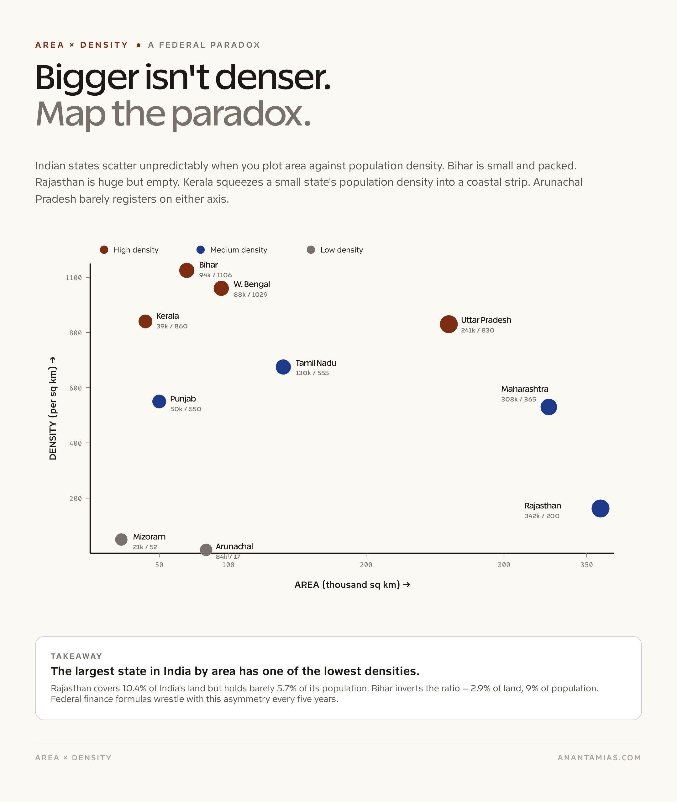
The largest state in India by area isn’t the most densely populated. Population density paints a different ranking.
| State | Area Rank | Population Rank | Density (per sq km) |
|---|---|---|---|
| Bihar | 13 | 3 | ~1,106 |
| West Bengal | 14 | 4 | ~1,029 |
| Kerala | 22 | 13 | ~860 |
| Uttar Pradesh | 4 | 1 | ~830 |
| Punjab | 19 | 16 | ~550 |
| Rajasthan | 1 | 7 | ~200 |
| Mizoram | 24 | 27 | ~52 |
| Arunachal Pradesh | 15 | 26 | ~17 |
Bihar leads density (see highest population density state in India for the full ranking). Arunachal Pradesh has India’s lowest density. The largest state in India by area, Rajasthan, has population density barely a quarter of India’s national average. This mismatch between area and population creates federal finance puzzles — Finance Commission devolution formulas weight both criteria, and how they’re balanced determines whether Bihar or Rajasthan benefits more from any given iteration.
Federal Significance of State Size
State size shapes representation in Parliament. Lok Sabha seats are roughly proportional to population (frozen by the 84th Amendment 2002 until the first census after 2026). Uttar Pradesh sends 80 MPs, Maharashtra 48, West Bengal 42, Bihar 40, Tamil Nadu 39. Rajasthan, despite being the largest state in India by area, sends 25.
Rajya Sabha representation is fixed by the Fourth Schedule regardless of size — UP has 31 seats, Maharashtra 19, Tamil Nadu 18, while Goa, Sikkim, Manipur, and Tripura each get just 1.
State size also affects how India fights elections, plans infrastructure, and runs schemes. PMGSY rural road targets in Rajasthan are different from Kerala. National Highway connectivity in Madhya Pradesh requires longer corridors than Punjab. NREGA workdays vary dramatically across the size spectrum.
Challenges and Significance
Large states face administrative scale challenges. UP’s 75 districts and 800+ blocks stretch state-government bandwidth thin. Rajasthan’s distances make Aadhaar enrolment, vaccination drives, and election logistics expensive. Small states like Sikkim, Mizoram, and Goa enjoy administrative tightness but struggle with diseconomies of scale in higher education, specialized healthcare, and industry. Each option has tradeoffs.
The debate about further state reorganization — proposals for Vidarbha, Bundelkhand, Gorkhaland, Purvanchal — turns partly on these tradeoffs. The Second States Reorganisation Commission, demanded periodically since the 1990s, has never been constituted.
Prelims Pointers
- The largest state in India by area is Rajasthan with 3,42,239 sq km, accounting for 10.41% of national territory
- The largest state by population is Uttar Pradesh, the only Indian state with over 20 crore residents
- The smallest state by area is Goa, 3,702 sq km
- The smallest state by population is Sikkim, around 6.8 lakh
- Ladakh is the largest Union Territory by area at 59,146 sq km after the 2019 reorganization
- Madhya Pradesh held the largest-state title until November 2000
- India’s total land area is 32,87,263 sq km
- States Reorganisation Act 1956 was based on the Fazl Ali Commission recommendations
- Andhra Pradesh was the first state created on linguistic basis (1953)
- Telangana is India’s 29th state, created June 2, 2014 (currently 28 states after J&K reorganization)
Mains Practice Questions
- The largest state in India by area, Rajasthan, faces unique administrative challenges. Discuss how state size affects governance and federal finance. (GS Paper 2, 15 marks)
- Examine the principle of linguistic reorganization adopted by the States Reorganisation Act 1956. Is it still relevant in 2026? (GS Paper 2, 15 marks)
- Analyze the implications of the post-2026 delimitation exercise for India’s largest states by population. (GS Paper 2, 10 marks)
- Compare and contrast the development trajectories of India’s largest state by area (Rajasthan) and smallest state by area (Goa). (GS Paper 1, 10 marks)
Way Forward
Indian state boundaries remain a live political question. As Census 2031 nears (Census 2021 was deferred), delimitation will reshape Lok Sabha representation. States with successful population control — Tamil Nadu, Kerala, Andhra Pradesh — fear losing seats to high-fertility states in the north. Demands for new states, federal-finance recalibration, and northeastern integration will keep the conversation open. The largest state in India by area, Rajasthan, and the largest by population, Uttar Pradesh, will continue to set the terms of that debate.
Frequently Asked Questions
Which is the largest state in India by area?
Rajasthan is the largest state in India by area at 3,42,239 square kilometres, covering about 10.4% of India’s total land area. It has been the largest since Madhya Pradesh was split in November 2000.
Which is the largest state in India by population?
Uttar Pradesh is the largest state by the latest completed Census, with 199,812,341 residents in 2011. Use a named post-Census projection for any current estimate rather than presenting it as a new official count.
Which is the smallest state in India by area?
Goa is the smallest state by area at 3,702 square kilometres. It became a full state in 1987 after being a Union Territory since liberation from Portuguese rule in 1961.
Which is the smallest state in India by population?
Sikkim is the smallest state by Census 2011 population, with 610,577 people. Sikkim joined the Indian Union as the 22nd state in 1975 following a referendum.
How many states does India have currently?
India has 28 states and 8 Union Territories as of 2026. The current number reflects the August 2019 reorganization that converted Jammu and Kashmir into two Union Territories — J&K and Ladakh.
Which is the largest Union Territory in India?
Ladakh is the largest Union Territory by area at 59,146 square kilometres after the J&K Reorganization Act 2019 took effect on October 31, 2019.
Which state has the highest population density?
Bihar has the highest population density among Indian states, at over 1,100 persons per square kilometre. Among Union Territories, Delhi has India’s highest overall density.
Which state has the lowest population density?
Arunachal Pradesh has the lowest density among states at around 17 persons per square kilometre, due to its mountainous terrain and small population.
Was Madhya Pradesh ever the largest state in India?
Yes. Madhya Pradesh was the largest state in India by area until November 1, 2000, when Chhattisgarh was carved out as a separate state. Since then Rajasthan has held the title.
How many Lok Sabha seats does the largest state in India have?
Uttar Pradesh, the largest state by population, sends 80 MPs to the Lok Sabha — the highest of any state. Rajasthan, the largest by area, sends 25 MPs.
Tell Google you want more of this.
Add Anantam IAS as a preferred sourceOne tap, and this site shows up more often in your own Top Stories, AI Overviews and AI Mode. Remove it any time.