Disclosure: this guide contains Amazon affiliate links. As an Amazon Associate, Anantam IAS earns from qualifying purchases — at no extra cost to you.
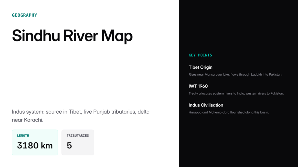
The Sindhu river map traces the course of the Indus River, one of the longest rivers in Asia and the lifeline of the western Indian subcontinent. The Indus rises near Lake Mansarovar in Tibet, flows northwest through Ladakh, turns south through the plains of Punjab and Sindh in Pakistan, and empties into the Arabian Sea near Karachi. Its total length of roughly 3,180 kilometres makes it longer than the Ganga. Five Himalayan tributaries — the Jhelum, Chenab, Ravi, Beas, and Sutlej — give Punjab (meaning "land of five rivers") its name. The Indus basin is also the subject of the Indus Waters Treaty, 1960, one of the world's most-cited water-sharing agreements.
Origin and Course
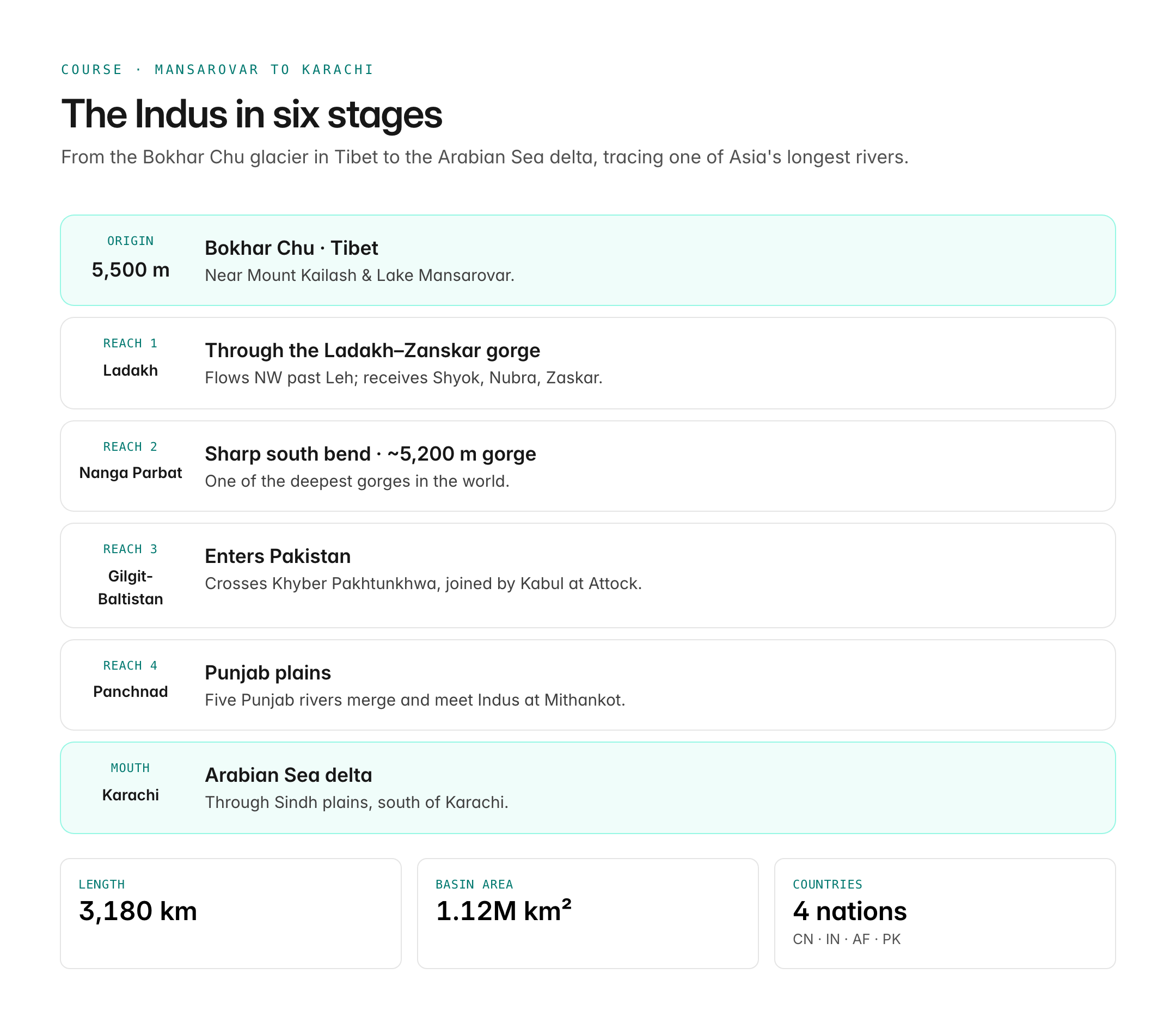
The Indus originates at an altitude of about 5,500 metres near Mount Kailash and Lake Mansarovar in the Tibetan plateau, in a region called the Bokhar Chu glacier. From there it flows:

Oxford Student Atlas for India — 7th Edition
- 160 pages, Oxford University Press, the current edition
- India-focused thematic maps: physical, political, rivers, climate, soils, vegetation, plus world maps
- Made for UPSC and state PSC map work; slim enough to stay open beside the textbook
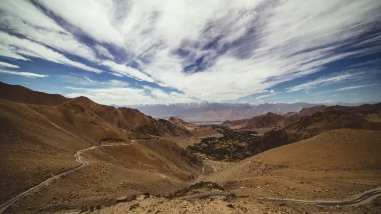
- Northwest through Ladakh, cutting a deep gorge between the Ladakh range and the Zanskar range.
- Past Leh, receiving tributaries like the Shyok, Nubra, Gilgit, and Zaskar.
- Takes a sharp southward bend near Nanga Parbat, one of the deepest gorges in the world (~5,200 m deep).
- Enters Pakistan near Gilgit-Baltistan, flows through Khyber Pakhtunkhwa, then across the plains of Punjab and Sindh.
- Empties into the Arabian Sea south of Karachi through a large delta.
The river drains a total basin area of about 1.12 million sq km, shared by China, India, Afghanistan, and Pakistan.
Major Tributaries
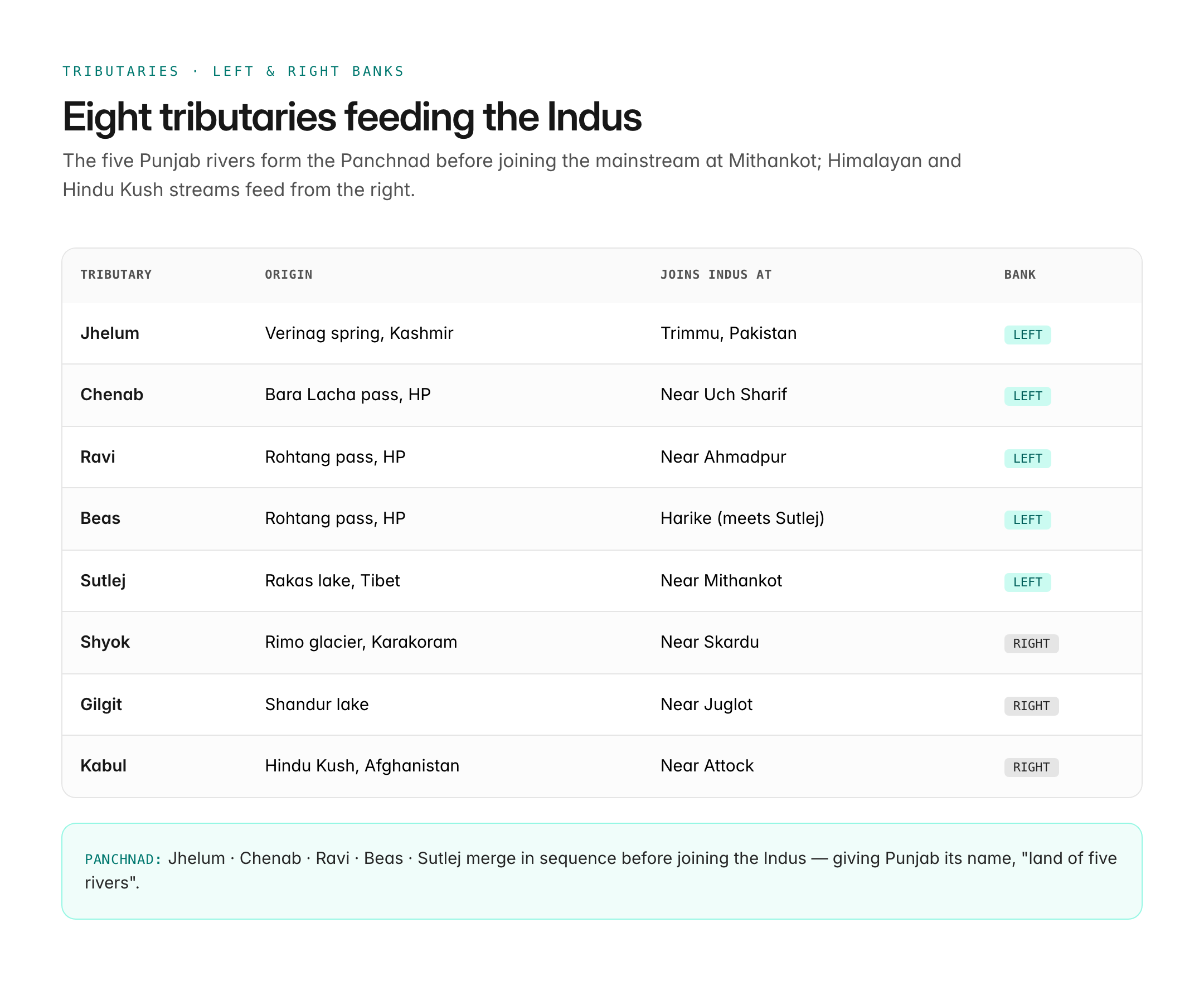
The Indus receives both left-bank and right-bank tributaries.
| Tributary | Origin | Joins Indus At | Bank |
|---|---|---|---|
| Jhelum | Verinag spring, Kashmir | Trimmu, Pakistan | Left |
| Chenab | Bara Lacha pass, Himachal | Near Uch Sharif | Left |
| Ravi | Rohtang pass, Himachal | Near Ahmadpur | Left |
| Beas | Rohtang pass, Himachal | Harike (meets Sutlej) | Left |
| Sutlej | Rakas lake, Tibet | Near Mithankot | Left |
| Shyok | Rimo glacier, Karakoram | Near Skardu | Right |
| Gilgit | Shandur lake | Near Juglot | Right |
| Kabul | Hindu Kush, Afghanistan | Near Attock | Right |
The five rivers of Punjab — Jhelum, Chenab, Ravi, Beas, Sutlej — merge successively and are collectively called the Panchnad before joining the Indus at Mithankot.
Indus Waters Treaty, 1960
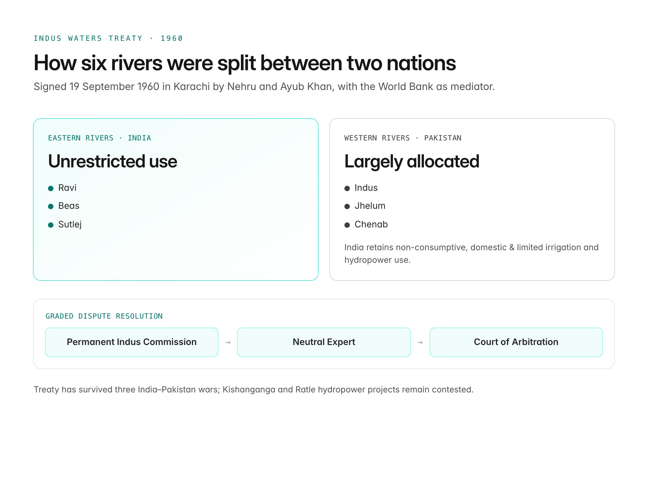
The Indus Waters Treaty (IWT) was signed on 19 September 1960 in Karachi by Jawaharlal Nehru and Pakistan's President Ayub Khan, with the World Bank as mediator. Its key provisions:
- Eastern rivers — Ravi, Beas, Sutlej — allocated to India for unrestricted use.
- Western rivers — Indus, Jhelum, Chenab — allocated largely to Pakistan, with India permitted non-consumptive uses like hydropower, domestic, and limited irrigation.
- A Permanent Indus Commission comprising a commissioner from each country was established to resolve disputes.
- Graded dispute resolution: Commission → Neutral Expert → Court of Arbitration.
The treaty has endured three wars between India and Pakistan and is often cited as a model of technical diplomacy, though in recent years India has signalled a willingness to revisit its terms.
Hydropower and Irrigation Projects
The Indus basin supports vast irrigation and power infrastructure:
- India: Bhakra-Nangal dam (Sutlej), Pong dam (Beas), Ranjit Sagar (Ravi), Baglihar and Kishanganga projects (Chenab, Jhelum), Nimoo-Bazgo and Chutak (Indus, Ladakh).
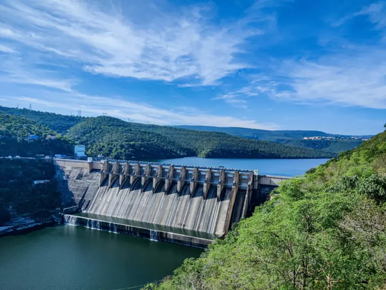
- Pakistan: Tarbela dam on the Indus (one of the largest earth-filled dams), Mangla on Jhelum, and the extensive canal network of Punjab and Sindh.
India's Kishanganga and Ratle hydropower projects have been contested by Pakistan under the treaty's dispute-resolution mechanism.
Geographical Features and Cities
Several important cities and physical features lie along the Indus system:
- Indian side: Leh, Srinagar (on Jhelum), Ludhiana (on Sutlej), Amritsar, Jalandhar.
- Pakistani side: Sukkur, Hyderabad (Sindh), Karachi (near delta), Multan, Lahore (on Ravi), Islamabad (near Kabul-Indus junction).
- Physical features: Indus Gorge near Nanga Parbat, Pamir knot (river rise region), Sulaiman and Kirthar ranges to the west, Thar Desert to the east.
The Indus Valley Civilisation (c. 3300–1300 BCE) flourished on this river's banks at sites such as Harappa, Mohenjo-daro, and Dholavira, giving the river immense civilisational and cultural significance.
Ecological Significance
The Indus basin is ecologically rich but increasingly stressed:
- Indus river dolphin (Platanista minor) — one of the world's rarest freshwater dolphins, found in the lower Indus in Pakistan and in small numbers in Punjab's Beas conservation reserve (India's only IWT-area cetacean).
- Snow-leopard habitat in the upper basin.
- Wetlands along the delta support migratory birds.
- Threats include glacial retreat in the Karakoram–Himalaya, siltation of reservoirs, pollution, and over-abstraction of water for irrigation.
Climate-induced changes in Himalayan glaciers directly affect the basin's long-term water availability, making the Indus a key climate-security concern.
UPSC Relevance
Prelims focus: origin (near Mansarovar, Tibet), total length (~3,180 km), five Punjab tributaries and their origins, Indus Waters Treaty year (1960), parties (India, Pakistan, World Bank), eastern vs. western rivers under the treaty, and the Indus river dolphin.
Mains GS angle:
- GS I — physical geography of India, drainage systems, important geographical features.
- GS II — India and its neighbourhood, bilateral treaties (IWT), regional water diplomacy.
- GS III — conservation, environmental issues relating to rivers, climate change impact on Himalayan river systems.
Sample PYQ angle: UPSC Mains has asked about the relevance of the Indus Waters Treaty in the present context and whether India should renegotiate it. A good answer maps the basin, summarises the treaty's allocation framework, flags the Kishanganga and Ratle disputes, and weighs the strategic, ecological, and diplomatic costs of renegotiation against the credibility of long-standing transboundary agreements.
Tell Google you want more of this.
Add Anantam IAS as a preferred sourceOne tap, and this site shows up more often in your own Top Stories, AI Overviews and AI Mode. Remove it any time.