Ask where the Ganga begins and most aspirants say Gangotri. That answer is half right, and the missing half is where marks are won. The stream that religion crowns as the Ganga is the Bhagirathi, which comes off the Gangotri glacier. But the stream that carries more water and runs longer before the two meet is the Alaknanda. So the river that hydrologists would call the true headwater of the Ganga is not the one the pilgrimage does. That single mismatch trips up almost everyone.
Hold onto this picture and the whole of Garhwal’s drainage falls into place: the Alaknanda rises high near the Tibet border, then swallows four mountain rivers at four sacred junctions, and only at the fifth junction, Devprayag, does it join the Bhagirathi and finally take the name Ganga. Learn the river as that chain of confluences, not as a line on a map, and you can reconstruct the entire system from memory.
Where the Alaknanda actually rises
The Alaknanda rises at about 3,880 metres near the meeting point of the Satopanth and Bhagirath Kharak glaciers, below the Chaukhamba massif in the Chamoli district of Uttarakhand, close to the India-Tibet frontier. Satopanth is the larger of the two, a long tongue of ice named for a glacial lake the Hindu tradition ties to the “true path.” So the river is glacier-fed from its first metre, which is why its flow surges in the summer melt and the monsoon and thins in winter.
Here is the detail worth fixing early: the Alaknanda passes Badrinath, one of the four Char Dham shrines, in its very first stretch. Above Badrinath, at the village of Mana, a small tributary called the Saraswati joins it at a spot locals call Keshav Prayag. That is why some texts speak of a sixth prayag, though the classical count of sacred confluences stays at five and starts lower down.
By the time it reaches its junction with the Bhagirathi, the Alaknanda has run roughly 190 kilometres and drained a basin larger than the Bhagirathi’s. If you have worked through the physical features of the Himalayas, place the Alaknanda in the Great Himalayan and trans-Himalayan zone: a young, fast, deeply cutting river, exactly the kind that carves the gorges Garhwal is known for.
Why the “source of the Ganga” question has two answers
The Ganga does not have one uncontested source, and the honest answer names both streams and the rule that separates them. By religious tradition, the Ganga descends at Gaumukh, the snout of the Gangotri glacier, as the Bhagirathi, and that is the source the Gangotri pilgrimage honours. By hydrology, the main stem of a river is the tributary that is longest and carries the greatest discharge, and on both counts the Alaknanda wins over the Bhagirathi at their meeting point.
Let me show you what that means at the junction. When the two rivers meet at Devprayag, the Alaknanda arrives with a larger volume of water and a longer course behind it. A geographer measuring the system would therefore treat the Alaknanda as the parent stream and the Bhagirathi as a tributary joining it. The name Ganga, though, begins only below this confluence, regardless of which stream you consider the “real” source.
So both statements are true, and the trap is treating them as rivals. Say it cleanly: the Bhagirathi is the source by faith, the Alaknanda is the source by volume, and the Ganga is the name the combined river takes at Devprayag. Keep those three clauses separate on the page and you will never fumble the question, however it is framed. For the broader network this feeds, connect it back to your notes on the Ganga river system.
The Panch Prayag: five confluences, one growing river
The Panch Prayag are the five sacred river junctions through which the Alaknanda gathers its major tributaries, and their order from the mountains down to Devprayag is the spine of the whole topic. “Prayag” means a confluence, a sangam, and each one marks the point where a distinct Himalayan river surrenders into the Alaknanda. The classical sequence, upstream to downstream, is Vishnuprayag, Nandprayag, Karnaprayag, Rudraprayag, and Devprayag.
Walk them in order and the river grows in front of you. At Vishnuprayag, the highest of the five, the Dhauliganga comes in from the north. At Nandprayag, the Nandakini joins. At Karnaprayag, the Pindar arrives, carrying meltwater from the Pindari glacier region. At Rudraprayag, the Mandakini enters, and that is the stream that runs up to Kedarnath. And at Devprayag, the lowest junction, the Bhagirathi finally meets the Alaknanda and the river becomes the Ganga.
| Confluence (Prayag) | Tributary that joins the Alaknanda | Position | Note |
|---|---|---|---|
| Vishnuprayag | Dhauliganga | Highest of the five | Below Badrinath and Joshimath |
| Nandprayag | Nandakini | Second | Named for King Nanda |
| Karnaprayag | Pindar (Karnaganga) | Third | Pindar drains the Pindari glacier area |
| Rudraprayag | Mandakini | Fourth | Mandakini runs up to Kedarnath |
| Devprayag | Bhagirathi | Fifth and lowest | Below this point the river is the Ganga |
The memory hook most aspirants miss is that the tributaries and towns pair off cleanly, one river per prayag, so you only have to remember five pairs in one direction. A useful mnemonic for the junctions in order is Vishnu, Nand, Karna, Rudra, Dev, running from the snows down to the town of Devprayag. Learn the sequence downstream, because that is the direction the water and the volume both increase.
Devprayag: where the Ganga is born
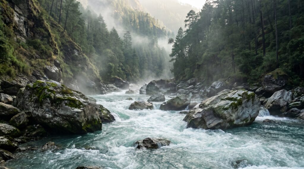
Devprayag is the confluence where the Alaknanda and the Bhagirathi merge and the river is called the Ganga for the first time. Stand at the sangam and you can see the difference: the Alaknanda usually arrives greener and heavier, the Bhagirathi greyer with glacial silt, and below the meeting the single braided current runs on as the Ganga toward Rishikesh and Haridwar. This is the literal birthplace of the river by name, which is why the town carries “Dev,” the divine, in its name.
The junction matters beyond ritual. Once the Ganga forms here, it still has to cut through the Himalayan foothills before it reaches the plains at Haridwar, where it leaves the mountains and fans out across north India. So Devprayag is the hinge: everything above it is mountain river with many names, and everything below it is the Ganga of the plains that a fifth of India’s population eventually depends on.
For revision, treat Devprayag as the answer to a specific, high-frequency question: “At which confluence does the Ganga get its name?” The reflex answer people give is Haridwar or Gangotri, and both are wrong. The Ganga is named at Devprayag, the fifth and final prayag, and Haridwar is merely where it first touches the plains.
Pilgrimage, power, and the pressure on the river
The Alaknanda valley carries two of India’s heaviest loads at once: religious pilgrimage and hydropower ambition, and the tension between them is the river’s defining modern story. The pilgrimage load is old and enormous. Badrinath, on the Alaknanda, and the route to Kedarnath, up the Mandakini tributary, draw millions of Char Dham pilgrims every season, and the road network threading the gorges was built to move them.
The hydropower load is newer and heavier on the river itself. The steep gradient that makes the Alaknanda and its tributaries so scenic also makes them prime sites for run-of-the-river dams, and a long chain of projects, built and proposed, sits on the Alaknanda, the Dhauliganga, the Mandakini, and the Pindar. Supporters point to clean power for a power-short region. Critics point to fragmented rivers, tunnelled flows, and slopes destabilised by blasting and muck dumping. If you are revising hydropower in India, the Alaknanda basin is the sharpest live example of the dam-versus-ecology debate in the Himalaya.
Both loads collide with the mountain’s own instability. The Alaknanda basin is seismically active, geologically young, and prone to landslides, cloudbursts, and glacial-lake outbursts. The 2013 Kedarnath disaster, when a cloudburst and moraine-dammed lake sent a wall of water down the Mandakini, and the 2021 Chamoli flood, when a rock-and-ice avalanche surged down the Rishiganga and Dhauliganga, both struck tributaries of this very system and both wrecked hydropower works in their path. Read them together with Himalayan glaciers and climate change and the pattern is clear: a warming, crowded, over-engineered basin is a basin that floods harder. The government’s own hazard framing appears in the reports of the National Disaster Management Authority.
The ecology the river runs through
The upper Alaknanda threads through some of India’s most protected mountain country, and naming it fixes the river to the conservation map. Its headwaters sit beside the Nanda Devi Biosphere Reserve, which contains Nanda Devi National Park and the Valley of Flowers National Park, together inscribed as a UNESCO World Heritage Site. The Pindar and Dhauliganga catchments brush this same high-alpine zone.
The wildlife here is classic high-Himalaya: snow leopard, Himalayan musk deer, bharal (blue sheep), and, in the meadows of the Valley of Flowers, a burst of endemic alpine plants that flower in the short monsoon window. This is fragile, slow-growing country, which is exactly why the hydropower footprint provokes such sharp argument. Slot it into your national parks of India notes as the western-Himalaya counterpart to the eastern-Himalaya parks, and the alpine ecology stops being scenery and becomes a system under measurable stress.
How to lock the Alaknanda into your notes
The efficient way to master this river is to memorise it as a downstream chain and hang every other fact on the confluences. Start with the source pair, Satopanth and Bhagirath Kharak glaciers above Badrinath, then run the five prayags in order, Vishnuprayag, Nandprayag, Karnaprayag, Rudraprayag, Devprayag, and attach one tributary to each. That single sequence answers the largest share of questions the topic can throw at you.
Then separate the two “source of the Ganga” claims deliberately, because that is the highest-yield confusion. Write one line for the Bhagirathi as the religious source from Gaumukh and one line for the Alaknanda as the hydrological main stem by length and discharge, and a third that the Ganga is named only below Devprayag. Three clean lines beat one muddled sentence every time.
Last, tie the physical facts to consequences you can discuss. Karnaprayag is not just a name; the Pindar that meets there drains the Pindari glacier. Rudraprayag is not just a junction; the Mandakini above it carries the memory of 2013. Facts anchored to a place, a glacier, or an event survive revision. Loose ones evaporate the week before the exam. For the wider drainage logic, keep this next to your Himalayan rivers and drainage system notes so the Alaknanda reads as one strand of a larger braid.
Frequently Asked Questions
Where does the Alaknanda river originate?
The Alaknanda rises at about 3,880 metres near the confluence of the Satopanth and Bhagirath Kharak glaciers, below the Chaukhamba peaks in Chamoli district, Uttarakhand, close to the India-Tibet border and just above the Badrinath shrine.
Is the Alaknanda or the Bhagirathi the true source of the Ganga?
Both, depending on the test. The Bhagirathi, from the Gangotri glacier, is the source by religious tradition. The Alaknanda is the source by hydrology because it is longer and carries more water where the two meet. The Ganga is named only after they join.
What are the Panch Prayag?
The five sacred confluences on the Alaknanda: Vishnuprayag (with the Dhauliganga), Nandprayag (Nandakini), Karnaprayag (Pindar), Rudraprayag (Mandakini), and Devprayag (Bhagirathi), listed from the mountains down to Devprayag.
At which confluence does the river become the Ganga?
At Devprayag, the fifth and lowest of the Panch Prayag, where the Alaknanda meets the Bhagirathi. Below Devprayag the combined river is called the Ganga.
Which important pilgrimage sites lie on the Alaknanda?
Badrinath sits directly on the Alaknanda, and the Kedarnath route follows the Mandakini, a tributary that joins the Alaknanda at Rudraprayag. Both are part of the Char Dham circuit of Uttarakhand.
Why is the Alaknanda basin prone to disasters?
It is young, steep, and seismically active, with glaciers, moraine-dammed lakes, and heavy rainfall. The 2013 Kedarnath cloudburst on the Mandakini and the 2021 Chamoli flood on the Dhauliganga both struck tributaries of the Alaknanda system.
What is the total length of the Alaknanda?
The Alaknanda runs roughly 190 kilometres from its glacial source to its meeting with the Bhagirathi at Devprayag, draining a basin larger than the Bhagirathi’s.
Practice Questions
1. The Alaknanda river originates from the confluence of which glaciers?
a) Gangotri and Khatling
b) Satopanth and Bhagirath Kharak
c) Zemu and Kangchen
d) Siachen and Baltoro
Answer: b
2. At which of the Panch Prayag does the Alaknanda meet the Bhagirathi to form the Ganga?
a) Vishnuprayag
b) Karnaprayag
c) Rudraprayag
d) Devprayag
Answer: d
3. Which tributary joins the Alaknanda at Rudraprayag?
a) Dhauliganga
b) Nandakini
c) Mandakini
d) Pindar
Answer: c
4. Which pilgrimage town lies directly on the banks of the Alaknanda?
a) Kedarnath
b) Badrinath
c) Gangotri
d) Yamunotri
Answer: b
5. The correct upstream-to-downstream order of the Panch Prayag is:
a) Devprayag, Rudraprayag, Karnaprayag, Nandprayag, Vishnuprayag
b) Vishnuprayag, Nandprayag, Karnaprayag, Rudraprayag, Devprayag
c) Karnaprayag, Vishnuprayag, Rudraprayag, Devprayag, Nandprayag
d) Nandprayag, Vishnuprayag, Devprayag, Karnaprayag, Rudraprayag
Answer: b
Mains-style questions
1. “The source of the Ganga is a question of hydrology and of faith, and the two do not agree.” Explain with reference to the Alaknanda and the Bhagirathi. 2. Discuss the Panch Prayag as a framework for understanding the drainage of the upper Ganga basin. 3. Examine the tension between hydropower development and ecological stability in the Alaknanda valley, using recent disasters as evidence. 4. Assess how the combination of pilgrimage, road building, and dam construction has raised disaster risk in the upper Himalayan river basins. 5. Locate the Alaknanda within the wider Himalayan drainage system and describe its major tributaries and confluences.
The Alaknanda rewards the aspirant who refuses to memorise it as a single line and instead learns it as a growing river. The source glaciers and the five confluences are the frame, but the river earns its place in your preparation because it ties together so much at once: the physiography of young Himalayan rivers, the contested source of the Ganga, a chain of sacred junctions, the country’s fiercest dam-versus-ecology fight, and a fragile alpine ecology that keeps paying the price for getting it wrong. Learn it as that bundle, walk it downstream from Satopanth to Devprayag, and the Alaknanda stops being a name you confuse with Gangotri and becomes the river you can explain from its first metre of ice to the moment it becomes the Ganga.
Tell Google you want more of this.
Add Anantam IAS as a preferred sourceOne tap, and this site shows up more often in your own Top Stories, AI Overviews and AI Mode. Remove it any time.