
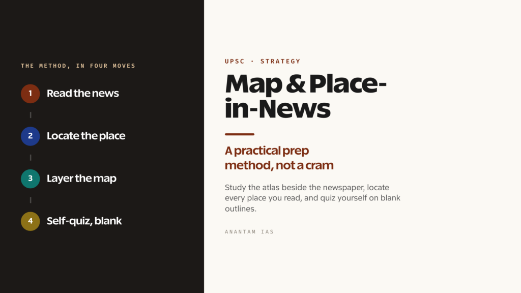
Map work is the part of UPSC preparation that aspirants postpone for months and then panic over in the final weeks. It feels like a memory game with no end — thousands of rivers, ranges, parks and capitals, none of which seem to connect to anything. So the atlas sits closed, the newspaper gets read without a map open beside it, and a steady source of easy Prelims marks quietly slips away.
The fix is not more memorising. It’s a method. Map-based and place-in-news questions reward an aspirant who locates every place as they encounter it, builds the picture in layers, and quizzes themselves on blank outlines — not one who tries to cram an atlas the week before the exam. This guide lays out that method: where maps actually decide marks in UPSC, the categories worth your time, the atlas-plus-newspaper habit that does most of the work, and the mistakes that waste the rest.
Where Maps Decide Marks in UPSC
Maps run through more of the exam than most aspirants realise. In Prelims, the General Studies Paper I carries a dependable block of geography questions, and a good share of them are location-based — which strait separates these two landmasses, which states a river flows through, which country borders a particular sea. The Commission has leaned hard into the “place in news” pattern, where the question simply names a place that appeared in recent headlines and asks you to locate it or attach a fact to it. If you’ve been reading the news with an atlas open, these are gifts. If you haven’t, they’re guesses.
World geography matters as much as Indian geography here, and that catches people out. A question on a conflict zone, a shipping chokepoint, or a newly significant port can sit anywhere on the globe. The same place-in-news logic applies — a strait that suddenly matters because of a blockade, an island group in a maritime dispute, a region hit by famine or floods. The Commission rewards an aspirant who can place world events on a mental map, not just one who has memorised Indian river systems.
In Mains, maps work differently but still pay off. A map-supported answer in the General Studies Paper I geography section, or in any answer touching resources, climate or strategic location, reads far better when you can sketch a quick locational diagram or describe a place’s position with precision. You won’t be handed a blank map to fill, but the candidate who writes “located at the head of the Bay of Bengal, straddling the delta” instead of a vague gesture at a region signals real command of the subject. Spatial clarity is a marker of a serious answer.
The High-Yield Map Categories
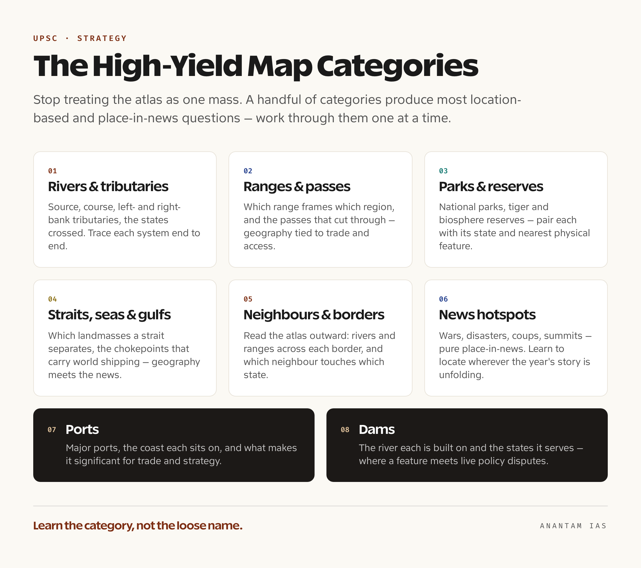
Map preparation becomes manageable the moment you stop treating the atlas as one undifferentiated mass and start working category by category. A handful of categories generate the overwhelming majority of location-based questions, and concentrating on them gives you the best return for the hours you put in.
Rivers and their tributaries come first. Know the source, the broad course, the major tributaries that join from the left and the right, and the states or countries a river passes through before it meets the sea. The confluences and the order of tributaries are favourite question material, so trace each major system end to end rather than memorising names in isolation. Mountain ranges and passes are the natural companion — the ranges that frame a region, the passes that cut through them, and which range separates which basins. Passes in particular show up because they tie physical geography to trade routes and strategic access.
National parks, tiger reserves and biosphere reserves are a perennial favourite, almost always in the place-in-news mode. A protected area enters the headlines because of a fire, a new species count, a relocation or a status change, and the question asks which state it sits in or which river or range it adjoins. Pair every park with its state and its nearest physical feature and you’ve answered most of what gets asked. Straits, seas and gulfs are the maritime equivalent — which two landmasses a strait separates, which seas a gulf opens into, and the chokepoints that carry the world’s shipping. These are heavily favoured precisely because they connect geography to current trade and security news.
The remaining categories round out the high-yield list. Neighbouring countries and their geography — the rivers, ranges and regions just across each border, and which neighbour touches which Indian state — reward an aspirant who reads the atlas outward, not just within national lines. Conflict and news hotspots are pure place-in-news: wherever a war, a coup, a disaster or a summit is unfolding, learn to locate it. Ports matter for trade and strategic questions, so know the major ones, the coast they sit on, and what makes each significant. And dams, sitting at the meeting point of rivers, irrigation, power and inter-state disputes, tie a physical feature to live policy debates — know the river each major dam is built on and the states it serves.
The Atlas-Plus-Newspaper Method
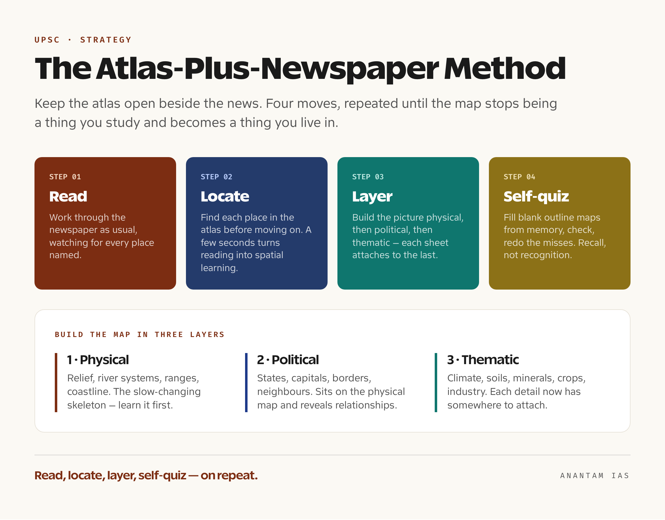
The single habit that does most of the work is studying the atlas alongside the news. Keep a good standard atlas open whenever you read the newspaper, and make one rule non-negotiable: every time a place is mentioned, find it. A river in a flood report, a district in a poll story, a strait in a shipping dispute, a town near a new project — locate each one before you move on. This costs a few extra seconds per item and turns passive reading into spatial learning. Within months, the map stops being a thing you study and becomes a thing you live in, because you’ve placed hundreds of real news events on it.
Build the picture in layers rather than trying to absorb everything at once. Start with the physical layer — the relief, the river systems, the ranges, the coastline. This is the skeleton, and it changes slowly, so it’s worth learning first and learning well. Add the political layer next — states, capitals, international borders, neighbouring countries. Because the political map sits on top of the physical one, you’ll start seeing relationships: which state a river crosses, which range marks a border. Finish with the thematic layer — climate zones, soils, minerals, crops, population, industry. Layered this way, each new sheet of information has somewhere to attach, instead of floating free in memory. The Survey of India’s official maps are the right reference for Indian boundaries, since they show borders as India officially depicts them.
Self-quizzing is what converts recognition into recall, and the tool for it is the blank outline map. Reading an atlas builds a comforting but shallow familiarity — you recognise a place when you see it labelled, yet can’t produce it on a blank sheet. So print or sketch blank outlines and fill them from memory: rivers on one, ranges and passes on another, parks and reserves on a third, then check against the atlas and redo the ones you missed. This active retrieval, repeated, is far more powerful than re-reading. It also surfaces exactly what you don’t know, which re-reading conveniently hides. The same retrieval logic underpins a sound UPSC Prelims strategy across every subject, not just geography — you learn by testing yourself, not by re-reading.
Place-in-News: Building a Running List
The place-in-news pattern deserves its own system, because it’s where map work meets current affairs and where the easy Prelims marks concentrate. The idea is simple: maintain a running list of every place that appears in the news with a reason attached, and revise it before the exam. This is the same discipline behind a good UPSC current affairs strategy — you’re not collecting headlines, you’re filing each one against something you can be tested on.
Keep the list lean and structured. For each entry, note three things: the place, where it is, and why it was in the news. A national park because of a tiger census, a strait because of a blockade, a district because of a new mineral find, a town because it hosted a summit. Keep it organised by category — parks, straits, ports, conflict zones, dams — so that revision is a clean sweep through each type rather than a scroll through random dates. Government primary sources help you get the facts right: the Press Information Bureau (PIB) carries the official version of a project launch or a status change, which is safer than a paraphrase when the question turns on a specific location.
The running list earns its keep at revision. In the final weeks, you read down a short, organised file of places-in-news with their locations and reasons, and you’ve covered the single most likely source of location-based Prelims questions in a fraction of the time it would take to re-read an atlas. Pair it with a quick blank-map pass and you walk into Prelims having both seen these places and placed them. The working window is roughly the last twelve to eighteen months before the exam, so you’re building a focused record of that period — not an archive of everywhere that has ever made news.
Common Map-Prep Mistakes
The first and most expensive mistake is rote-memorising without locating. Aspirants make lists of rivers, parks and straits and try to learn them as text, never opening the atlas to see where each one sits. Map knowledge that isn’t spatial is almost useless in the exam, because the question is spatial — it asks you to place something, not to recite a name. The cure is the locating habit: never learn a place as a word, always learn it as a position on the map.
The second is ignoring world geography. Indian geography feels more familiar, so it hogs the attention, and the world map gets left until it’s too late. But the place-in-news pattern is global, and a steady stream of questions comes from world straits, conflict zones, ports and regions. Give world geography real time — at minimum, the continents’ broad relief, the major rivers and ranges, the chokepoint straits, and wherever the year’s big news has been unfolding. A candidate strong only in Indian geography is leaving certain marks on the table.
The third is the absence of revision. Map work decays faster than almost anything else in the syllabus, because it’s dense and visual and easy to forget. An aspirant who fills outline maps once in the foundation phase and never returns to them will have lost most of it by the exam. Build revision into the plan from the start: periodic blank-map passes, a regular sweep of the place-in-news list, and a final round before Prelims. As with the rest of the syllabus, the work isn’t done when you’ve learned it once — it’s done when you can reproduce it under pressure. The broader UPSC syllabus guide shows where geography sits across the papers, so your map work lines up with what’s actually tested.
Frequently Asked Questions
How many map-based questions does UPSC actually ask in Prelims?
It varies by year, but geography typically contributes a meaningful block of the hundred General Studies Paper I questions, and location-based and place-in-news items are a recurring share of that. The exact count moves cycle to cycle, so the safe approach is to treat map work as a dependable source of several marks rather than chase a fixed number. Because these questions are often straightforward once you can locate the place, the return on map preparation is high relative to the effort.
Which atlas should I use for UPSC map preparation?
One standard school atlas, used consistently, is enough — the Oxford or similar widely used editions are the common choices. The atlas itself matters far less than the habit of keeping it open beside the newspaper and locating every place you read about. For Indian boundaries specifically, cross-check against the Survey of India’s official maps, since those depict borders the way India officially does, which is the depiction the exam follows.
How do I prepare for place-in-news questions when the places change every year?
You don’t predict the places — you build a system that catches them. Keep a running list of every place that appears in the news with its location and the reason it was reported, organised by category, and revise it in the final months. Because the working window is roughly the last twelve to eighteen months before the exam, a focused, well-organised list of recent places-in-news covers most of what gets asked.
Should I study world geography or focus only on India?
Both, and world geography is the one most aspirants neglect. The place-in-news pattern is global, so questions draw on world straits, ports, conflict zones and regions just as readily as on Indian features. Cover the world map’s broad relief, major rivers and ranges, the key chokepoint straits, and wherever the year’s major news has unfolded — skipping it leaves predictable marks unclaimed.
Tell Google you want more of this.
Add Anantam IAS as a preferred sourceOne tap, and this site shows up more often in your own Top Stories, AI Overviews and AI Mode. Remove it any time.