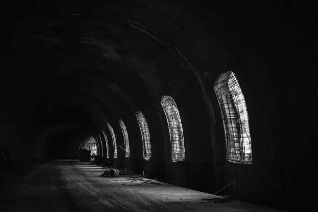
Most aspirants file the Atal Tunnel under “longest highway tunnel above 10,000 feet” and stop there, which means they can name the record but not explain why India spent two decades and thousands of crores digging under a mountain pass. The record is the least interesting thing about it. The real point is that for half of every year the Rohtang Pass sealed off an entire Himalayan valley behind snow, cut its people off from hospitals and markets, and blocked the army’s road to the border, and a 9-kilometre hole through the mountain undid all of that in one stroke. Understand what the tunnel replaced and you understand why it is a favourite for questions on infrastructure, strategy, and mountain geography at once.
What the Atal Tunnel is and where it sits
The Atal Tunnel is a 9.02-kilometre road tunnel through the eastern Pir Panjal range of the Himalayas in Himachal Pradesh, running below the Rohtang Pass to connect the Manali side in the Kullu valley with the Lahaul valley to the north. It carries two lanes of highway, and at an altitude of about 3,000 metres, or roughly 10,000 feet, it is recognised as the world’s longest highway tunnel above 10,000 feet, a record certified by the World Book of Records.
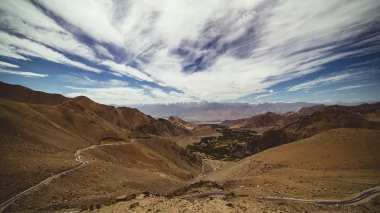
The geography is the whole reason it exists, so anchor it precisely. The Rohtang Pass, at about 3,978 metres, is the traditional crossing between Manali and Lahaul, and for centuries it was the only land route into the Lahaul valley from the south. The problem is that Rohtang is buried under heavy snow for roughly five to six months a year, which meant Lahaul, and beyond it Spiti and the road toward Ladakh, were physically cut off from the rest of Himachal for half of every year. The Atal Tunnel burrows underneath the pass, so traffic no longer climbs over the snow-choked crest at all. Instead of a white-knuckle mountain crossing open only in summer, there is now an all-weather tunnel open in every season. This is the same category of problem that Himalayan connectivity projects keep running into across the Himalayas, where a single high pass can isolate a whole region for months, and it echoes the strategic logic behind other high-altitude tunnels in the north, from the Zojila Tunnel on the Srinagar-Leh axis to the Shyok Tunnel closer to the frontier.
The tunnel’s two ends tell the story of what it links. The south portal lies near Manali at around 3,060 metres, and the north portal opens near the village of Sissu in Lahaul, from where the road runs on to Keylong, the district headquarters, and eventually toward Sarchu and Leh. A village that once spent winter marooned now sits on a road that never closes.
Why it was built: an ambition older than the tunnel
The Atal Tunnel matters because it solves a problem that had defeated planners for generations, and its long timeline is part of the answer, not just trivia. The idea of tunnelling under Rohtang is old, but the decision that mattered came in June 2000, when the government of then Prime Minister Atal Bihari Vajpayee approved building the tunnel, and the foundation stone for the access road was laid on 26 May 2002. The tunnel is named after Vajpayee, and the naming was formalised in 2019 to honour the leader who ordered it.
There is a strategic reason the decision landed in 2000 rather than earlier. The 1999 Kargil conflict had just exposed how exposed India’s supply line to Ladakh was, because the main road to Leh through Srinagar and Zoji La ran close to the Line of Control and could be cut or watched by an adversary. A tunnel under Rohtang promised a second, more sheltered road to Ladakh through Manali, one that stayed usable in winter, so the case for building it shifted from a regional convenience to a national-security priority almost overnight. When you explain why the tunnel was approved when it was, Kargil is the event that turned an old idea into a funded project.
Actual tunnelling, however, ran into the mountain’s own defences and took far longer than planned. The most notorious obstacle was the Seri Nallah fault zone, a roughly 587-metre stretch of crushed, water-logged rock where the mountain kept flooding and collapsing into the works, and crossing it alone consumed years. Because of such conditions the project, initially expected to finish in the early 2010s, was completed only in 2020 at a cost of around 3,200 crore rupees, well above its first estimates. That gap between plan and delivery is not a footnote. It is the lesson that Himalayan engineering runs on the mountain’s timetable, not the contractor’s, a theme that shows up in almost every high-altitude project India attempts. When you write about infrastructure in fragile mountain terrain, the Seri Nallah story is the concrete detail that proves you understand why these projects overrun.
The tunnel was finally inaugurated by Prime Minister Narendra Modi on 3 October 2020, and it was built by the Border Roads Organisation, the military engineering agency that constructs and maintains roads in India’s border regions, with the actual excavation carried out by a joint venture of the Austrian firm Strabag and India’s Afcons. That authorship is a clue to the tunnel’s real purpose, which was never only civilian.
The engineering: how you build a tunnel under a Himalayan pass
The Atal Tunnel is a single-tube, two-lane tunnel with a clever safety design folded into its cross-section, and the engineering choices all answer the same question: how do you keep a road open and survivable deep inside a mountain at 3,000 metres. Start with the shape.
The tunnel has a horseshoe cross-section about 10 metres wide, carrying a two-lane carriageway with an overhead clearance of around 5.5 metres, enough for trucks and military vehicles. It was driven largely by the New Austrian Tunnelling Method, a drill-and-blast approach that supports the rock progressively as the bore advances rather than lining it all at once, which suits the shifting, fractured strata of a young mountain range. Built into the floor, beneath the roadway, is a separate emergency escape tunnel, so that if a fire or accident blocks the main tube, people can drop into the passage below and walk out safely. That “tunnel within a tunnel” is the single most examinable design feature, because it shows the whole structure was engineered around survival, not just traffic.
The tunnel’s alignment also carries a small piece of clever routing worth knowing. Rather than run in a dead-straight line, it curves slightly and its two portals sit at nearly the same altitude, which keeps the gradient gentle and manageable for heavy vehicles climbing through at height, where engines already struggle with thin air. Every kilometre of that bore had to be cut through rock under the weight of a mountain and a snowpack above it, in a work season shortened by winter, which is why a nine-kilometre tunnel that would take a couple of years in easy terrain took the better part of a decade of active tunnelling here.
The safety and ventilation systems are extensive, and a short list is worth remembering as evidence of the design’s seriousness. The tunnel uses a semi-transverse ventilation system to pull in fresh air and push out vehicle fumes, monitored by air-quality sensors along its length. It is fitted with emergency exits and escape routes at regular intervals, fire hydrants and fire-detection sensors, emergency telephones, CCTV cameras, and a central SCADA control system that watches the whole tunnel from one command room. The design speed is about 80 kilometres per hour, and the tunnel is built to handle a heavy daily flow of cars and trucks.
| Feature | Detail |
|---|---|
| Location | Below Rohtang Pass, Pir Panjal range, Himachal Pradesh |
| Length | 9.02 km |
| Altitude | About 3,000 m (around 10,000 ft) |
| Connects | Manali (Kullu) to Lahaul valley (Sissu / Keylong) |
| Record | World’s longest highway tunnel above 10,000 ft |
| Built by | Border Roads Organisation (BRO) |
| Approved / inaugurated | Approved June 2000; inaugurated 3 October 2020 |
| Named after | Former PM Atal Bihari Vajpayee |
| Cost | Around 3,200 crore rupees |
Building all of this meant working at altitude where the air is thin, the winters are brutal, and machinery and workers both underperform, which is part of why the project took so long. The payoff is a tunnel that stays open and safe when the pass above it is under metres of snow, and that reliability is exactly what transforms life for the valley on the far side and for the soldiers who use the road beyond it.
What the tunnel changed: all-weather connectivity to Lahaul and Leh
The Atal Tunnel’s biggest practical effect is that it gives the Lahaul valley year-round access to the rest of the country and shortens the strategic road toward Leh, and both changes flow from the same fact that the tunnel never closes. Take the civilian gain first.
Before the tunnel, the people of Lahaul spent every winter cut off, because once Rohtang Pass closed under snow there was no land route out. A medical emergency could become a death sentence, perishable produce could not reach market, and anyone who needed to leave in winter had to fly out or wait for spring. With the tunnel open through all seasons, Lahaul is now connected in December as easily as in June. That has real consequences for healthcare and trade in the valley, and it is why a facility like the ICMR high-altitude medicine centre at Keylong, deep in Lahaul, is even feasible to run and reach year-round. The tunnel turned a seasonally abandoned valley into a permanently reachable one.
The strategic gain is just as large. The tunnel sits on the Manali-Leh axis, one of the two main road routes to Ladakh, and by bypassing Rohtang it cuts the Manali-Sarchu distance by about 46 kilometres and saves roughly four to five hours of driving. For the armed forces this is decisive: it means troops, fuel, ammunition, and supplies can move toward the Ladakh frontier faster and, crucially, in winter, when the alternative was to wait for a pass to open. Given the tensions along the frontier with China, from the India-China border delimitation talks to the broader reset in India-China ties, the ability to sustain forces in Ladakh through the whole year is a genuine military asset, not a convenience. This is why the tunnel was built by the Border Roads Organisation and why it belongs in any answer on border infrastructure alongside the frontier ranges it serves, from the eastern Pir Panjal here to the Karakoram range further north.
There is a cost side worth naming honestly, because a good answer holds both. All-weather access has also brought a surge of tourist traffic into a fragile high-altitude ecosystem, raising worries about waste, congestion, and pressure on Lahaul’s thin infrastructure, and the same easy access that helps the valley also exposes it to the strains of mass tourism. The tunnel is a clear net gain, but it is not a free one, and saying so is what separates an evaluated answer from a press release.
Where the Atal Tunnel fits in India’s border-infrastructure push
The Atal Tunnel is best understood as the first big win in a wider campaign to keep India’s Himalayan frontier roads open all year, because a tunnel matters most when it plugs into a network, not when it stands alone. For decades India deliberately kept its border roads thin, on the old logic that good roads would only help an invader move faster. That thinking has been reversed. The state now treats all-weather connectivity to the frontier as a strategic necessity, and the Atal Tunnel is the flagship of that shift.
Seen in that frame, the tunnel is one node in a chain. On the other main route to Ladakh, the Zojila Tunnel under the Zoji La pass is being built to keep the Srinagar-Leh road open through winter, the very vulnerability that Kargil exposed. Closer to the frontier, works like the Shyok Tunnel aim to shield forward roads from both weather and observation. Together with new bridges, widened highways, and higher-altitude airstrips, these projects are meant to let India sustain troops and supplies in Ladakh through every season rather than only in summer, which changes the military balance in a standoff. That is why the Atal Tunnel keeps coming up in discussions of the frontier with China, whether the news is about talks or tension: the ability to move and stay is the quiet foundation under every headline.
The tunnel also reset expectations for what is buildable. Before it, a 9-kilometre road tunnel at 3,000 metres in the Indian Himalayas was a plan on paper; after it, it is a proven template, and the confidence it created feeds directly into the next generation of mountain tunnels. In an answer on infrastructure or security, treating the Atal Tunnel as a proof of concept for a whole programme, rather than a one-off record, is what lifts the point from description to analysis.
How to study the Atal Tunnel for the exam
Study the Atal Tunnel as a fact card wrapped around one argument, because its exam value is the “why,” not just the record. Lock a clean identity line, then attach the significance.
The identity line is: the Atal Tunnel, 9.02 km long, below Rohtang Pass in the Pir Panjal range of Himachal Pradesh, at about 3,000 metres, the world’s longest highway tunnel above 10,000 feet, built by the Border Roads Organisation, inaugurated on 3 October 2020, named after former PM Atal Bihari Vajpayee, connecting Manali with the Lahaul valley. If you can recite that cleanly, you own the Geography and infrastructure facts. Then attach the significance: it gives the Lahaul valley all-weather connectivity where Rohtang Pass had closed it for five to six months a year, and it shortens the Manali-Leh military route by about 46 kilometres and four to five hours, which matters for sustaining forces in Ladakh in winter.
For value addition, keep two things ready. First, an engineering detail, the escape tunnel built beneath the roadway and the Seri Nallah fault zone that delayed the project, which lets you speak specifically about the challenges of Himalayan tunnelling rather than in generalities. Second, a comparison set, placing the Atal Tunnel alongside other strategic Himalayan tunnels like Zojila and Shyok on the routes to Ladakh, so you can discuss India’s wider push for border connectivity as a system rather than one project. In Prelims, expect a straight factual question on length, location, or the record. In Mains, the tunnel is a ready example for infrastructure in difficult terrain, for border-area development and defence logistics, and for the tension between connectivity and ecological fragility in the mountains. Learn it as one line of facts plus one argument about all-weather access, and it will serve you across Geography, security, and governance alike.
Frequently Asked Questions
Where is the Atal Tunnel located?
The Atal Tunnel is in Himachal Pradesh, running below the Rohtang Pass through the eastern Pir Panjal range of the Himalayas. It connects Manali in the Kullu valley with the Lahaul valley to the north, at an altitude of about 3,000 metres.
How long is the Atal Tunnel and why is it a record?
It is 9.02 kilometres long, which makes it the world’s longest highway tunnel above 10,000 feet, a record certified by the World Book of Records. Its length and its high altitude together are what earn it the distinction.
When was the Atal Tunnel inaugurated and who built it?
It was inaugurated by Prime Minister Narendra Modi on 3 October 2020 and was built by the Border Roads Organisation, the agency that constructs roads in India’s border regions. The decision to build it was taken in 2000 under Prime Minister Atal Bihari Vajpayee, after whom it is named.
Why is the Atal Tunnel strategically important?
It lies on the Manali-Leh axis and provides year-round connectivity toward Ladakh, cutting the Manali-Sarchu distance by about 46 kilometres and four to five hours. This lets the armed forces move troops and supplies to the frontier with China even in winter, when the Rohtang Pass is closed.
How did the Atal Tunnel help the Lahaul valley?
Before the tunnel, the Lahaul valley was cut off for five to six months each year when snow closed the Rohtang Pass. The tunnel, being all-weather, keeps the valley connected in every season, transforming access to healthcare, markets, and the rest of the state.
What makes the Atal Tunnel’s design notable?
It is a single-tube, two-lane tunnel with a separate emergency escape tunnel built beneath the main roadway, plus semi-transverse ventilation, fire safety systems, CCTV, and a central SCADA control system. The escape tunnel below the road is its most distinctive safety feature.
Why did the Atal Tunnel take so long to build?
High-altitude conditions and difficult geology slowed it down, most notably the Seri Nallah fault zone, a stretch of about 587 metres of unstable, water-logged rock that repeatedly flooded and collapsed. Crossing it took years and pushed the project’s completion to 2020.
Practice Questions
1. The Atal Tunnel passes below which mountain pass?
a) Zoji La
b) Rohtang Pass
c) Nathu La
d) Banihal Pass
Answer: b
2. The Atal Tunnel is recognised as the world’s longest highway tunnel above:
a) 5,000 feet
b) 8,000 feet
c) 10,000 feet
d) 15,000 feet
Answer: c
3. The Atal Tunnel was built by which agency?
a) National Highways Authority of India
b) Border Roads Organisation
c) Indian Railways
d) Central Public Works Department
Answer: b
4. The Atal Tunnel connects Manali with which valley?
a) Spiti valley
b) Nubra valley
c) Lahaul valley
d) Zanskar valley
Answer: c
5. Which of the following was the major geological obstacle during the tunnel’s construction?
a) The Seri Nallah fault zone
b) The Main Boundary Thrust
c) The Karakoram fault
d) The Indus suture zone
Answer: a
Mains-style questions
- The Atal Tunnel is as much a strategic asset as an engineering feat. Discuss its significance for border connectivity and defence logistics.
- Examine the engineering and geological challenges of building road tunnels in the high Himalayas, with reference to the Atal Tunnel.
- All-weather connectivity in the mountains brings both development and ecological pressure. Evaluate this trade-off in the context of the Lahaul valley.
- How do projects like the Atal Tunnel, Zojila, and other Himalayan tunnels fit into India’s larger strategy of border-area infrastructure development?
- Discuss the role of the Border Roads Organisation in strengthening India’s connectivity and security in frontier regions.
The Atal Tunnel earns its record, but the record is the smallest part of its story. What it really did was delete a six-month wall of snow that had isolated a Himalayan valley and slowed the army’s road to the border, and it did so only after two decades and a fight with the mountain itself at Seri Nallah. Learn it that way, as a fix for a specific geographic problem with a specific strategic payoff, and you will be able to answer not just where the tunnel is or how long it runs, but why a country decided it was worth digging nine kilometres through a mountain to build.
Tell Google you want more of this.
Add Anantam IAS as a preferred sourceOne tap, and this site shows up more often in your own Top Stories, AI Overviews and AI Mode. Remove it any time.