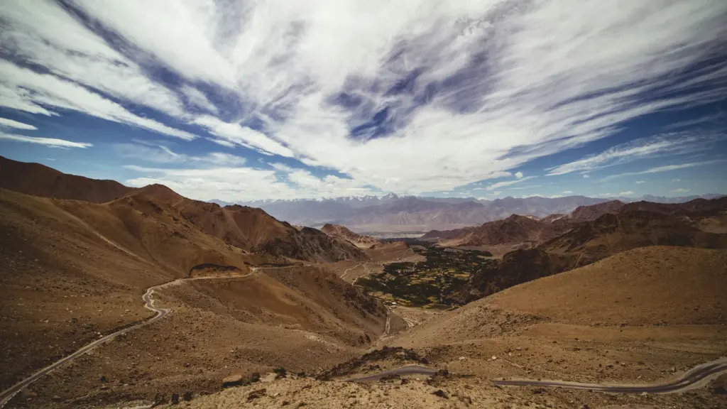
Khardung La is a mountain pass on the Ladakh Range in the Leh district of Ladakh, about 40 km north of Leh by road. The Khardung La pass carries the road from Leh down into the Shyok and Nubra valleys, so it’s the everyday link between Leh and the villages of Nubra, and the supply road for the troops who have held the Siachen heights since 1984.
Two beliefs travel with the pass, and both come from the signboard at the top. One is that it stands at 18,379 ft; the other, that it’s the highest motorable road in the world. Neither holds up. The Ministry of Defence itself gave the pass’s height as 17,582 ft in 2021, and the Guinness record for the highest road has belonged to Umling La, another road in Ladakh, since November 2021. This note settles the height and the record, and then explains why Khardung La matters anyway.
Where Is Khardung La and What Does It Connect?
Khardung La is a road pass across the Ladakh Range, the ridge that divides the Indus valley around Leh from the Shyok valley to its north. La is the Ladakhi word for a pass, which is why so many of the region’s pass names end the same way, and official papers often run the name together as Khardungla. The note on mountain passes of India sets it among the Himalayan and trans-Himalayan passes; these are the facts about this one.
| Fact | Detail |
|---|---|
| Location | Leh district, Union Territory of Ladakh; about 40 km from Leh by road (Leh district administration) |
| Range | Ladakh Range, between the Indus valley (Leh) and the Shyok valley |
| Connects | Leh with the Shyok and Nubra valleys, and on toward the Siachen base camp |
| Height on the signboard | 5,602 m (18,379 ft), a figure the Leh district’s tourism page repeats |
| Measured height | About 5,359 m (17,582 ft): Ministry of Defence (PIB, 4 August 2021), matched by satellite elevation data |
| Road built and kept open by | Border Roads Organisation: Project Himank (raised 1985) is credited with the road; Project Vijayak (raised 2010) keeps it open in winter |
| Highest motorable road? | No. Umling La, 5,798 m (19,024 ft), holds the Guinness record from November 2021; the BRO reported Mig La at 19,400 ft in October 2025 |
| Permits | No Inner Line Permit for Indians since the order of 6 August 2021; foreigners need a Protected Area Permit |
| Proposed tunnel | 5.5 km all-weather tunnel; in March 2026 the BRO said it would fund it from the defense budget |
Two rows carry two numbers each, the height and the record. That isn’t carelessness in the table. Those are exactly the two places where the popular account and the measured record part ways, so the next two sections take them one at a time.
What Is the Real Khardung La Height?
The measured height of Khardung La is about 5,359 m (17,582 ft). The number painted on the summit signboard, and repeated on the Leh district’s own tourism page, is 5,602 m (18,379 ft), which is about 240 m higher than the pass actually stands.
The bigger number is older than the road. William O. Douglas, the US Supreme Court judge who traveled through Ladakh, listed the Khardong Pass at 18,380 ft in his 1952 book Beyond the High Himalayas, long before a motor road crossed it and decades before satellites measured it. The figure stuck. It moved from travel writing onto the signboard, and from the signboard into guidebooks and websites, government ones included.
Three independent checks put the pass lower:
- The Ministry of Defence. A PIB release of 4 August 2021, announcing the Umling La road, gave Khardung La’s altitude as 17,582 ft, which works out to 5,359 m.
- A mountaineering record. An expedition report in the Himalayan Journal (volume 54), written by climbers retracing the old silk route north of Leh, puts the pass at 5,362 m.
- Satellite elevation data. Two public elevation models, NASA’s SRTM and the ASTER model, give 5,348 to 5,362 m at the pass’s coordinates.
Put the gap in terms you can picture. Take 5,359 from 5,602 and you get 243 m, roughly 800 ft. That’s more than three Qutub Minars stacked one on top of the other. A gap of that size isn’t rounding. It’s a different number.
So which figure goes into a written answer? The measured one, with the discrepancy named in a clause: about 5,359 m (17,582 ft), though the summit board says 5,602 m. It is wise to know both, because government pages still carry both, and a writer who knows the number is disputed reads as better informed than one who repeats the board.
Is Khardung La the Highest Motorable Road in the World?
No. The Guinness World Records title for the highest road belongs to the road over Umling La in eastern Ladakh, measured at 5,798 m (19,024 ft) and recognized in November 2021. In October 2025 the BRO reported a higher road still, at Mig La, at 19,400 ft.
This is the part most accounts skip. Khardung La couldn’t claim the record even on its own signboard number. Before Umling La, the title belonged to a road in Bolivia climbing toward the Uturuncu volcano, at 18,953 ft by the PIB’s account. That’s higher than the 18,379 ft on the Khardung La board and well above the pass’s measured 17,582 ft. The world’s-highest tag was a local claim that no record-keeper had ever verified.
| Road or pass | Height | What the record says |
|---|---|---|
| Mig La (Likaru-Mig La-Fukche road), Ladakh | 19,400 ft | Reported by All India Radio on 4 October 2025 as a new BRO (Project Himank) record; Guinness’s public listing still showed Umling La in September 2026 |
| Umling La (Chisumle-Demchok road), Ladakh | 5,798 m (19,024 ft) | Guinness highest altitude road, achieved 9 November 2021 |
| Road to the Uturuncu volcano, Bolivia | 18,953 ft | The earlier record that Umling La beat, per the PIB |
| Khardung La (Leh-Nubra road), Ladakh | 18,379 ft on the signboard; 17,582 ft measured | Never a verified record |
Two numbers in that table have already moved downward once someone checked them. Khardung La’s is one. Umling La’s is the other: the BRO’s first release in August 2021 put the road at 19,300 ft, and the figure Guinness verified three months later was 19,024 ft. A height on a board is a claim until someone measures it, and that habit of mind is worth more than any single figure here.
Mig La needs one careful sentence. All India Radio reported on 4 October 2025 that the BRO’s Project Himank had built the Mig La road, part of a new axis to Fukche village near the border, and had beaten its own Guinness record. Guinness’s record page, checked in September 2026, still names Umling La and notes that new records aren’t always published online at once. The safe way to write it: Umling La holds the Guinness title from 2021, and the BRO has reported a higher road at Mig La since October 2025.
How Did a Caravan Pass Become a Military Road?
For centuries Khardung La was a pack-animal pass on the summer caravan route from Leh to Central Asia. The motor road came much later, and what the road is for changed with the frontier.
The Caravan Route to Yarkand
Traders leaving Leh in summer crossed Khardung La, went down into the Nubra valley and climbed again over the Saser La toward the Karakoram Pass. The Himalayan Journal account describes Leh traders unloading at staging camps beyond the Saser La, where Central Asian traders loaded their horses and carried the goods over the Karakoram Pass to Yarkand and Kashgar. That trade ended when the border was sealed after China’s 1949 revolution.
Douglas’s 1952 book still describes the trail north of the Indus as the way to Leh, the pass and Yarkand, which he called an ancient trading center of Sinkiang. The far end of that trail is closed today. Its first high pass now carries a motor road.
The Motor Road and Siachen
The motor road over the pass is a Border Roads Organisation (BRO) road. You’ll often read that it was built in 1976 and opened to civilian vehicles in 1988. Both years come from secondary accounts rather than a BRO or government record, so they’re best treated as unconfirmed in an answer.
The firmer record is about who does the work. The Tribune credits Project Himank, the BRO project raised in 1985 for eastern Ladakh, with the roads over Khardung La, Tanglang La and Chang La. A 2023 report credits Project Vijayak, raised in 2010, with keeping Khardung La open through winter, its crews working at minus 25 degrees Celsius.
What turned a trade pass into a military artery was Operation Meghdoot. On 13 April 1984 the Army and the Air Force moved onto the Siachen Glacier to secure the Saltoro Ridge heights that overlook the Nubra valley. From then on, the road over Khardung La became the supply line for the troops on the glacier as well as the road for Nubra’s villages; the 2023 report calls it a lifeline for both.
Why Is Khardung La Strategically Important?
Khardung La matters because it carries the direct road from Leh into the valleys that lead to Siachen. Follow the road north and the geography sorts itself out:
- From Leh, in the Indus valley, the road climbs about 40 km to the pass on the Ladakh Range.
- It descends to Khalsar in the Shyok valley.
- One branch runs up the Nubra river through Tirit to Panamik, toward the Siachen base camp.
- The other follows the Shyok to Hunder and Diskit, and on toward Turtuk.
Both rivers belong to the Indus system. NCERT lists the Shyok and the Nubra among the Himalayan tributaries of the Indus, and the note on the Indus river system maps the rest of the basin.
The Nubra valley is more than a corridor to the glacier. The Leh district administration records these facts about it:
- It lies about 120 km north of Leh, and its old name, Ldumra, means valley of flowers.
- Double-humped Bactrian camels graze the sand dunes at Hunder.
- Diskit is its largest town.
- Turtuk, at its western end, was under Pakistani control until the 1971 war.
- The Siachen Glacier lies at the head of the valley.
Ladakh is a cold desert, and Nubra shows both faces of one: sand dunes at Hunder, and enough orchards that the district calls the valley the orchard of Ladakh.
Think of Khardung La as the front door of the Nubra valley. Most traffic uses it, and when a landslide or heavy snow blocks it, everything behind it waits. The analogy breaks at one point, and the break matters, because the house has side entrances.
A longer loop through Chang La, Durbuk and the Shyok valley via Agham reaches Nubra without crossing Khardung La, and in October 2021 the BRO began upgrading the 70 km stretch from Khalsar to Shyok via Agham. The same day it launched a new 26.6 km road from Hanuthang in the Indus valley to Turtuk, across the Stakpuchan Range, which the PIB said would cut the drive to Turtuk from nine hours to three and a half without crossing Khardung La.
One confusion is worth heading off here. The road to Daulat Beg Oldie is a different axis: the Darbuk-Shyok-DBO road runs north from Darbuk up the Shyok valley, and the 920 m Shyok tunnel sits on it. Khardung La’s road serves Nubra and Siachen. The note on the Karakoram Range covers the glacier and the Saltoro Ridge that the Siachen posts hold.
Khardung La Today
Three questions govern the pass today: who may cross it, whether a tunnel will bypass it and how its old record claim now reads. Each answer carries a date.
Permits for Indians and Foreigners
Indian citizens no longer need an Inner Line Permit (ILP) to cross Khardung La. An ILP was a district-issued pass that let an Indian visitor enter Ladakh’s protected areas for a fixed period. The timeline is short:
- 13 March 2020. The District Magistrate, Leh withdrew every ILP already issued and stopped new ones as a COVID-19 precaution.
- 6 August 2021. The Ladakh administration removed the ILP requirement for domestic tourists in areas including the Nubra valley, Khardung La, Pangong Tso, Tso Moriri, Turtuk and Hanle.
- Now. Indian visitors still register on the Leh district’s online permit system and pay its fees, and the district’s Nubra page says the Siachen area is open to domestic tourists only up to the base camp.
Foreigners are on a different track. They need a Protected Area Permit (PAP) under the Foreigners (Protected Areas) Order, 1958. The Home Ministry’s 2018 list of approved circuits names two through this pass, Leh-Khardung La-Khalsar-Tirit up to Panamik and Leh-Khardung La-Khalsar up to Hunder, open to groups of two or more with a recognized travel agent for up to seven days. The Inner Line Permit note explains why the ILP and the PAP come from different laws.
The Khardung La Tunnel
A 5.5 km all-weather tunnel under the pass has been on the table since at least 2022. On 24 November 2022 the Ladakh administration said consultants were preparing detailed project reports for tunnels at Khardung La, Fotu La, Namika La and Key La. It gave three reasons for the Khardung La tunnel:
- It would cut about an hour off the drive from Leh to the Nubra valley.
- It would bypass the landslide and avalanche-prone stretches of the road.
- It would protect the Khardung glacier, a major source of water for Leh town, from the heat of vehicle traffic.
Then the project stalled over money. On 24 March 2026 the BRO said work hadn’t started because the Union Territory hadn’t funded it, and that it would now build the tunnel from the defense budget as a priority. The Atal Tunnel under the Rohtang Pass is the working example of a high pass road replaced by a tunnel.
The Record and the Latest Road Work
Umling La’s 2021 Guinness title is still the one on the record-keeper’s own page, and the BRO’s Mig La road, reported on 4 October 2025 at 19,400 ft, is the newer claim. Khardung La features in neither. The wider building push goes on around it: on 7 December 2025 Defence Minister Rajnath Singh dedicated 125 BRO projects from Ladakh, the largest single-day inauguration in the BRO’s history, with the Shyok tunnel as the highlight. The note on BRO border infrastructure projects covers that batch.
How to Study Khardung La for Exams
Khardung La sits in two places in the syllabus. In GS Paper I it belongs to the physiography of the Himalaya and the passes of Ladakh. In GS Paper III it belongs to border management and border roads. Mains doesn’t ask about the pass by name; it asks about Ladakh and the border, and the pass is the concrete example that lifts an answer.
Mains 2026 GS Paper III asked: “Ladakh is strategically located between China and Pakistan. As a measure to win hearts and minds of locals, discuss the Border Area Development Programmes (BADP) by the Central Government and civic actions by the Army. Also discuss demand of promulgation of provision of the Sixth Schedule of constitution for Ladakh.” An answer on connectivity there needs roads by name, and Khardung La, Umling La and the Shyok tunnel are the three to reach for.
Mains 2016 GS Paper III asked the wider version: “Border management is a complex task due to difficult terrain and hostile relations with some countries. Elucidate the challenges and strategies for effective border management.” Difficult terrain is the phrase this pass illustrates best.
Prelims tests the map around the pass. The 2020 paper asked where the Siachen Glacier lies, and the answer was north of the Nubra valley. Geography accounts for 82 of the 1,403 questions in the Prelims question bank, and questions like that one reward knowing which valley sits behind which pass.
These are the facts to carry into revision:
- Location: Ladakh Range, Leh district; about 40 km from Leh; links Leh to the Shyok and Nubra valleys.
- Height: about 5,359 m (17,582 ft) measured; 5,602 m (18,379 ft) on the signboard.
- Highest road: Umling La, 5,798 m (19,024 ft), Guinness record from November 2021; Mig La, 19,400 ft, reported by the BRO in October 2025.
- Builders: the BRO; Project Himank (raised 1985) is credited with the road, and Project Vijayak (raised 2010) keeps it open in winter.
- Siachen link: Operation Meghdoot began on 13 April 1984, and the road over the pass is the supply line to the glacier.
- Permits: no ILP for Indians since 6 August 2021; foreigners need a PAP.
- Tunnel: 5.5 km proposed; in March 2026 the BRO said it would fund it from the defense budget.
Four confusions come up again and again, and each has a one-line fix:
- Khardung La and the Karakoram Pass. Khardung La is an internal road pass on the Ladakh Range. The Karakoram Pass lies far to the north on the old caravan route to Yarkand, closed to that trade since the border was sealed after 1949.
- Khardung La and Chang La. Both are road passes out of Leh. Khardung La leads to Nubra; Chang La leads to Durbuk (Darbuk) and the Pangong side.
- Umling La and Mig La. Umling La holds the Guinness title (2021). Mig La is the BRO’s newer, higher road (2025).
- ILP and PAP. The ILP was for Indians and has gone; the PAP is for foreigners and remains.
The sibling passes are easiest to keep apart by the road each one carries:
| Pass | Road it carries | What to remember |
|---|---|---|
| Khardung La | Leh to the Shyok and Nubra valleys | The height dispute and the supply line to Siachen |
| Chang La | Leh to Durbuk and the Pangong side | Leads to Darbuk, where the DS-DBO road begins |
| Zoji La | Srinagar to Kargil and Leh | The winter bottleneck on the Srinagar-Leh road; the BRO reopened it within 31 days of its winter closure in April 2025 |
| Umling La | Chisumle to Demchok | Guinness highest road, 19,024 ft (2021) |
| Mig La | Likaru to Fukche | 19,400 ft, reported by the BRO in 2025 |
| Karakoram Pass | No road; the old caravan route to Yarkand | Trade ended after the border was sealed in the wake of 1949 |
Khardung La is a small topic with a large lesson in it. It trains the habit of checking a number before repeating it, and it gives any answer on Ladakh one concrete road to stand on. Learn it as the hinge between Leh and Siachen rather than as a record, because that’s how the syllabus actually uses it.
Frequently Asked Questions
Which range and district is Khardung La located in?
Khardung La is located in the Leh district of the Union Territory of Ladakh, on the Ladakh Range. It lies about 40 km north of Leh by road and carries the road from the Indus valley around Leh into the Shyok and Nubra valleys.
What is the actual Khardung La height?
Measured, Khardung La stands at about 5,359 m, or 17,582 ft, the figure the Ministry of Defence used in 2021 and the one satellite elevation data support. The summit signboard and some tourism pages give 5,602 m, or 18,379 ft, an older figure that is about 240 m too high.
Is Khardung La the highest motorable road in the world?
No. The Guinness record for the highest road belongs to the Umling La road in eastern Ladakh, at 5,798 m or 19,024 ft, recognized in November 2021. The BRO reported an even higher road at Mig La, 19,400 ft, in October 2025, while Khardung La’s measured height is about 17,582 ft.
Which valley does the Khardung La pass lead to?
The Khardung La pass leads from Leh into the Shyok valley at Khalsar, where the road divides for the Nubra valley toward Panamik and Siachen and for Hunder and Diskit along the Shyok. It’s the direct road between Leh and the Nubra valley.
Why is Khardung La important for Siachen?
Since Operation Meghdoot began on 13 April 1984, the Army has held the Saltoro Ridge heights above the Nubra valley, and the road from Leh to Nubra runs over Khardung La. That makes the pass the supply line for troops in the Siachen sector as well as the lifeline for Nubra’s villages, which is why the BRO keeps it open through winter.
Do Indians need an Inner Line Permit for Khardung La?
No. The Ladakh administration removed the Inner Line Permit requirement for domestic tourists by an order of 6 August 2021. Indian visitors still register on the Leh district’s online permit system, while foreign nationals need a Protected Area Permit and must travel in approved groups.
Who built and maintains the Khardung La road?
The road is a Border Roads Organisation road. Project Himank, raised in 1985 for eastern Ladakh, is credited with the roads over Khardung La, Tanglang La and Chang La, while Project Vijayak, raised in 2010, keeps the pass open through winter.
Is a tunnel being built under Khardung La?
Not yet. A 5.5 km all-weather tunnel has been planned since at least 2022 to cut an hour off the drive from Leh to Nubra and to protect the Khardung glacier, which feeds Leh’s water supply. In March 2026 the BRO said it would build the tunnel from the defense budget because the Union Territory had not funded it.
Practice Questions
Prelims
1. Consider the following statements about Khardung La: 1. It lies on the Ladakh Range. 2. It carries the road from Leh to the Nubra valley. 3. It holds the Guinness World Record for the highest motorable road. Which of the statements given above is/are correct?
- (a) 1 and 2 only
- (b) 2 and 3 only
- (c) 1 and 3 only
- (d) 1, 2 and 3
Answer: (a) The Guinness record for the highest road belongs to the Umling La road, recognized in November 2021.
2. Consider the following statements: 1. The road over Umling La connects Chisumle and Demchok in eastern Ladakh. 2. Guinness World Records recognized the Umling La road as the highest altitude road in 2021. Which of the statements given above is/are correct?
- (a) 1 only
- (b) 2 only
- (c) Both 1 and 2
- (d) Neither 1 nor 2
Answer: (c) Umling La carries the Chisumle-Demchok road, which Guinness recognized at 5,798 m (19,024 ft) in November 2021.
3. The Siachen Glacier lies at the head of which one of the following valleys?
- (a) Zanskar valley
- (b) Nubra valley
- (c) Suru valley
- (d) Spiti valley
Answer: (b) The Siachen Glacier lies up the Nubra valley, which the road over Khardung La connects to Leh.
4. Consider the following statements about visiting the Nubra valley: 1. Since August 2021, Indian nationals do not need an Inner Line Permit to visit it. 2. Foreign nationals need a Protected Area Permit issued under the Foreigners (Protected Areas) Order, 1958. Which of the statements given above is/are correct?
- (a) 1 only
- (b) 2 only
- (c) Both 1 and 2
- (d) Neither 1 nor 2
Answer: (c) The Ladakh administration removed the ILP for domestic tourists on 6 August 2021, while the PAP regime for foreigners continues.
5. Consider the following pairs of pass and the road it carries: 1. Khardung La: Leh to the Nubra valley 2. Chang La: Leh to Durbuk 3. Zoji La: Srinagar to Kargil. How many of the pairs given above are correctly matched?
- (a) Only one
- (b) Only two
- (c) All three
- (d) None
Answer: (c) Khardung La leads to Nubra, Chang La to Durbuk and the Pangong side, and Zoji La carries the Srinagar-Kargil-Leh road.
Mains
- India has a long and troubled border with China and Pakistan fraught with contentious issues. Examine the conflicting issues and security challenges along the border. Also give out the development being undertaken in these areas under the Border Area Development Programme (BADP) and Border Infrastructure and Management (BIM) Scheme. (15 marks, 250 words) Previous year: Mains 2024, GS Paper III.
- How can the mountain ecosystem be restored from the negative impact of development initiatives and tourism? (15 marks, 250 words) Previous year: Mains 2019, GS Paper I.
- The road over Khardung La serves both the troops in the Siachen sector and the villages of the Nubra valley. Examine how dual-use roads in Ladakh balance military logistics with civilian needs. (10 marks, 150 words)
- The proposed Khardung La tunnel promises shorter travel and protection for a glacier that feeds Leh’s water supply. Discuss the benefits and ecological risks of replacing high passes with tunnels in the trans-Himalaya. (15 marks, 250 words)
- The removal of the Inner Line Permit for domestic tourists in Ladakh in 2021 widened access to sensitive border valleys. Critically examine how tourism, security and ecology can be balanced in the Nubra valley. (10 marks, 150 words)
Tell Google you want more of this.
Add Anantam IAS as a preferred sourceOne tap, and this site shows up more often in your own Top Stories, AI Overviews and AI Mode. Remove it any time.