Ask most aspirants to name a Harappan site and you’ll hear Harappa, Mohenjo-daro, maybe Lothal. Dholavira gets skipped, and that’s a mistake, because it’s the one site that answers a question the others can’t: how did a Bronze Age city survive for over a thousand years in a desert with almost no rain? The answer is water engineering so advanced that it earned Dholavira the tag of India’s 40th UNESCO World Heritage Site, the first Indus Valley city in the country to make that list.
What sets Dholavira apart isn’t a single spectacular find. It’s a whole design philosophy: a city built of stone instead of brick, sliced into three walled districts, and wrapped in a network of reservoirs that turned a few days of seasonal runoff into a year-round water supply. Get that picture right and Dholavira becomes one of the most quotable case studies you have, useful for ancient history, for art and culture, and for any answer on water conservation or urban planning.
Where Dholavira is, and why the location is the whole story
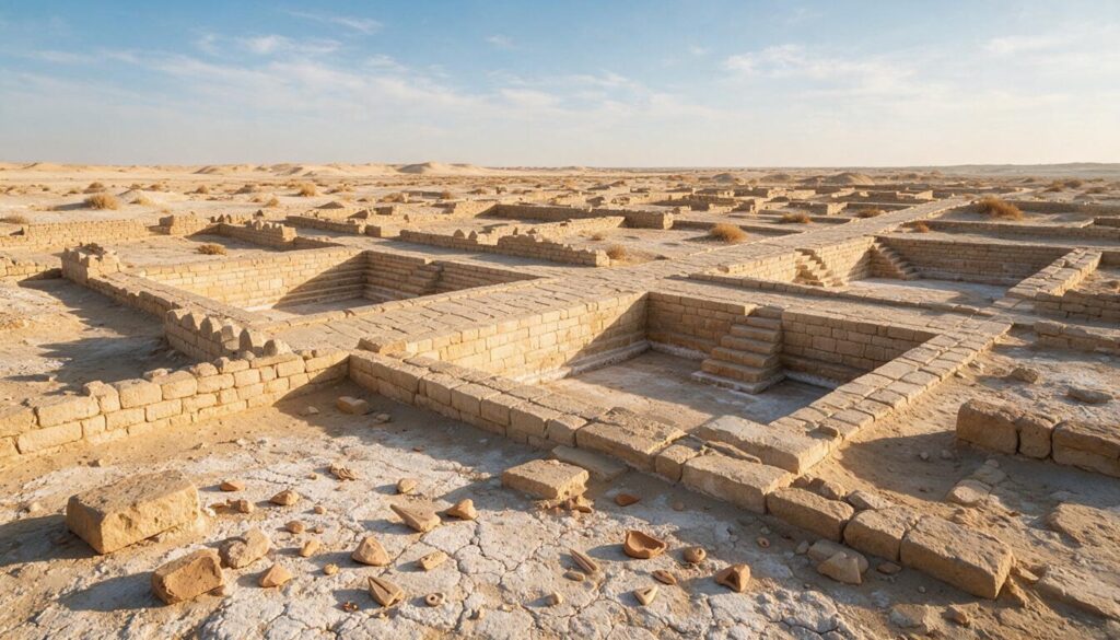
Dholavira sits on Khadir bet, an island of higher ground in the Great Rann of Kutch in Gujarat, and the setting explains almost everything about the city. The word “bet” means island, and Khadir rises just enough above the surrounding salt flats to stay dry when the Rann floods. Around it, for most of the year, lies a shimmering white expanse of salt and cracked mud where nothing grows and no fresh water flows on the surface.
That’s the puzzle the Harappans solved here. The site had two seasonal streams, Manhar and Mansar, that ran only briefly during the monsoon, and rainfall so scanty that a modern farmer would call the place unfarmable. Yet a city of roughly 100 hectares flourished on this island for centuries. The location wasn’t chosen despite the harshness. It was chosen for the strategic value of a defensible island near the coast and the Rann’s trade routes, and the water problem was simply engineered away.
The modern village nearby is called Dholavira, which gives the site its common name. Archaeologists also call it Kotada or Kotada Timba, meaning “large fort”, after the mound that first hinted at what lay buried. It was formally discovered in 1967-68 by J. P. Joshi of the Archaeological Survey of India, and serious excavation began only in 1990 under the archaeologist Ravindra Singh Bisht, whose team spent more than a decade uncovering the city. Dholavira ranks among the largest of the mature Harappan cities, part of the same Indus Valley Civilization whose broad features you should already have in place before drilling into any one site.
The water-conservation system that defines Dholavira
Dholavira’s reservoirs are the reason it’s on the world map, and they’re the single most exam-relevant thing about the site. In a place with two brief seasonal streams and barely any rain, the Harappans built at least sixteen reservoirs cut into the rock, ringing the city inside its walls and storing every drop the monsoon delivered.
The scale is worth carrying as a hard number. Some of these stone-cut reservoirs reach about 7 metres deep and stretch up to roughly 79 metres long, and together they occupied a large share of the walled city, so much that Dholavira is sometimes described as a settlement built around its water rather than the other way round. Think of the whole city as a giant rainwater tank with houses on top. That’s not far from the truth.
The system worked as a chain, and understanding the chain is what turns a fact into an answer. Earthen and stone dams and bunds were thrown across the seasonal Manhar and Mansar streams to intercept their brief flow. That water was channelled through stone drains into the reservoirs, where it was stored through the long dry months. Rock-cut wells, one of them a large stepped well near the citadel that’s among the oldest known, tapped groundwater as a backup. Storm water and rooftop runoff inside the city were also harvested and directed into the tanks. Nothing was allowed to run off and disappear into the salt.
The engineering runs deeper than storage. Excavators found rock-cut channels and inlets that fed water between reservoirs, so the tanks worked as a connected system rather than isolated pits, and one large reservoir on the eastern side was fitted with steps running down its full depth so people could reach the water level as it fell through the dry season. A city that could move, store and ration water at this scale wasn’t improvising. It was running a planned water utility four thousand years before the phrase existed, which is exactly why Dholavira anchors the argument that the Harappans were serious hydraulic engineers, not lucky settlers on a good river.
This is why Dholavira is the go-to example for any question on rainwater harvesting and traditional water management. It shows that sophisticated water conservation in India isn’t a modern borrowing but a four-thousand-year-old indigenous practice, and that a civilization can be organized, at the level of city planning, around the storage of a scarce resource. When you’re arguing that ancient India had genuine engineering science, this reservoir network belongs right next to the achievements you study under science and technology in ancient India.
A city in three parts: citadel, middle town and lower town
Dholavira followed a strict geometric plan, and its clearest signature is that it was divided into three distinct walled sections, a layout more rigidly separated than at most other Harappan cities. Fix these three and you’ve fixed the city’s structure.
At the top of the hierarchy stood the citadel, the most heavily fortified zone, itself split into two adjoining enclosures that excavators named the castle and the bailey. The castle had exceptionally thick double ramparts and was almost certainly where the ruling elite or administrators lived, the highest and best-defended ground in the city. Below and beside it lay the middle town, a planned residential area with its own fortification, streets and a separate gateway, thought to house officials and better-off residents. Furthest out was the lower town, the largest area, where the general population and craft workers lived and worked, parts of it also enclosed.
| Division | What it was | Who likely lived there |
|---|---|---|
| Citadel (castle + bailey) | Highest, most fortified zone with double ramparts | Rulers and administrators |
| Middle town | Separately walled planned residential area | Officials and well-off residents |
| Lower town | Largest area, partly walled | General population and craftspeople |
This tripartite plan carries real analytical weight. It suggests a clearly stratified society with a recognized hierarchy of space, which you can use as evidence in debates about social organization in the Harappan world. It also shows a level of deliberate town planning, water bodies and defensive walls integrated with residential zoning, that anchors Dholavira firmly within the wider Harappan civilization and its reputation for urban order.
One more feature is worth a line: between the castle and the middle town lay a large open ground that excavators interpret as a ceremonial or stadium-like space, possibly used for public gatherings or festivals. It’s the kind of detail that makes a Mains answer feel specific rather than generic.
The stone city and the ten-sign signboard
Two things about Dholavira make it genuinely distinctive among Harappan sites, and both make good, memorable answer points.
The first is its material. At Harappa and Mohenjo-daro, the buildings are overwhelmingly of baked and mud brick. At Dholavira, almost everything that survives is built of dressed stone, quarried locally and laid with real masonry skill. That switch is partly practical, since good stone was at hand on Khadir island and clay for bricks was not, but it also gives Dholavira a look and durability unlike its river-valley cousins. When a question contrasts Harappan sites, “brick cities versus the stone city of Dholavira” is a clean, high-value distinction.
The second is the famous Dholavira signboard. In a chamber beside the northern gateway of the citadel, excavators found the remains of a long inscription made of ten large signs of the Indus script, each about 37 centimetres high, inlaid in gypsum on a wooden board roughly 3 metres long. The wood had rotted away, but the gypsum letters kept their arrangement. It’s one of the longest single Indus inscriptions ever found, and it was mounted over a gateway where everyone entering the city would see it, which is why some scholars call it the world’s oldest known signboard.
Here’s the honest catch, and it matters for a balanced answer: nobody can read it. The Indus script remains undeciphered, so we don’t know whether the signboard names the city, blesses it, warns visitors, or does something else entirely. Its importance is not its meaning but its context and scale, direct evidence that the Harappans used writing publicly and monumentally. For the wider debate on early Indian writing and its limits, the survey of inscriptions in ancient India puts the signboard in its proper place.
Trade, crafts and the strange empty graves
Dholavira wasn’t a self-contained farming town. Its position near the coast and the Rann made it a trading hub, and the finds bear that out. Excavators recovered a busy craft economy: workshops for bead-making using semi-precious stones like carnelian and agate, shell-working from the nearby Arabian Sea, copper objects, seals, weights, terracotta, and pottery. The standardized weights and Indus seals found here are the same system used across the Harappan world, which tells you Dholavira was plugged into a shared network rather than doing its own thing.
That network reached well beyond India. Dholavira sat on the maritime route that linked the Harappans to Mesopotamia, trading through the region Mesopotamian records call Meluhha, exchanging beads, timber, ivory and semi-precious stones for the metals and goods of the west. So the little city on a salt island was a node in one of the oldest long-distance trade systems on earth, a point worth carrying into any answer on Harappan commerce or India’s ancient sea links.
The oddest finds are at the funerary ground west of the city. Dholavira’s cemetery holds a striking set of memorial structures, some large and dome-shaped, that on excavation turned out to contain no skeletons or bodies. They’re best understood as cenotaphs, empty memorials raised in someone’s honour rather than actual graves, which suggests a distinctive belief about death and commemoration. For students, this is a memorable, slightly eerie detail that separates Dholavira from other sites and gives an answer texture: a Harappan people who built grand tombs and then left them deliberately empty.
How long Dholavira lasted, and how it declined
Dholavira wasn’t a short-lived outpost. It was continuously occupied for well over a thousand years, and its excavator, R. S. Bisht, identified seven cultural stages at the site, spanning roughly 2650 BCE to 1450 BCE. That long, layered occupation is part of why it’s so valuable: you can read the rise, peak and gradual decline of a Harappan city in a single mound.
The stages track the familiar arc. The early phases show the settlement growing into a fortified town, the middle phases capture the mature, planned city at its height with the citadel and reservoirs in full use, and the later phases record decline. There was even a period of near-desertion around 1900 to 1850 BCE, after which the site was reoccupied on a poorer, less-organized scale during the Late Harappan phase, when the grand town planning gave way to smaller, rounder houses and a simpler way of life.
The decline probably came from a slow squeeze rather than a single catastrophe: a drying climate and weakening monsoon, the reduction of the seasonal streams the city depended on, changes in the Rann that affected trade and the coastline, and the broader eclipse of Harappan urban life across the region. As the monsoon faltered, even sixteen reservoirs couldn’t hold back a permanent shortfall, and the trade that justified the island’s location thinned as the wider Harappan world unravelled. The very location that let Dholavira thrive through clever water engineering also left it exposed the moment the water stopped coming reliably. That’s a neat, quotable irony for an answer on Harappan decline.
Why Dholavira became a UNESCO World Heritage Site
In July 2021, Dholavira was inscribed on the UNESCO World Heritage List, becoming India’s 40th World Heritage Site and the first Indus Valley Civilization site in India to earn the tag. It was also the fourth site from Gujarat on the list. Those four facts, 40th overall, first IVC site, 2021, from Gujarat, are the ones worth memorizing exactly.
UNESCO recognized Dholavira for its outstanding water-management system, its unique multi-layered fortifications and stone architecture, its planned three-part urban form, and its funerary structures and evidence of long-distance trade. The nomination made the case that Dholavira preserves the Harappan urban idea in an unusually complete and legible form, on a site that later reuse never destroyed. If you’re assembling the country’s inscribed sites for revision, the full list of UNESCO World Heritage Sites in India is worth keeping alongside the significance of World Heritage Day and the criteria UNESCO uses.
How to study Dholavira for the exam
Dholavira is high-value precisely because it plugs into several syllabus areas at once, so learn it as a connector.
Anchor five hard facts first, because most factual questions come straight from them: it’s on Khadir bet in the Great Rann of Kutch, Gujarat; it was excavated by R. S. Bisht from 1990; it has sixteen-plus stone reservoirs; it carries the ten-sign gypsum signboard; and it became India’s 40th and first-IVC UNESCO site in 2021. Next, hold the three-part plan, citadel with castle and bailey, middle town, lower town, as your structural spine. Third, keep two contrasts ready: brick cities versus the stone city, and river-valley sites versus the desert-island water city. Those contrasts are what let you compare Dholavira with Harappa, Mohenjo-daro and Lothal in a single sentence.
For Mains, practice deploying Dholavira as evidence rather than as a standalone topic. It backs answers on ancient Indian water conservation, on the sophistication of Harappan town planning, on social stratification, and on the vulnerability of civilizations to climate change. For sourcing, lean on the Archaeological Survey of India and UNESCO for the site facts and on standard NCERT and art-and-culture material for the framing. Don’t try to memorize every reservoir dimension. The concept, the location, and the five anchor facts carry the marks.
Frequently Asked Questions
Where is Dholavira located?
Dholavira is on Khadir bet, an island of raised ground in the Great Rann of Kutch, in the Kutch district of Gujarat. It sits amid the salt flats of the Rann and depended on two seasonal streams, the Manhar and Mansar, for water.
Why is Dholavira famous?
For its extraordinary water-conservation system. In a near-rainless desert, the Harappans built at least sixteen stone reservoirs and a network of dams, drains and wells to store seasonal water. Dholavira is also known for being built of stone rather than brick, its three-part city plan, and the ten-sign signboard.
What is the Dholavira signboard?
It’s a long inscription of ten large Indus-script signs, each about 37 centimetres high, that was inlaid in gypsum on a wooden board roughly 3 metres long and mounted over the northern gateway. It’s one of the longest known Indus inscriptions, but since the Indus script is undeciphered, its meaning is unknown.
How was Dholavira’s city divided?
Into three walled sections: the citadel (comprising the heavily fortified castle and the adjoining bailey), the middle town, and the largest lower town. This clear tripartite division points to a stratified, well-planned society.
Who discovered and excavated Dholavira?
It was discovered in 1967-68 by J. P. Joshi of the Archaeological Survey of India. Large-scale excavation began in 1990 under the archaeologist R. S. Bisht, who identified seven cultural stages at the site.
When did Dholavira become a UNESCO World Heritage Site?
In July 2021. It became India’s 40th World Heritage Site and the first site of the Indus Valley Civilization in India to receive the recognition. It was the fourth UNESCO site from Gujarat.
How old is Dholavira and why did it decline?
It was occupied for over a thousand years, roughly from 2650 BCE to 1450 BCE across seven stages. Its decline is linked to a drying climate and weakening monsoon, shrinking of its seasonal streams and changes in the Rann, and the wider eclipse of Harappan urban life.
Practice Questions
1. Dholavira is located in which of the following?
a) Kathiawar peninsula, Gujarat
b) Khadir bet in the Great Rann of Kutch, Gujarat
c) the Ghaggar plains of Haryana
d) the lower Indus valley, Sindh
Answer: b) Khadir bet in the Great Rann of Kutch, Gujarat
2. The Dholavira signboard is significant because it:
a) has been fully deciphered and names the city
b) is one of the longest Indus-script inscriptions, though undeciphered
c) is written in early Brahmi script
d) records a treaty between two Harappan cities
Answer: b) is one of the longest Indus-script inscriptions, though undeciphered
3. Which feature most distinguishes Dholavira from Harappa and Mohenjo-daro?
a) use of the potter’s wheel
b) presence of a great bath
c) construction largely in dressed stone rather than brick
d) worship of a mother goddess
Answer: c) construction largely in dressed stone rather than brick
4. Consider the following about Dholavira:
- It was divided into a citadel, a middle town and a lower town.
- It relied on at least sixteen reservoirs for water storage.
- It was India’s first Indus Valley site inscribed by UNESCO.
Which are correct?
a) 1 and 2 only
b) 2 and 3 only
c) 1 and 3 only
d) 1, 2 and 3
Answer: d) 1, 2 and 3
5. Dholavira became a UNESCO World Heritage Site in:
a) 2004
b) 2014
c) 2021
d) 2024
Answer: c) 2021
Mains-style questions
- “Dholavira represents Harappan hydraulic engineering at its peak.” Discuss its water-conservation system and what it reveals about the civilization’s adaptation to a harsh environment.
- Compare Dholavira with the river-valley Harappan cities of Harappa and Mohenjo-daro in terms of building material, town planning and setting.
- Examine what the three-part plan and the signboard of Dholavira suggest about social organization and the use of writing in the Harappan world.
- Ancient Indian water-harvesting traditions offer lessons for contemporary water management. Discuss with reference to Dholavira.
- Account for the decline of Dholavira and place it within the broader debate on the end of Harappan urbanism.
Dholavira rewards study because it refuses to be a footnote. It’s the proof that the Harappans didn’t just settle where rivers made life easy; they could engineer a great city onto a salt-ringed island and keep it alive for a thousand years on stored rain. Carry the reservoirs, the stone, the three towns and the silent signboard, and you’re holding one of the most versatile examples in the whole ancient-history syllabus, equally at home in an answer on urban planning, on water security, or on how civilizations rise and fall with the climate that feeds them.
Tell Google you want more of this.
Add Anantam IAS as a preferred sourceOne tap, and this site shows up more often in your own Top Stories, AI Overviews and AI Mode. Remove it any time.