The Farakka Barrage is one of those topics that shows up in two syllabus boxes at once, and that is exactly why aspirants get it half-right. Ask about it in a Geography paper and it is an engineering fix that saved Kolkata port from dying of silt. Ask about it in International Relations and it is the reason India and Bangladesh spent two decades arguing over the Ganga. Both descriptions are true, and the barrage only makes sense once you hold them together. A wall across a river in West Bengal turns out to be a story about ports, sediment, a lower riparian neighbour, and a treaty whose clock runs out in 2026. Here is the whole thing, in the order it actually connects.
What the Farakka Barrage is, and why it is a barrage and not a dam
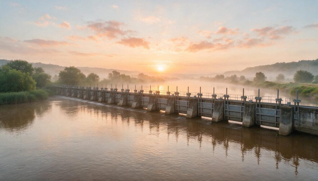
The Farakka Barrage is a gated structure across the Ganga at Farakka in Murshidabad district, West Bengal, roughly 18 km from the border with Bangladesh. It became operational on 21 April 1975. It runs over 2.2 km across the river and carries 109 gates that can be raised or lowered to control how much water goes where. It is managed by the Farakka Barrage Project under the Ministry of Jal Shakti.
The word to get right first is barrage, because it is not a dam. A dam is built to store water, holding a tall reservoir behind a high wall so you can release it on demand for power or irrigation. A barrage is a low structure whose job is to raise the water level just enough to divert it sideways, not to hoard it. Think of a dam as a bucket and a barrage as a speed bump with a side gate: it does not stack up a deep lake, it lifts the flow a little and steers a share of it into a canal. That distinction is the single most tested fact about Farakka, and it also explains why the barrage cannot simply “hold back extra water” the way people assume in an argument about Bangladesh. It was never engineered to store; it was engineered to redirect. The Ganga here is the trunk of the Himalayan river system, and understanding where it sits in India’s river systems helps you see why a diversion this far downstream has consequences all the way to the delta.
The idea of a barrage to revive Kolkata’s port was old, floated in various forms since the colonial period, but the modern project moved when construction began in 1961 and ran through the 1960s and early 1970s before the structure was commissioned in 1975. That long gestation matters for one reason: the barrage was designed and half-built during a period when the eastern half of Bengal was East Pakistan, and it only started diverting water in 1975, four years after that territory became independent Bangladesh. So the structure India engineered to solve an internal navigation problem began operating just as the downstream stretch became a sovereign neighbour with its own claim on the same water, and a domestic project turned overnight into a foreign-policy one.
Why India built it: saving Kolkata port from silt
India built Farakka to rescue Kolkata Port from slow strangulation by sediment. That is the entire origin story, and it predates independence.
Kolkata sits not on the main Ganga but on the Bhagirathi-Hooghly, a western distributary that peels off the Ganga and runs down to the Bay of Bengal. Over the 19th and 20th centuries the Ganga’s main flow shifted eastward toward the Padma channel in what is now Bangladesh, and the Bhagirathi-Hooghly started receiving less and less headwater during the dry season. A river starved of flow cannot flush itself, so silt settled in the Hooghly channel faster than the tide could scour it out. By the 1950s and 1960s, ships were struggling to reach Kolkata, and the port that had been the commercial heart of eastern India was silting toward irrelevance.
The engineering answer was to build a barrage on the main Ganga upstream, at Farakka, and use it to force a guaranteed share of dry-season water back into the Bhagirathi-Hooghly. That extra flow does one specific thing: it increases the river’s velocity in the lean months so the current keeps silt in suspension and carries it out to sea instead of letting it settle in the shipping channel. In plain terms, Farakka gives the Hooghly enough push to clean its own throat. The barrage diverts up to 40,000 cusecs (cubic feet per second) into a feeder canal precisely so Kolkata and the downstream Haldia port stay navigable. This is also why you cannot treat Farakka as a pure irrigation or power project the way you would a multipurpose river-valley scheme: its headline purpose is sediment management for a port, which is unusual and worth stating in exactly those words.
The Bhagirathi-Hooghly feeder canal: how the flushing actually works
The mechanism that carries diverted water from the barrage to the Hooghly is the Farakka Feeder Canal, and it is the physical link that makes the whole scheme function. The canal runs roughly 38 to 40 km from the barrage and rejoins the Bhagirathi-Hooghly near Jangipur, delivering the diverted Ganga water into the channel that flows down past Kolkata.
Picture the layout as a Y with a controllable junction. The Ganga arrives at Farakka as the top of the Y. The barrage gates decide the split: part of the flow is allowed to continue east into Bangladesh as the Padma, and part is lifted and steered into the feeder canal that forms the western arm heading toward the Hooghly. When India wants to flush Kolkata’s channel, it opens the diversion; the feeder canal fills; the extra water races down the Bhagirathi-Hooghly and keeps the silt moving. The barrage’s capacity to divert 40,000 cusecs is not an accident, it is matched to the feeder canal’s carrying capacity, and that same 40,000 cusecs figure becomes the anchor of the treaty numbers you are about to meet. Get the canal clear in your head and the diplomacy stops being abstract: every cusec that goes west to save the port is a cusec that does not go east to Bangladesh, and that trade-off is the seed of the entire dispute.
The India-Bangladesh dispute and the 1996 Ganga Water Treaty
The core conflict is simple to state: the Ganga is a shared river, and Farakka lets India divert dry-season water that Bangladesh, sitting downstream, also needs. India is the upper riparian, Bangladesh the lower riparian, and a lower riparian always fears what the upstream state does to the tap. When Farakka began diverting water in 1975, Bangladesh argued it was being deprived of flow it depended on for its own irrigation, navigation, and salinity control in the dry months. That grievance is the backbone of the water chapter in India-Bangladesh relations.
The two countries worked toward a settlement in stages. A short-term Agreement of 1977 was the first formal water-sharing deal, followed by Memoranda of Understanding in 1982 and 1985 that lapsed. The durable settlement came on 12 December 1996, when Prime Minister H. D. Deve Gowda and Bangladesh Prime Minister Sheikh Hasina signed the Ganga Water Treaty in New Delhi. It is a 30-year treaty, which is why its expiry falls in 2026, and it recognises Bangladesh’s rights as a lower riparian while giving India its Farakka diversion within an agreed formula.
The sharing formula, in plain numbers
The treaty splits the flow measured at Farakka in three tiers, and the driving idea is that when water is scarce, both sides share the pain rather than one side taking a fixed amount. The highest Indian diversion equals the 40,000-cusec feeder-canal capacity.
| Flow arriving at Farakka | India’s share | Bangladesh’s share |
|---|---|---|
| 75,000 cusecs or more | 40,000 cusecs | Balance of the flow |
| Between 70,000 and 75,000 cusecs | Balance of the flow | 35,000 cusecs |
| 70,000 cusecs or less | Half | Half (50:50) |
On top of the tiers, the treaty guarantees each country 35,000 cusecs in alternate ten-day periods during the driest stretch, from 11 March to 10 May, when the Ganga is at its thinnest and every cusec is contested. The elegance of the formula is that at very low flows nobody gets a guaranteed fixed volume off the top; the shortage is shared equally. That is a fairer design than the fixed-allocation logic of the Indus Waters Treaty with Pakistan, where whole rivers are assigned to each side rather than proportions of a single flow.
The unresolved question: where does more water come from?
Underneath the sharing formula sits a deeper disagreement the treaty never fully settled, and it is worth knowing because it explains why the dispute keeps returning. During the dry season the Ganga simply does not carry enough water for both a full Farakka diversion and Bangladesh’s needs, so the real fix is not just dividing the existing flow but augmenting it. India’s long-standing proposal has been to bring extra water into the Ganga through a link canal drawing on the water-rich Brahmaputra, part of the wider logic of interlinking rivers. Bangladesh has resisted that, preferring instead to build storage dams upstream in Nepal to hold monsoon water and release it in the lean months. Neither side has conceded, so the augmentation question stays open, and until it is answered the two countries are left arguing over how to slice a pie that is too small rather than agreeing how to bake a bigger one. This is the single most useful point to add to a standard answer, because it moves you past “they share water” to “they disagree on how to create more of it.”
Why 2026 is the year to watch
The treaty runs out in 2026, and renewal is not automatic. India and Bangladesh have been in talks, and a Joint Rivers Commission-level review has been examining a renewal or a fresh arrangement. Two things make the moment delicate. First, the Ganga’s dry-season flow has itself become less predictable, so both sides worry a formula written in 1996 may not fit a warmer, more erratic hydrology. Second, the wider relationship colours the water talks: whenever political trust between Delhi and Dhaka dips, technical negotiations over shared rivers get harder, exactly as they have on the still-unsigned deal over the Teesta. Watch whether the renewed treaty keeps the same tiers, adds a minimum guaranteed flow, or brings in joint data-sharing on actual releases, because that is where the negotiation will turn.
The criticism: silt, floods, erosion and the hilsa
Farakka’s critics argue it solved one silt problem by creating several others, and the charge sheet is worth knowing in specifics rather than as a vague “environmental impact” line.
The first complaint is sediment trapping and upstream flooding. Because the barrage raises the water level and slows the Ganga above it, sediment that used to move downstream now settles in the riverbed near the barrage. A raised, silt-choked bed means the river holds less water before it spills, so districts of Bihar upstream, around Bhagalpur and beyond, blame Farakka for worsening floods. The Bihar government has repeatedly demanded a review of the barrage on exactly these grounds. The second complaint is bank erosion in Malda and Murshidabad in West Bengal, where the altered flow regime eats away farmland and villages on the riverbanks.
The third and most evocative is the hilsa. The hilsa (ilish) is a prized migratory fish that swims up from the sea to breed in the freshwater reaches of the Ganga. The barrage is a physical wall across its migratory path, and after 1975 the hilsa catch upstream of Farakka collapsed while the fish stayed concentrated below the barrage and in Bangladesh’s Padma. For fishing communities and for the cultural life of Bengal on both sides of the border, the vanished upstream hilsa became the human face of what a barrage does to a river’s biology. Downstream, the reduced dry-season flow into Bangladesh has been linked to rising salinity in the southwest, which stresses agriculture and the mangrove ecology of the Sundarbans delta. None of this cancels the case for saving Kolkata port, but a good answer holds the benefit and the cost in the same frame rather than picking a side.
How to study Farakka for the exam
Treat Farakka as a hub that connects four themes you already study separately, and revise it through those links rather than as an isolated fact card.
Start with the one-line identity: a barrage, not a dam, on the Ganga in Murshidabad, West Bengal, operational 1975, built to divert up to 40,000 cusecs via a feeder canal into the Bhagirathi-Hooghly to flush silt and keep Kolkata and Haldia ports navigable. If you can say that sentence cleanly, you have the Geography and Economy angle covered. Then attach the treaty layer: 1977 first agreement, 1996 thirty-year Ganga Water Treaty signed by Deve Gowda and Sheikh Hasina, three-tier sharing formula, expiry in 2026. That is the International Relations angle, and it slots straight into your notes on the India-Bangladesh relationship alongside connectivity projects like the cross-border river bridges.
For value addition, keep three comparisons ready. Compare the proportional sharing at Farakka with the whole-river allocation of the Indus Waters Treaty, contrast the settled Ganga treaty with the stalled Teesta negotiation, and place Farakka’s single-purpose port logic against a genuine multipurpose project. In Mains, the barrage is a ready case study for upper-versus-lower riparian ethics, for the tension between national infrastructure and interstate impact when Bihar blames a Bengal barrage for its floods, and for the way ecology (hilsa, salinity, the delta) turns an engineering decision into a human one. Also fold in that the Ganga’s health at Farakka is inseparable from its condition upstream, where issues of river pollution and reduced flow compound one another. Study it as a network, and the same handful of facts will answer a Prelims MCQ, a Geography question, and a GS2 diplomacy question without any extra memorising.
Frequently Asked Questions
Is the Farakka Barrage a dam?
No. It is a barrage, a low gated structure that raises the water level to divert flow sideways, not a dam that stores water in a tall reservoir. Farakka’s job is to steer a share of the Ganga into a feeder canal, not to hold a lake behind it.
Which river is the Farakka Barrage built on, and where?
It is built on the Ganga at Farakka in Murshidabad district, West Bengal, roughly 18 km upstream of the Bangladesh border. It became operational in 1975.
Why was the Farakka Barrage constructed?
To save Kolkata Port. It diverts up to 40,000 cusecs of Ganga water through a feeder canal into the Bhagirathi-Hooghly during the dry season so the added flow flushes silt out of the channel and keeps Kolkata and Haldia ports navigable.
What is the 1996 Ganga Water Treaty?
A 30-year water-sharing treaty signed on 12 December 1996 by Prime Ministers H. D. Deve Gowda and Sheikh Hasina. It divides the dry-season flow measured at Farakka between India and Bangladesh using a three-tier formula and guarantees each country 35,000 cusecs in alternate ten-day periods during the leanest weeks.
Why is 2026 important for Farakka?
The 1996 treaty is valid for 30 years, so it expires in 2026. India and Bangladesh are in talks over renewal, and the terms of any new arrangement, especially a minimum guaranteed flow and joint data-sharing, are the key thing to watch.
How does the Farakka Barrage affect Bangladesh?
As the lower riparian, Bangladesh receives whatever India does not divert. Reduced dry-season flow has been linked to falling water availability, rising salinity in the southwest, and stress on agriculture and the Sundarbans delta, which is why water-sharing has long been a sensitive issue in India-Bangladesh ties.
What is the hilsa problem at Farakka?
The hilsa is a migratory fish that swims upstream from the sea to breed. The barrage blocks its path, so after 1975 the hilsa catch upstream of Farakka collapsed while the fish stayed concentrated below the barrage, hurting fishing communities in Bengal.
Practice Questions
1. The Farakka Barrage was constructed primarily to:
a) Generate hydroelectric power for West Bengal
b) Store water for irrigation in Bihar
c) Divert Ganga water to flush silt from the Kolkata port channel
d) Control floods in the Sundarbans delta
Answer: c
2. The feeder canal from the Farakka Barrage discharges into which river?
a) The Padma
b) The Bhagirathi-Hooghly
c) The Damodar
d) The Teesta
Answer: b
3. The 1996 Ganga Water Treaty was signed for a period of:
a) 15 years
b) 25 years
c) 30 years
d) 50 years
Answer: c
4. Under the 1996 Ganga Water Treaty, when the flow at Farakka is 70,000 cusecs or less, the water is:
a) Fully allotted to India
b) Shared equally between India and Bangladesh
c) Fully allotted to Bangladesh
d) Diverted entirely into the feeder canal
Answer: b
5. Which of the following is a criticism associated with the Farakka Barrage?
a) Upstream sediment deposition and flooding in Bihar
b) Bank erosion in Malda and Murshidabad
c) Disruption of hilsa fish migration
d) All of the above
Answer: d
Mains-style questions
- “The Farakka Barrage solved a port’s silt problem but created a river-sharing dispute.” Examine the engineering rationale behind Farakka and its consequences for India-Bangladesh relations.
- Discuss the water-sharing formula of the 1996 Ganga Water Treaty. How does it differ in design from the Indus Waters Treaty, and what challenges does its 2026 expiry pose?
- Evaluate the ecological and social costs of the Farakka Barrage on both the Indian and Bangladeshi sides of the border.
- Interstate impacts of national infrastructure often go unaddressed. Analyse this in the context of Bihar’s demand for a review of the Farakka Barrage.
- “Trust between neighbours is the real reservoir behind every shared-river treaty.” Comment with reference to the Ganga and Teesta negotiations.
Learn Farakka as a hinge, not a fact. It is where a port, a river, and a border all pass through the same set of gates, and the exam rewards the aspirant who can walk from the silt in the Hooghly to the cusecs in the treaty to the hilsa that no longer reaches Bihar without ever losing the thread. The barrage will keep earning questions precisely because it refuses to sit in one syllabus box, and the 2026 renewal guarantees it stays current for years. Hold the benefit and the cost together, keep the three comparison cases ready, and you will answer whatever angle the question takes.
Tell Google you want more of this.
Add Anantam IAS as a preferred sourceOne tap, and this site shows up more often in your own Top Stories, AI Overviews and AI Mode. Remove it any time.