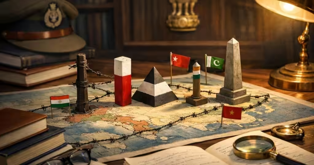
International boundary lines — drawn through wars, treaties, negotiations, and colonial agreements — define the political geography of the modern world. For UPSC, boundary lines appear in both Prelims (factual MCQs) and Mains (International Relations, Geography). Several boundary lines directly involve India and carry ongoing geopolitical significance. This reference guide covers all major boundary lines, their history, and current relevance.
Boundary Lines Involving India
Radcliffe Line
| Feature | Detail |
|---|---|
| Between | India and Pakistan (both West and East Pakistan/Bangladesh) |
| Drawn By | Sir Cyril Radcliffe |
| Year | 1947 |
| Purpose | Partition of British India |
| Length | ~3,323 km (India-Pakistan) + ~4,096 km (India-Bangladesh) |
The Radcliffe Line, drawn in just five weeks by Sir Cyril Radcliffe — who had never visited India before — divided British India into India and Pakistan. The line split Punjab in the west and Bengal in the east, triggering one of history's largest mass migrations and communal violence.
UPSC Significance: Partition history, India-Pakistan relations, India-Bangladesh border management, refugee crisis.
McMahon Line
| Feature | Detail |
|---|---|
| Between | India and China (Tibet) |
| Drawn By | Sir Henry McMahon |
| Year | 1914 (Simla Convention) |
| Purpose | Demarcate India-Tibet border |
| Status | Accepted by India, rejected by China |
The McMahon Line was drawn at the Simla Convention (1914) between British India and Tibet. China — which considers Tibet part of its territory — has never accepted this line. The boundary dispute was a primary cause of the 1962 India-China War and remains unresolved.
UPSC Significance: India-China relations, Arunachal Pradesh dispute, LAC (Line of Actual Control), 1962 war.
Durand Line
| Feature | Detail |
|---|---|
| Between | Pakistan and Afghanistan |
| Drawn By | Sir Mortimer Durand |
| Year | 1893 |
| Length | ~2,640 km |
| Status | Recognized by Pakistan, disputed by Afghanistan |
The Durand Line was drawn between British India and Afghanistan. After Partition, Pakistan inherited this boundary. Afghanistan has never fully accepted it, claiming Pashtun areas on the Pakistani side. This dispute fuels cross-border tensions and impacts India's strategic calculus in the region.
UPSC Significance: Afghanistan-Pakistan relations, Pashtun issue, India’s neighbourhood policy.
Line of Control (LoC)
| Feature | Detail |
|---|---|
| Between | India and Pakistan (in Kashmir) |
| Established | 1972 (Simla Agreement) |
| Predecessor | Ceasefire Line (1949) |
| Length | ~740 km |
| Status | De facto border, not international boundary |
The LoC converted the 1949 Ceasefire Line into a more formally recognized boundary after the 1971 war. It's not an international border — both India and Pakistan claim the entire territory of Jammu & Kashmir.
Line of Actual Control (LAC)
| Feature | Detail |
|---|---|
| Between | India and China |
| Length | ~3,488 km |
| Status | Not clearly demarcated; different perceptions by both sides |
| Sectors | Western (Ladakh), Middle (UP/Uttarakhand), Eastern (Arunachal Pradesh) |
The LAC is not a mutually agreed line. India and China have different perceptions of where it lies, leading to recurring standoffs — Doklam (2017), Galwan Valley (2020), and other friction points.
Related: India-China Relations: Complete Analysis
Major World Boundary Lines
Complete Reference Table
| Boundary Line | Between | Year | Drawn By/Treaty |
|---|---|---|---|
| Radcliffe Line | India–Pakistan/Bangladesh | 1947 | Sir Cyril Radcliffe |
| McMahon Line | India–China (Tibet) | 1914 | Sir Henry McMahon |
| Durand Line | Pakistan–Afghanistan | 1893 | Sir Mortimer Durand |
| 17th Parallel | North Vietnam–South Vietnam | 1954 | Geneva Accords |
| 38th Parallel | North Korea–South Korea | 1945 | US and USSR |
| 49th Parallel | USA–Canada | 1846 | Oregon Treaty |
| Maginot Line | France–Germany | 1930s | France (defensive fortification) |
| Siegfried Line | Germany | 1930s | Germany (defensive fortification) |
| Hindenburg Line | France/Belgium (WWI) | 1917 | Germany (defensive retreat line) |
| Mason-Dixon Line | Pennsylvania–Maryland (USA) | 1767 | Charles Mason, Jeremiah Dixon |
| Oder-Neisse Line | Germany–Poland | 1945 | Potsdam Conference |
| Mannerheim Line | Finland–Russia | 1939 | Finland (defensive fortification) |
| Blue Line | Israel–Lebanon | 2000 | United Nations |
| Green Line | Israel–Palestine (pre-1967) | 1949 | Armistice agreements |
| Purple Line | Israel–Syria (Golan Heights) | 1974 | UN Disengagement Agreement |
| Curzon Line | Poland–Russia | 1920 | Lord Curzon |
Cold War Lines
| Line | Significance |
|---|---|
| 38th Parallel | Divided Korea into communist North and democratic South. The Korean War (1950–53) reinforced this division. Demilitarized Zone (DMZ) runs along it. |
| 17th Parallel | Divided Vietnam after the French withdrawal. The Vietnam War (1955–75) eventually reunified Vietnam under communist rule in 1975. |
| Iron Curtain | Not a physical line but Churchill's term for the ideological boundary between Western democracies and Soviet-controlled Eastern Europe during the Cold War. |
| Berlin Wall | Physical barrier (1961–1989) dividing East and West Berlin. Its fall symbolized the end of the Cold War. |
Famous Defensive Lines
| Line | Context |
|---|---|
| Maginot Line | French fortification along the German border, built in the 1930s. Germany bypassed it through Belgium in 1940, rendering it strategically useless. |
| Siegfried Line | German defensive fortification opposite the Maginot Line. |
| Hindenburg Line | German defensive position in WWI. Breaking this line in 1918 contributed to Germany's defeat. |
| Bar-Lev Line | Israeli fortification along the Suez Canal. Breached by Egypt in the 1973 Yom Kippur War. |
| Mannerheim Line | Finnish fortifications against Soviet invasion during the Winter War (1939–40). |
Boundary Lines by Continent
Asia
| Line | Countries |
|---|---|
| McMahon Line | India–China |
| Durand Line | Pakistan–Afghanistan |
| Radcliffe Line | India–Pakistan, India–Bangladesh |
| 38th Parallel | North Korea–South Korea |
| 17th Parallel | Former North–South Vietnam |
| LoC | India–Pakistan (Kashmir) |
| LAC | India–China |
Europe
| Line | Countries/Context |
|---|---|
| Oder-Neisse Line | Germany–Poland |
| Curzon Line | Poland–Russia (historic) |
| Maginot Line | France–Germany border |
| Mannerheim Line | Finland–Russia |
Middle East
| Line | Countries |
|---|---|
| Blue Line | Israel–Lebanon |
| Green Line | Israel–Palestine |
| Purple Line | Israel–Syria |
North America
| Line | Countries |
|---|---|
| 49th Parallel | USA–Canada |
| Mason-Dixon Line | Historical line within USA (free states vs slave states) |
Boundary Disputes: Current Hotspots
| Dispute | Parties | Status |
|---|---|---|
| LAC (India-China) | India, China | Ongoing negotiations, periodic standoffs |
| LoC (Kashmir) | India, Pakistan | Ceasefire since 2021, status quo |
| Durand Line | Pakistan, Afghanistan | Afghanistan doesn't recognize |
| 38th Parallel/DMZ | North Korea, South Korea | Technically still at war |
| Green Line | Israel, Palestine | Central to peace negotiations |
| Crimea | Russia, Ukraine | Annexed by Russia (2014), disputed |
Frequently Asked Questions
What is the difference between LoC and LAC?
The Line of Control (LoC) separates Indian and Pakistani-administered Kashmir. It was formalized in the 1972 Simla Agreement and is relatively well-defined with ceasefire monitoring. The Line of Actual Control (LAC) is the de facto India-China border, which isn't clearly demarcated — both countries have different perceptions of where it lies, causing recurring standoffs.
Why doesn't China accept the McMahon Line?
China argues the McMahon Line was drawn between British India and Tibet without Chinese consent. Since China considers Tibet part of its territory, it views the Simla Convention (1914) as invalid. China claims approximately 90,000 sq km of Arunachal Pradesh (which it calls "South Tibet") based on this position.
What is the significance of the 49th Parallel?
The 49th Parallel forms the boundary between the United States and Canada from the Pacific coast to the Great Lakes region. Established by the Oregon Treaty of 1846, it's one of the world's longest undefended international borders — symbolizing peaceful coexistence between the two nations.
Which boundary line caused the largest human displacement?
The Radcliffe Line, drawn during India's partition in 1947, caused the largest mass migration in history. An estimated 10–15 million people were displaced as Hindus moved to India and Muslims to Pakistan. The partition also led to communal violence that killed an estimated 200,000 to 2 million people.
Are defensive lines the same as boundary lines?
No. Defensive lines (Maginot, Siegfried, Hindenburg, Mannerheim) are military fortifications built within or along a country's territory for defence against invasion. They're not international boundaries. Boundary lines (Radcliffe, McMahon, Durand) define political borders between nations and carry legal and sovereignty implications.
Tell Google you want more of this.
Add Anantam IAS as a preferred sourceOne tap, and this site shows up more often in your own Top Stories, AI Overviews and AI Mode. Remove it any time.