Disclosure: this guide contains Amazon affiliate links. As an Amazon Associate, Anantam IAS earns from qualifying purchases — at no extra cost to you.
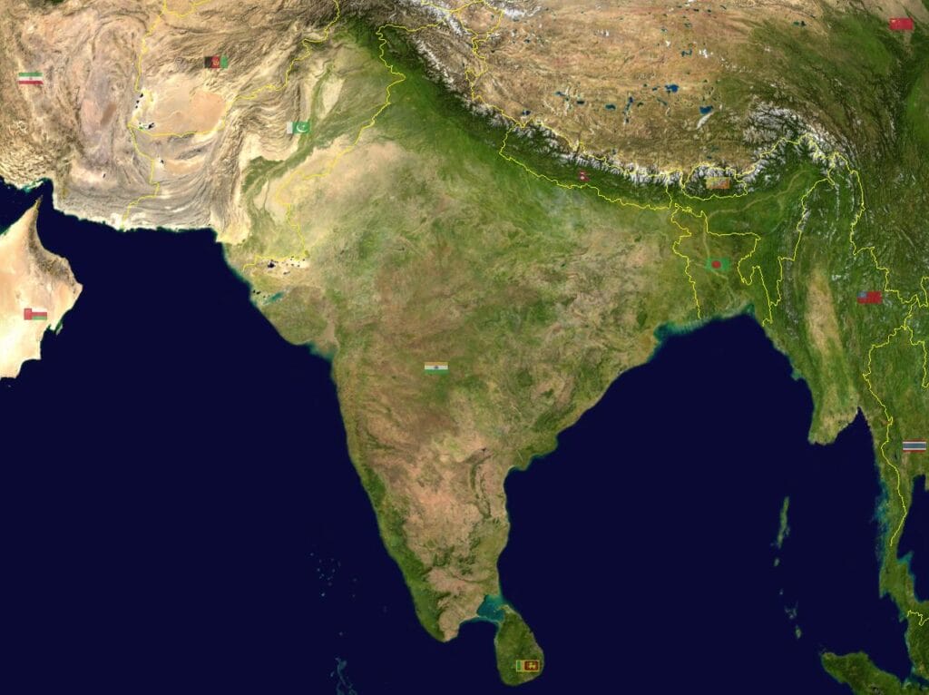
India shares its borders with 9 countries — 7 sharing land borders and 2 sharing only maritime boundaries. This makes India one of the countries with the most neighbours in Asia. For UPSC, India’s borders are tested in Geography (GS1), International Relations (GS2), and Security (GS3). Map-based questions on border states, border lengths, and boundary lines are Prelims staples.
India's 7 Land Neighbours
| # | Country | Border Length (km) | Border Name/Line | Indian States Sharing Border |
|---|---|---|---|---|
| 1 | Bangladesh | 4,096 | — | West Bengal, Assam, Meghalaya, Tripura, Mizoram |
| 2 | China | 3,488 | Line of Actual Control (LAC) / McMahon Line | Jammu & Kashmir (UT), Ladakh (UT), Himachal Pradesh, Uttarakhand, Sikkim, Arunachal Pradesh |
| 3 | Pakistan | 3,323 | Radcliffe Line / Line of Control (LoC) | Jammu & Kashmir (UT), Ladakh (UT), Punjab, Rajasthan, Gujarat |
| 4 | Nepal | 1,751 | Open border | Uttarakhand, Uttar Pradesh, Bihar, West Bengal, Sikkim |
| 5 | Myanmar | 1,643 | — | Arunachal Pradesh, Nagaland, Manipur, Mizoram |
| 6 | Bhutan | 699 | — | Sikkim, West Bengal, Assam, Arunachal Pradesh |
| 7 | Afghanistan | 106 | Durand Line (via PoK) | Ladakh (UT) — through Pakistan-occupied Kashmir |
Key fact: Bangladesh has the longest border with India (4,096 km), not Pakistan or China. This is a common Prelims trick question.
Afghanistan: India shares a very short border (106 km) with Afghanistan through the Wakhan Corridor — a narrow strip of Afghan territory that separates Pakistan from Tajikistan. This border runs through Pakistan-occupied Kashmir (PoK/Gilgit-Baltistan), which India claims as its territory but does not control. The border is therefore theoretical from a practical standpoint.
India's 2 Maritime Neighbours
| # | Country | Water Body | Separation |
|---|---|---|---|
| 1 | Sri Lanka | Palk Strait, Gulf of Mannar | Separated by approximately 30 km at the narrowest point (Palk Strait); Adam's Bridge (Ram Setu) — a chain of limestone shoals — connects the two |
| 2 | Maldives | Lakshadweep Sea / Arabian Sea | Separated by approximately 700 km from the Indian mainland (but much closer to Lakshadweep islands — ~130 km) |
Sri Lanka is separated from India by the Palk Strait (narrowest point ~30 km). The disputed Katchatheevu island was ceded to Sri Lanka in 1974. Indian fishermen from Tamil Nadu regularly cross into Sri Lankan waters, creating a recurring bilateral issue.
Maldives is India’s closest maritime neighbour in the Indian Ocean and strategically important for India’s maritime security in the Indian Ocean Region (IOR).
Key Border Lines and Boundary Issues
| Border Line | Between | Significance |
|---|---|---|
| Radcliffe Line | India–Pakistan (Punjab and Bengal borders) | Drawn by Sir Cyril Radcliffe in 1947 during Partition; divided Punjab and Bengal |
| Line of Control (LoC) | India–Pakistan (J&K) | Established after 1972 Shimla Agreement; not a legally recognised international boundary |
| Line of Actual Control (LAC) | India–China | De facto border; not formally demarcated; source of frequent standoffs (Doklam 2017, Galwan 2020) |
| McMahon Line | India–China (Arunachal Pradesh) | Drawn at the Simla Convention (1914); accepted by India and Tibet; rejected by China |
| Durand Line | Afghanistan–Pakistan | Drawn in 1893; separates Afghanistan from Pakistan; India's Afghan border runs through PoK beyond this line |
| Sir Creek | India–Pakistan (Gujarat-Sindh) | Disputed marshy boundary in the Rann of Kutch |
Country-by-Country Key Facts
1. Pakistan (3,323 km)
- Capital: Islamabad
- Border states: J&K, Ladakh, Punjab, Rajasthan, Gujarat
- Key issues: Kashmir dispute, LoC violations, cross-border terrorism, Indus Water Treaty, Sir Creek dispute
- Border features: Thar Desert (Rajasthan), Rann of Kutch (Gujarat), Punjab plains, mountain terrain (J&K/Ladakh)
2. China (3,488 km)
- Capital: Beijing
- Border states/UTs: Ladakh, HP, Uttarakhand, Sikkim, Arunachal Pradesh
- Key issues: LAC not demarcated, Aksai Chin (occupied by China, claimed by India), Arunachal Pradesh (claimed by China as "South Tibet"), Doklam, Galwan Valley
- Border features: Entirely mountainous — Karakoram, Himalayas, trans-Himalayan region
3. Bangladesh (4,096 km — longest)
- Capital: Dhaka
- Border states: West Bengal, Assam, Meghalaya, Tripura, Mizoram
- Key issues: Illegal immigration, river water sharing (Teesta, Ganges), border fencing, enclaves (resolved by 2015 Land Boundary Agreement)
- Border features: Riverine, flat terrain, difficult to fence in many areas
4. Nepal (1,751 km)
- Capital: Kathmandu
- Border states: Uttarakhand, UP, Bihar, West Bengal, Sikkim
- Key issues: Open border (free movement under 1950 Treaty), Kalapani-Lipulekh-Limpiyadhura territorial dispute, anti-India sentiment in Nepali politics, Chinese influence
- Open border: Indian and Nepali citizens can cross without passports or visas
5. Myanmar (1,643 km)
- Capital: Naypyidaw
- Border states: Arunachal Pradesh, Nagaland, Manipur, Mizoram
- Key issues: Insurgent groups operating across border, Free Movement Regime (FMR) — allowing border tribes to travel 16 km into each other's territory, Kaladan Multi-Modal Transit project, refugees from Myanmar's civil conflict
- Note: India ended the FMR in 2024–25 and began border fencing
6. Bhutan (699 km)
- Capital: Thimphu
- Border states: Sikkim, West Bengal, Assam, Arunachal Pradesh
- Key issues: India's closest strategic ally in South Asia, Doklam standoff (2017) involved India defending Bhutanese territory against Chinese road-building, hydropower cooperation
- Relationship: India-Bhutan Treaty of Friendship (1949, revised 2007)
7. Afghanistan (106 km)
- Capital: Kabul
- Border: Through PoK (Wakhan Corridor area)
- Key issues: No functional border crossing (border runs through PoK); India's development assistance to Afghanistan; Taliban government since August 2021
Which Indian States Border the Most Countries?
| State/UT | Countries Bordered | Count |
|---|---|---|
| Arunachal Pradesh | China, Myanmar, Bhutan | 3 |
| Sikkim | China, Nepal, Bhutan | 3 |
| West Bengal | Bangladesh, Nepal, Bhutan | 3 |
| Ladakh (UT) | China, Pakistan, Afghanistan | 3 |
Prelims favourite: Sikkim and Arunachal Pradesh each border 3 countries. West Bengal also borders 3 countries (Bangladesh, Nepal, Bhutan).
India's Total Land Border
India's total land border is approximately 15,106 km (figures vary slightly across sources).
| Country | Border Length (km) | % of Total |
|---|---|---|
| Bangladesh | 4,096 | 27.1% |
| China | 3,488 | 23.1% |
| Pakistan | 3,323 | 22.0% |
| Nepal | 1,751 | 11.6% |
| Myanmar | 1,643 | 10.9% |
| Bhutan | 699 | 4.6% |
| Afghanistan | 106 | 0.7% |
| Total | ~15,106 | 100% |
India's coastline is approximately 7,516 km (mainland: 6,100 km; islands: 1,416 km).
Strategic Significance
Neighbourhood First Policy
India's foreign policy since 2014 has emphasised the "Neighbourhood First" doctrine — prioritising relations with immediate neighbours through development assistance, connectivity projects, and institutional frameworks like SAARC and BIMSTEC.
Buffer States
Historically, Nepal and Bhutan served as buffer states between India and China. Their strategic orientation remains critical to India's northern border security.
Border Security Architecture
| Force | Border Responsibility |
|---|---|
| BSF (Border Security Force) | Pakistan and Bangladesh borders |
| ITBP (Indo-Tibetan Border Police) | China border (LAC) |
| SSB (Sashastra Seema Bal) | Nepal and Bhutan borders |
| Assam Rifles | Myanmar border |
UPSC Map-Based Tips

India and World Political Maps, laminated 70 × 100 cm (pair)
- Two maps in one set: India political and world political, 70 × 100 cm each
- Laminated on both sides, wipe-clean, with adhesive strips already applied
- Certified maps with states, countries, capitals and major physical features labelled
- Know which states border which country — this is the most common question type
- Border lengths: Bangladesh > China > Pakistan > Nepal > Myanmar > Bhutan > Afghanistan
- Trick questions: "Which state borders both China and Myanmar?" → Arunachal Pradesh
- Maritime boundaries: Sri Lanka (Palk Strait), Maldives (Lakshadweep Sea)
- Disputed areas: Aksai Chin, Arunachal Pradesh, PoK, Kalapani, Sir Creek
Key Prelims Facts
- Total land neighbours: 7 (+ 2 maritime = 9 total)
- Longest border: Bangladesh (4,096 km)
- Shortest border: Afghanistan (106 km)
- Open border: Nepal (1950 Treaty)
- States bordering 3 countries: Arunachal Pradesh, Sikkim, West Bengal, Ladakh
- Total land border: ~15,106 km
- Total coastline: ~7,516 km
- Border forces: BSF (Pak/BD), ITBP (China), SSB (Nepal/Bhutan), Assam Rifles (Myanmar)
Tell Google you want more of this.
Add Anantam IAS as a preferred sourceOne tap, and this site shows up more often in your own Top Stories, AI Overviews and AI Mode. Remove it any time.