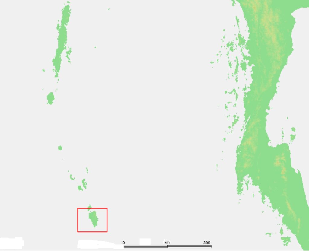
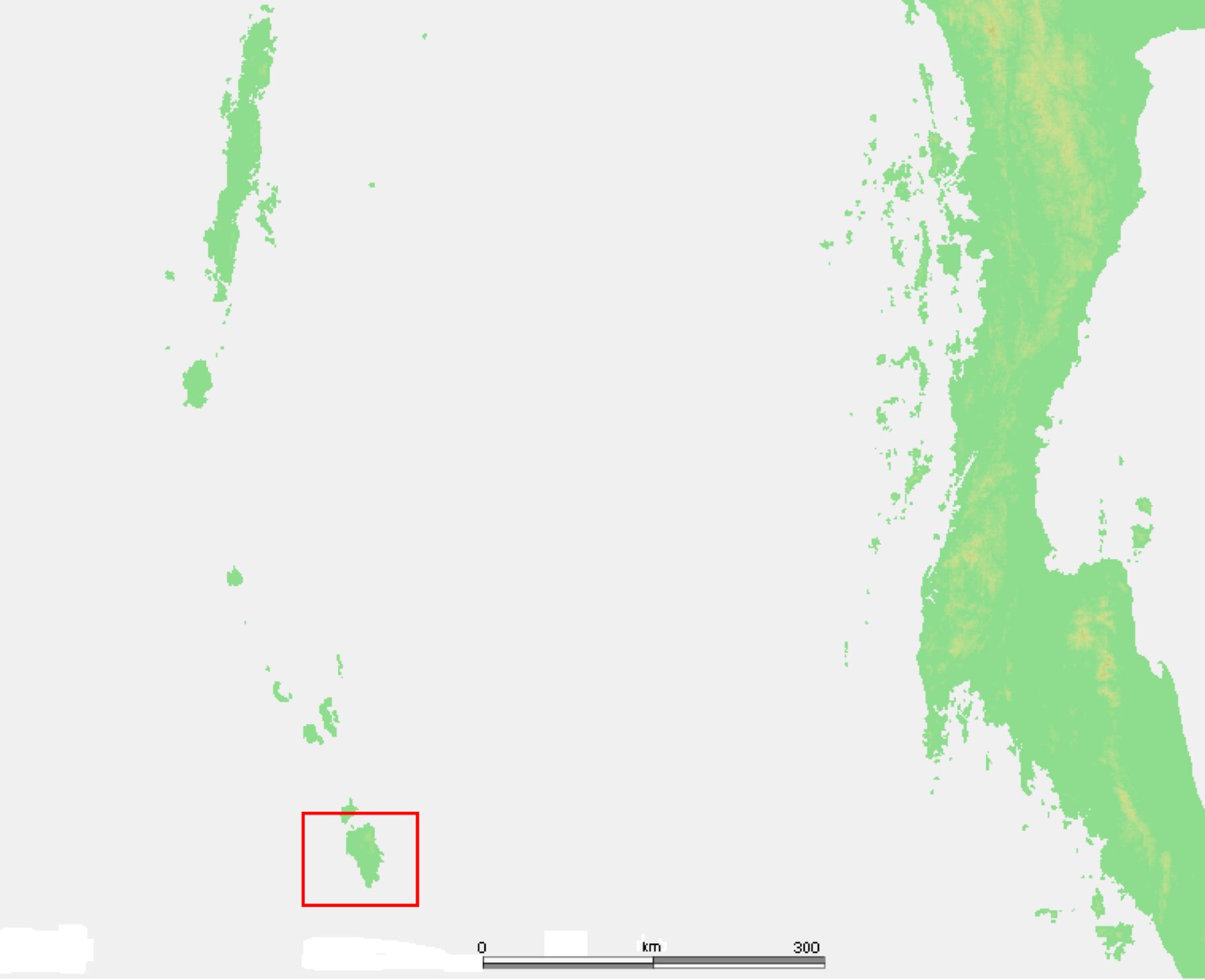
The southernmost tip of India is Indira Point in Great Nicobar Island of the Andaman and Nicobar Islands. It sits at 6 degrees 45 minutes north latitude. The southernmost point of the Indian mainland, by contrast, is Kanyakumari at the tip of Tamil Nadu, at 8 degrees 4 minutes north. Both points are correct answers to the question “where does India end in the south,” depending on whether you mean the geographical extent of the Republic of India (which includes its island territories) or only the mainland.
For UPSC and most general-knowledge tests, the southernmost tip of India is Indira Point. The mistake of saying Kanyakumari is so common that the distinction between the two has become a standard prelims trap. The difference of about one and a half degrees of latitude, or roughly 160 kilometres, separates the southern edge of the Indian mainland from the actual southern limit of Indian territory.
This article explains both points, the history behind the name Indira Point, the impact of the 2004 Indian Ocean tsunami that submerged part of the lighthouse there, the geographical extent of India in all four directions, and the reasons UPSC keeps returning to this topic.
Quick Facts: The Two Southernmost Points
The two points that share the title in common usage are easily confused. The vital facts of each are worth memorising.
- Indira Point, Great Nicobar: 6 degrees 45 minutes 10 seconds N, 93 degrees 49 minutes 36 seconds E. The southernmost point of India including all territories.
- Kanyakumari, Tamil Nadu: 8 degrees 4 minutes N, 77 degrees 33 minutes E. The southernmost point of the Indian mainland.
- Distance between them: about 1,800 km in a straight line across the Bay of Bengal.
- Distance from Indira Point to Indonesia: about 145 km to the nearest Sumatran island (Pulau Rondo).
- Distance from Kanyakumari to Sri Lanka: about 110 km across the Gulf of Mannar.
The southernmost tip of India, when the full Republic is meant, is Indira Point.
What Is Indira Point and Where Is It
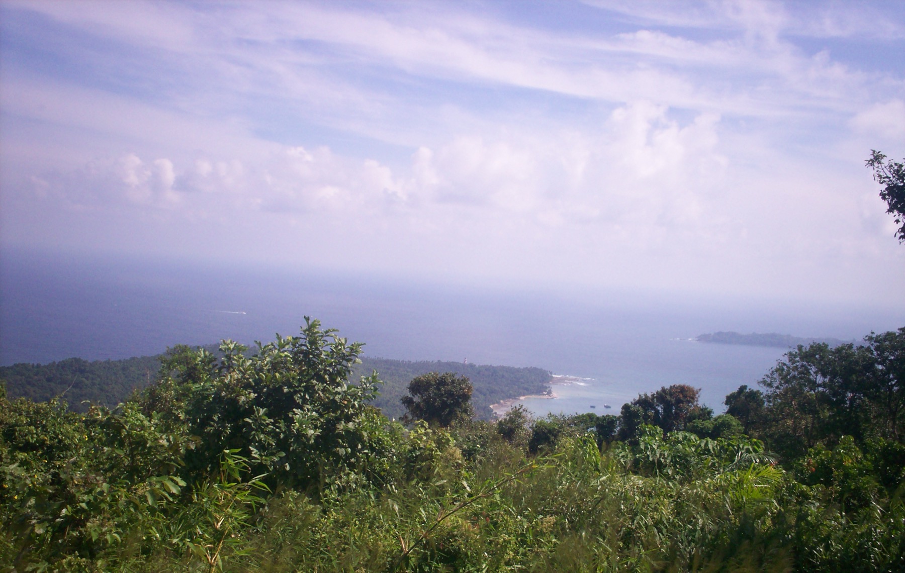
Indira Point lies at the southern tip of Great Nicobar, the largest island in the Nicobar group. The Nicobars together form the southern half of the Andaman and Nicobar Islands, an Indian Union Territory in the eastern Bay of Bengal.
Before 1985, Indira Point was called Pygmalion Point. It was renamed Indira Point in honour of Prime Minister Indira Gandhi after her assassination in 1984. The renaming was formal and the older name has largely disappeared from official maps, though it still appears in some older geography textbooks and atlases.
The point itself is the southernmost cape of Great Nicobar Island. A lighthouse was built there in 1972 and commissioned by then Vice President G.S. Pathak. Until 2004 it stood about 23 metres above sea level and served the busy shipping lane between the Strait of Malacca and the Indian Ocean.
The site is remote even by Indian island standards. The nearest large settlement is Campbell Bay, about 30 km to the north. Access historically depended on a sea connection from Port Blair, the capital of the Andaman and Nicobar Islands, which lies about 530 km to the north.
Indira Point After the 2004 Tsunami
The 26 December 2004 Indian Ocean earthquake and tsunami changed Indira Point physically. The epicentre of the magnitude 9.1 earthquake was about 500 kilometres north of Indira Point in the Andaman Sea. The seabed at the southern Nicobars subsided sharply, and the tsunami waves that followed inundated the southern cape of Great Nicobar.
The most measurable effect was that the land at Indira Point subsided by about 4.25 metres. The base of the lighthouse, which had previously stood well above mean sea level, is now permanently submerged in shallow water. The 23-metre tower itself still stands but with its lower section in the sea. The helipad, several houses near the lighthouse and large areas of coastal vegetation were washed away.
Between sixteen and twenty families who lived in and around the lighthouse complex were lost in the tsunami, along with four scientists who were studying leatherback sea turtles at the southern beaches. The lighthouse was extensively damaged and only restored to limited service after repairs.
The submergence of part of Indira Point is occasionally cited in popular writing as evidence that India’s southernmost point “moved north” after 2004. That is technically inaccurate. The geographical point itself did not relocate. The lighthouse remains where it was. What changed is that the land surface at that exact coordinate is now under water at low tide. The internationally recognised southernmost point of Indian territory is unchanged.
Why Kanyakumari Is the Mainland Southernmost Point
Kanyakumari, formerly Cape Comorin, lies at the meeting point of the Western Ghats and the Eastern Ghats and at the southern tip of the Indian peninsula. It sits in Tamil Nadu, at the southern end of the coastal plains of India where the Coromandel and Malabar coasts meet.
At 8 degrees 4 minutes north, Kanyakumari is the southernmost point of the Indian landmass that is connected by continuous land to the rest of India. It is also the only place in India where the Arabian Sea, the Bay of Bengal and the Indian Ocean are said to meet, although the boundaries between the three are conventional rather than geological.
The name Kanyakumari is from Sanskrit and refers to the Kanyakumari Amman temple at the cape, dedicated to the goddess Kanya Kumari, an aspect of Devi. The Vivekananda Rock Memorial and the Thiruvalluvar Statue lie just offshore.
For tourism, Kanyakumari is by far the better-known southernmost point. For administrative geography it is the southernmost district headquarters on the mainland.
Geographical Extent of India: All Four Cardinal Points
The four cardinal extreme points of India are a standard prelims question. The southernmost tip of India is only one of four corners.
Northernmost point: Indira Col, at the eastern end of the Siachen Glacier in the Karakoram. Located at about 35 degrees 40 minutes north. This is the official northernmost limit of the Indian-administered territory.
Southernmost point: Indira Point, Great Nicobar, at 6 degrees 45 minutes north.
Westernmost point: Ghuar Mota or Sir Creek area, in Kutch district of Gujarat, near the disputed boundary with Pakistan. Located at about 68 degrees 7 minutes east.
Easternmost point: Kibithu in Arunachal Pradesh (formerly cited as Walong), at about 97 degrees 24 minutes east.
The north-south extent of India is therefore about 3,214 km and the east-west extent is about 2,933 km, giving roughly a 1.1:1 ratio. Mainland India extends from 8 degrees 4 minutes north to 37 degrees 6 minutes north and from 68 degrees 7 minutes east to 97 degrees 25 minutes east.
Geographic vs Geopolitical: Why the Distinction Matters
The southernmost tip of India question gets sharper when you ask exactly what counts as India.
The Republic of India, as a sovereign state, includes all its island territories. That makes Indira Point the correct southernmost point.
The Indian mainland, as a continuous landmass, ends at Kanyakumari. Anyone asking about the geographical Indian Peninsula or about the southernmost city or state capital will get Kanyakumari as the answer.
The Indian subcontinent, a larger tectonic and historical concept that includes Pakistan, Bangladesh, Nepal, Bhutan, Sri Lanka and the Maldives, extends further south. Sri Lanka’s Dondra Head is at about 5 degrees 55 minutes north, which makes it the southernmost point of the Indian subcontinent as a physiographic region, though it is in a separate sovereign state.
This three-way distinction (mainland, sovereign territory, subcontinent) is what makes the southernmost-tip question a perennial prelims favourite.
Andaman and Nicobar Islands at a Glance
The Andaman and Nicobar Islands are a chain of 572 islands, of which only 38 are permanently inhabited. They lie in the southeastern Bay of Bengal and form an Indian Union Territory administered from Port Blair.
The chain is divided into the Andaman group in the north and the Nicobar group in the south, separated by the Ten Degree Channel (so called because it lies along the 10th parallel north).
Geologically the islands are the exposed peaks of an underwater ridge that continues the Arakan Yoma of Myanmar to the north and connects to the Sumatran arc of Indonesia to the south. They sit close to a major tectonic plate boundary, which is why the 2004 earthquake was so severe in this area.
Great Nicobar is the largest of the Nicobar Islands at about 1,045 sq km. The southern part of the island includes the Great Nicobar Biosphere Reserve and two national parks (Campbell Bay and Galathea). The biosphere reserve is one of UNESCO’s Man and Biosphere Reserve sites. Indira Point lies just outside the formally protected boundaries but is part of the wider biosphere area.
Strategic Importance of the Southern Tip
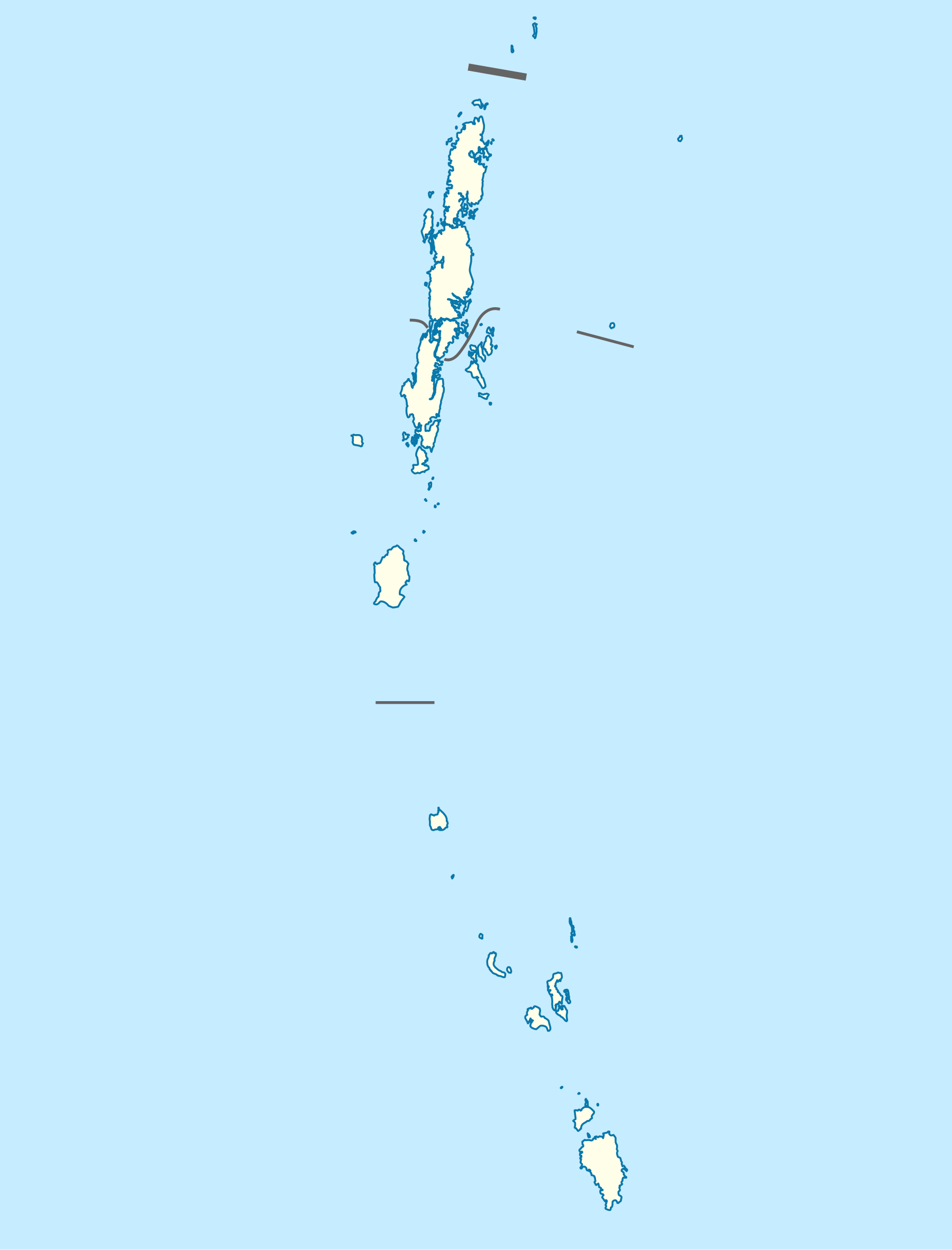
Indira Point sits along one of the busiest shipping lanes in the world. Vessels moving between the Strait of Malacca and the Indian Ocean pass within sight of the Nicobars. India’s claim to this point gives it a continuous maritime zone of 200 nautical miles southward, which is the limit of its exclusive economic zone.
The Indian Navy and the Coast Guard maintain installations on Great Nicobar. The Andaman and Nicobar Command, headquartered at Port Blair, is India’s only tri-services theatre command. The Great Nicobar Development Project announced in recent years aims to expand port and airfield infrastructure on the island, partly for strategic reasons and partly to develop the southern tip as a transshipment hub.
Kanyakumari is also strategically significant, though for different reasons. It lies near busy shipping lanes between the Arabian Sea and the Bay of Bengal, and the Tamil Nadu coast is part of India’s southern naval command area.
Comparative Note on Other “Tips” of India
A few other claims to a southernmost point appear in older sources and are worth disposing of.
Indu Point, sometimes confused with Indira Point, does not exist as an official name. The point is Indira Point.
Cape Comorin and Kanyakumari are the same place, with the older British colonial name replaced by the Tamil name after 1947.
The Maldives, though much further south, are a separate sovereign state and have never been part of India.
Some sources call Point Calimere (also called Kodiakarai) on the Tamil Nadu coast the southernmost point of the eastern peninsular shore, but this is the easternmost point of a small cuspate foreland rather than the southernmost point of anything significant.
UPSC Pointers and Common Traps
Indira Point is the southernmost tip of India and is in Great Nicobar Island. It is at 6 degrees 45 minutes north. It was renamed from Pygmalion Point in 1985 in honour of Indira Gandhi.
Kanyakumari is the southernmost point of the Indian mainland, at 8 degrees 4 minutes north, in Tamil Nadu. The 2004 tsunami submerged part of the lighthouse at Indira Point but did not change India’s official southernmost coordinate.
For comparative geography of India see our overview of the rivers of India and the wider Peninsular Plateau, both of which set the southern peninsula in its broader physiographic context.
Frequently Asked Questions
What is the southernmost tip of India?
The southernmost tip of India is Indira Point in Great Nicobar Island, at 6 degrees 45 minutes north. The southernmost point of the Indian mainland is Kanyakumari in Tamil Nadu at 8 degrees 4 minutes north.
Why is Kanyakumari called the southernmost point when Indira Point is further south?
Kanyakumari is the southernmost point of the Indian mainland, the continuous landmass that forms the peninsula. Indira Point is the southernmost point of India as a whole country, including its island territories. Both are correct answers depending on what aspect of India is meant.
Was Indira Point earlier called Pygmalion Point?
Yes. Indira Point was called Pygmalion Point until 1985, when it was renamed in memory of Prime Minister Indira Gandhi, who was assassinated in October 1984.
What happened to Indira Point in the 2004 tsunami?
The 2004 Indian Ocean earthquake caused the land at Indira Point to subside by about 4.25 metres. The base of the lighthouse there was permanently submerged, and several families and scientists living near the lighthouse were lost. The lighthouse tower still stands but with its lower section in seawater.
How far is Indira Point from the Indian mainland?
Indira Point is about 1,800 km from the closest point on the Indian mainland by sea, roughly the same distance from Port Blair as the southernmost tip of Kerala. The Andaman and Nicobar Islands as a whole lie much closer to Indonesia (about 145 km to the nearest Indonesian island) than to mainland India.
Which is the northernmost point of India for comparison?
The northernmost point of India is Indira Col, at the eastern end of the Siachen Glacier in the Karakoram, at about 35 degrees 40 minutes north. India’s full north-south extent is therefore from 6 degrees 45 minutes north (Indira Point) to about 35 degrees 40 minutes north (Indira Col), a span of roughly 3,214 km.
Tell Google you want more of this.
Add Anantam IAS as a preferred sourceOne tap, and this site shows up more often in your own Top Stories, AI Overviews and AI Mode. Remove it any time.