

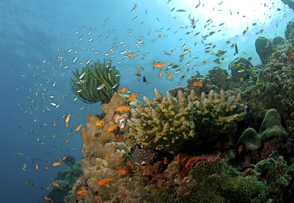
The Andaman and Nicobar Islands are a 572-island archipelago in the south-eastern Bay of Bengal that forms a Union Territory of India and one of its most strategically important maritime frontiers. Stretching for more than 800 kilometres in a north–south arc between the Coco Channel (just south of Myanmar) and the Six Degree Channel (just north of Indonesia’s Aceh), the Andaman and Nicobar Islands occupy roughly 8,249 square kilometres of land but project India’s exclusive economic zone over more than 600,000 square kilometres of ocean. They are India’s only inhabited island chain with a true volcanic component, the only territory of India where an active volcano (Barren Island) is presently erupting, and one of the very few places on Earth where uncontacted hunter-gatherer societies — the Sentinelese — still live in voluntary isolation. The Andaman and Nicobar Islands are simultaneously a biodiversity hotspot, a tribal heritage zone, a colonial penal history site, and a forward-deployed military theatre.
Geographical Setting and Extent
The Andaman and Nicobar Islands consist of 572 islands, islets, and rocks, of which roughly 38 are permanently inhabited. The archipelago is divided into two groups separated by the 150-kilometre-wide Ten Degree Channel. The Andaman group lies to the north and includes 325 islands. The Nicobar group lies to the south and includes 247 islands. The Ten Degree Channel is named for the parallel of 10° North latitude that runs through it and is an important international shipping lane between the Bay of Bengal and the Strait of Malacca.
The Andaman and Nicobar Islands lie east of the Indian mainland, 1,200 kilometres from Chennai and 1,300 kilometres from Kolkata, but only 150 kilometres from the western tip of Sumatra. The capital, Port Blair (recently renamed Sri Vijaya Puram), is on South Andaman Island. The territory has a total population of around 4 lakh, with the bulk concentrated in the Andaman group and on the larger Nicobarese island of Car Nicobar. Geographically, the chain is a partly submerged continuation of the Arakan Yoma range of Myanmar, with the Indo-Burma orogenic belt extending southward as the Andaman ridge and continuing into the Indonesian arc.
Geological Origin and Volcanism
The Andaman and Nicobar Islands sit along the active boundary where the Indian plate is being subducted beneath the Burma microplate at the eastern edge of the Indo-Australian plate system. This convergent margin is responsible for both the islands’ present elevation and their volcanism. The Andaman Sea, east of the chain, is an active back-arc basin where new oceanic crust is being formed by sea-floor spreading along the Central Andaman Trough.
Barren Island: India’s Only Active Volcano
Barren Island, located 135 kilometres north-east of Port Blair, is India’s only confirmed active volcano. The island is a stratovolcano standing 354 metres above sea level with a diameter of about three kilometres. It first erupted in recorded history in 1787 and has been intermittently active since. The most recent eruptive episode began in 1991 after a quiescence of around 150 years and has continued with phases of ash emission, lava effusion, and pyroclastic activity. Narcondam Island, about 150 kilometres north-east of Barren, is a dormant volcano not known to have erupted in historical time.
Tectonic Significance
The 2004 Indian Ocean earthquake and tsunami originated on the Sunda megathrust just south of the Andaman and Nicobar Islands. Great Nicobar, Car Nicobar, and parts of South Andaman were among the worst-affected regions in India. The earthquake caused permanent vertical land movement of up to 3 metres at the southern end of the chain and led to the destruction of the lighthouse at Indira Point, the southernmost tip of India.
Major Islands and Topography
The Andaman group is dominated by North Andaman, Middle Andaman, South Andaman, and Little Andaman. North Andaman hosts Saddle Peak, the highest point in the territory at 732 metres. The Andaman Islands have a hilly topography with narrow coastal plains, mangrove fringes, and short, fast-flowing streams. Coral reefs surround most of the larger islands, although they are less developed than the atolls of Lakshadweep.
The Nicobar group has three main divisions: the northern Nicobars (Car Nicobar and Battimalv), the central Nicobars (Camorta, Trinkat, Nancowry, Katchall), and the southern Nicobars (Little and Great Nicobar). Great Nicobar is the largest island in the territory and contains Mount Thullier (642 m) and Indira Point. Great Nicobar Biosphere Reserve covers most of the island.
Climate and Vegetation
The Andaman and Nicobar Islands have a tropical maritime climate with little seasonal variation. Average annual rainfall is 3,000 to 3,800 millimetres, distributed across both the south-west and north-east monsoons. The islands are among the wettest regions of India. Cyclones occasionally cross the chain in May and November.
Natural vegetation is dominated by tropical evergreen and semi-evergreen forests, mangroves along the coasts, and littoral forests behind the beaches. About 86 per cent of the territory’s land area remains under forest cover, one of the highest proportions in India. Endemic plants include the Andaman padauk and the Nicobar canes. The islands harbour the saltwater crocodile, dugong, Nicobar megapode, Andaman wild pig, and a unique population of leatherback turtles that nest on the beaches of Great Nicobar.
Indigenous Communities of the Andaman and Nicobar Islands
The Andaman and Nicobar Islands are home to six recognised indigenous communities, four in the Andamans and two in the Nicobars. The four Andamanese groups — Great Andamanese, Onge, Jarawa, and Sentinelese — are Negrito populations whose ancestors are believed to have reached the islands more than 30,000 years ago. The two Nicobarese groups — Nicobarese and Shompen — are Mongoloid populations with linguistic and cultural affinities to mainland South-East Asia.
Great Andamanese, Onge, Jarawa, Sentinelese
The Great Andamanese were the dominant population of the Andaman group at the time of British contact. Their numbers collapsed from epidemic disease in the late nineteenth century, and today only around 50 individuals survive on Strait Island. The Onge of Little Andaman number around 100. The Jarawa of South and Middle Andaman number around 500 and remained largely uncontacted until the late 1990s. The Sentinelese of North Sentinel Island are the only group that has consistently rejected contact and remain in voluntary isolation; their population is estimated between 50 and 150. All four communities are recognised as Particularly Vulnerable Tribal Groups under the PVTG framework.
Nicobarese and Shompen
The Nicobarese are the largest indigenous community of the territory, numbering around 30,000 and inhabiting most of the Nicobar Islands. They live in settled villages, practice horticulture and pig-rearing, and largely converted to Christianity in the twentieth century. The Shompen are a much smaller community of around 230 individuals living in the interior of Great Nicobar; they are also recognised as a Particularly Vulnerable Tribal Group.
Colonial History and Cellular Jail
The British established a penal settlement at Port Blair in 1858 after the failure of an earlier attempt in the 1790s. The settlement was created specifically to deport prisoners convicted in connection with the Revolt of 1857. The Cellular Jail, constructed between 1896 and 1906, was designed for solitary confinement and was used to incarcerate India’s most prominent political prisoners, including Vinayak Damodar Savarkar, Batukeshwar Dutt, and dozens of revolutionaries from Bengal, Punjab, and the Madras Presidency. The jail’s seven radiating wings (three survive today) earned the islands the popular name Kala Pani, or “black water”. The Cellular Jail is now a national memorial.
The islands were occupied by the Japanese from 1942 to 1945 during the Second World War. Subhas Chandra Bose hoisted the Azad Hind flag at Port Blair in December 1943, and the islands were briefly designated Shaheed and Swaraj. After Independence in 1947, the territory was administered by India as Andaman and Nicobar.
Andaman and Nicobar Command and Strategic Importance
The Andaman and Nicobar Command (ANC), headquartered at Port Blair, was established in 2001 as India’s only fully tri-service operational command, integrating Army, Navy, Air Force, and Coast Guard elements under a single Commander-in-Chief. The Andaman and Nicobar Islands sit astride the western approaches to the Strait of Malacca, through which roughly 30 per cent of global trade and 80 per cent of China’s energy imports pass. INS Baaz on Campbell Bay (Great Nicobar) and INS Kohassa on Diglipur (North Andaman) are the principal forward naval air stations. Plans for a major transshipment port and greenfield development at Great Nicobar have been under discussion since the early 2020s as part of broader Indo-Pacific positioning.
Administration and Connectivity
The Andaman and Nicobar Islands are administered as a Union Territory directly under the Government of India, headed by a Lieutenant Governor. The territory has three districts: North and Middle Andaman, South Andaman, and Nicobar. The Nicobar district remains restricted under the Andaman and Nicobar Islands (Protection of Aboriginal Tribes) Regulation, 1956, and tourists require special permits to visit any island other than Car Nicobar. Connectivity to the mainland is by air (Port Blair to Chennai, Kolkata, Delhi, and Bengaluru) and by sea (Chennai–Port Blair and Kolkata–Port Blair passenger ships).
Frequently Asked Questions
How many islands are there in the Andaman and Nicobar Islands?
The Andaman and Nicobar Islands consist of 572 islands, islets, and rocks, of which around 38 are permanently inhabited. The chain is divided into the Andaman group (325 islands) in the north and the Nicobar group (247 islands) in the south, separated by the 150-kilometre Ten Degree Channel.
Where is Barren Island and why is it important?
Barren Island lies about 135 kilometres north-east of Port Blair. It is India’s only confirmed active volcano, a stratovolcano standing 354 metres above sea level with a diameter of around three kilometres. It first erupted in 1787 and resumed activity in 1991 after roughly 150 years of dormancy. Narcondam, further north-east, is a dormant volcano not known to have erupted in historical time.
What is the highest point in the Andaman and Nicobar Islands?
Saddle Peak on North Andaman Island is the highest point in the territory at 732 metres above sea level. Mount Thullier on Great Nicobar (642 m) is the highest peak in the Nicobar group.
Which indigenous tribes live in the Andaman and Nicobar Islands?
Six indigenous communities live in the territory. The Andamans host four Negrito groups — Great Andamanese, Onge, Jarawa, and Sentinelese — recognised as Particularly Vulnerable Tribal Groups. The Nicobars host the Nicobarese (around 30,000) and the Shompen (around 230, also a PVTG). The Sentinelese of North Sentinel Island remain in voluntary isolation.
What is the Cellular Jail and why is it significant?
The Cellular Jail, built between 1896 and 1906 at Port Blair, was a British penal facility designed for the solitary confinement of political prisoners. Prominent inmates included Vinayak Damodar Savarkar and Batukeshwar Dutt. Three of its original seven wings survive today and the complex is now a national memorial commemorating India’s freedom struggle.
What is the Andaman and Nicobar Command?
Established in 2001, the Andaman and Nicobar Command is India’s only fully integrated tri-service operational command, headquartered at Port Blair. It oversees Army, Navy, Air Force, and Coast Guard assets in the territory and is responsible for the defence of India’s eastern maritime frontier and the approaches to the Strait of Malacca.
How were the Andaman and Nicobar Islands affected by the 2004 tsunami?
The 2004 Indian Ocean earthquake on the Sunda megathrust originated just south of the Nicobar chain. Great Nicobar, Car Nicobar, and the southern Andamans suffered severe damage, with vertical land movement of up to 3 metres at the southern end of the territory. The Indira Point lighthouse at the southernmost tip of India was destroyed, and several Nicobarese settlements had to be permanently relocated.
What is the strategic importance of the Andaman and Nicobar Islands?
The islands lie astride the western approaches to the Strait of Malacca, one of the world’s busiest maritime chokepoints. They give India forward operating bases nearly 1,200 kilometres east of the mainland and project an Exclusive Economic Zone of over 600,000 square kilometres. The Andaman and Nicobar Command at Port Blair allows integrated tri-service operations across the eastern Indian Ocean.
Tell Google you want more of this.
Add Anantam IAS as a preferred sourceOne tap, and this site shows up more often in your own Top Stories, AI Overviews and AI Mode. Remove it any time.






