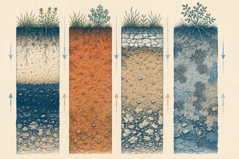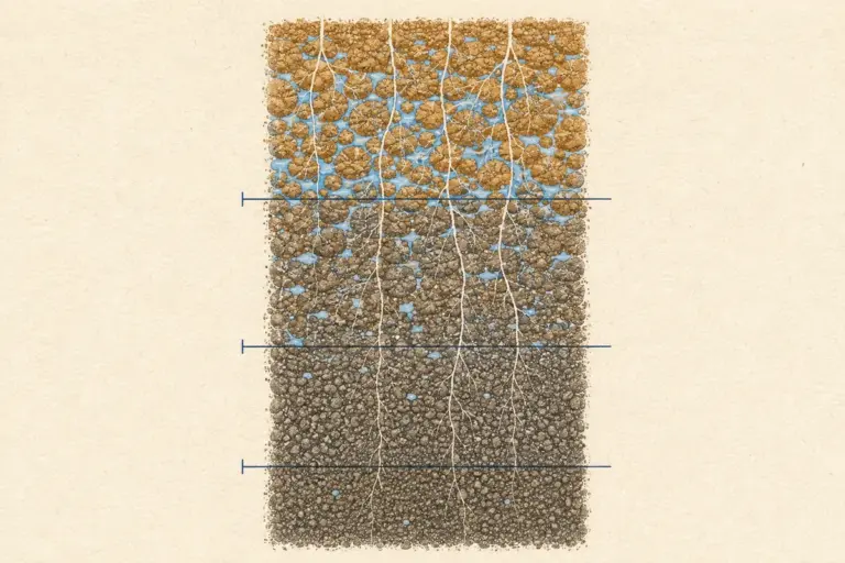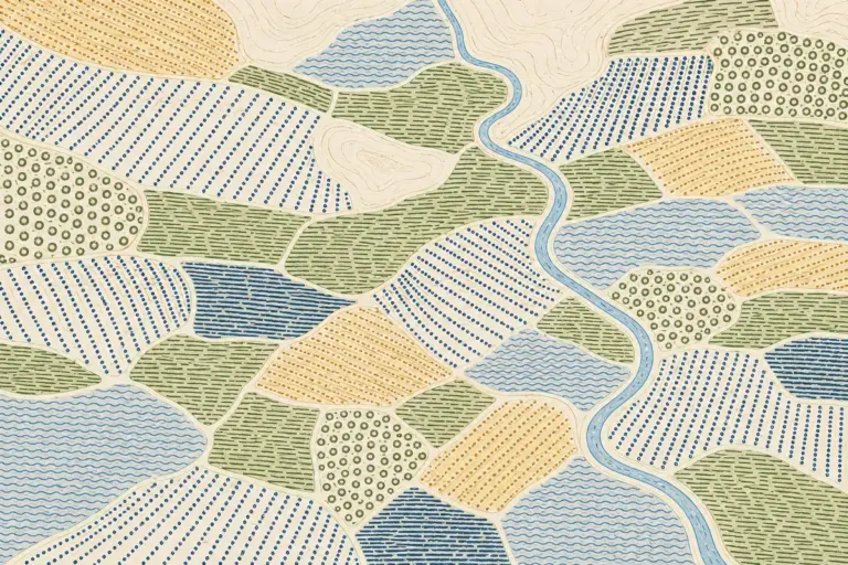
Soil is the loose, weathered top layer of the earth where plants actually grow, and in a country where most people still eat what the land produces nearby, the kind of soil under a district decides what gets sown there. Cotton thrives on the black soil of the Deccan but sulks on the sandy soil of Rajasthan. Tea grows on the leached red-brown laterite of the Western Ghats but never on the river-laid plains of Punjab. Once you see soil as the link between rock, rain and crop, the map of Indian agriculture stops being a list to memorise and starts making sense.
For an aspirant, this is one of the highest-return topics in physical geography. The Indian Council of Agricultural Research (ICAR) groups the country’s soils into eight major types, and Prelims loves to test whether you can match a soil to its region and its crop. That single skill, soil to region to crop, answers more questions than any amount of definition-cramming. This guide walks through all eight types, then shows you exactly how to revise them for the exam.
What Soil Is and Why Classification Matters
Soil is not just dirt. It is a living mix of weathered mineral particles, decayed organic matter (called humus), water, air and micro-organisms. The parent rock decides the minerals, the climate decides how fast it weathers, and the vegetation decides how much humus it holds. Change any of those three and you get a different soil.
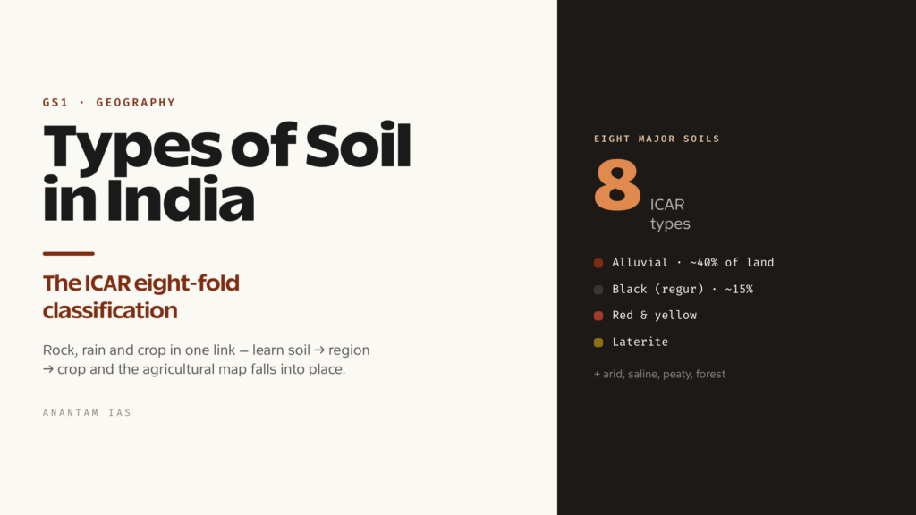
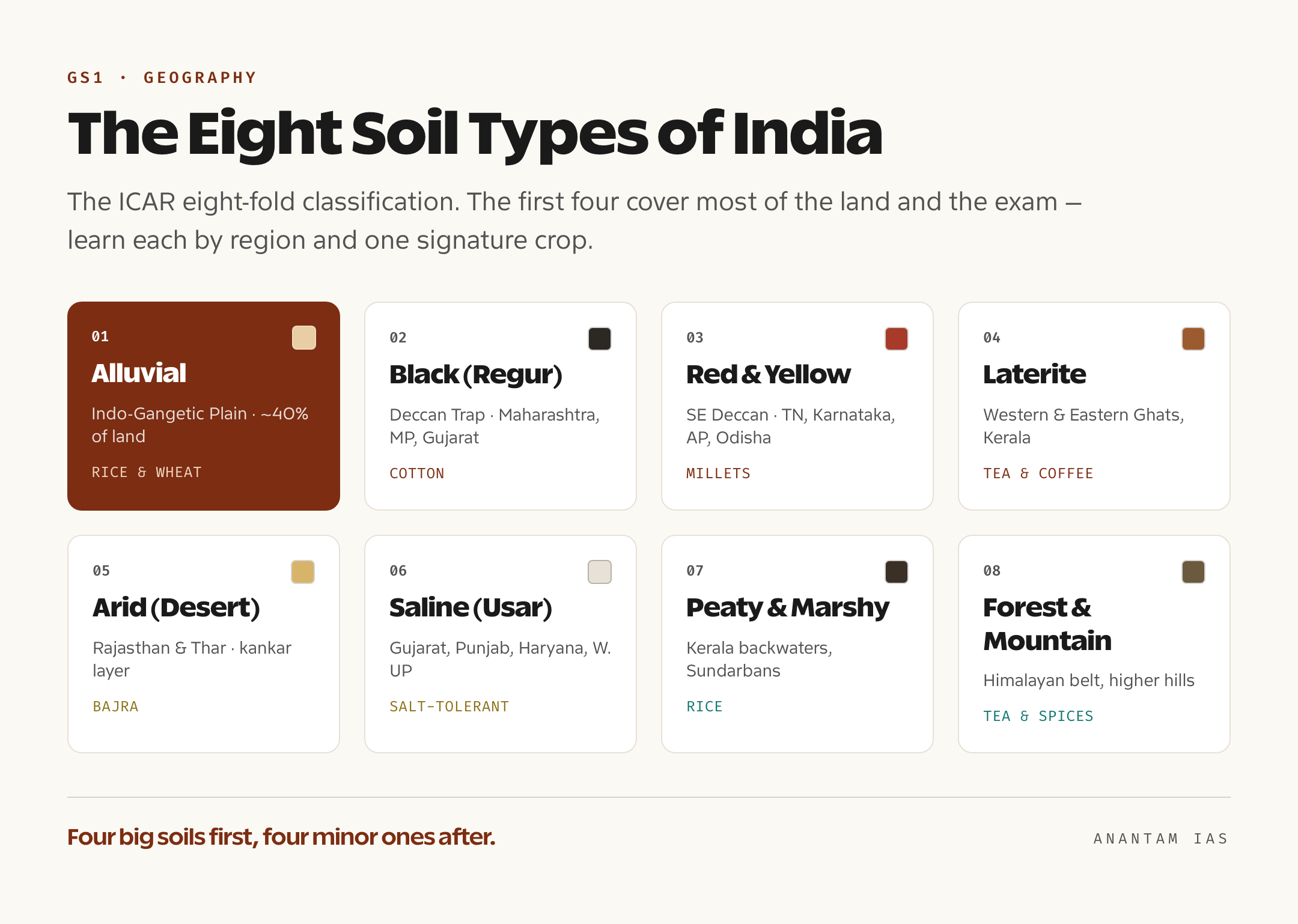
Classification matters because soil is a resource we are steadily losing. We sort soils so we can match crops to fertility, plan irrigation, and target conservation where erosion or salinity is eating into farmland. India follows the ICAR eight-fold classification: alluvial, black, red and yellow, laterite, arid (desert), saline and alkaline, peaty and marshy, and forest and mountain soils. The older colonial scheme used only four broad classes (alluvial, black, red, laterite), so if a question mentions four “major” types it is using that legacy grouping. To see how soil sits inside the larger physical-geography story, read our explainer on the Deccan Plateau, whose basalt is the parent rock of India’s black soil.
Two ideas make the rest of this page click. First, fertility is not the same as colour. Black soil looks rich but is poor in nitrogen and organic matter; alluvial soil looks plain but feeds most of the nation. Second, leaching, the washing-away of soluble minerals by heavy rain, is what separates a fertile soil from a worn-out one. Hold those two ideas and the eight types fall into place.
The Eight Major Soil Types of India
India’s eight ICAR soils each carry a clear signature of formation, region and crop. The four big ones (alluvial, black, red, laterite) cover most of the country and most of the exam, so spend the bulk of your time there. The remaining four (arid, saline, peaty, forest) are smaller in area but each has one or two facts examiners love.
Alluvial Soil
Alluvial soil is India’s most widespread and most important soil, covering roughly 40 percent of the land and feeding the bulk of the population. It is not formed in place by weathering; it is deposited (laid down) by rivers as they slow on the plains and drop the silt carried from the mountains. That is why it blankets the great Indo-Gangetic Plain across Punjab, Haryana, Uttar Pradesh, Bihar and West Bengal, and the deltas of the east coast.
Alluvial soil splits into two ages you must keep straight. Khadar is the new alluvium, refreshed by fresh silt every flood season, lighter and more fertile, found close to the active river channel. Bhangar is the old alluvium on higher ground away from the river, darker, more clayey, often dotted with lime nodules called kankar. Khadar grows paddy, wheat, maize and vegetables; bhangar suits wheat, mustard and tobacco. Rich in potash but short on nitrogen and phosphorus, alluvial soil supports rice, wheat, sugarcane and pulses, which is why it underwrites the kharif and rabi seasons alike. We cover its sub-types and chemistry in our dedicated alluvial soil explainer.
Black Soil (Regur or Cotton Soil)
Black soil, locally called regur and often nicknamed cotton soil, is the dark, clayey soil of the Deccan Trap, formed by the weathering of basalt lava and covering about 15 percent of India. It dominates the lava plateau of Maharashtra, Madhya Pradesh, Gujarat, Karnataka and Andhra Pradesh, plus the Malwa plateau. Its dark colour comes from iron-rich basalt and accumulated humus, not from being especially fertile in the usual sense.
Two traits make black soil exam gold. It is moisture-retentive: the fine montmorillonite clay holds water for months, which is exactly why it grows cotton through the long dry season without irrigation. And it is self-ploughing: when the clay dries it shrinks and cracks open wide, surface soil tumbles into the cracks, and when the rains swell the clay shut again the soil is effectively turned over on its own. So farmers need less deep ploughing. Black soil is rich in lime, iron, magnesium and potash but poor in nitrogen, phosphorus and organic matter. Best crops: cotton, sugarcane, wheat, jowar, tobacco, oilseeds and citrus.
Red and Yellow Soil
Red soil forms on the old crystalline and metamorphic rocks of the peninsula, mostly granite and gneiss, in the low-rainfall eastern and southern parts of the Deccan plateau. It gets its red colour from iron oxide coating the particles; where the soil is hydrated (holds more water), the same iron turns it yellow, hence “red and yellow soil.” You find it across Tamil Nadu, Karnataka, Andhra Pradesh, Telangana, Chhattisgarh, Odisha, Jharkhand and the southeast of Madhya Pradesh.
Red soil is generally porous, friable and low in nitrogen, phosphorus and humus, so it is only moderately fertile and responds well to fertiliser and irrigation. The fine-grained red and yellow soils in the lower areas can be quite productive; the coarse, gravelly ones on the uplands are poor. Typical crops: millets (ragi, bajra), pulses, groundnut, potato, tobacco and, with irrigation, rice and cotton.
Laterite Soil
Laterite soil is the leached, brick-like soil of high-rainfall tropical zones, and its name comes from the Latin later, meaning brick, because once dug and dried it hardens so completely that it is literally cut into building blocks. It forms in hot, wet climates with sharp wet-and-dry seasons, where heavy rain washes away the silica and leaves behind iron and aluminium oxides. That intense leaching is the whole story of laterite. It strips out the soluble plant nutrients and the lime, leaving a soil rich in iron and aluminium but poor in nitrogen, phosphorus, potash, lime and organic matter, and acidic on top.
You find laterite along the summits and slopes of the Western Ghats, the Eastern Ghats, parts of the northeastern hills, and patches in Kerala, Karnataka, Tamil Nadu, Maharashtra, Odisha and West Bengal. On its own it is poor cropping land, but with manure and fertiliser the low-lying laterite of Kerala and the coast grows the plantation crops it is famous for: tea, coffee, rubber, cashew and coconut. Its other claim to fame is non-agricultural, the hardened blocks used in construction. Our laterite soil explainer covers the formation chemistry in detail.
Arid and Desert Soil
Arid or desert soil is the sandy, low-fertility soil of India’s dry west, chiefly Rajasthan and the Thar Desert, extending into parts of Haryana, Punjab and Gujarat. It forms under very low rainfall and high evaporation, so weathering is mechanical rather than chemical and humus barely accumulates. The texture is sandy, the colour reddish-brown, and the soil is dry, saline and low in nitrogen and organic matter.
A signature feature is the kankar (calcium carbonate) layer that builds up below the surface and restricts the downward movement of water. Because evaporation pulls salts upward, parts of the desert are saline enough that common salt is harvested by evaporating groundwater. With irrigation (the Indira Gandhi Canal is the classic example) these soils grow drought-resistant crops like bajra, pulses, guar, jowar and barley.
Saline and Alkaline Soil (Usar)
Saline and alkaline soils carry too much salt for most crops, and they are known by a string of local names you should recognise: usar, reh, kallar, thur and chopan. They occur where the land is poorly drained and the climate is dry, so salts of sodium, calcium and magnesium are drawn to the surface by capillary action and crust there as the water evaporates. The worst-hit belts are western Gujarat, the deltas of the eastern coast, and the canal-irrigated plains of Punjab, Haryana and western Uttar Pradesh, where over-irrigation without drainage steadily turns good land saline.
This is a soil problem as much as a soil type, and it is spreading. Treatment means improving drainage, leaching the salts down with extra water, applying gypsum to fix sodium soils, and growing salt-tolerant crops. It links neatly to land-degradation questions in GS3.
Peaty and Marshy Soil
Peaty soil is the heavy, dark, highly organic soil of waterlogged, high-rainfall areas, formed where dead vegetation piles up faster than it can fully decay in the airless, swampy ground. The result is a soil with very high organic matter (sometimes 40 to 50 percent), often acidic, and frequently saline near the coast. The textbook locations are the backwaters of Kerala (Kuttanad, in Alappuzha and Kottayam, where farming happens below sea level), the Sundarbans delta of West Bengal, and patches in coastal Odisha and Tamil Nadu.
Marshy soil is the close cousin, found in waterlogged depressions and tidal flats. Both are hard to farm because of waterlogging and acidity, but the reclaimed peaty land of Kuttanad famously grows rice. For the exam, the link to remember is peaty/marshy → Kerala backwaters and Sundarbans → high organic matter, acidic.
Forest and Mountain Soil
Forest and mountain soil forms on the slopes of the Himalayas and other hill ranges under forest cover, and its character changes sharply with altitude. On the higher, snow-touched slopes it is thin, acidic and low in humus; in the lower, sheltered valleys it is loamy, silty and rich in organic matter from the forest litter above. Because it sits on slopes, it is shallow, stony and very prone to erosion once the trees are cleared.
You find it along the Himalayan belt from Jammu and Kashmir to Arunachal Pradesh, and on the higher Western Ghats and peninsular hills. The fertile valley pockets grow tea, coffee, spices, fruits and, on terraces, rice and maize. The exam angle is almost always conservation: this is the soil most at risk from deforestation and landslides.
Soil Fertility, Erosion and Conservation
Soil fertility in India is under steady pressure, and the exam expects you to connect the soil types above to the threats and the fixes. Three problems dominate. Soil erosion, the removal of topsoil by water and wind, is worst on the bare slopes of forest, laterite and red-soil regions and along the gullied ravines of the Chambal. Salinity and alkalinity creep across over-irrigated alluvial belts and the dry saline tracts. And nutrient depletion, the loss of nitrogen, phosphorus and organic matter, dogs almost every Indian soil because so few are naturally rich in all three.
The conservation toolkit is straightforward and high-yield to memorise. On slopes, contour bunding (building low ridges along the contour) and terracing slow the runoff and trap soil. Strip cropping and shelter belts of trees break the force of wind in dry regions. Gully plugging and check dams heal ravines, while crop rotation, green manure and avoiding over-grazing rebuild fertility. Matching these measures to the right soil is exactly the kind of application GS3 rewards. Because the monsoon drives both the leaching that creates laterite and the runoff that erodes hill soils, it pays to read our monsoon in India explainer alongside this page.
The honest takeaway is that India’s most fertile soils are not its most pampered ones. Alluvial soil carries the country on its back yet runs short of nitrogen; black soil grows cotton beautifully yet needs careful nutrient management. Conservation, in other words, is not a side topic. It is the reason soil classification exists.
Soil Type, Region and Crop: The Complete Table
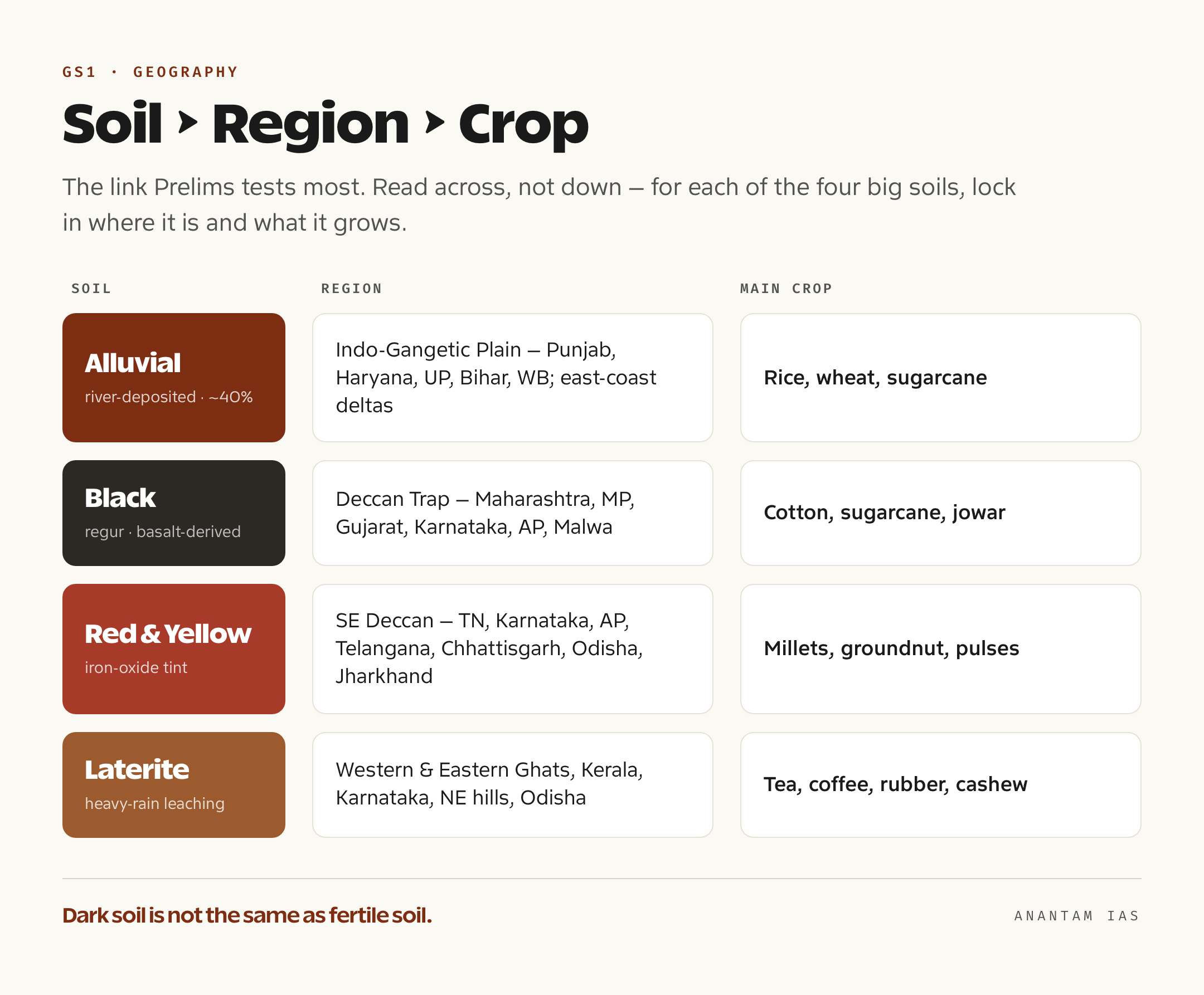
The single most useful thing you can do with this topic is build the soil-region-crop link until it is automatic. Almost every Prelims question on soil is testing one of those three columns against another. Read the table below across, not down: for each soil, lock in where it is and what it grows, and you will clear the matching questions cold.
| Soil Type | Where Found | Key Features | Suited Crops |
|---|---|---|---|
| Alluvial | Indo-Gangetic Plain (Punjab, Haryana, UP, Bihar, WB), east-coast deltas | River-deposited; ~40% of area; khadar (new, fertile) vs bhangar (old); rich in potash, low in nitrogen | Rice, wheat, sugarcane, maize, pulses |
| Black (Regur) | Deccan Trap: Maharashtra, MP, Gujarat, Karnataka, AP, Malwa | Basalt-derived; moisture-retentive; self-ploughing clay; rich in lime and iron, low in nitrogen | Cotton, sugarcane, jowar, wheat, oilseeds, tobacco |
| Red and Yellow | SE Deccan: TN, Karnataka, AP, Telangana, Chhattisgarh, Odisha, Jharkhand | Crystalline-rock origin; iron oxide gives red/yellow tint; porous; low in nitrogen and humus | Millets, groundnut, pulses, potato, tobacco |
| Laterite | Western and Eastern Ghats, Kerala, Karnataka, NE hills, Odisha | Heavy-rain leaching; iron-aluminium rich; acidic, low fertility; hardens into bricks | Tea, coffee, rubber, cashew, coconut |
| Arid (Desert) | Rajasthan and Thar, parts of Haryana, Punjab, Gujarat | Sandy, saline, low humus; kankar layer below surface | Bajra, pulses, guar, barley (with irrigation) |
| Saline and Alkaline (Usar) | Gujarat, Punjab, Haryana, western UP, coastal deltas | Salt crust from capillary action; poor drainage; spreading degradation | Salt-tolerant crops after reclamation |
| Peaty and Marshy | Kerala backwaters (Kuttanad), Sundarbans, coastal Odisha and TN | Very high organic matter; acidic; waterlogged; often saline | Rice (in reclaimed areas) |
| Forest and Mountain | Himalayan belt, higher Western Ghats and peninsular hills | Varies with altitude; thin and acidic high up, loamy in valleys; erosion-prone | Tea, coffee, spices, fruits, terraced rice and maize |
How to Study This for UPSC
Treat this as a memory-and-mapping topic, not a reading topic. Start with the four major soils (alluvial, black, red, laterite), because they cover the most area and the most questions, and only then add the four minor ones. For each soil, fix four things in your head: how it formed (parent rock plus climate), where it occurs, one or two diagnostic features, and the crop it is famous for. That is the whole syllabus for this topic.
For Prelims, expect matching and statement-based questions: soil to state, soil to crop, or “which of the following statements about black soil is correct.” The classic traps are mixing up khadar and bhangar, forgetting that laterite forms by leaching (not deposition), and assuming dark soil means fertile soil. Drill the table above until those reflexes are automatic. The standard sources are the NCERT Geography (Class 8 Resources and Development and Class 11 India: Physical Environment) for the base, then G.C. Leong or any standard physical-geography text for depth. Our geography books for UPSC guide lists what to read and what to skip.
For Mains, soil shows up in GS1 (geographical features and their location) and especially GS3 (agriculture, land degradation, conservation). Here the examiner wants application: why cotton suits black soil, why laterite needs heavy manuring, how to combat soil erosion on Himalayan slopes. Connect soil to the monsoon, to cropping seasons, and to food security, and you turn a static list into an answer that scores.
Frequently Asked Questions
How many types of soil are there in India? The Indian Council of Agricultural Research (ICAR) recognises eight major soil types: alluvial, black, red and yellow, laterite, arid (desert), saline and alkaline, peaty and marshy, and forest and mountain. The older colonial classification used only four broad classes, alluvial, black, red and laterite, which are still the four largest by area.
Which is the most fertile and most widespread soil in India? Alluvial soil is both the most widespread, covering roughly 40 percent of the country, and the most agriculturally productive, feeding the bulk of the population across the Indo-Gangetic Plain. It is rich in potash but needs added nitrogen and phosphorus.
Why is black soil called self-ploughing and cotton soil? Black soil is made of montmorillonite clay that swells when wet and cracks deeply when dry. Surface soil falls into the cracks and gets mixed in when the clay swells shut, turning the soil over on its own, hence self-ploughing. Its strong moisture retention through the dry season makes it ideal for cotton, so it is also called cotton soil.
How does laterite soil form, and why is it used for bricks? Laterite forms in hot, wet tropical climates where heavy rain leaches away silica and soluble nutrients, leaving iron and aluminium oxides behind. When this iron-aluminium soil is cut and dried in the air it hardens irreversibly into a brick-like mass, which is why it is quarried for construction; the Latin word later means brick.
Which states have saline (usar) and peaty soils? Saline and alkaline soils (usar, reh, kallar) occur in Gujarat, Punjab, Haryana, western Uttar Pradesh and the coastal deltas, mostly where over-irrigation or poor drainage lets salts crust on the surface. Peaty and marshy soils, very high in organic matter, are found in the Kerala backwaters (Kuttanad), the Sundarbans of West Bengal, and coastal patches of Odisha and Tamil Nadu.
Practice Questions
Prelims MCQs
- Which one of the following soils is formed by the weathering of the basaltic lava of the Deccan Trap? (a) Alluvial soil (b) Red soil (c) Black soil (d) Laterite soil. Answer: (c) Black (regur) soil is derived from Deccan basalt, which is why it overlaps the lava plateau of Maharashtra, MP and Gujarat.
- Consider the new alluvium and old alluvium of the northern plains. Which statement is correct? (a) Khadar is old alluvium and less fertile (b) Bhangar is new alluvium renewed every year (c) Khadar is new alluvium and more fertile (d) Both are equally fertile and identical in age. Answer: (c) Khadar is the new, flood-refreshed alluvium near the river and is more fertile; bhangar is the older, higher alluvium often containing kankar nodules.
- Laterite soil is best described as a product of which process? (a) Deposition by rivers (b) Intense leaching under heavy rainfall (c) Accumulation of wind-blown sand (d) Capillary rise of salts. Answer: (b) Heavy tropical rainfall leaches out silica and nutrients, leaving iron and aluminium oxides that harden into laterite.
- The local names reh, kallar, usar and thur refer to which soil? (a) Peaty soil (b) Forest soil (c) Saline and alkaline soil (d) Red soil. Answer: (c) These are regional names for saline and alkaline soils that develop where salts rise to the surface by capillary action in poorly drained, dry areas.
- Which soil is most associated with the Kerala backwaters and the Sundarbans, and is high in organic matter? (a) Arid soil (b) Peaty and marshy soil (c) Black soil (d) Red and yellow soil. Answer: (b) Peaty and marshy soils form in waterlogged, high-rainfall tracts where organic matter accumulates faster than it decays; they are typically acidic and often saline.
Mains Practice Questions
- Discuss the formation, distribution and agricultural significance of alluvial soil in India, and explain why it remains the country’s most important soil despite its nutrient limitations. (15 marks, 250 words)
- “Black soil is moisture-retentive and self-ploughing but nutritionally one-sided.” Examine this statement with reference to its formation and crop suitability. (15 marks, 250 words)
- Explain how climate and parent rock together determine the character of laterite, red and forest soils in India. (10 marks, 150 words)
- Soil degradation through erosion, salinity and nutrient depletion threatens Indian agriculture. Suggest soil-specific conservation measures to address it. (15 marks, 250 words)
- Account for the regional distribution of India’s eight major soil types and explain how this distribution shapes the country’s cropping pattern. (15 marks, 250 words)
Master this topic and you have done more than learn a list. You have learned to read the Indian landscape the way the examiner expects, where a soil’s colour hints at its rock, its location hints at its rainfall, and the two together hint at the crop in the field. Get the four big soils and the soil-region-crop table to the point of reflex, layer the four minor types and the conservation methods on top, and soil stops being a place where you lose marks and becomes a place where you bank them.
Tell Google you want more of this.
Add Anantam IAS as a preferred sourceOne tap, and this site shows up more often in your own Top Stories, AI Overviews and AI Mode. Remove it any time.