

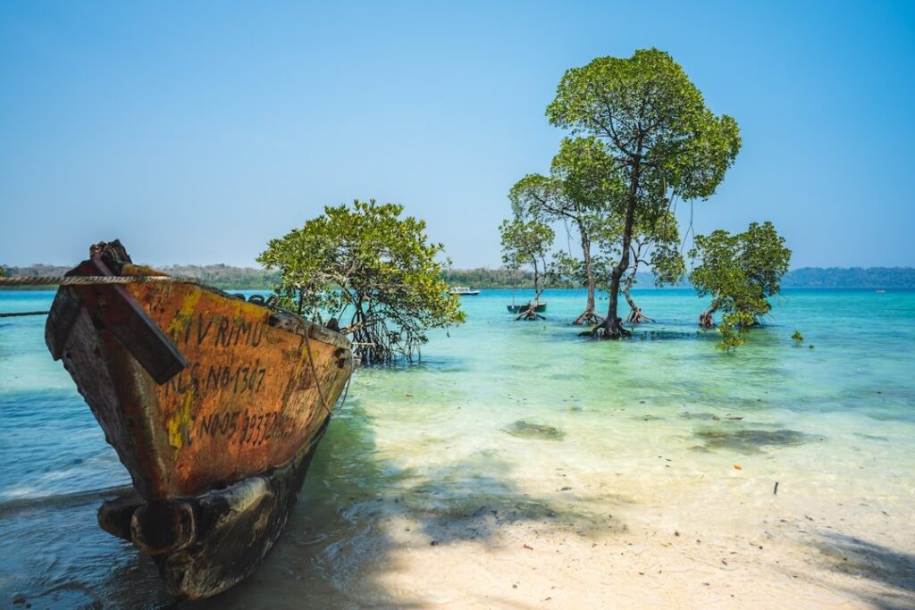
The Andaman and Nicobar climate is the wettest, most humid and least seasonal of any Indian region. The Andaman and Nicobar Islands lie scattered across more than 800 km of the Bay of Bengal between roughly 6°45’N and 13°41’N latitude, well within the equatorial-tropical belt. Their climate is humid tropical (Koppen type Am — tropical monsoon) with high temperatures year-round, short dry windows, and rainfall delivered by both the southwest and northeast monsoons. Most stations receive their peak precipitation between May and December, making the Andaman and Nicobar climate a key exception to mainland India’s single-monsoon pattern.
The Andaman and Nicobar climate stays unusually equable thanks to the buffering effect of the surrounding warm sea. Daily temperatures rarely exceed 31 C or drop below 22 C; the annual range is just 3-4 C — among the smallest in India. Annual rainfall ranges from 3,100 mm at Port Blair to over 3,500 mm at Car Nicobar and parts of Great Nicobar.
Location and Geographic Context
The Andaman and Nicobar Islands are a 572-island chain — only 38 inhabited — strung along the submarine ridge that links the Arakan Yoma of Myanmar with the Sumatran arc of Indonesia. The Andaman group lies to the north, the Nicobar group to the south, separated by the 150-km-wide Ten Degree Channel along latitude 10°N. For background on geography and tribes see our note on Andaman and Nicobar Islands.
Latitudinal Spread
The northernmost point — Landfall Island — lies at 13°41’N, while the southernmost — Indira Point on Great Nicobar — is at 6°45’N, only 150 km from Sumatra. This nearly seven-degree spread combined with the equatorial position means the southern Nicobars verge on equatorial climate while the northern Andamans show clearer monsoonal seasonality.
The Four Climatic Seasons of Andaman and Nicobar
Unlike mainland India, the Andaman and Nicobar climate does not have a true cold-dry winter or a sharp pre-monsoon hot season. The four seasons are softer:
1. Cool-Dry Season (January-February)
This is the only stretch resembling a “winter”. Skies are mostly clear, northeast trade winds bring drier air from mainland Asia, and rainfall drops to 25-50 mm a month. Temperatures range 22-29 C. This is also the peak tourist season.
2. Pre-Monsoon Hot Season (March-Mid-May)
Temperatures rise to 30-32 C with high humidity. Convective afternoon thunderstorms begin in April. The Andaman branch of the southwest monsoon, which usually arrives over Port Blair by 20 May (the earliest monsoon onset in Indian territory), already begins delivering rain.
3. Southwest Monsoon (Late May-September)
The southwest monsoon hits the Andamans 10-12 days before it reaches Kerala. Heavy rainfall — frequently 600-700 mm a month — lashes the islands as moisture-laden southwesterly winds sweep up from the equatorial Indian Ocean. Cumulonimbus storms, lightning, and short-duration tropical depressions are common.
4. Northeast Monsoon and Retreating Phase (October-December)
Unlike most of mainland India (which is dry in winter except for Tamil Nadu), the Andaman and Nicobar Islands continue to receive copious rainfall right through October, November and even into December. This is because the islands lie close enough to the equator to be reached by the northeast monsoon that brings rain to coastal Tamil Nadu. Tropical cyclones spawned over the Bay of Bengal also frequently brush the islands during this season.
Why Both Monsoons Reach the Andaman and Nicobar
The Andaman and Nicobar climate is one of only two regions in India (the other being Tamil Nadu’s east coast) where the northeast monsoon is a significant rain-bringer. Three factors explain the bimodal regime:
Equatorial Position
At latitudes below 13°N, the islands sit close enough to the equator to be reached by the equatorial trough and inter-tropical convergence zone (ITCZ) as it migrates seasonally between the hemispheres.
Sea-Surface Temperature
The Bay of Bengal stays above 28 C year-round around the islands. Warm SSTs maintain a moist, unstable air column over the islands, ready to release precipitation whenever a trigger (a tropical wave, a depression, or the monsoon trough) passes.
Bay of Bengal Cyclones
Both the southwest and northeast monsoon transition periods (April-May and October-December) are peak times for tropical cyclones in the Bay of Bengal. Even when cyclone tracks miss the islands, the associated rainbands deliver heavy precipitation.
Rainfall Distribution
Rainfall peaks between May and December and falls sharply only in February-March. Annual totals:
| Station | Annual Rainfall | Wettest Month |
|---|---|---|
| Port Blair (South Andaman) | 3,180 mm | June (570 mm) |
| Mayabunder (Middle Andaman) | 3,300 mm | June |
| Car Nicobar | 3,440 mm | November |
| Hut Bay (Little Andaman) | 3,500 mm | November |
| Campbell Bay (Great Nicobar) | 3,000 mm | October |
The northern Andamans peak with the southwest monsoon; the southern Nicobars peak slightly later, with the northeast monsoon. Both regions remain wet for at least seven months of the year.
Temperature Regime
Mean annual temperature is around 26-27 C. The diurnal range is small (5-7 C), and the seasonal range is even smaller. Port Blair’s all-time maximum is just 36.8 C and its all-time minimum 14 C — extraordinarily narrow compared with the 50+ C swings seen in mainland north India. The sea moderates everything.
Humidity
Relative humidity averages 70-85 per cent year-round and rarely drops below 60 per cent. This is why even at moderate temperatures the islands feel sticky.
Vegetation Driven by the Climate
The combination of high temperature, high humidity and 3,000+ mm of well-distributed rainfall supports tropical evergreen and tropical semi-evergreen forests — the only such forests on Indian territory outside the Western Ghats and the Northeast. About 86 per cent of the Andaman and Nicobar’s land area is forested, the highest forest-cover percentage of any Union Territory or state.
Major Forest Types
- Tropical evergreen rainforest (interiors of Great Nicobar, Middle and South Andaman)
- Tropical semi-evergreen forest (most of the Andamans)
- Moist deciduous forest (drier patches in North Andaman)
- Littoral forest (coastlines)
- Mangrove forest (estuaries and tidal creeks — about 600 sq km)
Cyclones and Tsunamis
Cyclones
The Andaman Sea is a cradle of Bay of Bengal cyclones. Many depressions originate near the islands before moving northwest toward Odisha, Andhra Pradesh or Bangladesh. The islands themselves are usually skimmed rather than struck head-on, but cyclones still cause heavy rainfall, gales and storm surge.
The 2004 Indian Ocean Tsunami
The 26 December 2004 magnitude-9.1 Sumatra earthquake generated a tsunami that devastated the Nicobars and parts of the southern Andamans. Indira Point’s lighthouse was partly submerged and the southern tip of Great Nicobar permanently subsided about 1.5 metres. Although a seismic event, the tsunami exposed the islands’ coastal vulnerability and reshaped disaster planning.
El Nino and the Indian Ocean Dipole
The Andaman and Nicobar climate is sensitive to ENSO and the Indian Ocean Dipole (IOD).
- Positive IOD (warm western, cool eastern Indian Ocean) tends to suppress rainfall over the Andamans because the convective hub shifts west.
- El Nino years often deliver weaker southwest monsoons but stronger post-monsoon rainfall around the islands as cyclone activity intensifies.
For deeper coverage of ocean-atmosphere drivers see our notes on El Nino and the Indian Ocean Dipole.
Climate Change Implications
Sea-surface temperatures around the Andaman and Nicobar Islands have risen by approximately 0.7-0.9 C since 1950. The consequences:
- More intense (though not necessarily more frequent) cyclones
- Coral bleaching, especially during 2016 and 2020 marine heatwaves
- Sea-level rise threatening low-lying Nicobar settlements
- Mangrove range shifts and erosion of coastal beaches
Frequently Asked Questions
What is the climate type of the Andaman and Nicobar Islands?
The Andaman and Nicobar climate is humid tropical (Koppen type Am — tropical monsoon). It features uniformly high temperatures, very high humidity and abundant rainfall from both the southwest and northeast monsoons.
Why do the Andaman and Nicobar Islands receive rainfall from both monsoons?
Because the islands lie at low latitudes (6°-13°N) close to the equator and are surrounded by very warm sea water. Both the southwest monsoon (May-September) and the retreating northeast monsoon (October-December) bring rain to the islands.
When is the wettest period in the Andaman and Nicobar climate?
Rainfall peaks between May and December. Northern Andamans receive maximum rainfall in June-July (SW monsoon) while the southern Nicobars peak in October-November (NE monsoon).
Why is the temperature range so small in the Andaman and Nicobar Islands?
Because the islands are surrounded by warm sea water that buffers seasonal and diurnal swings. The annual mean temperature is around 27 C with a range of only 3-4 C.
What is the earliest monsoon onset date in India?
The Andaman and Nicobar Islands receive the earliest southwest monsoon onset in Indian territory, usually around 20 May at Port Blair — about ten days before the monsoon reaches Kerala.
How much rainfall do the Andaman and Nicobar Islands receive?
Annual rainfall ranges from about 3,100 mm at Port Blair to over 3,500 mm in parts of Great and Little Nicobar — among the highest totals in India.
What kind of forests dominate the Andaman and Nicobar?
Tropical evergreen and semi-evergreen rainforest dominate, with mangroves along coasts. Forest cover is about 86 per cent of land area — the highest of any Indian Union Territory.
How are cyclones related to the Andaman and Nicobar climate?
The Andaman Sea is a spawning ground for Bay of Bengal tropical cyclones. The islands typically experience heavy rain, gales and storm surge from cyclones during April-May and October-December.
Tell Google you want more of this.
Add Anantam IAS as a preferred sourceOne tap, and this site shows up more often in your own Top Stories, AI Overviews and AI Mode. Remove it any time.






