Why in News?
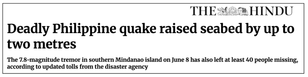
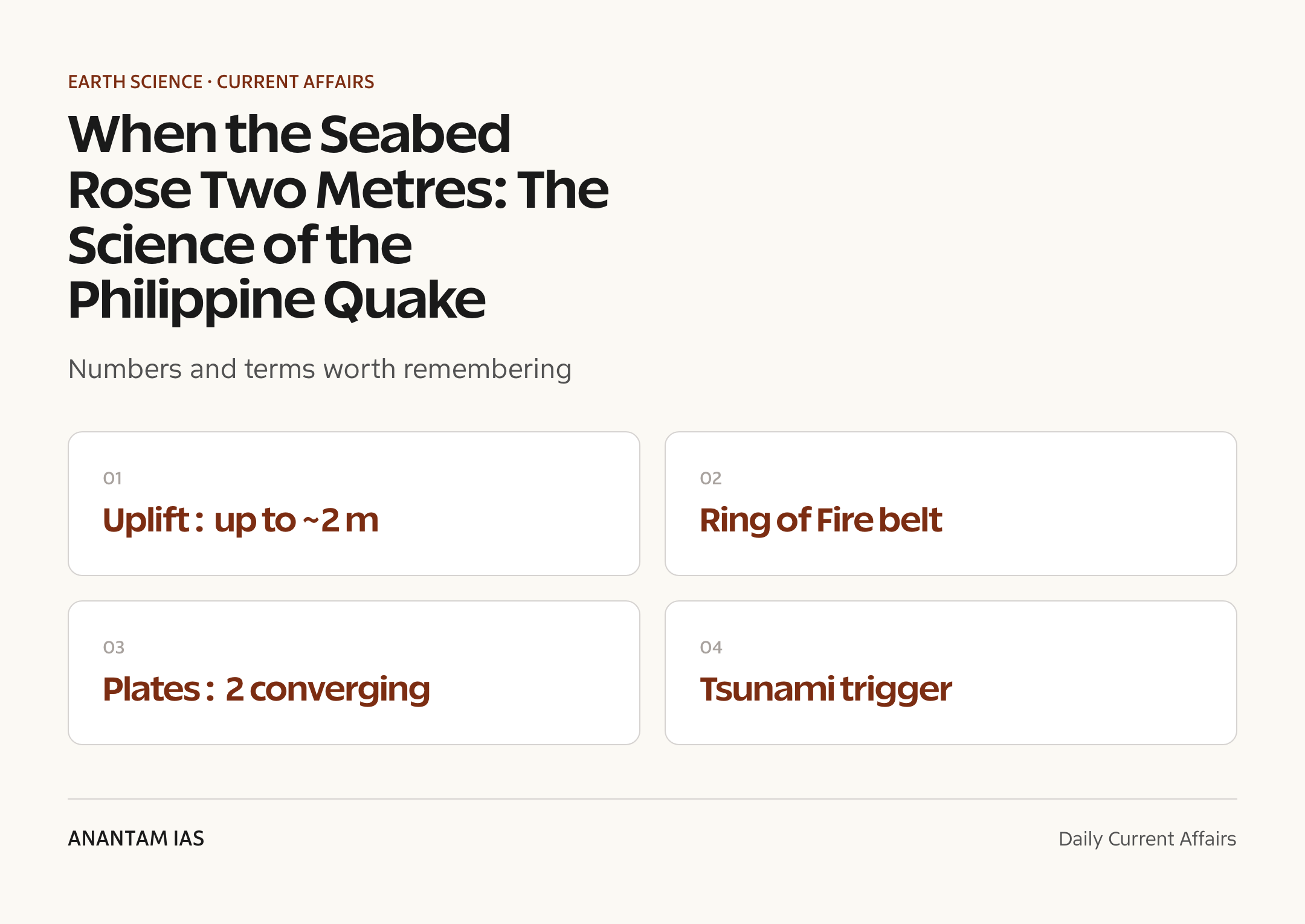
The Hindu reported that a deadly earthquake in the Philippines lifted the seabed by up to two metres, a dramatic instance of what geologists call coseismic uplift – the permanent rise of the ground that happens during the rupture itself.
The detail matters for the syllabus because it is a clean, real-world illustration of how the Philippines sits astride the Pacific Ring of Fire, where converging plates and active faults make it one of Earth’s most earthquake- and volcano-prone nations.
- Coseismic uplift: the sudden, permanent rise of the crust along a fault when an earthquake ruptures, here pushing the offshore seabed up by up to two metres.
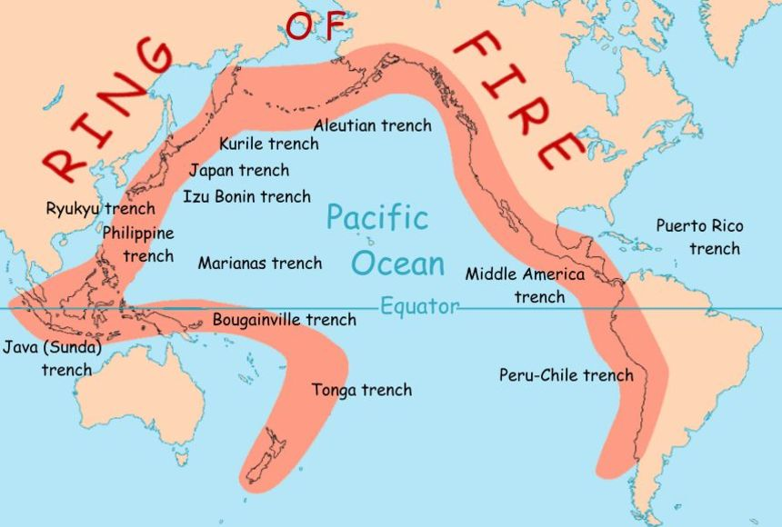
- Setting: the Philippines lies on the Pacific Ring of Fire, a horseshoe-shaped belt of subduction zones, trenches and volcanoes around the Pacific basin.
- Plate context: the country is squeezed between the westward-moving Philippine Sea Plate and the Sunda (Eurasian) Plate, with the Philippine Fault running through the islands.
- Why uplift: at a subduction zone, one plate is thrust over another; when the locked interface slips, the overriding plate springs up, raising the seafloor and coastline.
- Tsunami link: vertical displacement of the seabed displaces the water column above it, which is the classic trigger for a tsunami.
- Hazard profile: the islands face frequent strong quakes, volcanic eruptions and typhoons, making layered disaster management essential.
The development matters in the context of:
- Comparative learning: the event is a live demonstration of subduction-zone mechanics that UPSC tests through Indian examples like the Andaman-Sumatra region.
- India link: India’s own high-risk zones – the Himalaya and the Andaman trench – share the same convergent-margin physics.
- Preparedness: coastal uplift and tsunami risk underline why early-warning systems and seismic building codes save lives.
UPSC Relevance
Prelims Relevance
- Coseismic uplift/subsidence: permanent vertical change of the ground caused by fault slip during an earthquake.
- Ring of Fire: a horseshoe-shaped Pacific-rim belt of subduction zones, deep trenches, frequent earthquakes and about three-quarters of the world’s active volcanoes.
- Subduction zone: a convergent boundary where a denser oceanic plate sinks beneath another plate, building a trench and volcanic arc.
- Philippine Sea Plate vs Sunda Plate: the two main plates whose convergence shapes Philippine seismicity.
- Philippine Fault: a major left-lateral strike-slip fault running the length of the archipelago.
- Focus (hypocentre) vs epicentre: the underground point of rupture versus the point on the surface directly above it.
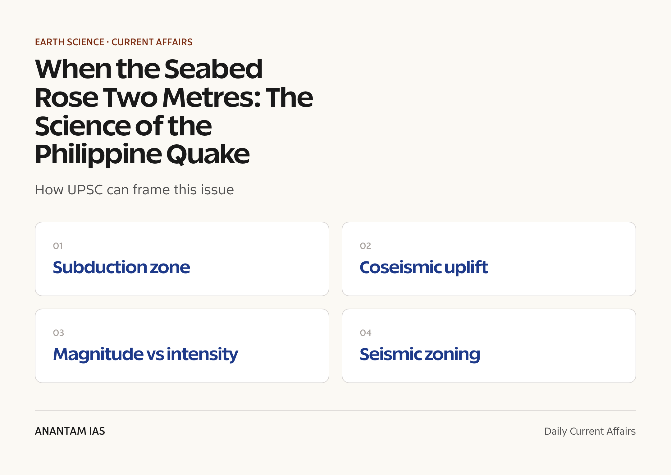
- Magnitude vs intensity: magnitude (Moment Magnitude, Mw) measures energy released; intensity (e.g. Modified Mercalli) measures shaking felt at a place.
- Tsunami generation: caused mainly by vertical seabed displacement, undersea landslides or volcanic activity, not by the shaking alone.
- Seismic waves: P-waves (primary, fastest), S-waves (secondary), and surface waves (Love and Rayleigh) that cause most damage.
- India’s seismic zones: the Bureau of Indian Standards code maps the country into Zones II-V, with Zone V the most hazardous.
Mains Relevance
GS Paper 1
- Plate tectonics: explain how convergent boundaries and subduction produce earthquakes, trenches, volcanic arcs and coseismic uplift or subsidence.
- Distribution of seismicity: map the global pattern of earthquakes along the Ring of Fire and the Alpine-Himalayan belt and account for it.
- Geomorphic effects: discuss how repeated coseismic uplift builds coastlines, marine terraces and island arcs over geological time.
GS Paper 3
- Disaster management: evaluate earthquake and tsunami early-warning, seismic building codes and community preparedness in high-risk regions.
- Risk in India: assess India’s exposure in the Himalaya and the Andaman-Nicobar arc and the adequacy of NDMA’s mitigation framework.
Essay
- Living with a restless Earth: argue how scientific understanding of plate tectonics turns natural hazards into manageable risks through preparedness.
- Nature’s reminders: use coseismic uplift to reflect on humanity’s place on a dynamic planet and the ethics of building safely.
Background and Context
Why the seabed rose: subduction-zone mechanics
The two-metre rise is not magic – it is the predictable spring-back of crust that had been bent and locked for centuries.
- Convergent boundary: at a subduction zone, a denser oceanic plate dives beneath an overriding plate, but the contact often gets stuck (locked).
- Strain build-up: while locked, the overriding plate is slowly dragged down and squeezed, storing elastic strain like a bent ruler.
- The rupture: when friction is overcome, the fault slips suddenly; the overriding plate lurches up and seaward, releasing energy as an earthquake.
- Coseismic uplift: that lurch permanently raises the seafloor and nearby coast, here by as much as two metres, while areas farther inland may sink (coseismic subsidence).
- Elastic rebound: this stick-slip cycle of slow loading and sudden release is the classic elastic rebound theory of how earthquakes work.
The Philippines on the Ring of Fire
Few places concentrate tectonic hazards like the Philippine archipelago.
- Pacific Ring of Fire: a roughly 40,000 km horseshoe of subduction zones and volcanoes ringing the Pacific, source of most of the world’s large earthquakes.
- Plate squeeze: the islands are caught between the converging Philippine Sea Plate and the Sunda (Eurasian) Plate, producing trenches on both flanks.
- Philippine Fault: a major strike-slip fault threading the length of the country, adding horizontal-slip quakes to the subduction quakes offshore.
- Volcanic company: the same convergence feeds active volcanoes such as Mayon and Taal, so quakes and eruptions share a cause.
- Frequent shaking: the country records hundreds of felt earthquakes a year, most small but periodically large and destructive.
Reading an earthquake: focus, magnitude and intensity
Exam questions hinge on a few precise distinctions about how quakes are described.
- Focus and epicentre: the focus (hypocentre) is the underground point where rupture begins; the epicentre is the surface point directly above it.
- Magnitude: measured today on the Moment Magnitude scale (Mw), it captures the total energy released and is a single number for the whole event.
- Intensity: measured on scales like the Modified Mercalli scale, it describes the shaking and damage felt at a particular place, so it varies with distance and soil.
- Depth matters: shallow quakes shake the surface harder than deep ones of the same magnitude.
- Seismic waves: fast P-waves arrive first, slower S-waves follow, and surface waves trailing them cause most structural damage.
From seabed uplift to tsunami
The same vertical motion that lifts the seabed can launch a wall of water.
- The trigger: a tsunami forms mainly when the seafloor moves vertically, suddenly displacing the entire column of water above it.
- Other causes: undersea landslides, volcanic eruptions and, rarely, meteorite impacts can also generate tsunamis.
- Wave behaviour: in deep water, the wave is low and fast; as it nears shore, it slows and piles up into a destructive surge.
- Not every quake: purely horizontal strike-slip quakes rarely make large tsunamis, which is why offshore thrust quakes are the dangerous kind.
- Warning needed: this is why Pacific and Indian Ocean tsunami-warning systems track seabed-displacing quakes within minutes.
What it means for India
India shares the same physics and must apply the same lessons across its own high-risk belts.
- Himalayan front: the Indian Plate’s collision with the Eurasian Plate makes the Himalaya a zone of great earthquake potential.
- Andaman-Nicobar arc: the islands sit on a subduction zone linked to the 2004 Indian Ocean tsunami, India’s own coseismic uplift event.
- Seismic zoning: the Bureau of Indian Standards divides India into Zones II to V, with the northeast, Himalaya and Kachchh in the highest-risk Zone V.
- Preparedness: the National Disaster Management Authority (NDMA) frames earthquake-safety guidelines and retrofitting drives.
- Building safety: enforcing earthquake-resilient design and the building code is the single biggest lever to cut deaths, since quakes don’t kill – collapsing buildings do.
Building to survive the shaking
Engineering, not luck, separates a survivable quake from a catastrophe.
- Resilient design: ductile detailing, soft-storey avoidance and proper reinforcement let structures flex and absorb shaking rather than snap.
- Base isolation and dampers: advanced buildings use isolators and dampers to decouple the structure from ground motion.
- Microzonation: mapping soil and ground-shaking risk, city-by-city guides on where and how to build.
- Early warning: fast detection of P-waves can give seconds of warning to halt trains, lifts and gas lines before strong shaking arrives.
- Community readiness: drills, awareness and clear evacuation routes turn engineering into saved lives during the actual event.
Way Forward
Science and monitoring
- Strengthen dense seismic and GPS networks to track strain build-up and detect coseismic deformation in near-real time.
- Invest in seafloor sensors and ocean-bottom geodesy that catch seabed uplift and tsunami risk at the source.
- Improve hazard mapping and microzonation, so risk is understood neighbourhood by neighbourhood.
Building and codes
- Enforce earthquake-resilient building codes and retrofit vulnerable schools, hospitals and lifeline structures.
- Promote affordable, safe-construction techniques for informal and rural housing where most casualties occur.
- Mandate seismic safety audits for critical infrastructure in high-risk zones.
Warning and community
- Expand and integrate tsunami and earthquake early-warning systems with last-mile alerting.
- Run regular community drills and embed disaster education in schools.
- Strengthen regional cooperation on Pacific and Indian Ocean warning networks.
Conclusion
A planet in motion: a seabed rising two metres in moments is a vivid reminder that the Earth’s crust is alive, driven by the slow grind of plates at subduction zones.
From hazard to risk: the science of coseismic uplift, magnitude and tsunami generation lets societies turn an unstoppable natural force into a manageable, prepared-for risk.
The Indian takeaway: with the Himalaya and the Andaman arc on the same restless margins, India’s safety rests on seismic zoning, resilient building and warning systems built well before the next big one strikes.
UPSC Practice Questions
Prelims MCQ 1
With reference to earthquakes and plate tectonics, consider the following statements:
- Coseismic uplift is the permanent rise of the ground caused by fault slip during an earthquake.
- A tsunami is generated mainly by the vertical displacement of the seabed during an undersea earthquake.
- The Philippines lies along the Pacific Ring of Fire, a belt of subduction zones and volcanoes.
How many of the above statements are correct?
(a) Only one (b) Only two (c) All three (d) None
Answer: (c) All three
Explanation:
All three are correct. Coseismic uplift is the permanent vertical rise from fault slip; tsunamis are triggered chiefly by vertical seabed displacement, and the Philippines sits on the Pacific Ring of Fire between the Philippine Sea and Sunda plates.
Prelims MCQ 2
Which one of the following statements about the magnitude and intensity of an earthquake is correct?
(a) Magnitude varies from place to place, while intensity is a single value for the whole event
(b) Magnitude measures the energy released, while intensity measures the shaking felt at a given location
(c) Both magnitude and intensity are measured on the Modified Mercalli scale
(d) Intensity measures the total energy released at the focus
Answer: (b) Magnitude measures the energy released, while intensity measures the shaking felt at a given location
Explanation:
Magnitude (e.g. Moment Magnitude, Mw) is one number for the energy released by the whole event. Intensity (e.g. Modified Mercalli) describes the shaking and damage felt at a particular place, so it varies with distance, depth and local soil.
UPSC Mains Questions
- Explain how plate tectonics at convergent boundaries produces earthquakes, coseismic uplift and tsunamis. Using a recent subduction-zone earthquake as a reference, discuss why such margins are among the most hazardous regions on Earth.
- Distinguish between the magnitude and the intensity of an earthquake, and between its focus and epicentre. Why are these distinctions important for disaster planning and damage assessment?
- India shares the same convergent-margin physics that make the Pacific rim so seismically active. Examine India’s earthquake-risk profile and assess the adequacy of its seismic zoning, building codes and early-warning systems.
Sources: United States Geological Survey (USGS) earthquake hazards programme and The Hindu.
Frequently Asked Questions
What is coseismic uplift?
Coseismic uplift is the sudden, permanent rise of the ground that happens during an earthquake when a locked fault finally slips. At a subduction zone the overriding plate springs upward as it releases stored strain, lifting the seabed and nearby coastline – in the Philippine event by as much as two metres. It is the same process, in reverse, that can also make other areas sink.
Why is the Philippines so earthquake-prone?
The Philippines sits on the Pacific Ring of Fire, squeezed between the converging Philippine Sea Plate and the Sunda (Eurasian) Plate, with the major Philippine Fault running through the islands. This combination of subduction offshore and active faulting onshore produces frequent earthquakes and feeds active volcanoes, making the archipelago one of the world’s most tectonically restless regions.
How does an earthquake cause a tsunami?
A tsunami forms mainly when an undersea earthquake suddenly moves the seafloor up or down, displacing the entire column of water above it. That displaced water spreads outward as long, fast waves. In deep ocean the waves are low and barely noticeable, but as they reach shallow coastal water they slow and pile up into a destructive surge. Purely horizontal slip rarely makes large tsunamis.
What is the difference between magnitude and intensity?
Magnitude measures the total energy released by an earthquake and is a single value for the whole event, today usually given on the Moment Magnitude scale. Intensity measures the shaking and damage actually felt at a particular place, on scales such as the Modified Mercalli scale, so it changes with distance from the source, depth and local soil conditions.
What does this Philippine quake teach India?
India lies on similar convergent margins – the Himalaya, where the Indian Plate collides with Eurasia, and the Andaman-Nicobar subduction arc linked to the 2004 tsunami. The lesson is that seismic zoning, strict earthquake-resilient building codes, microzonation and tsunami early-warning systems must be built and enforced before a major quake, since collapsing buildings, not the shaking itself, cause most deaths.
What is the Pacific Ring of Fire?
The Pacific Ring of Fire is a horseshoe-shaped belt roughly 40,000 km long that rings the Pacific Ocean, marking the boundaries where oceanic plates dive beneath others at subduction zones. It hosts the majority of the world’s large earthquakes and about three-quarters of its active volcanoes, which is why countries along it, including the Philippines, Japan and Indonesia, face such intense tectonic hazards.
Tell Google you want more of this.
Add Anantam IAS as a preferred sourceOne tap, and this site shows up more often in your own Top Stories, AI Overviews and AI Mode. Remove it any time.