

The Mountain Passes of India are the natural gateways that thread through the country’s complex mountain systems and have shaped its trade, military strategy, migration, and connectivity for thousands of years. From the desolate Karakoram Pass on the Sino-Indian frontier to the Palghat Gap that lets the south-west monsoon spill into Tamil Nadu, the Mountain Passes of India fall into three broad regions: the Himalayan and Trans-Himalayan ranges of the north, the Patkai-Naga-Mizo arc of the north-east, and the Western and Eastern Ghats of the peninsular block. UPSC syllabus expects candidates to know the location, elevation, connecting regions, and strategic or commercial significance of about thirty important passes. This explainer organises the Mountain Passes of India by region with a quick-reference table and the geographical context that makes each pass matter.
What is a Mountain Pass?
A mountain pass is a navigable route across a mountain range, usually at a relatively low elevation between two peaks or along a ridge saddle. Most natural passes lie on river divides where headwaters from opposite sides have cut back into the ridge. The high-altitude Mountain Passes of India are often glacier-cut cols, while the Ghats passes (or “gap”) are erosional troughs cut by westward-flowing rivers.
Mountain Passes of the Himalayas
The Himalayan and Trans-Himalayan ranges contain the highest, most numerous, and most strategically loaded Mountain Passes of India. The principal passes are summarised in the table below.
| Pass | State / UT | Range | Elevation (m) | Connects |
|---|---|---|---|---|
| Karakoram Pass | Ladakh | Karakoram | 5,540 | Ladakh – Yarkand (closed) |
| Khardung La | Ladakh | Ladakh | 5,359 | Leh – Nubra Valley |
| Saser La | Ladakh | Saser Muztagh | 5,411 | Nubra – Shyok / Karakoram Pass |
| Chang La | Ladakh | Ladakh | 5,360 | Leh – Pangong Tso |
| Imis La | Ladakh | Ladakh | 5,300 | Leh – Hanle |
| Zoji La | J&K – Ladakh | Greater Himalaya | 3,528 | Srinagar – Kargil – Leh |
| Bara-lacha La | Himachal | Zaskar | 4,890 | Manali – Leh (NH-3) |
| Rohtang Pass | Himachal | Pir Panjal | 3,978 | Kullu – Lahaul |
| Shipki La | Himachal | Zaskar | 5,669 | Kinnaur – Tibet (Sutlej route) |
| Lipulekh Pass | Uttarakhand | Greater Himalaya | 5,200 | Pithoragarh – Tibet (Kailash Mansarovar) |
| Niti Pass | Uttarakhand | Greater Himalaya | 5,068 | Chamoli – Tibet |
| Mana Pass | Uttarakhand | Greater Himalaya | 5,608 | Badrinath – Tibet |
| Nathu La | Sikkim | Greater Himalaya | 4,310 | Sikkim – Tibet (closed/limited trade) |
| Jelep La | Sikkim | Greater Himalaya | 4,267 | Sikkim – Tibet (Chumbi Valley) |
| Bomdi La | Arunachal | Eastern Himalaya | 2,217 | Tawang – Tezpur (NH-13) |
| Diphu La | Arunachal | Patkai | 4,587 | Arunachal – Myanmar – Tibet trijunction |
Western Himalayan Passes
Zoji La (3,528 m) in the Greater Himalaya is the lifeline of Ladakh. The Srinagar–Kargil–Leh National Highway crosses it, and the under-construction Zoji La tunnel (14.15 km, expected open 2026) will make Ladakh accessible year-round for the first time. Zoji La closes from November to May under heavy snow.
Rohtang Pass (3,978 m) on the Pir Panjal connects the Kullu valley to Lahaul and the Spiti–Leh routes. The Atal Tunnel under the Rohtang, opened in 2020, has reduced the Manali–Keylong distance by 46 kilometres and provided year-round access to Lahaul.
Bara-lacha La (4,890 m) on the Zaskar Range is the second great pass on the Manali–Leh highway. Beyond Bara-lacha, the highway enters the high desert valleys of Lahaul and Zaskar.
Shipki La (5,669 m) in Kinnaur is the route by which the Sutlej enters India from Tibet. It was historically the principal trade route between the Hindustan-Tibet road and the Tibetan plateau and is now a Border Personnel Meeting point.
Central Himalayan Passes
In Uttarakhand, three high passes cross the Greater Himalaya into Tibet. Lipulekh Pass (5,200 m) in Pithoragarh district is the gateway for the Kailash Mansarovar yatra and lies at the tri-junction of India, Nepal, and China. Niti Pass (5,068 m) in Chamoli was the route of the Bhotia trans-Himalayan trade. Mana Pass (5,608 m) lies just north of Badrinath and is one of the highest motorable passes in the world.
Eastern Himalayan Passes (Sikkim and Arunachal)
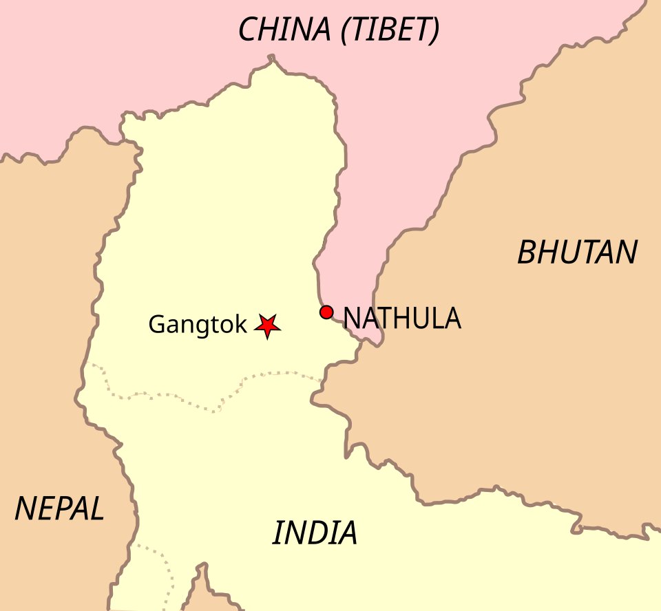
Nathu La (4,310 m) on the Sino-Indian border in Sikkim is the most famous trans-Himalayan pass on the eastern frontier. It was closed after the 1962 war and reopened for limited border trade in 2006. The 1967 skirmishes at Nathu La and the neighbouring Cho La were significant test cases of Indian preparedness on the eastern front.
Jelep La (4,267 m) in Sikkim also leads into the Chumbi Valley of Tibet and was the principal route of the Younghusband Expedition of 1903–04. It has remained closed since 1962.
Bomdi La in Arunachal Pradesh is on the Tezpur–Tawang highway. Diphu La lies at the India–Myanmar–Tibet tri-junction and is the easternmost important Himalayan pass.
Ladakh and the Trans-Himalayan Passes
The Karakoram Pass (5,540 m) is the highest pass that historically carried regular commercial traffic anywhere in Asia. It linked Leh to Yarkand and Kashgar in the silk and pashmina trade. The pass now lies on the Line of Actual Control and is closed.
Khardung La (5,359 m) on the Ladakh Range, often advertised as the world’s highest motorable pass (though disputed), connects Leh to the Nubra valley and the Siachen base camp. Chang La (5,360 m) is the road pass for Pangong Tso. For more on the high northern frontier, see the article on the Karakoram Range.
Mountain Passes of the Northeast
The Patkai-Naga-Mizo arc that separates India from Myanmar contains several historically and strategically important passes.
| Pass | State | Range | Elevation (m) | Connects |
|---|---|---|---|---|
| Pangsau Pass | Arunachal | Patkai | 1,136 | Arunachal – Myanmar (Stilwell Road) |
| Tuju Pass | Manipur | Manipur Hills | 1,800 | Manipur – Myanmar |
| Yangyap Pass | Arunachal | Eastern Himalaya | 3,856 | Brahmaputra entry into India |
| Pen La | Arunachal | Eastern Himalaya | 4,664 | Tawang sector |
Pangsau Pass in the Patkai hills carries the historic Stilwell Road that linked Ledo in Assam to Kunming in China through Myanmar during the Second World War. The pass is the principal entry point between India and Myanmar in the north-east and was used heavily by Allied forces in 1944–45.
Mountain Passes of the Western Ghats
The Western Ghats run as a near-continuous wall along the western coast, but several deep gaps cut through them and these have historically channelled all road, rail, and monsoon traffic between the coast and the Deccan.
| Pass | State | Elevation (m) | Connects |
|---|---|---|---|
| Thal Ghat | Maharashtra | 583 | Mumbai – Nashik (Kasara Ghat) |
| Bhor Ghat | Maharashtra | 630 | Mumbai – Pune (Khandala) |
| Pal Ghat | Kerala – Tamil Nadu | about 140 | Coimbatore – Palakkad – Kochi |
| Sengottai Pass | Tamil Nadu – Kerala | 220 | Madurai – Kollam |
| Goran Ghat | Goa – Karnataka | – | Belgaum – Goa |
The Palghat (Palakkad) Gap at only about 140 metres is the most important gap in the Western Ghats. It is a structural depression, 24 to 40 km wide depending on the source, between the Nilgiri Hills to the north and the Anaimalai Hills to the south. The gap carries the Bharathapuzha river west and the south-west monsoon east, and it is the only easy land route between Kerala and Tamil Nadu. The Palghat Gap is also a major biogeographical break in the Western Ghats: many endemic species north of the gap are absent south of it, and vice versa. For more on the hills that flank the gap, see Nilgiri Hills.
Thal Ghat (Kasara Ghat) on the Sahyadri carries the Mumbai–Kolkata national highway and the Central Railway main line over the Western Ghats. Bhor Ghat (Khandala) carries the Mumbai–Pune highway and railway and is the older of the two routes, surveyed in the 1820s.
Strategic Significance Across the System
The Mountain Passes of India are not just transport corridors but the principal control points for national security, trade, and diplomacy. The 1962 war with China was fought across Bomdi La, Diphu La, and the high passes of Arunachal. The 1965 and 1971 wars passed through Zoji La and the Kashmir passes. The Karakoram, Khardung La, and Saser La form the highway to the Siachen sector. The Lipulekh, Niti, Mana, Nathu La, and Jelep La are pilgrim and former trade routes that have repeatedly been the focus of diplomatic exchanges with China. In the peninsula, the Palghat Gap continues to determine the climate of half of Tamil Nadu. Studying the Mountain Passes of India is, in the end, studying the geometry of how the subcontinent connects to itself and the world.
Frequently Asked Questions
What is the highest mountain pass in India?
Among Mountain Passes of India that lie on motorable roads, Mana Pass (5,608 m) in Uttarakhand and Shipki La (5,669 m) in Himachal Pradesh are the highest. Among non-motorable cartographic passes, several glaciated cols above 6,000 metres exist in the Karakoram Range.
Which pass connects Srinagar with Leh?
Zoji La (3,528 m) on the Greater Himalaya connects Srinagar with Kargil and Leh via the NH-1D. It is currently closed for several months each winter, but the under-construction Zoji La tunnel will provide year-round access.
What is the strategic importance of Nathu La?
Nathu La (4,310 m) in Sikkim is the most important border pass on the eastern Sino-Indian frontier. It was the site of the 1967 clashes that decisively tested Indian preparedness and was reopened for limited border trade in 2006.
What is the Palghat Gap and why does it matter?
The Palghat Gap is a structural depression in the Western Ghats, about 140 metres above sea level and 24 to 40 km wide, between the Nilgiri Hills and the Anaimalai Hills. It is the only easy land route between Kerala and Tamil Nadu, the principal corridor for the south-west monsoon into the eastern Deccan, and a major biogeographical break in the Ghats.
Which mountain pass connects Manali with Leh?
The Manali–Leh highway crosses four high passes: Rohtang (3,978 m, now bypassed by the Atal Tunnel), Bara-lacha La (4,890 m), Nakee La, and Tanglang La. Together they make the route accessible only from May to October in most years.
What is the difference between Lipulekh, Niti, and Mana passes?
All three are Mountain Passes of India that cross the Greater Himalaya into Tibet from Uttarakhand. Lipulekh (5,200 m) in Pithoragarh is the Kailash Mansarovar route and lies at the India-Nepal-China tri-junction. Niti (5,068 m) in Chamoli was the historic Bhotia trade route. Mana (5,608 m) just north of Badrinath is one of the highest motorable passes in the world.
How many passes lie on the Sino-Indian border?
Several dozen named cols and passes lie on the Sino-Indian border. The principal ones from west to east are Karakoram Pass, Khardung La (Indian internal), Demchok area passes, Shipki La, Lipulekh, Niti, Mana, Nathu La, Jelep La, Bum La, and Diphu La.
What is the lowest important pass in India?
The Palghat Gap in the Western Ghats at around 140 metres is the lowest important pass in India. It is properly a u0022gapu0022 rather than a pass, because it cuts the Ghats nearly to base level rather than crossing a ridge near a summit.
Tell Google you want more of this.
Add Anantam IAS as a preferred sourceOne tap, and this site shows up more often in your own Top Stories, AI Overviews and AI Mode. Remove it any time.






