The Nadi-Sukta palaeo-drainage debate sits at the intersection of Vedic textual scholarship, geomorphology and Quaternary geology — a rare meeting of shruti and stratigraphy. Hymn 10.75 of the Rigveda, the Nadi-Sukta, lists the rivers of north-western India in a precise west-to-east order. When that order is laid against modern palaeo-drainage maps assembled from satellite imagery, sediment cores and isotope studies, a startling correspondence emerges: the hymn appears to fossilise the memory of a drainage system that was already changing during the late Pleistocene and early Holocene.
This article walks through the hymn itself, the palaeo-channel evidence for the Ghaggar–Hakra (Saraswati) system, the great Yamuna and Sutlej diversions, the curious presence of the Ganga river dolphin in the Indus river system, and the role of pioneers like Robert Bruce Foote in establishing the Quaternary stratigraphy of the subcontinent.
What the Nadi Sukta Actually Says
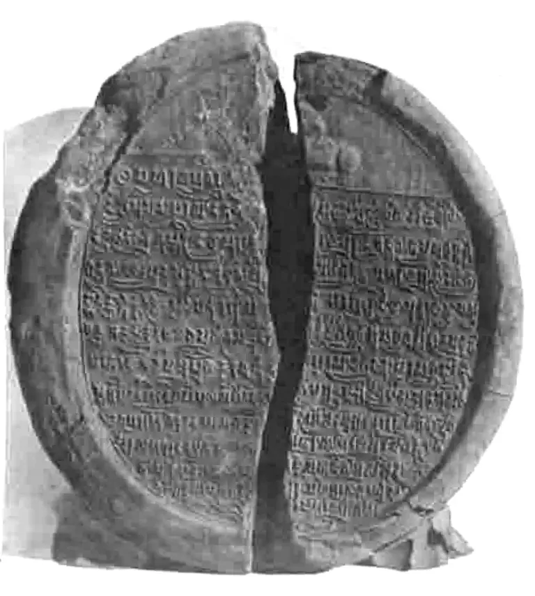
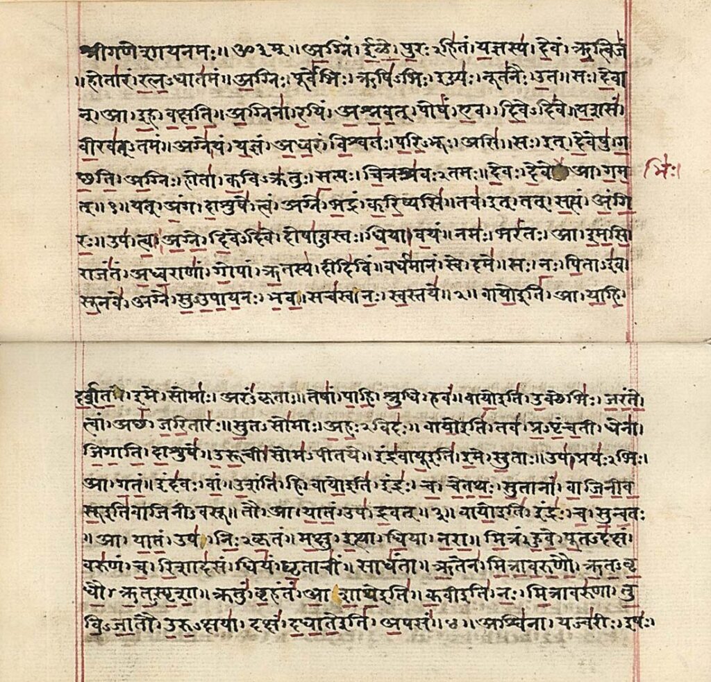
Rigveda 10.75 is a hymn of 9 verses. Verses 5 and 6 contain the famous river list. The poet invokes ten streams in sequence, beginning from the east and moving west:
- Ganga, Yamuna, Sarasvati, Shutudri (Sutlej), Parushni (Ravi),
- Asikni (Chenab), Marudvridha, Vitasta (Jhelum), Arjikiya, Sushoma.
He then turns to the Sindhu (Indus) himself and praises him as the leader of all streams. The order is not poetic license — it follows river basins from the doab through Punjab to the trans-Indus tributaries. This geographical fidelity is what makes the this textual–geological correspondence discussion possible. The hymn behaves like a snapshot. And snapshots can be compared with later snapshots.
The Saraswati Problem
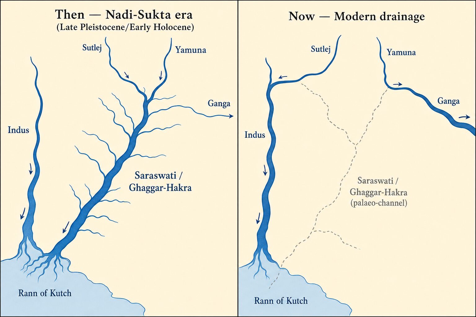
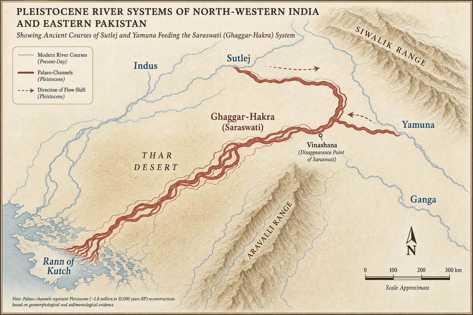
The Rigveda calls the Saraswati naditame (best of rivers) and places her between the Yamuna and the Sutlej. In modern terms this is the dry bed of the Ghaggar–Hakra palaeo-channel, which once carried glacial-fed flow from the western Himalaya across present-day Haryana, Rajasthan and Cholistan into the Rann of Kachchh. By the time of the later Vedic texts, the Saraswati is already described as disappearing in the sands of the Thar at a place called Vinashana. Something — a Pleistocene reorganisation — broke her.
What’s contested. The textual–palaeo-drainage match is not settled. Michael Witzel, Gregory Possehl and Romila Thapar have argued that the Rigvedic Saraswati may be the Helmand (Haraxvaiti) of Afghanistan rather than the Ghaggar–Hakra, and that the late-Pleistocene river-shift correspondence may be a coincidence rather than direct hymnal memory. The Ghaggar–Hakra identification remains the majority Indian-geological view; the Helmand alternative remains the principal philological dissent.
Pleistocene Drainage of North-West India
The Pleistocene (~2.6 million to 11,700 years before present) saw repeated glaciations in the Himalaya, monsoon weakening and strengthening, and tectonic uplift of the foreland basin. Three drainage events bear directly on the this drainage reconstruction problem:
1. The Yamuna Diversion
Sediment provenance studies on the Ghaggar–Hakra channel show a palaeo-Yamuna once flowed west through the present Markanda–Ghaggar course before being captured by its modern Ganga-bound channel. Optically stimulated luminescence (OSL) dates on the abandoned western channels place the bulk of the diversion between about 49,000 and 10,000 years BP, with continued reduction into the mid-Holocene. The hymn places Yamuna immediately west of Ganga — already in her modern position — but venerates Saraswati as still a great river. That fits a window when the Yamuna had largely turned east but residual flow plus Sutlej contribution still fed the Ghaggar.
2. The Sutlej Diversion
The Sutlej, the Shutudri of the Rigveda, today joins the Beas before meeting the Indus. Palaeo-channel mapping shows an earlier course that ran south-east via the Ghaggar towards the Saraswati. The avulsion to the modern course is dated, again by OSL and detrital zircon work, to between roughly 15,000 and 8,000 years BP. The list-order of Sarasvati → Shutudri in the hymn — Saraswati east of Sutlej — only makes sense if the Sutlej had already swung west. The this picture picture therefore captures a post-avulsion world.
3. Indus Avulsions
The Indus itself has shifted laterally by tens of kilometres across the Punjab plain through the Pleistocene and Holocene, abandoning channels that are visible today as dry depressions on satellite imagery (CORONA, SRTM, IRS data). Greg Possehl, Rita Wright, Sanjeev Gupta and Peter Clift have all contributed to dating these avulsions.
The Indus-Ganga Dolphin Evidence
The this synthesis thesis gets a biological reinforcement from an unexpected witness — the river dolphin. The Indus dolphin (Platanista minor) and the Ganga dolphin (Platanista gangetica) were treated as a single species until very recently. Genetic and morphological studies in 2021 (Braulik et al.) formally separated them, but estimated their divergence at only about 550,000 years — a Middle to Late Pleistocene split. Their common ancestor swam in a single, connected river system. That system is exactly the kind of west-east network the this model model predicts: a palaeo-Saraswati or palaeo-Yamuna corridor linking the two modern basins long enough for one population, then breaking that link before full speciation could occur.
The dolphin is not a piece of poetry. It is a living relic of a hydrology the hymn happens to remember.
A caveat on timing. The dolphin split at ~550,000 years BP predates the late-Pleistocene/early-Holocene river-shift window the hymn most directly remembers by an order of magnitude. The genetic evidence therefore speaks to an earlier Mid-Pleistocene connection between the basins, not the same drainage event the Rigvedic hymn describes. It supports the broader thesis that the Indus and Ganga were once hydrologically connected — it is not direct corroboration of hymn-era geography.
Palaeo-Drainage Research Methods
How do researchers reconstruct vanished rivers? Four converging methods underpin the this reconstruction consensus.
- Remote sensing. Multispectral and radar imagery reveals palaeo-channels under thin sand cover. The Ghaggar–Hakra trace is most easily seen in Landsat band combinations and in SRTM elevation differences.
- Sediment provenance. Detrital zircon U-Pb ages and Sr-Nd isotope ratios in palaeo-channel sediments are fingerprinted against modern Himalayan source rocks. A Sutlej signature in the Ghaggar bed proves the Sutlej once flowed there.
- Optically stimulated luminescence (OSL). Dates the last time buried quartz grains saw sunlight. This pins channel abandonment in absolute time.
- Archaeological correlation. Harappan and pre-Harappan site density along dry channels (Bhirrana, Kalibangan, Rakhigarhi) testifies to a living river at those times.
Key Indian Contributions
K. S. Valdiya, V. M. K. Puri, A. K. Gupta, S. K. Tandon and the IIT-Kanpur–IIT-Bombay teams have led much of the Indian work. International collaborators include Sanjeev Gupta (Imperial College), Peter Clift (Louisiana State) and Liviu Giosan (WHOI). Their convergent finding: the Ghaggar carried major glacial-fed flow in the early Holocene, lost it by about 4,500–4,000 years BP, and was reduced to a monsoon-only stream — coinciding with the late mature Harappan decline.
Foote’s Chronology — The Dating Framework
None of the OSL dates or stratigraphic correlations above would have a yardstick without Robert Bruce Foote (1834–1912). The Geological Survey of India officer who picked up a hand-axe at Pallavaram on 30 May 1863 founded Indian Quaternary chronology — the framework within which every subsequent palaeo-channel date is now situated. His later stratigraphic work in the Sabarmati and Narmada valleys, and his laterite classification across Gujarat, gave Pleistocene India its first deep-time scale.
Why It Matters for UPSC
The topic crosses three GS papers and offers high-yield exam material at both Prelims and Mains levels. Map your reading by stage:
Prelims-likely MCQ facts
- Rigveda hymn 10.75 = Nadi-Sukta — lists ten rivers east-to-west
- Saraswati = Ghaggar–Hakra palaeo-channel (Haryana → Rajasthan → Cholistan → Rann of Kachchh)
- Vinashana = disappearance point in the Thar (later Vedic reference)
- Sutlej avulsion away from Saraswati: ~15,000–8,000 years BP
- Indus and Ganga river dolphins diverged ~0.55 Mya (Braulik et al. 2021)
- 4.2 kiloyear event = global aridity spike linked to late Mature Harappan decline
- Robert Bruce Foote — 1863 Pallavaram hand-axe = first Indian Palaeolithic
Mains GS-I — History & Heritage
- Saraswati controversy & Rigvedic chronology debate (Witzel vs Lal vs Danino)
- Harappan civilisation decline correlated with Saraswati desiccation
- Continuity-vs-migration thesis — how oral tradition preserves vanished landscapes
Mains GS-I — Geography
- Pleistocene drainage evolution of north-west India — river capture & avulsion
- Role of antecedent drainage and Himalayan tectonic uplift
- Holocene Climatic Optimum and monsoon variability as river-shift drivers
Mains GS-III — Environment
- Endemic freshwater biogeography: Indus dolphin (Platanista minor) & Ganga dolphin (Platanista gangetica) — conservation status & Project Dolphin
- Speleothem-based palaeo-climate reconstructions (Mawmluh, Bittoo, Qunf caves)
- Climate-change parallels — what the 4.2 ka event teaches about future monsoon variability
Quick-recall facts table
| Fact | Value |
|---|---|
| Rigveda hymn reference | Mandala 10, Sukta 75 |
| Verse range of river list | Verses 5 & 6 |
| Number of rivers named | 10 (plus Sindhu invoked separately) |
| Modern identity of Saraswati | Ghaggar–Hakra palaeo-channel |
| Disappearance-point name | Vinashana (in the Thar) |
| Indus & Ganga dolphin divergence | ~550,000 years BP (Braulik et al. 2021) |
| Sutlej avulsion (away from Saraswati) | ~15,000–8,000 years BP |
| Yamuna eastward diversion (main pulse) | ~49,000–10,000 years BP |
| Holocene Climatic Optimum | ~11,000–5,000 years BP |
| 4.2 kiloyear event | ~4,200 years BP (Harappan decline marker) |
| Robert Bruce Foote — first hand-axe | Pallavaram, 30 May 1863 |
Climate Forcing Behind the Shifts
The this hydrology picture cannot be separated from monsoon variability. Indian Summer Monsoon (ISM) reconstructions from speleothems in Mawmluh Cave (Meghalaya), Bittoo Cave (Uttarakhand) and Qunf Cave (Oman) show a strong monsoon between roughly 11,000 and 5,000 years BP — the so-called Holocene Climatic Optimum — followed by progressive weakening into the late Holocene. Strong monsoon years pushed the Saraswati to her Rigvedic glory; weakening monsoons combined with the loss of glacial-fed Sutlej and Yamuna tributaries to dry her. The 4.2 kiloyear event — a global aridity spike around 4,200 years BP — marks the inflection point. Its signature is visible in the oxygen-18 record of Mawmluh stalagmites and corresponds to the late Mature Harappan crisis. The hymn’s geography therefore plausibly captures a hydrology that was recently strong but already attenuating — exactly the late Holocene window before the 4.2 ka event.
Tectonic Background (the slower forcing beneath climate)
Tectonic uplift is the other forcing. The Himalayan foreland basin tilts gently south-eastward over time as the Himalaya rises. That tilt biases river capture eastward — pulling the Yamuna toward the Ganga and reducing the gradient available to the Saraswati. Over Quaternary time scales, tectonics is a slow but inexorable steering wheel on the this drainage system system.
A Hymn Older Than It Sounds
The most provocative implication of the this correspondence correspondence is chronological. If the hymn captures a hydrology that no longer existed by, say, 1500 BCE, then the oral tradition behind it must reach further back than the conventional dating of Rigvedic composition. Scholars such as B. B. Lal, S. Kalyanaraman and Michel Danino argue exactly this. Others, including Romila Thapar and Irfan Habib, caution that the hymn’s geography could equally be a literary inheritance — a memory transmitted through generations until the rivers were gone but the names remained.
Both positions can stand together. Memory is durable; rivers are not. The hymn does what poetry has always done: it keeps a landscape alive after the landscape has moved.
Further Reading & References
- Valdiya, K. S. (2002). Saraswati: The River That Disappeared. Universities Press — the standard Indian geological synthesis.
- Braulik, G. T. et al. (2021). “Taxonomic revision of the South Asian River dolphins (Platanista).” Marine Mammal Science — the paper that split Indus and Ganga dolphins into two species.
- Possehl, G. L. (2002). The Indus Civilization: A Contemporary Perspective. AltaMira Press — the principal sceptical view on Saraswati identification.
- Clift, P. D. & Giosan, L. (2014). “Sediment dispersal in the Indus river basin: Source-to-sink integration.” Detrital zircon foundational work.
- Singh, A. et al. (2017). “Counter-intuitive influence of Himalayan river morphodynamics on Indus Civilisation urban settlements.” Nature Communications — the headline OSL-based Sutlej avulsion paper.
- Danino, M. (2010). The Lost River: On the Trail of the Sarasvati. Penguin India — accessible textual synthesis.
- Wikipedia: Sarasvati River — useful entry point with full bibliography.
- Wikipedia: Ghaggar–Hakra River — palaeo-channel evidence summary.
Related on AnantamIAS
- Rigvedic rivers — ancient and modern names
- Indus river & antecedent drainage
- River dolphins of India — Indus, Ganga, conservation status
- Harappan archaeological findings
- Largest rivers of India — ranked
- Indus river system — complete map
- UPSC Syllabus — Prelims and Mains
Frequently Asked Questions
What is the Nadi Sukta?
The Nadi Sukta is hymn 10.75 of the Rigveda, addressed to the rivers of north-west India. Verses 5 and 6 list ten streams from Ganga in the east to the Sushoma in the west, with the Sindhu praised as their leader.
Why is the Nadi Sukta important for Pleistocene river studies?
Because its river order matches a palaeo-drainage configuration where the Saraswati still flowed and the Sutlej and Yamuna had already begun their shifts — a window the Late Pleistocene and early Holocene actually fits.
What is the modern identity of the Saraswati?
The Ghaggar–Hakra palaeo-channel that runs through Haryana, Rajasthan and Cholistan into the Rann of Kachchh. It is now seasonal but once carried Himalayan glacial-fed flow.
How does the Ganga dolphin evidence support the hymn?
The Indus and Ganga river dolphins diverged only ~550,000 years ago, meaning their ancestral population lived in a connected river system — consistent with a palaeo-Saraswati or palaeo-Yamuna corridor linking the basins.
Who was Robert Bruce Foote?
A Geological Survey of India officer who discovered the first Indian Palaeolithic hand-axe at Pallavaram near Madras in 1863, founding Quaternary archaeology in India.
What is OSL dating?
Optically Stimulated Luminescence dating measures the time elapsed since buried quartz grains were last exposed to sunlight. It is the workhorse method for dating palaeo-channels.
Did the Sutlej once flow into the Saraswati?
Yes. Detrital zircon and isotope studies confirm a Sutlej signature in the Ghaggar–Hakra sediments. The avulsion to its modern westward course occurred between roughly 15,000 and 8,000 years ago.
Does the Nadi Sukta prove a very ancient Rigveda?
It is suggestive but not conclusive. The hymn’s geography fits a window that ends with full Saraswati desiccation around 4,000 years BP, but oral tradition could carry such a memory forward by centuries.
Tell Google you want more of this.
Add Anantam IAS as a preferred sourceOne tap, and this site shows up more often in your own Top Stories, AI Overviews and AI Mode. Remove it any time.