
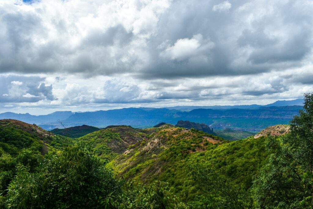
India is one of only seventeen megadiverse countries on the planet, and four of the world’s thirty-six global biodiversity hotspots fall within or extend into its boundaries. These biodiversity hotspots in India — the Western Ghats, the Eastern Himalaya, the Indo-Burma region and the Sundaland (through the Nicobar Islands) — together hold a disproportionate share of the country’s endemic plants, amphibians, reptiles, fish and mammals, while also facing some of the most intense habitat pressure on the subcontinent. Conservation here is not a regional concern; it is a planetary one.
The biodiversity hotspot framework was first articulated by British ecologist Norman Myers in 1988, refined in 1999, and adopted by Conservation International as a strategic lens for directing limited conservation funding. A region qualifies as a hotspot only if it meets two strict thresholds: it must contain at least 1,500 species of vascular plants found nowhere else on Earth, and it must have already lost at least seventy percent of its primary vegetation. By that yardstick, the four biodiversity hotspots in India are simultaneously irreplaceable and acutely threatened.
What Is a Biodiversity Hotspot
A biodiversity hotspot is a biogeographic region with exceptional concentrations of endemic species under exceptional threat of destruction. The concept was designed to answer a difficult triage question — if you cannot save everywhere, where do you spend first?
Norman Myers Criteria
Two criteria define a hotspot under the Conservation International framework:
- Endemism threshold: the region must hold at least 1,500 vascular plant species (about 0.5 percent of the world’s total) found nowhere else.
- Habitat loss threshold: the region must have lost seventy percent or more of its original primary vegetation.
Globally, thirty-six hotspots cover only about 2.5 percent of the Earth’s land surface, yet they support more than half of the world’s endemic plants and roughly forty-three percent of endemic vertebrate species. India’s share — four hotspots in one country — is unusually high.
Why India Qualifies
India sits at the meeting point of three biogeographic realms: the Indo-Malayan, the Palearctic and the Afrotropical. Its altitudinal range stretches from sea level to over 8,500 metres, its rainfall gradient from below 100 mm in the Thar to over 11,000 mm in Mawsynram, and its coastline reaches both the equatorial Nicobar and the temperate Himalayan foothills. The result is a mosaic of habitats that supports about 8 percent of the world’s recorded species on 2.4 percent of its land area.
Western Ghats Biodiversity Hotspot
The Western Ghats run for roughly 1,600 km along India’s western coast, from Gujarat through Maharashtra, Goa, Karnataka, Kerala and into Tamil Nadu. The range was inscribed as a UNESCO World Heritage Site in 2012 and is considered older than the Himalayas.
Endemic Species of the Ghats
The Ghats hold extraordinary endemism. About 1,500 endemic plant species, 179 endemic amphibians, 157 endemic reptiles and 290 endemic freshwater fish have been recorded. Flagship species include:
- Lion-tailed macaque (Macaca silenus) — restricted to evergreen forests.
- Nilgiri tahr (Nilgiritragus hylocrius) — Tamil Nadu’s state animal.
- Malabar civet, listed as Critically Endangered.
- Purple frog (Nasikabatrachus sahyadrensis) — a living fossil that spends most of its life underground.
- Malabar grey hornbill and Nilgiri laughingthrush among 35 endemic bird species.
Threats to the Western Ghats
Plantation expansion (tea, coffee, rubber and cardamom), hydroelectric projects, quarrying, the widening of the Mumbai–Goa–Mangaluru road and rail corridor, and unplanned tourism have fragmented forest cover. The Gadgil Committee (2011) recommended classifying the entire range as an Ecologically Sensitive Area, while the Kasturirangan Committee (2013) proposed a more restricted approach covering about 37 percent of the range. Implementation has been contested by state governments.
Eastern Himalaya Hotspot
The Eastern Himalaya hotspot extends across Bhutan, north-east India (Sikkim, Arunachal Pradesh, parts of Assam, Nagaland, Meghalaya and northern West Bengal), Nepal and parts of southern China and Myanmar. It is one of the most biologically rich temperate zones on Earth.
Distinctive Flora and Fauna
The region is the global centre of diversity for rhododendrons (over 130 species) and orchids (more than 700 species). It is also the only place where the red panda, snow leopard, takin, musk deer, golden langur, clouded leopard and Bengal florican occur together along an altitudinal gradient. Arunachal Pradesh alone has produced over a dozen new species descriptions in the last two decades, including the leaf deer and the Arunachal macaque.
Pressures in the North-East
Shifting cultivation cycles have shortened from 20–30 years to 3–5 years in many areas, leading to soil exhaustion. Hydropower expansion on the Brahmaputra tributaries, road infrastructure to border areas, and the spread of oil palm plantations under the National Mission on Edible Oils are the dominant new threats. Climate-driven upslope shifts are already documented in butterflies and birds in Sikkim.
Indo-Burma Hotspot
The Indo-Burma hotspot covers most of mainland Southeast Asia, including India’s north-east plains and the Andaman Islands’ surrounding waters. It is the most populous of all hotspots and arguably the most rapidly changing.
Aquatic and Forest Wealth
Indo-Burma is the global centre of freshwater turtle diversity and one of only two hotspots where Asian elephants, tigers and gibbons co-occur. The Ganges river dolphin, hoolock gibbon (India’s only ape), pygmy hog, and Bengal florican are flagship species. The region is also a centre of rice diversity, with thousands of traditional varieties still cultivated.
Threats and Conservation Response
Logging, dam-building on the Mekong and Brahmaputra systems, the bushmeat and exotic-pet trade, and the conversion of wetlands to paddy and aquaculture are the principal threats. India’s conservation response includes Project Tiger reserves in Manas, Pakke and Namdapha, and the Brahmaputra Riverine Wildlife Sanctuaries. See also the Panchayat Extension to Scheduled Areas Act and forest conservation for the legal architecture governing tribal-area forests.
Sundaland Hotspot
Sundaland covers the western half of the Indo-Malayan archipelago — Borneo, Sumatra, Java and the Malay Peninsula — and extends into India through the Nicobar Islands. The Andamans are biogeographically closer to Indo-Burma, but the Nicobars belong firmly to Sundaland.
Nicobar Endemics
The Nicobar group contributes species such as the Nicobar megapode (a mound-building bird that incubates eggs using geothermal and decomposing-vegetation heat), the Nicobar long-tailed macaque, the Nicobar tree shrew, the Nicobar scrubfowl and the Nicobar pigeon. The 2004 Indian Ocean tsunami reshaped much of this habitat and caused steep but recoverable population declines.
Strategic and Ecological Stakes
Conservation in the Nicobars is complicated by the strategic significance of the islands, the limited population of indigenous communities (such as the Shompen and Nicobarese), and recent proposals to develop a transhipment port and township on Great Nicobar. The National Green Tribunal and the Environment Ministry’s Expert Appraisal Committee have repeatedly flagged the project’s potential impact on coral reefs, leatherback turtle nesting beaches and primary rainforest.
Common Threats Across the Four Hotspots
Across all biodiversity hotspots in India, a recurring set of stressors operates:
- Habitat fragmentation from linear infrastructure (roads, rail, transmission lines, canals).
- Land-use change for plantations, mining, urban expansion and large dams.
- Climate change — upslope migration of montane species, coral bleaching in island reefs, glacial retreat in Himalayan headwaters.
- Invasive species like Lantana camara, Mikania micrantha, Prosopis juliflora and the African catfish.
- Wildlife trade — tiger and pangolin parts, exotic birds, marine ornamentals.
- Human-wildlife conflict — elephants, leopards and macaques increasingly enter human-dominated landscapes.
The Forest Survey of India‘s biennial India State of Forest Report now records small absolute increases in forest cover at the national level but losses in primary forest within the hotspot zones — a divergence that matters more than the headline number.
Conservation Architecture in India
India’s response to biodiversity loss is layered across constitutional, legislative, institutional and international tiers.
Legal Framework
- Wildlife (Protection) Act, 1972 — schedules species and creates Protected Areas (National Parks, Wildlife Sanctuaries, Conservation Reserves, Community Reserves).
- Forest (Conservation) Act, 1980 (amended 2023) — regulates diversion of forest land for non-forest use.
- Biological Diversity Act, 2002 — implements India’s obligations under the Convention on Biological Diversity (CBD) and creates the National Biodiversity Authority.
- Environment (Protection) Act, 1986 — umbrella legislation enabling Ecologically Sensitive Area notifications.
Major Programmes
- Project Tiger (1973), Project Elephant (1992), Project Snow Leopard (2009) and Project Dolphin (2020).
- Compensatory Afforestation Fund Management and Planning Authority (CAMPA) — finances afforestation and habitat work from forest diversion levies.
- National Mission for a Green India — under the National Action Plan on Climate Change.
International Commitments
India is a Party to the CBD, the Kunming-Montreal Global Biodiversity Framework (2022) with its 30×30 target (30 percent of land and sea under effective conservation by 2030), the Convention on International Trade in Endangered Species (CITES), the Convention on Migratory Species (CMS) and the Ramsar Convention on Wetlands. India submitted its updated National Biodiversity Strategy and Action Plan in 2024.
Way Forward
Protecting the four biodiversity hotspots in India requires moving beyond the protected area model — which covers only about five percent of the country — to a landscape approach that integrates community forests, sacred groves, plantation buffers, riverine corridors and marine spatial planning. Specific priorities include:
- Securing wildlife corridors between Protected Areas, especially for elephants and tigers in the Western Ghats and Eastern Himalaya.
- Recognising community conservation through the Forest Rights Act and Community Forest Resource rights.
- Embedding biodiversity safeguards in environmental clearance for infrastructure, plantations and mining.
- Climate-resilient conservation planning that accounts for shifting altitudinal and latitudinal ranges.
- Strengthening science — long-term ecological monitoring stations, taxonomic capacity and citizen-science networks like the India Biodiversity Portal.
The biodiversity hotspots in India are not simply repositories of charismatic wildlife. They underwrite the water security of peninsular and northern India, the genetic base of agriculture, the livelihoods of millions of forest-dependent people and the cultural identities of dozens of indigenous communities. The case for protecting them is ecological, economic and ethical at once.
Frequently Asked Questions
How many biodiversity hotspots are in India?
Four — the Western Ghats, the Eastern Himalaya, the Indo-Burma region and the Sundaland (through the Nicobar Islands). Together they cover a small share of India’s land area but hold a disproportionate concentration of endemic species.
Who proposed the biodiversity hotspot concept?
British ecologist Norman Myers proposed the concept in 1988 and refined it in 1999. Conservation International adopted and operationalised it for funding global biodiversity work.
What are the two criteria for declaring a biodiversity hotspot?
A region must (i) contain at least 1,500 vascular plant species found nowhere else on Earth and (ii) have lost at least seventy percent of its primary vegetation.
Why is the Western Ghats called a biodiversity hotspot?
The Western Ghats hold about 1,500 endemic plants, hundreds of endemic amphibians, reptiles and freshwater fish, and several flagship mammals like the lion-tailed macaque and Nilgiri tahr. They have also lost most of their original forest cover, satisfying both Myers criteria.
Which Indian states fall under the Eastern Himalaya hotspot?
Sikkim, Arunachal Pradesh, the hill districts of Assam, Meghalaya, Nagaland, Manipur, Mizoram, Tripura and the northern parts of West Bengal.
Is the Andaman and Nicobar region a biodiversity hotspot?
Biogeographically, the Andamans are part of the Indo-Burma hotspot and the Nicobars are part of the Sundaland hotspot. Both are recognised as priority island ecosystems for conservation.
What is the Kunming-Montreal Global Biodiversity Framework?
Adopted under the Convention on Biological Diversity in 2022, it sets twenty-three targets for 2030, including the headline u002230 by 30u0022 goal of placing thirty percent of the world’s land and ocean under effective conservation management.
How does climate change affect Indian biodiversity hotspots?
Climate change drives upslope and poleward shifts of species, alters monsoon timing, bleaches coral reefs around the Andaman and Nicobar Islands, accelerates glacial retreat in the Eastern Himalaya, and amplifies fire and drought risk in the Western Ghats.
Tell Google you want more of this.
Add Anantam IAS as a preferred sourceOne tap, and this site shows up more often in your own Top Stories, AI Overviews and AI Mode. Remove it any time.





