

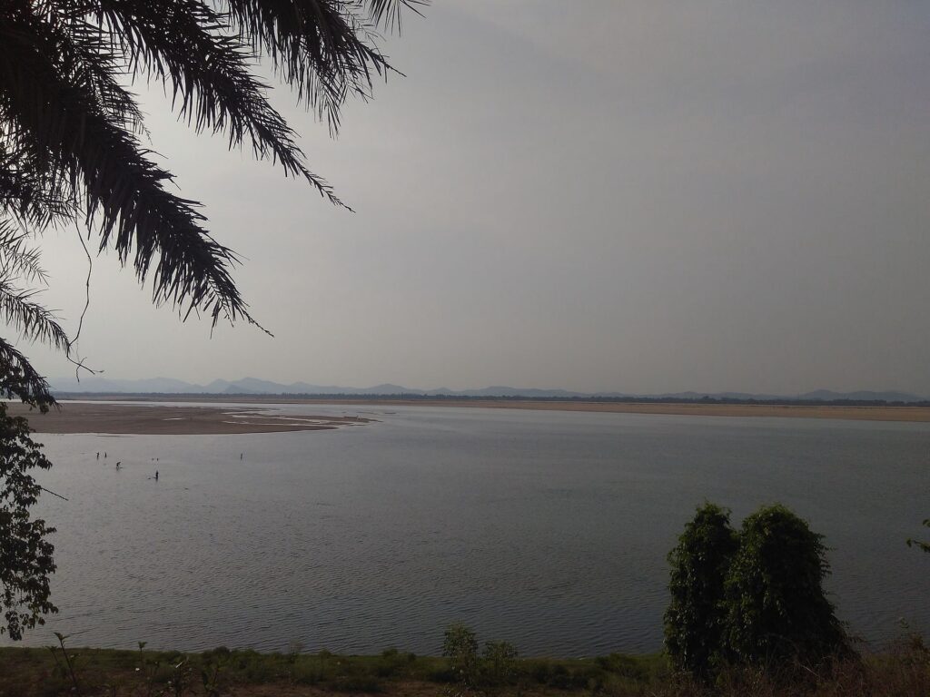
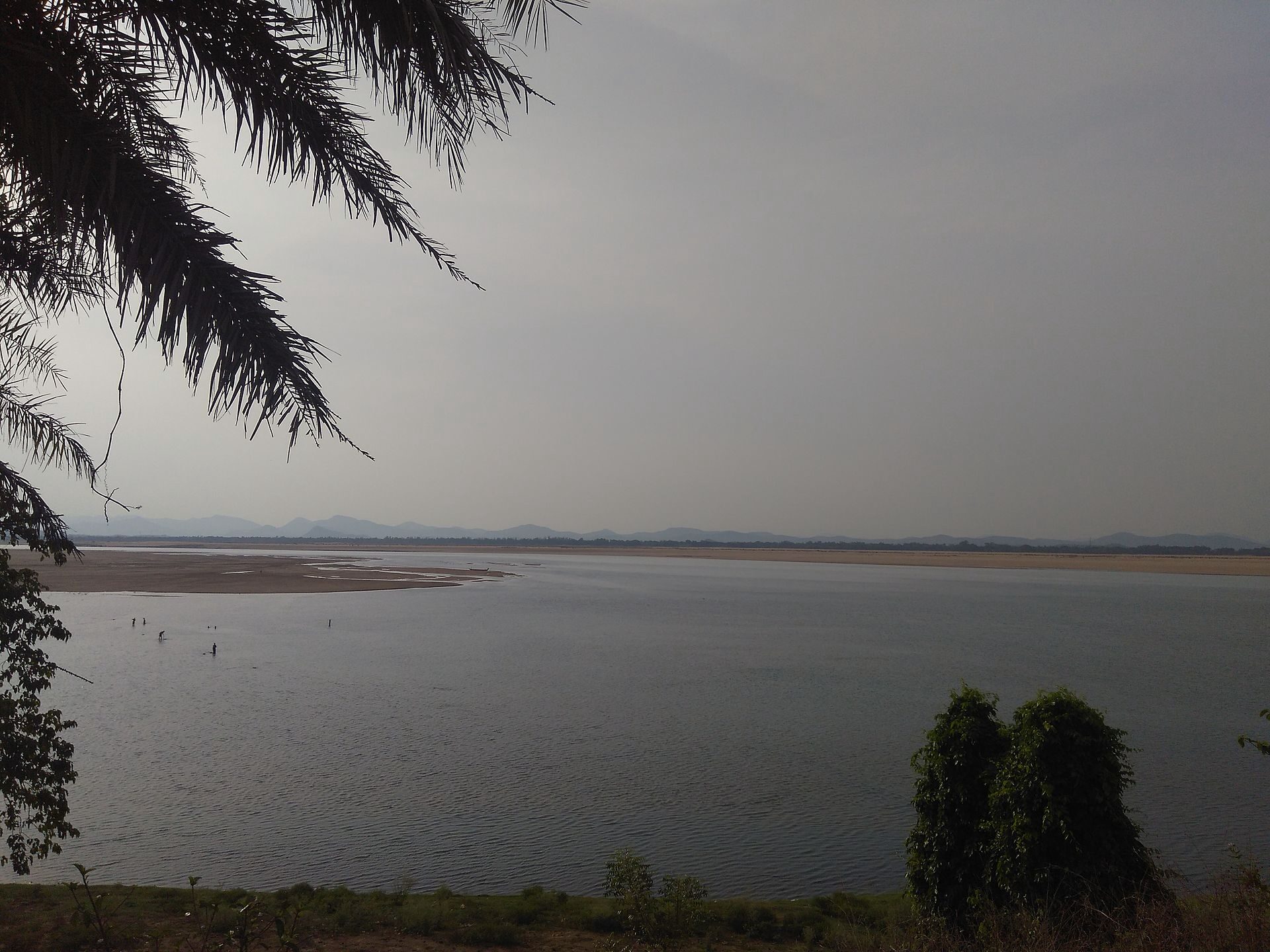
The Mahanadi River is one of the major east-flowing rivers of Peninsular India and the largest river of Odisha. It rises in the Sihawa hills of Chhattisgarh and flows for 858 km before draining into the Bay of Bengal through a large delta around Cuttack and Paradip. The Mahanadi basin spans about 141,589 sq km across Chhattisgarh, Odisha, Jharkhand, Madhya Pradesh and Maharashtra, and supports one of India’s most ambitious mid-20th-century engineering projects — the Hirakud Dam, the longest earthen dam in the world.
For UPSC aspirants, the Mahanadi River is examinable for its physical geography (one of the few peninsular rivers with a large delta), its hydrology (it once carried so much sediment that the Mahanadi delta was building outward faster than almost any other in India), the Hirakud Dam as a Nehru-era flagship project, and the ongoing Chhattisgarh-Odisha Mahanadi water dispute — among the most active inter-state water tribunals at present.
Quick Facts About the Mahanadi River
| Attribute | Detail |
|---|---|
| Source | Sihawa hills, Dhamtari district, Chhattisgarh |
| Elevation at source | ~442 m |
| Length | 858 km |
| Basin area | ~141,589 sq km |
| Basin states | Chhattisgarh, Odisha, Jharkhand, Madhya Pradesh, Maharashtra |
| Direction | East/southeast |
| Mouth | Bay of Bengal (Mahanadi delta near Paradip, Odisha) |
| Major tributaries | Seonath, Hasdeo, Mand, Ib, Jonk, Tel, Ong |
| Major dam | Hirakud Dam (longest earthen dam in the world) |
| Cultural status | Sacred in Odisha; festival sites at Sonepur, Cuttack, Jagatsinghpur |
Source and Course of the Mahanadi
The Mahanadi rises in the Sihawa hills of Dhamtari district in Chhattisgarh, at an elevation of about 442 metres, very close to the village of Pharsiya. Hindu tradition holds that Sage Sringi performed penance here, and the local Mahanadi tirtha is a small temple at the source.
Three Reaches
- Upper reach (Sihawa to Hirakud): the river drains the Chhattisgarh plains, joined by tributaries like the Seonath and the Hasdeo, before entering Odisha at the Hirakud reservoir.
- Middle reach (Hirakud to Naraj): below Hirakud, the river cuts through the Eastern Ghats in a gorge.
- Lower reach (Naraj to the Bay of Bengal): at Naraj (near Cuttack), the Mahanadi enters the deltaic plain and splits into multiple distributaries before emptying into the Bay of Bengal near Paradip.
Mahanadi Basin
The Mahanadi basin covers 141,589 sq km — roughly 4.3% of India’s geographical area — split between:
- Chhattisgarh (~53%)
- Odisha (~46%)
- Small portions of Jharkhand, Madhya Pradesh and Maharashtra
The basin is bounded by the Maikal range in the west, the Central Indian highlands in the north, the Eastern Ghats in the south, and the Bay of Bengal in the east.
Tributaries of the Mahanadi
Left-bank Tributaries
- Seonath — the longest left-bank tributary; rises in the Maikal range and joins the Mahanadi near Sheorinarayan in Chhattisgarh.
- Hasdeo — drains the coalfields of Korba; site of the Hasdeo-Bango reservoir.
- Mand
- Ib — meets the Mahanadi at the Hirakud reservoir; site of the Ib coalfields.
- Kharun — drains Raipur.
Right-bank Tributaries
- Pairi — joins near Rajim, an important Chhattisgarh temple town.
- Jonk — drains parts of Odisha and Chhattisgarh.
- Ong — drains southwest Odisha.
- Tel — the largest right-bank tributary; meets the Mahanadi near Sonepur in Odisha.
Hirakud Dam
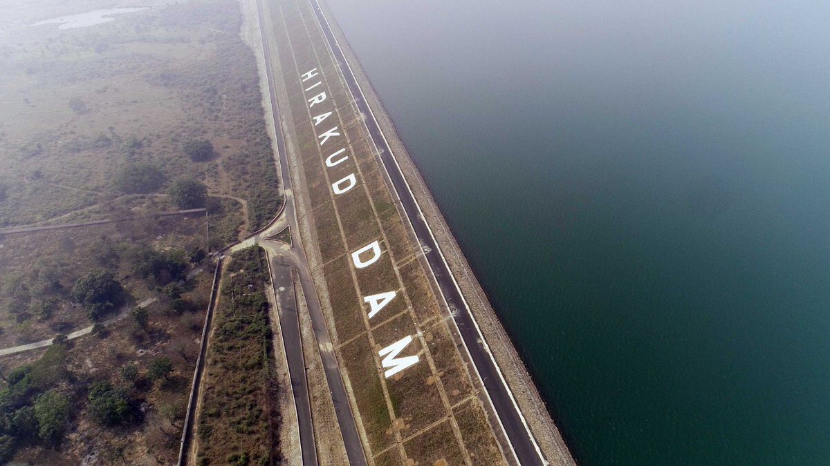
The Hirakud Dam on the Mahanadi in Sambalpur district of Odisha is the longest earthen dam in the world and one of the first major multi-purpose river-valley projects of independent India.
Key Statistics
- Total length: 25.79 km (including dykes; main dam is ~4.8 km)
- Height: 60.96 m
- Reservoir: Hirakud Reservoir is one of Asia’s largest artificial lakes, with a gross capacity of 8.136 billion cubic metres and a spread of ~743 sq km at full reservoir level.
- Installed hydropower: 347.5 MW
- Irrigation: ~1.55 lakh hectares (kharif) and ~1.08 lakh hectares (rabi)
- Built: Commissioned in 1957 by Prime Minister Jawaharlal Nehru.
Significance
- Flood control: Designed primarily to control floods in the Mahanadi delta — Cuttack and the lower Mahanadi flooded almost every year before Hirakud.
- First post-Independence megaproject: Hirakud was conceived in 1937 by Sir M. Visvesvaraya but was built only after Independence; foundation laid in 1948.
- Tourist attractions: Cattle Island, Gandhi Minar, Nehru Minar, and the iconic dam viewpoint.
- Bird life: the Hirakud reservoir is a major migratory waterbird site; counted under the Mahanadi Wildlife and Bird Sanctuary circuit.
Compare with the Bhakra Dam on the Sutlej and the Tehri Dam on the Bhagirathi — Hirakud sits in the same lineage of Nehru-era “Temples of Modern India.”
The Mahanadi Delta
The Mahanadi delta begins at the Naraj barrage near Cuttack, where the river splits into several distributaries — the Mahanadi proper, Kathjodi, Birupa, Daya and Devi. The delta covers roughly 9,000 sq km and is one of the most densely populated agricultural regions in Odisha.
Significance of the Delta
- Bhitarkanika National Park in the delta hosts the world’s second-largest population of estuarine saltwater crocodiles and is a Ramsar wetland.
- Gahirmatha Beach, at the Mahanadi mouth, is the world’s largest mass-nesting site for Olive Ridley turtles.
- Paradip Port sits at the Mahanadi mouth.
- The delta is a flood-prone zone and is integral to Odisha’s rice economy.
Chhattisgarh-Odisha Water Dispute (Mahanadi Tribunal)
The Chhattisgarh-Odisha Mahanadi water dispute is one of the most recent inter-state water disputes in India.
Background
After Chhattisgarh was carved out of Madhya Pradesh in 2000, it began constructing a series of barrages and weirs in the Mahanadi basin to support coal-based thermal power plants and irrigation. Odisha objected that:
- Chhattisgarh’s upstream withdrawals were reducing non-monsoon (lean season) flows to Hirakud and below.
- No prior consultation took place under the Inter-State Water Disputes Act.
Mahanadi Water Disputes Tribunal
Odisha approached the Supreme Court in 2016 seeking a tribunal. The Centre constituted the Mahanadi Water Disputes Tribunal in March 2018 under the Inter-State River Water Disputes Act, 1956. The tribunal’s terms of reference include:
- Determination of unutilised water in the Mahanadi basin.
- Sharing of waters between Chhattisgarh, Odisha and other basin states.
- Regulation of upstream barrages and weirs.
The tribunal has been granted several extensions and is yet to issue its final award. The Mahanadi dispute exemplifies the larger pattern of inter-state water disputes governed by Article 262 of the Constitution.
Climate, Soils and Agriculture
- Rainfall: ~1,360 mm annual mean — among the higher figures for peninsular basins.
- Soils: Red and yellow soils in Chhattisgarh; black cotton soils in patches; alluvial soils in the delta.
- Crops: rice is dominant in both Chhattisgarh and Odisha; supplemented by pulses, oilseeds, jute (delta) and sugarcane.
The Mahanadi basin is often called the “Rice Bowl of India” in the lower stretches because of its kharif paddy intensity.
Cultural and Religious Significance
The Mahanadi has been important to Odia and Chhattisgarhi culture for centuries:
- Rajim (Chhattisgarh) — confluence of the Mahanadi, Pairi and Sondur; site of the Rajiv Lochan temple and the annual Rajim Kumbh Mela.
- Sonepur (Odisha) — confluence of the Mahanadi and the Tel; revered Tribeni pilgrimage spot.
- Cuttack — historical capital of Odisha on the banks of the Mahanadi.
- Sambalpur — Hirakud and the Samalei Devi temple lie on the river.
- The Bali Yatra of Cuttack commemorates Odisha’s maritime trade through the Mahanadi delta to Indonesia (Bali).
Environmental Concerns
The Mahanadi basin faces multiple pressures:
- Lean-season flow depletion due to upstream barrages in Chhattisgarh and intensive industrial water use (coal-based thermal plants and steel plants in Korba, Bhilai, Raigarh).
- Sediment trapping behind Hirakud and reduction of delta-building.
- Coastal erosion at Paradip and along the Mahanadi delta foreshore.
- Pollution of tributaries like the Kharun (Raipur) and Hasdeo by industrial effluent.
- Cyclone vulnerability — the Mahanadi delta is one of India’s most cyclone-exposed coasts.
For broader context, see flood management in India, urban flooding in India, and drought in India.
Mahanadi River — UPSC Significance
The Mahanadi River appears across the UPSC syllabus:
- GS-I Geography: east-flowing peninsular rivers, basin hydrology, deltaic landforms, monsoon climate.
- GS-II Polity: Article 262, Inter-State River Water Disputes Act, Mahanadi Tribunal, federalism.
- GS-III Environment: Bhitarkanika and Gahirmatha (Ramsar/turtles), coastal erosion, dam-induced ecological changes.
- Prelims: source (Sihawa), length, Hirakud Dam facts, tributaries (Seonath, Hasdeo, Mand, Ib, Tel), basin states.
Comparable rivers to study together include the Cauvery water dispute (another east-flowing peninsular river), the Brahmaputra inland waterways push (a north-east river-management case), and the Krishnarajasagara Dam for parallels with Hirakud.
Frequently Asked Questions
What is the source of the Mahanadi River?
The Mahanadi River rises in the Sihawa hills of Dhamtari district in Chhattisgarh, at an elevation of about 442 metres, near the village of Pharsiya.
How long is the Mahanadi River?
The Mahanadi River is 858 km long. About 53% of its basin lies in Chhattisgarh and about 46% in Odisha.
What is the Hirakud Dam?
The Hirakud Dam is a 25.79-km-long composite dam (including dykes) on the Mahanadi River in Sambalpur district, Odisha. Commissioned in 1957, it is the longest earthen dam in the world, has 347.5 MW of installed hydropower capacity, irrigates ~1.55 lakh hectares, and was built primarily for flood control of the Mahanadi delta.
What are the major tributaries of the Mahanadi?
The major left-bank tributaries are the Seonath (longest), Hasdeo, Mand and Ib. The major right-bank tributaries are the Pairi, Jonk, Ong and Tel.
What is the Chhattisgarh-Odisha Mahanadi water dispute?
Odisha alleged that Chhattisgarh’s upstream barrages and weirs were reducing non-monsoon flow to Hirakud. After Odisha approached the Supreme Court in 2016, the Centre constituted the Mahanadi Water Disputes Tribunal in March 2018 under the Inter-State River Water Disputes Act, 1956, to allocate Mahanadi waters between the basin states.
Where does the Mahanadi River meet the sea?
The Mahanadi empties into the Bay of Bengal through a delta downstream of Cuttack, near Paradip in Odisha. The delta hosts Bhitarkanika National Park and the Gahirmatha turtle-nesting beach.
Which states does the Mahanadi basin cover?
The Mahanadi basin covers five states — Chhattisgarh (~53%), Odisha (~46%), and small portions of Jharkhand, Madhya Pradesh and Maharashtra.
Why is the Mahanadi delta important ecologically?
The Mahanadi delta hosts Bhitarkanika National Park (a Ramsar wetland with the world’s second-largest saltwater crocodile population) and Gahirmatha Beach (the world’s largest mass-nesting site for Olive Ridley turtles), making it one of India’s most important coastal-ecological zones.
Why is the Hirakud Dam called the longest earthen dam in the world?
The Hirakud Dam complex spans 25.79 km when its two main earthen dykes — the Laxmidungri dyke (north) and the Chandili dyke (south) — are added to the central masonry section. Although only ~4.8 km of the structure is the main concrete dam, the inclusion of the dykes gives Hirakud the title of the longest earthen dam in the world. The Hirakud reservoir behind it spreads across 743 sq km at full reservoir level, making it one of Asia’s largest artificial lakes.
How does the Mahanadi compare with other peninsular rivers?
The Mahanadi (858 km) is shorter than the Godavari (1,465 km) and the Krishna (1,400 km), but its basin receives higher rainfall (~1,360 mm) than either. Unlike the Godavari and Krishna, the Mahanadi’s lean-season flow is modest, which is the core of the Chhattisgarh-Odisha dispute. The Mahanadi also stands out for its very productive delta — second only to the Godavari delta in peninsular India — and for the Hirakud Dam, which was India’s first major post-Independence multi-purpose project.
Tell Google you want more of this.
Add Anantam IAS as a preferred sourceOne tap, and this site shows up more often in your own Top Stories, AI Overviews and AI Mode. Remove it any time.






