

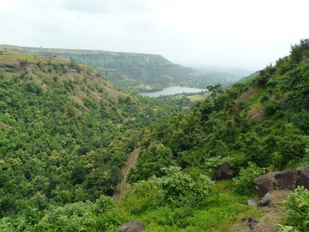
The Vindhya Range is a discontinuous chain of low mountains and scarps that runs roughly east-west across central India, traditionally treated as the boundary between North India and South India. It stretches about 1,050 kilometres from Gujarat in the west to Bihar in the east, mostly along the northern edge of the Narmada River valley. For UPSC purposes, the Vindhya Range is best understood not as a single mountain chain but as the steep northern escarpment of the Malwa and Bundelkhand plateaus, marking the geological and cultural threshold between the Indo-Gangetic Plain and the peninsular Deccan.
Although the Vindhya Range lacks the height of the Himalayas or even the Satpura, its strategic east-west alignment, its role as a drainage divide, and its place in Indian classical literature make it one of the most consequential physical features of the subcontinent. The Vindhyas separate the Ganga basin from the Narmada basin, host the headwaters of the Chambal, Betwa, Ken, and Son, and form the structural backbone of the Bundelkhand and Malwa regions.
Quick Facts About the Vindhya Range
- Type: scarp of plateau (not a true fold or block mountain)
- Length: about 1,050 kilometres
- General direction: east-west
- States covered: Gujarat, Madhya Pradesh, Uttar Pradesh, Rajasthan, Chhattisgarh, Bihar
- Highest peak: Sad-bhawana Shikhar in the Kalumar area, around 752 metres
- Northern boundary of: Narmada valley
- Southern boundary of: Malwa and Bundelkhand plateaus
- Major sub-ranges: Bhanrer Range, Kaimur Range, Vindhyachal proper
Geological Origin of the Vindhya Range
The Vindhya Range is geologically much older than the Himalayas but younger in surface form than the Aravallis. It is not a fold mountain. Most geomorphologists describe the Vindhyas as the steep north-facing scarp of the Malwa plateau, exposed where the plateau drops down towards the Ganga plain.
The bedrock belongs to the Vindhyan Super Group, one of the largest and most studied sedimentary sequences in India. These rocks were deposited between roughly 1,400 and 600 million years ago, in shallow seas that covered parts of the Indian craton during the Proterozoic. The sequence includes sandstones, shales, limestones, and quartzites. The sandstones of the Vindhyan Super Group are the famous building stones of central India, used in monuments from Sanchi to the Red Fort.
The Narmada-Son lineament runs along the southern foot of the Vindhya Range. This is one of the oldest and most active fault zones in the Indian peninsula. Repeated uplift along this lineament during the Tertiary and Quaternary has exposed the Vindhyan sandstones as a steep northern scarp facing the Ganga plain, while the southern slopes blend gently into the Malwa plateau.
Why Vindhyas are Called a Scarp, not a True Mountain Range
A true mountain range is formed by folding or faulting that uplifts a continuous structure. The Vindhyas, by contrast, are essentially the edge of an uplifted plateau that has been eroded back into a series of steep cliffs and isolated hills. The “range” appearance is the result of erosion etching the plateau margin into a serrated escarpment. South of this scarp, the land does not drop again; it continues as the high plateau of Malwa.
Extent and Geographic Coverage
The Vindhya Range runs roughly parallel to and north of the Narmada River across central India. Its western end approaches the Aravallis in Gujarat and Rajasthan, where it merges with the Mewar uplands. Its eastern end continues as the Kaimur Range through Madhya Pradesh, Uttar Pradesh, and into Bihar before fading near the Ganga at Rohtas.
The Vindhya covers parts of:
- Gujarat (eastern edge, Pavagadh area)
- Rajasthan (south-eastern Mewar)
- Madhya Pradesh (the bulk of the range, Vindhyachal proper)
- Uttar Pradesh (Bundelkhand and Mirzapur)
- Chhattisgarh (north-western fringe)
- Bihar (Kaimur plateau)
The width of the range varies from less than 30 kilometres in places to over 100 kilometres where it merges with the Bundelkhand and Malwa plateaus.
Sub-Ranges of the Vindhya System
The Vindhya Range is not a single ridge. It includes several sub-ranges and parallel scarps. UPSC commonly tests recognition of these.
Vindhyachal Proper
This is the central section that runs through Madhya Pradesh, north of the Narmada, between Bhopal and Rewa. The highest summits of the system are found here, including Sad-bhawana Shikhar (about 752 metres) and Kalumar peak. The Vindhyachal Devi temple near Mirzapur lends its name to this section.
Bhanrer Range
The Bhanrer is a parallel ridge running south-east of the main Vindhyachal, between the Ken and Tons rivers in northern Madhya Pradesh. It is sometimes treated as a southern arm of the Vindhya system.
Kaimur Range
The Kaimur is the eastern extension of the Vindhya. It runs from north-east Madhya Pradesh through southern Uttar Pradesh into Bihar, finally ending near Rohtas. The Kaimur plateau is well known for its sandstone gorges, the Kaimur Wildlife Sanctuary in Bihar, and prehistoric rock shelters at Bhimbetka and Lakhaniya.
Major Peaks of the Vindhya Range
The Vindhya Range is a low range by any standard. Most summits are between 450 and 750 metres. Important peaks include:
- Sad-bhawana Shikhar in the Kalumar area: about 752 metres, often cited as the highest
- Kalumar peak: about 752 metres
- Goramata: about 752 metres in the Damoh area
- Janapav: about 854 metres in the Indore district (sometimes counted with the Vindhyas)
- Pavagadh: about 760 metres in Gujarat, structurally part of the Vindhya western extension
Some sources differ on the exact “highest peak” of the Vindhyas because the system blends gradually into the plateau and into the Satpura at points.
Vindhya as a Drainage Divide
The Vindhya Range is one of the two most important drainage divides of peninsular India. To its north drain the major Ganga tributaries that originate in central India. To its south drains the Narmada and its tributaries into the Arabian Sea.
North of the Vindhya, the following rivers rise on the Malwa and Bundelkhand plateaus and cut north through gorges in the Vindhya to join the Yamuna or Ganga:
- Chambal (rises near Janapav in Madhya Pradesh)
- Betwa (rises near Bhopal)
- Ken (rises in the Kaimur)
- Son (rises at Amarkantak, but flows along the southern edge of the Kaimur)
South of the Vindhya, the Narmada flows westward in the rift between the Vindhya and the Satpura. Smaller streams from the southern slopes of the Vindhya feed the Narmada.
Climate, Vegetation and Biodiversity
The Vindhya region experiences a subtropical climate with hot dry summers and a moderate monsoon. Annual rainfall ranges from about 800 millimetres in the western Vindhya to over 1,200 millimetres in the eastern Kaimur. Winters are mild and dry.
The natural vegetation is tropical dry deciduous forest dominated by teak, sal in the eastern parts, and acacia. The Vindhyan forests are part of the central Indian wildlife corridor and contain several important protected areas, including Bandhavgarh National Park (Vindhyan sandstone country), Panna National Park, Ranthambore National Park (Aravalli-Vindhya transition), Sanjay-Dubri Tiger Reserve, and Kaimur Wildlife Sanctuary.
These reserves protect tigers, leopards, sloth bears, gharials in the Chambal, vultures, and a wide variety of central Indian flora and fauna.
Cultural and Historical Significance
The Vindhya Range has a uniquely deep place in Indian civilisational memory. It is traditionally cited as the boundary between Aryavarta (the land of the Aryans, north of the Vindhyas) and Dakshinapatha (the southern realm). This division appears in the Manusmriti, in the Ramayana when Rama crosses south of the Vindhyas, and in the Mahabharata.
The Vindhyan sandstone caves and rock shelters at Bhimbetka, a UNESCO World Heritage Site near Bhopal, contain rock paintings dated from the Mesolithic onward and represent one of the oldest continuous records of human occupation in the subcontinent. Sanchi, Khajuraho, Orchha, and Mandu all sit within the Vindhyan belt and are built largely from Vindhyan sandstone.
The Vindhyachal Devi temple at Mirzapur is one of the Shakti Peethas. The legend of Agastya, the sage who is said to have pressed the Vindhyas down to allow the sun to cross, encodes an old cultural memory of southern Aryan expansion.
Economic Importance of the Vindhyan Belt
The Vindhya region is economically significant for several reasons.
- Sandstone and dimension stone: Vindhyan sandstones (Rewa and Dhandraul varieties) are quarried extensively for construction and monument restoration.
- Coal: parts of the Singrauli coalfield lie at the eastern Vindhya foothills.
- Diamonds: the Panna diamond mines, India’s only major active diamond producer, lie in Vindhyan conglomerates.
- Limestone and cement: Vindhyan limestones feed major cement plants in MP and UP.
- Tourism: hill forts (Mandu, Orchha, Gwalior at the Vindhya-Bundelkhand transition), tiger reserves, and Bhimbetka draw significant heritage and wildlife tourism.
- Agriculture: the Malwa plateau south of the Vindhya scarp is one of India’s leading producers of soybean and wheat. The Bundelkhand plateau north of the scarp is climatically harsher and more drought-prone.
Vindhya vs Satpura: Common UPSC Confusion
UPSC frequently tests the difference between the Vindhya and the Satpura ranges. The key distinctions:
| Feature | Vindhya Range | Satpura Range |
|---|---|---|
| Type | Plateau scarp | Block mountain (horst) |
| Position | North of Narmada | South of Narmada |
| Highest peak | Sad-bhawana Shikhar, around 752 m | Dhupgarh, 1,350 m |
| Width | Variable, mostly narrow | Broader, multiple sub-ranges |
| Rock | Vindhyan sandstones, shales, limestones | Gondwana and pre-Cambrian rocks |
| Drainage divide | Narmada vs Ganga tributaries | Narmada vs Tapi |
The Narmada flows in the rift between the two, with Vindhya to its north and Satpura to its south. The Tapi flows south of the Satpura.
Vindhya Range in the UPSC Syllabus
The Vindhya Range appears in GS-1 Geography under the physical features of India, drainage systems, and biodiversity. It also enters GS-1 Indian Heritage through Bhimbetka, Sanchi, and Khajuraho, and GS-3 Environment through the central Indian tiger corridor. Prelims questions tend to focus on:
- Highest peak and exact position relative to Narmada
- Sub-ranges and their states
- Rivers that rise from or cut across the Vindhyas
- The Vindhyan Super Group and its economic minerals
- Protected areas located in the Vindhyas
Mains Practice Questions
- Critically examine the statement that the Vindhya Range is not a true mountain range but a plateau scarp. Discuss the geological evidence. (10 marks)
- Discuss the role of the Vindhya Range in shaping the drainage pattern of peninsular India. (15 marks)
- The Vindhya-Narmada-Satpura system forms the structural backbone of central India. Elaborate. (15 marks)
- Examine the cultural and historical significance of the Vindhya Range in the evolution of Indian civilisation. (10 marks)
Why the Vindhya Range Matters
The Vindhya Range is a study in how a modest physical feature can carry outsized civilisational weight. It is not a high range, not a tectonically dramatic one, and it does not dominate the skyline anywhere in India. But its east-west alignment turned it into the natural threshold of every major North-South interaction in Indian history, from the spread of Vedic culture to Mughal expansion to British rail planning. For UPSC, the Vindhya Range is the indispensable companion to the Satpura, the Narmada, and the Aravalli when describing the physiography of peninsular India.
Frequently Asked Questions
What is the Vindhya Range?
The Vindhya Range is a discontinuous east-west chain of low mountains and scarps running about 1,050 kilometres across central India, north of the Narmada River. It is structurally the northern escarpment of the Malwa and Bundelkhand plateaus and traditionally marks the boundary between North and South India.
Is the Vindhya a fold mountain or a block mountain?
The Vindhya is neither a fold nor a true block mountain. It is best described as a plateau scarp, the steep north-facing edge of the Malwa plateau exposed along the Narmada-Son lineament.
What is the highest peak of the Vindhya Range?
The highest peak is generally cited as Sad-bhawana Shikhar in the Kalumar area of Madhya Pradesh, at about 752 metres. Some sources give Goramata or Kalumar at the same elevation. The Vindhya is overall a low range.
Which states does the Vindhya Range pass through?
The Vindhya Range passes through Gujarat, Rajasthan, Madhya Pradesh, Uttar Pradesh, Chhattisgarh, and Bihar. Most of the range lies in Madhya Pradesh.
Which rivers originate in or cross the Vindhya Range?
The Chambal, Betwa, Ken, and Sind rivers rise on or near the Vindhya-Malwa edge and cut north across the range to join the Yamuna. The Son rises at Amarkantak and flows along the southern foot of the Kaimur. The Narmada flows along the southern base of the Vindhya in a rift valley.
What is the difference between the Vindhya and the Satpura range?
The Vindhya is a plateau scarp north of the Narmada, with highest peak around 752 metres. The Satpura is a block mountain (horst) south of the Narmada, with highest peak Dhupgarh at 1,350 metres. The Narmada flows in the rift between them, and the Tapi flows in another rift south of the Satpura.
Why is the Vindhya considered the boundary between North and South India?
The Vindhya Range, along with the Narmada River and the Satpura, forms a continuous east-west barrier across central India. In classical Indian texts this barrier separated Aryavarta in the north from Dakshinapatha in the south. The barrier influenced the spread of language, dynastic politics, monsoon patterns, and trade routes for over two millennia.
What is the Vindhyan Super Group?
The Vindhyan Super Group is a large sedimentary rock sequence deposited between about 1,400 and 600 million years ago in shallow seas over the Indian craton. It includes sandstones, shales, limestones, and conglomerates. Vindhyan sandstones are widely used in Indian monuments, and Vindhyan conglomerates host the Panna diamond deposits.
Tell Google you want more of this.
Add Anantam IAS as a preferred sourceOne tap, and this site shows up more often in your own Top Stories, AI Overviews and AI Mode. Remove it any time.






