Disclosure: this guide contains Amazon affiliate links. As an Amazon Associate, Anantam IAS earns from qualifying purchases — at no extra cost to you.
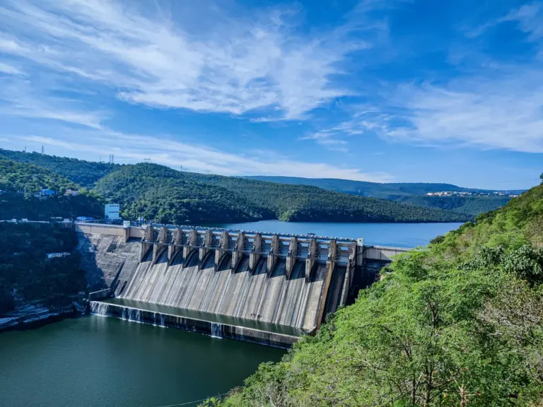
The Chenab River, also known as the Chandrabhaga, is one of the five rivers of Punjab and a major western tributary of the Indus River. Rising in the Upper Himalayas of Himachal Pradesh, it flows through Jammu and Kashmir into Pakistan, where it eventually joins the Sutlej. Allocated to Pakistan under the Indus Waters Treaty, 1960, the Chenab is nonetheless home to several Indian hydropower projects — Salal, Baglihar, Dul Hasti, Ratle, and Kishanganga-linked schemes — and to engineering landmarks like the Chenab Rail Bridge, the world’s highest railway arch bridge.
For UPSC, the Chenab is a high-yield topic in Geography (GS1), Indo-Pakistan relations (GS2) and national infrastructure.
Key Facts
| Aspect | Detail |
|---|---|
| Other name | Chandrabhaga |
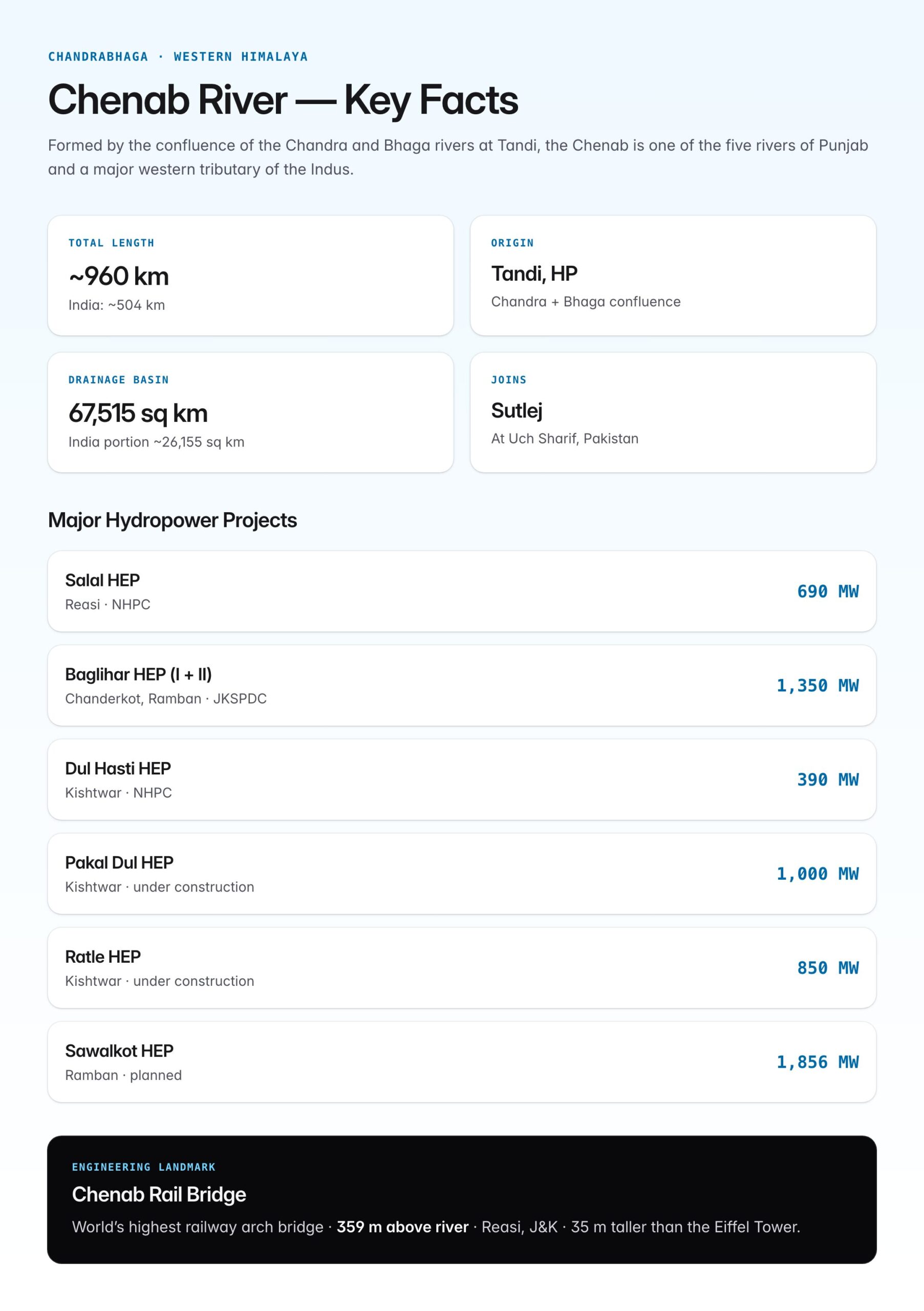
| Origin | Formed by confluence of Chandra and Bhaga rivers at Tandi, Lahaul-Spiti, Himachal Pradesh |
| Total length | ~960 km |
| Length in India | ~504 km |
| States in India | Himachal Pradesh, Jammu & Kashmir, Punjab (briefly) |
| Countries | India, Pakistan |
| Final confluence | Joins Sutlej River to form Panjnad River at Uch Sharif, Pakistan |
| Panjnad joins | Indus River near Mithankot, Pakistan |
| Drainage basin | ~67,515 sq km (India portion ~26,155 sq km) |
| Treaty status | Western River under Indus Waters Treaty, 1960 — allocated to Pakistan |
Origin — The Chandra and Bhaga
The Chenab is unique among Himalayan rivers in that it is formed by the confluence of two streams with distinct sources.
| Stream | Source | Length before Tandi |
|---|---|---|
| Chandra | Baralacha Pass (southern side), Lahaul | ~115 km |
| Bhaga | Baralacha Pass (northern side), Lahaul | ~60 km |
| Confluence point | Tandi (near Keylong), HP | Forms Chandrabhaga/Chenab |
The Baralacha Pass (4,890 m) in Lahaul is the common source region — a classic example of twin-source Himalayan drainage.
Course of the River

Oxford Student Atlas for India — 7th Edition
- 160 pages, Oxford University Press, the current edition
- India-focused thematic maps: physical, political, rivers, climate, soils, vegetation, plus world maps
- Made for UPSC and state PSC map work; slim enough to stay open beside the textbook
Stage 1 — Himachal Pradesh
| Section | Features |
|---|---|
| Lahaul (Tandi to Udaipur) | Cold desert; narrow valley; Chandra-Bhaga confluence |
| Pangi Valley | Deep gorges; sparse population |
| Enters J&K at Bhuja | Crosses from HP to UT of J&K |
Stage 2 — Jammu and Kashmir
| Section | Features |
|---|---|
| Kishtwar | Dul Hasti HEP; rugged terrain |
| Doda–Ramban | Baglihar Dam; deep gorges |
| Reasi | Salal Dam; Chenab Rail Bridge |
| Akhnoor | River enters plains; last Indian town before Pakistan |
Stage 3 — Pakistan
| Section | Features |
|---|---|
| Enters Pakistan | Near Akhnoor (India) / Sialkot (Pakistan) |
| Crosses Punjab (Pak) | Key irrigation sources for Pakistan Punjab |
| Joins Sutlej at Uch | Forms the Panjnad |
| Panjnad → Indus | At Mithankot |
Major Tributaries
| Tributary | Bank | Remarks |
|---|---|---|
| Marusudar | Right | Largest tributary in J&K; joins at Bhandalkot |
| Sind River (Shinder) | Right | Kashmiri tributary |
| Ans / Ans Ganga | Left | In Doda district |
| Tawi | Left | Through Jammu city; joins in Pakistan |
| Manawar Tawi | Left | In Jammu region |
| Bichleri | Right | Kishtwar area |
| Jhelum | Right (in Pakistan) | Joins Chenab at Trimmu (Pakistan) |
The Jhelum–Chenab confluence at Trimmu is one of the most important river confluences in South Asia.
Indus Waters Treaty, 1960
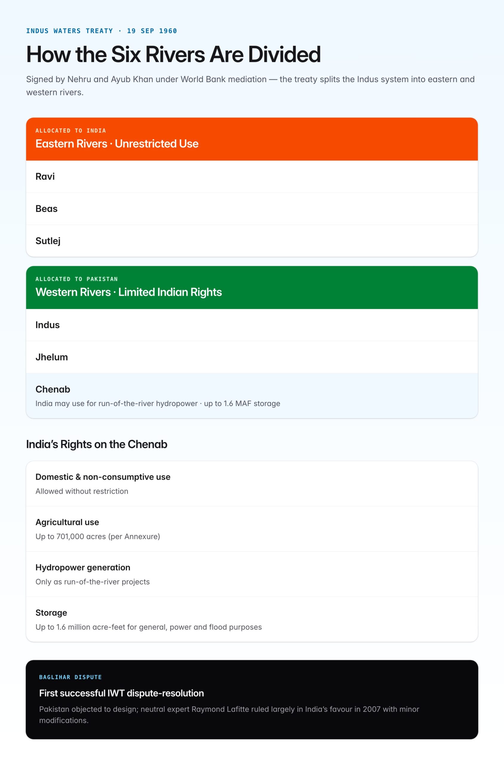
Signed on 19 September 1960 between India (Jawaharlal Nehru) and Pakistan (Ayub Khan) under World Bank mediation, the treaty governs the use of the Indus River System.
Division of Rivers
| Category | Rivers | Allocated To |
|---|---|---|
| Eastern Rivers | Ravi, Beas, Sutlej | India (unrestricted use) |
| Western Rivers | Indus, Jhelum, Chenab | Pakistan (with limited Indian rights) |
India's Rights on the Chenab
Although allocated to Pakistan, India can use the Chenab for:
| Use | Limits |
|---|---|
| Domestic & non-consumptive use | Allowed |
| Agricultural use | Up to 701,000 acres (specified in Annexure) |
| Hydropower generation | Permitted as run-of-the-river projects |
| Storage | Up to 1.6 million acre-feet for general, hydropower, and flood purposes |
Hydropower Projects on the Chenab
The Chenab has the highest hydropower potential among India's rivers.
| Project | Location | Capacity | Operator |
|---|---|---|---|
| Salal HEP | Reasi | 690 MW | NHPC |
| Baglihar HEP (I & II) | Chanderkot, Ramban | 900 MW + 450 MW | JKSPDC |
| Dul Hasti HEP | Kishtwar | 390 MW | NHPC |
| Ratle HEP (under construction) | Kishtwar | 850 MW | NHPC-JKSPDC JV |
| Kiru HEP (under construction) | Kishtwar | 624 MW | Chenab Valley Power Projects |
| Pakal Dul HEP (under construction) | Kishtwar | 1,000 MW | Chenab Valley Power Projects |
| Sawalkot HEP (planned) | Ramban | 1,856 MW | Proposed |
These together represent a multi-thousand-megawatt pipeline aligned with the Chenab Valley Power Projects initiative.
The Baglihar Dispute
Baglihar Dam became a flashpoint between India and Pakistan.
| Aspect | Detail |
|---|---|
| Location | Chanderkot, Doda district, J&K |
| Height | 143 m (gravity dam) |
| Capacity | 900 MW (Stage I); 450 MW (Stage II) |
| Pakistan's objections | Design features — gated spillway, low-level outlets — violate IWT's run-of-the-river principle |
| Arbitration | Referred to neutral expert under IWT (Raymond Lafitte, 2007) |
| Verdict (2007) | Largely in India's favour with minor design modifications |
This was the first successful invocation of the IWT dispute-resolution mechanism.
The Kishenganga–Ratle Dispute
A newer set of disputes involves the Kishenganga (on the Jhelum) and Ratle (on the Chenab) projects.
| Year | Event |
|---|---|
| 2010 | Pakistan challenges Kishenganga; Court of Arbitration approached |
| 2013 | PCA partial award; India's diversion upheld with environmental flow requirements |
| 2016 | Pakistan raises Ratle concerns |
| 2023 | India formally seeks modification of the IWT |
| 2024–25 | Continuing negotiations and third-party processes |
Salal Dam
- India's first major IWT-compliant hydro project on the Chenab
- Height: 113 m
- Capacity: 690 MW (3 × 115 MW + 3 × 115 MW)
- Commissioned in stages between 1987 and 1995
- Concrete gravity dam
- Has faced reservoir sedimentation issues
The Chenab Rail Bridge — World's Highest
The Chenab Rail Bridge is a landmark of Indian engineering, inaugurated in 2024–25 on the Udhampur-Srinagar-Baramulla Rail Link (USBRL) project.
| Parameter | Detail |
|---|---|
| Type | Single-arch steel and concrete railway bridge |
| Height above river | 359 m (35 m taller than Eiffel Tower) |
| Arch span | 467 m |
| Total length | 1,315 m |
| Location | Between Bakkal and Kauri, Reasi district, J&K |
| Design life | 120 years |
| Blast resistance | Designed to withstand explosions and earthquakes up to Zone V |
| Wind resistance | 266 km/h |
| Built by | Konkan Railway Corporation, with design inputs from WSP and Afcons |
It is the world's highest railway arch bridge, surpassing the previous record holder in China.
Cultural and Religious Significance
| Aspect | Detail |
|---|---|
| Mythology | Chenab finds mention in Mahabharata (as "Askini") and Rig Veda (as "Asikni") |
| Literature | Associated with Punjabi folk tales of Sohni-Mahiwal |
| Etymology | "Chenab" from Persian Chand-āb (moon river); same root as "Chandrabhaga" |
| Mahakumbh | Occasional fairs at Machail Mata near Kishtwar on tributary valleys |
Ecological Profile
| Aspect | Detail |
|---|---|
| Riverine flora | Alder, willow, poplar in upper reaches |
| Fish species | Schizothorax (snow trout); catfish downstream |
| Glacial source | Bara-lacha glaciers (Chandra and Bhaga) |
| Flood regime | Summer peaks due to glacial melt + monsoon |
| Climate change | Glacial retreat in Bara-lacha area affecting base flows |
Issues and Concerns
- Water-sharing tensions with Pakistan under IWT
- Environmental flow requirements downstream of dams
- Displacement of local populations for hydropower
- Seismic risk — Zone V region
- Cumulative impact of cascade hydropower projects
- Climate change — glacial retreat, altered flow timing
UPSC Relevance
GS1 (Physical Geography): Indian rivers, Himalayan drainage system. GS2 (IR): Indus Waters Treaty, India-Pakistan relations. GS3 (Infrastructure): Hydropower, bridges, border infrastructure.
Key Prelims facts:
- Chenab is also called Chandrabhaga
- Formed by confluence of Chandra and Bhaga at Tandi, Lahaul-Spiti
- Both source streams rise near Baralacha Pass (4,890 m)
- Total length: ~960 km; India length: ~504 km
- Joins Sutlej at Uch Sharif to form Panjnad
- Panjnad joins Indus at Mithankot
- Largest tributary: Marusudar (right bank)
- Jhelum joins Chenab at Trimmu in Pakistan
- Under Indus Waters Treaty, 1960 — a Western River allocated to Pakistan
- Treaty signed: 19 September 1960; mediator: World Bank
- Baglihar, Salal, Dul Hasti are major Indian hydropower projects
- Baglihar dispute — referred to neutral expert Raymond Lafitte; India largely won in 2007
- Chenab Rail Bridge: world's highest railway arch bridge; 359 m above river; in Reasi, J&K
- Ancient Sanskrit names: Askini/Asikni (Rig Veda)
Tell Google you want more of this.
Add Anantam IAS as a preferred sourceOne tap, and this site shows up more often in your own Top Stories, AI Overviews and AI Mode. Remove it any time.