

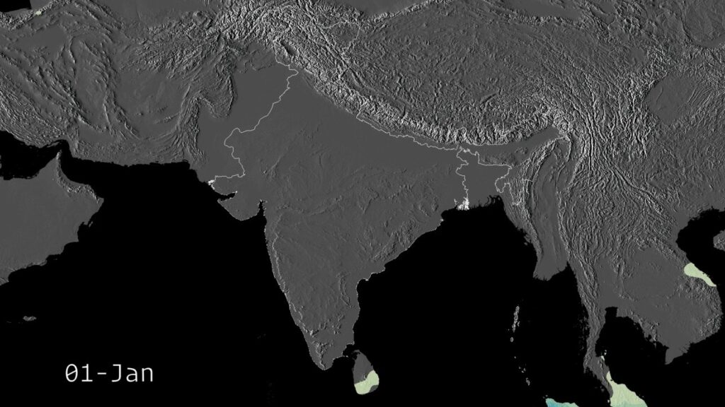
The Indian monsoon is the most important weather system in South Asia, the engine of the subcontinent’s agriculture, water supply, and rural economy, and a topic UPSC geography returns to year after year because no other phenomenon affects so many people so directly. The Indian monsoon is not a single event but a coupled atmospheric-oceanic seasonal cycle that delivers roughly 75% of the country’s annual rainfall in a four-month window between June and September, then reverses direction and delivers a smaller but critical second pulse to peninsular India between October and December. The mechanisms involve differential land-sea heating, the migration of the Inter-Tropical Convergence Zone, the seasonal switching of two upper-tropospheric jet streams, the cross-equatorial Somali jet, and the dynamic positioning of the monsoon trough across the Indo-Gangetic plain.
The Indian monsoon is also the most variable major monsoon on the planet. Total rainfall varies by 10-15% year to year around the long-term mean. Onset can arrive a week early or three weeks late. Some years deliver devastating drought; others bring catastrophic floods. The interannual variability is shaped by global climate modes including ENSO, the Indian Ocean Dipole, the Madden-Julian Oscillation, and Atlantic SSTs. For UPSC, the Indian monsoon shows up across GS Paper 1 physical geography, GS Paper 3 environment and agriculture, and prelims where mechanism, jet streams, and IMD definitions are tested as direct factual questions.
Quick Facts at a Glance
| Parameter | Value |
|---|---|
| Southwest monsoon period | June 1 (Kerala onset) to September 30 |
| Northeast monsoon period | October 15 to December 31 |
| Share of annual rainfall (SW) | ~75% |
| Long Period Average (1971-2020) | 868.6 mm (SW monsoon) |
| Normal range (LPA framework) | 96-104% of LPA |
| Tropical Easterly Jet | Summer, ~100-200 hPa, 15°N |
| Subtropical Westerly Jet | Winter, ~200 hPa, 25-30°N |
| Somali jet | Cross-equatorial low-level jet |
| Monsoon trough | Surface low along Indo-Gangetic plain |
| Active/break cycles | 3-7 day to 2-3 week oscillations |
Southwest Monsoon: June to September
The southwest monsoon is the primary rainy season for the Indian subcontinent. It is triggered by the seasonal heating of the Asian landmass and the corresponding low-pressure system that develops over the Tibetan Plateau and northwestern India. By late May, the land has warmed to the point where the pressure gradient between the heated continent and the cooler Indian Ocean is strong enough to drive moist air northward from the southern hemisphere across the equator into the subcontinent.
The southwest monsoon officially begins with the onset over Kerala, which IMD declares when specific rainfall, wind, and outgoing longwave radiation criteria are met. The normal date is June 1, with a standard deviation of about seven days. From Kerala the monsoon advances northward, reaching Mumbai by June 10, central India by mid-June, and Delhi by the end of June. By July 15, the monsoon has typically covered the entire subcontinent.
The Indian monsoon flow has two branches. The Arabian Sea branch flows north-east across the Arabian Sea, strikes the Western Ghats, and delivers heavy orographic rainfall to Kerala, coastal Karnataka, and Maharashtra. The Bay of Bengal branch flows from the south, curls around the Bay of Bengal, strikes the Khasi Hills and the Himalayan foothills, and delivers heavy rainfall to Northeast India, West Bengal, Odisha, and the eastern Gangetic plain. Cherrapunji and Mawsynram, in the Khasi Hills, are among the wettest places on Earth precisely because of this branch.
Mechanisms of the Monsoon
The Indian monsoon is driven by four overlapping mechanisms, each of which contributes to the seasonal reversal and the patterns of rainfall.
Differential Heating
The thermal contrast between the Asian landmass and the surrounding oceans is the classical explanation for monsoon circulation. Land has lower heat capacity than water and warms faster during summer. By May and June, the Tibetan Plateau and the deserts of northwest India and Pakistan reach surface temperatures above 45°C, creating a thermal low that pulls moist air from the southern Indian Ocean. In winter, the land cools faster than the ocean, the pressure pattern reverses, and dry continental air flows outward.
Jet Streams
The upper-tropospheric jet streams are critical. During winter, the Subtropical Westerly Jet sits over northern India, blocking the seasonal northward migration of the monsoon trough. As summer approaches, the STJ migrates north of the Himalayas. Simultaneously, the Tropical Easterly Jet establishes itself over peninsular India at 100-200 hPa, flowing from east to west around 15°N. The TEJ provides upper-level divergence that supports the rising motion required for deep convective rainfall.
The withdrawal of the STJ from south of the Himalayas and the establishment of the TEJ over India are the upper-atmospheric markers of monsoon onset. Conversely, the southward return of the STJ in October marks the withdrawal of the southwest monsoon and the transition to the northeast monsoon.
The Somali Jet
The Somali jet is a low-level cross-equatorial wind stream that develops in May and June off the East African coast. It accelerates south-easterly trade winds from the southern Indian Ocean across the equator, where the Coriolis force turns them into a south-westerly jet that delivers moisture into the Arabian Sea and onto the Indian subcontinent. The Somali jet is the primary moisture conveyor for the southwest monsoon, and its strength is one of the best predictors of monsoon rainfall.
Monsoon Trough
The monsoon trough is a quasi-stationary low-pressure system that stretches across the Indo-Gangetic plain from Pakistan in the west to the head of the Bay of Bengal in the east. It is the surface manifestation of the Asian thermal low and the focal point of monsoon rainfall. Low-pressure systems travel westward along the trough, depressions form along its eastern end in the Bay of Bengal, and the trough’s north-south position dictates whether rainfall concentrates in central India or in the foothills of the Himalayas.
Northeast Retreating Monsoon
The northeast monsoon is the secondary rainy season, active from October to December, and the primary water source for Tamil Nadu, coastal Andhra Pradesh, southern Karnataka, and parts of Kerala. After the southwest monsoon withdraws from northwestern India in September and from the southern peninsula by October, the wind pattern reverses. Cool, dry air flows from the northeast across the subcontinent toward the equator. As this air crosses the warm Bay of Bengal, it picks up moisture and delivers rainfall to the southeast coast of India when it strikes the Tamil Nadu and Andhra coasts.
The northeast monsoon is much smaller in total rainfall than the southwest monsoon, delivering 10-15% of the country’s annual total, but for Tamil Nadu it provides 50-60% of annual rainfall. It is also the season when tropical cyclones in the Bay of Bengal frequently make landfall on the east coast, often producing severe flooding.
Active and Break Phases
The monsoon does not deliver steady rainfall through the four-month season. It oscillates between active phases, when the monsoon trough sits over central India and rainfall is widespread and heavy, and break phases, when the trough shifts northward to the Himalayan foothills and central and northern India receive little rain. Active and break phases last anywhere from a few days to two or three weeks.
Active phases are associated with strong cross-equatorial flow, deep convection over the Bay of Bengal, and frequent westward-travelling low-pressure systems. Break phases are associated with weakened cross-equatorial flow, suppressed convection over the central Bay of Bengal, and enhanced rainfall in the Himalayan foothills, often causing flash floods in Uttarakhand and Himachal Pradesh.
The active-break cycle is partly driven by the Madden-Julian Oscillation, a 30-60 day eastward-propagating wave of tropical convection. When the MJO sits over the Indian Ocean, monsoon activity over India tends to strengthen; when the MJO moves to the western Pacific, the Indian monsoon often goes into break phase.
IMD’s Long Period Average Framework
The India Meteorological Department classifies monsoon rainfall against the Long Period Average, the mean rainfall for the southwest monsoon season computed over a 50-year reference period. The current LPA, updated in 2022, is 868.6 mm for the all-India southwest monsoon, calculated over 1971-2020.
The classification framework defines five categories: large excess (above 120% of LPA), excess (110-120%), normal (96-104%), below normal (90-95%), and deficient (below 90%). The wide normal band reflects the natural year-to-year variability of the monsoon. IMD issues two long-range forecasts each year: a first stage in April and an updated second stage in June, both expressed as a percentage of LPA.
Behind the LPA framework sits a substantial forecasting infrastructure. IMD uses a multi-model ensemble approach incorporating dynamical climate models, statistical predictors based on global SSTs and atmospheric circulation, and real-time monitoring of ENSO, IOD, and other modes. The forecasts have improved significantly over the last two decades, though the monsoon’s intrinsic variability sets a ceiling on predictability.
ENSO and IOD Modulation
The Indian monsoon’s interannual variability is shaped substantially by tropical Pacific and Indian Ocean climate modes. El Niño tends to suppress monsoon rainfall, La Niña tends to enhance it, a positive Indian Ocean Dipole tends to strengthen the monsoon, and a negative IOD tends to weaken it. The interaction between these modes can produce surprising outcomes: the 1997 monsoon was normal despite a record El Niño because a strong positive Indian Ocean Dipole overrode the ENSO signal; the 2019 monsoon was above normal because a record positive IOD dominated. The cool ENSO phase, covered in the La Niña explainer, tends to push the monsoon the other way. For the broader climate vs weather distinction, the monsoon sits at the climate scale rather than the weather scale, even though individual rainfall events occur on weather timescales.
Climate Change and the Monsoon
Climate change is altering the Indian monsoon in measurable ways. Total seasonal rainfall has shown no clear trend, but the distribution has shifted. The number of heavy rainfall events (above 65 mm in 24 hours) has increased substantially since 1950. The number of moderate rainfall days has declined. Dry spells within the monsoon season have lengthened. The result is the same total rainfall delivered through fewer, more intense events, with more dry days in between, a pattern that increases flood risk while simultaneously increasing drought stress.
The southwest monsoon onset and withdrawal dates have also shifted slightly. The Bay of Bengal has warmed measurably, providing more energy for tropical cyclones, including post-monsoon storms. Glacier melt in the Himalayas is altering river hydrology in ways that interact with monsoon variability. For policy, the implications are substantial: agriculture, water management, urban drainage, and disaster response all need to scale to a more extreme monsoon.
Frequently Asked Questions
What is the Indian monsoon?
The Indian monsoon is a seasonal reversal of wind systems and rainfall over the Indian subcontinent. The southwest monsoon (June-September) delivers about 75% of India’s annual rainfall, flowing from the Arabian Sea and Bay of Bengal into the subcontinent. The northeast retreating monsoon (October-December) delivers a second, smaller pulse of rainfall, primarily to Tamil Nadu and southeast peninsular India.
What causes the Indian monsoon?
The Indian monsoon is caused by differential heating of the Asian landmass and the surrounding oceans, supported by the seasonal switching of upper-tropospheric jet streams (the Subtropical Westerly Jet retreats north of the Himalayas in summer while the Tropical Easterly Jet establishes itself over peninsular India) and by the cross-equatorial Somali jet that delivers moisture from the southern Indian Ocean.
What is the Tropical Easterly Jet?
The Tropical Easterly Jet is a high-altitude wind stream that flows from east to west over peninsular India at 100-200 hPa during the southwest monsoon. Centred near 15°N, it provides upper-level divergence that supports rising air and deep convective rainfall across India. Its strength and position correlate with monsoon intensity.
What is the Somali jet?
The Somali jet is a low-level cross-equatorial wind stream off the East African coast that accelerates south-easterly trade winds from the southern Indian Ocean across the equator, where the Coriolis force turns them into south-westerly winds delivering moisture to the Indian subcontinent. It is the primary moisture conveyor for the southwest monsoon.
What is the monsoon trough?
The monsoon trough is a quasi-stationary low-pressure system that stretches across the Indo-Gangetic plain from Pakistan to the head of the Bay of Bengal during the southwest monsoon. Its position determines the geographic distribution of monsoon rainfall, and low-pressure systems travel westward along it, producing widespread heavy rain.
What is active and break monsoon?
Active and break refer to two phases of the southwest monsoon. Active phases feature widespread heavy rainfall driven by strong cross-equatorial flow and the monsoon trough sitting over central India. Break phases feature suppressed rainfall over the plains as the trough shifts to the Himalayan foothills. Active-break cycles typically last days to weeks and are partly driven by the Madden-Julian Oscillation.
What is IMD’s Long Period Average?
The Long Period Average is the mean southwest monsoon rainfall computed over a 50-year reference period, currently 868.6 mm for 1971-2020. IMD classifies monsoon rainfall as normal at 96-104% of LPA, below normal at 90-95%, deficient below 90%, excess at 110-120%, and large excess above 120%.
How is climate change affecting the Indian monsoon?
Climate change is increasing the frequency of heavy rainfall events (above 65 mm in 24 hours), reducing moderate rainfall days, and lengthening dry spells within the season. Total seasonal rainfall shows no clear trend, but the distribution has become more extreme: more flood-producing downpours, more drought-stressed dry spells, and warmer Bay of Bengal SSTs that fuel post-monsoon cyclones.
Tell Google you want more of this.
Add Anantam IAS as a preferred sourceOne tap, and this site shows up more often in your own Top Stories, AI Overviews and AI Mode. Remove it any time.






