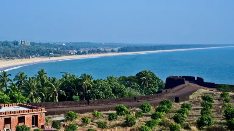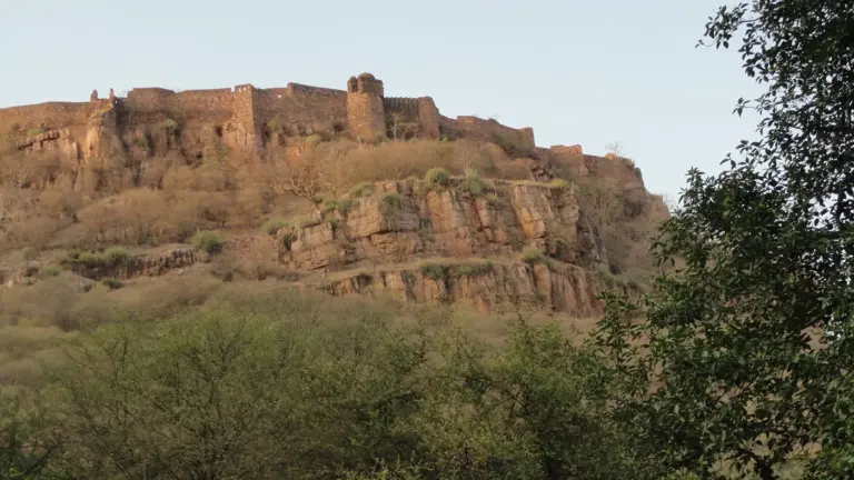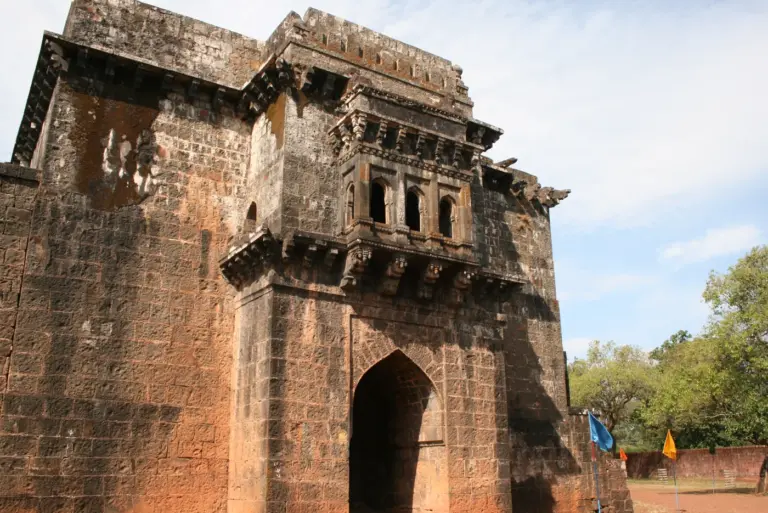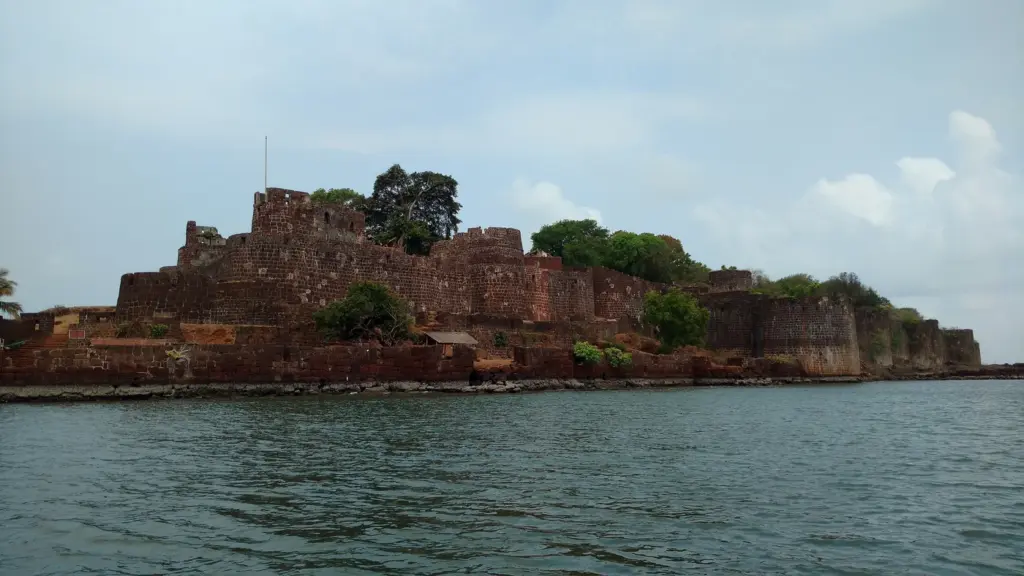
Vijaydurg fort is a Maratha coastal fort on a rocky headland at the mouth of the Vaghotan creek, in Devgad taluka of Sindhudurg district in Maharashtra. Known earlier as Gheria, it was strengthened by Shivaji in the middle of the 17th century and became the capital of the Angre admirals in 1698. It fell to a joint British and Peshwa attack in 1756, and in July 2025 it became one of the 12 forts of UNESCO’s Maratha Military Landscapes of India, the only one classed as a coastal fort.
Two things about Vijaydurg get repeated more often than they get checked. It is usually filed with Sindhudurg as an island fort, and it is often named as the place where the English astronomer Norman Lockyer found helium in 1868. The first is a matter of geography and the second mixes up two eclipses 30 years apart. This note settles both, and it keeps what surveyors have measured at the fort, including a 122 m stone structure under the sea, apart from what tourist accounts add.
Vijaydurg Fort at a Glance
Vijaydurg is a layered fort, and each layer belongs to a different power, from a 12th-century core to the Peshwa’s admirals. These are the facts worth writing on a revision card.
| Fact | Detail |
|---|---|
| Type | Coastal fort on a rocky headland, the only coastal fort in the Maratha Military Landscapes of India |
| Location | South shore of the Vaghotan river mouth, Devgad taluka, Sindhudurg district, Maharashtra (16°32′ N, 73°22′ E) |
| Earlier name | Gheria, which the district gazetteer translates as “the enclosure” |
| First fort | Believed to be the work of Bhoja II of the Shilahara dynasty, between about 1192 and 1205 |
| Shivaji’s work | Took it from Bijapur in the mid-17th century (1653 in most accounts), renamed it and added the third line of walls |
| Angre era | Capital of the Angre coastal territory from 1698; beat off English attacks in 1717 and 1720 and a Dutch attack in 1724 |
| Fall | February 1756, to a British fleet under Admiral Watson with Robert Clive’s troops, while the Peshwa’s army held the land side |
| Later holders | The Peshwa from October 1756; the British from June 1818, when the Dhulap commandants surrendered |
| Protection and status | Protected by the Archaeological Survey of India; inscribed on the World Heritage List on 11 July 2025 under criteria (iv) and (vi) |
Where Vijaydurg Fort Is and Why Its Harbor Mattered
Vijaydurg stands on the south shore of the entrance to the Vaghotan river on the southern Konkan coast. It lies in Devgad taluka of Sindhudurg district, which was carved out of Ratnagiri with effect from 1 May 1981, so older books, including the district gazetteer, place the fort in Ratnagiri.
The site’s value was the harbor more than the rock. The gazetteer calls it one of the best harbors on the western coast, with no bar, that is, no sandbank across the river mouth, so ships could enter in all weathers and shelter through the south-west monsoon. That was rare on the Konkan. The same gazetteer records Vengurla, farther south, closing as a port from mid-June to the end of August.
Two outside judgments show how the harbor was seen:
- In 1538 the Portuguese captain Dom Joao de Castro called the river the noblest in western India, the only big one without a bar or rocks.
- In December 1755, when an English officer was sent to survey it before an attack, Gheria was thought as strong as Gibraltar.
The water also did the defending. The deep channel, about one and a half cables wide (a cable is a tenth of a nautical mile, roughly 185 m), runs close to the western shore, so an incoming ship had to pass under the fort’s guns. Behind it the creek runs about 40 km inland, the state tourism department notes, giving the fleet a sheltered anchorage out of reach of the open sea.
Is it an island? Not today. The National Institute of Oceanography (NIO) survey report records that a wooden bridge once linked the fort to the mainland and was drawn up at night, and that silting has since joined the two. That’s why UNESCO classes Vijaydurg as coastal, while the three forts of the series still ringed by the sea are island forts.
Who Built Vijaydurg Fort?
No single ruler built Vijaydurg. It grew in three layers, and the sources are firm about the last two and cautious about the first. It is wise to repeat that caution in an answer rather than sound more certain than the records are.
The Shilahara Core
Tradition credits the first fort to Bhoja II of the Shilahara dynasty. The NIO report dates the work to between about 1192 and 1205 with the words “it is believed”, and the state tourism department also places it in the 12th century. None of these accounts cites an inscription, so the date is best read as an accepted tradition.
Bijapur’s Enlargement
By the 17th century the harbor belonged to the Adil Shahi sultans of Bijapur, and the gazetteer says the fort was enlarged under them. That work is hard to see now because, in the gazetteer’s words, the old Muslim buildings lie hidden under Maratha additions. It names a mosque near the flagstaff and the tomb of a Muslim saint.
Shivaji’s Third Wall and the New Name
Shivaji took the fort from Bijapur and rebuilt it. The gazetteer credits him with its finest features:
- the triple line of walls;
- the numerous towers;
- the massive buildings inside.
The NIO report is more exact: the older fort had a thick double wall with round towers, and Shivaji added the third line around it. He renamed Gheria Vijaydurg, the “fort of victory”. The gazetteer dates his work only to “about the middle of the seventeenth century”, while the state tourism department and the NIO report give 1653, the year to use in answers. His wider fort policy is covered in the Chhatrapati Shivaji Maharaj note.
Kanhoji Angre and the Maratha Navy at Vijaydurg
From 1698 Vijaydurg was the capital of the Angre admirals, and for more than half a century a Maratha fleet based here took on European fleets and merchant ships along the western coast.
The gazetteer puts the Angre territory at about 150 miles of coast and 30 to 60 miles inland. The NIO report names Kanhoji Angre as admiral of the Maratha navy by 1699 and explains why the harbor suited him. His grabs and gallivats, small warships of shallow draft (the depth a hull sits below the waterline), could slip into the creek where deep-draft European ships couldn’t follow.
The attacks the fort beat off show that strength:
- April 1717: an English fleet tried to breach the wall; the storming party was driven back with heavy losses.
- 1720: an English fleet under Walter Brown destroyed 16 Angre vessels but made no impression on the fort.
- 1724: a Dutch fleet from Batavia attacked with no better result.
A word about the words. The gazetteer, which leans on the East India Company’s naval histories, calls Angre a “pirate chief”, the Company’s view of a fleet that seized its ships. For the Maratha state the Angres were admirals holding its coast. In an answer, admiral and fleet are the safe words, and the colonial label is best quoted as a label.
How Vijaydurg Fell in 1756
Vijaydurg fell in February 1756 to a combined operation: a British fleet under Admiral Watson attacked from the sea while the army of the Peshwa, the chief minister of the Maratha state, closed the land side. The fort was lost as much to a split inside the Maratha world as to cannon.
The plan dated from 1755, when the Peshwa and the Bombay Government agreed that the Peshwa’s troops would attack Angre by land and the British by sea. It had already worked once: in April 1755 Commodore James bombarded Suvarnadurg, the Angre island fort off Harnai, took it and handed it to the Marathas. That December he surveyed Gheria and found it unlike its reputation, a large mass of buildings with round towers and long curtain walls, the stretches of wall between towers.
The attack, as the gazetteer tells it:
- The fleet of 12 warships, 6 of the Royal Navy and 6 of the Company’s, carried about 1,400 troops, with bomb vessels and a Maratha squadron of grabs and gallivats.
- It arrived off Gheria on the 11th. Tulaji Angre, the Angre chief then holding Gheria, left the fort in his brother’s charge and surrendered to the Peshwa’s general.
- On the 12th the fleet sailed into the river, anchored about 50 yards off the northern walls and opened fire. Angre’s ships, moored together under the fort, caught fire from a shell and burnt as one.
- Clive, learning that the fort was about to be handed to the Marathas, landed and held the ground between the Peshwa’s army and the fort.
- The garrison surrendered the next afternoon, and Clive’s troops marched in on the 14th.
On the month, books disagree. Royal Museums Greenwich titles its painting of the attack The Capture of Geriah, February 1756, while the district gazetteer and the NIO report print April dates. February is the majority reading and the one to use.
The Company tried to keep Gheria, offering Bankot in exchange, but the Peshwa refused and took the fort in October 1756. It became the seat of his admiral, Anandrav Dhulap. In May 1818 a British attack under Colonel Imlack was driven off, but the district had already passed to the British, and in June 1818 the two Dhulap brothers commanding the fort surrendered.
The lesson is in the gazetteer’s own verdict: the rock defenses were strong enough for a determined garrison to hold against any sea attack. Gheria gave way because its fleet burnt under its walls and its chief had surrendered on land. It also fell because the attack needed the Peshwa; British fleets on their own had failed in 1717 and 1720. Clive went on to Bengal soon after, a story the Robert Clive note follows.
A Walk Through Vijaydurg’s Defenses
Vijaydurg was built to be approached from the sea, so its defenses read best in the order a ship’s captain would have met them, starting under the water.
The Underwater Wall
In 1995 an NIO underwater survey found a stone structure, the underwater wall of popular accounts, off the fort’s western side. The team’s 1998 report measured it:
- about 122 m long, running east-west and then turning north-south;
- about 7 m wide and 3 m high;
- built of large weather-worn stones and some dressed blocks, laid with no mortar.
The report suggests it was meant to wreck enemy ships and to shield the fort from waves and currents. The structure is documented; its purpose is the surveyors’ reading. The state tourism department also describes a 200 m undersea escape tunnel, which the NIO report doesn’t mention, so the tunnel is best treated as a claim.
The Channel and the Rock
A ship past the wall had to use the narrow channel along the western shore, within range of the fort. The fort itself sits on solid rock with an almost sheer face of about 15 m, by the NIO’s account, and the gazetteer puts the whole fort about 100 feet above the river.
Three Walls and 27 Bastions
The walls run in three lines, the inner two older and the outer one Shivaji’s. The gazetteer counts 27 bastions, towers projecting from the wall so defenders could fire along its face, rising at the highest point into a great round tower. The circuit encloses about 20 acres by an 1862 government list, which the state tourism department now gives as 17 acres. On the part of the circuit he could see, Commodore James counted 32 embrasures, gun openings in the parapet, below and 15 above.
Water, Stores and the Dockyard
Fresh water decided how long a sea fort could hold out, and the gazetteer records good wells inside. The fleet’s workshop lay 3 km up the creek, where the NIO team surveyed a tidal dockyard:
- a basin about 110 m by 75 m, with a lime-mortar floor;
- a gateway 7 m wide at the base and 11 m at the top;
- walls partly cut into the rock.
The NIO report credits Kanhoji Angre with building it and Anandrav Dhulap with enlarging it for ships of up to 500 tons, and the gazetteer’s older measurement, 355 by 227 feet, agrees.
Did Lockyer Discover Helium at Vijaydurg?
No. The helium story attached to Vijaydurg mixes up two eclipses. The record of the discovery runs like this:
- On 18 August 1868 the French astronomer Pierre Janssen observed a total solar eclipse at Guntur in southern India and saw a new yellow line in the Sun’s spectrum.
- Later that year the English astronomer Norman Lockyer recorded the same line by observing the Sun through London’s smog, and named the unknown element helium.
Lockyer’s real link with Vijaydurg is the total eclipse of 22 January 1898. His expedition observed it at the fort, which the report spells Viziadrug, and the results appeared in the Philosophical Transactions of the Royal Society in 1901. The fort does belong to the history of solar physics, just not to the helium discovery.
Vijaydurg Fort Today: UNESCO Status and Protection
Vijaydurg is protected by the Archaeological Survey of India (ASI) and, since 11 July 2025, has been one of the 12 component forts of the Maratha Military Landscapes of India on the World Heritage List. The World Heritage Committee inscribed the series at its 47th session in Paris as India’s 44th World Heritage property.
The key points, from UNESCO’s listing and the PIB release of 11 July 2025:
- Criteria: (iv), an outstanding example of a type of building or ensemble that illustrates a stage of history, and (vi), a direct link with events and living traditions.
- Area: 1,577.63 ha, with a buffer zone of 96,500.43 ha that protects the setting around each fort.
- Protection: 8 of the 12 forts, Vijaydurg among them, are protected by the ASI, and the other 4 by Maharashtra’s Directorate of Archaeology and Museums.
- Process: India sent the nomination in January 2024, and the PIB release records that 18 of the 20 States Parties supported it.
On 31 July 2025, in a written reply in the Rajya Sabha on the recognition of the Maratha forts, the Union Minister for Tourism and Culture said ASI conservation is a continuous process funded according to each monument’s needs, while states lead tourism development with support from schemes such as Swadesh Darshan 2.0.
The records name the pressures a management plan must now answer. In 1880 the gazetteer found the western walls breached in places by the sea and loosened by trees and creepers. The revised gazetteer lists later buildings in and around the fort, among them police quarters opposite the main gate and a fish-curing yard built in front of it in 1951.
The current-affairs brief on the inscription covers the Committee session. Five hill forts of the series have their own notes:
- Raigad, where Shivaji was crowned in 1674;
- Rajgad, his first capital;
- Shivneri, his birthplace;
- Pratapgad, scene of the 1659 battle with Afzal Khan;
- Lohagad, a hill fort protected by the ASI.
Sindhudurg Fort, the island fort Shivaji built about 73 km to the south, is the natural next read, and its note follows in this series.
How to study Vijaydurg Fort for exams
Vijaydurg sits in three parts of the syllabus:
- GS Paper I art and culture: Maratha fort architecture and India’s World Heritage properties;
- GS Paper I modern history: the Maratha navy and the East India Company’s rise on the western coast;
- History optional: the Maratha state under the Peshwas.
For Prelims, the fort is mostly a heritage fact about its UNESCO series and its type. Art and Culture accounts for 94 of the 1,403 questions in the Prelims question bank, and History for 184. In Mains, the fort works as evidence. Mains 2026 History Optional Paper I asked “Trace the trajectory of Maratha polity from Shivaji to Peshwa Balaji Baji Rao. What was the impact of the Third Battle of Panipat (1761) on the Maratha State? Analyze.“, and the Angre-Peshwa conflict that ended at Vijaydurg falls inside that trajectory. Mains 2024 History Optional Paper I asked “How did the Maratha guerrilla warfare tactics contribute to their military successes against larger and more established armies?”, and forts like Vijaydurg are the physical side of that answer.
Seven facts carry most questions:
- Type: the only coastal fort among the 12 in the Maratha Military Landscapes of India, inscribed in 2025 under criteria (iv) and (vi).
- Location: Vaghotan creek, Devgad taluka, Sindhudurg district, formed from Ratnagiri on 1 May 1981.
- Layers: a Shilahara core credited to Bhoja II (about 1192 to 1205), enlarged by Bijapur and rebuilt by Shivaji (1653 in most accounts).
- Angre base: capital from 1698; it beat off the English in 1717 and 1720 and the Dutch in 1724.
- Fall: February 1756, to Watson and Clive by sea and the Peshwa by land; the Peshwa’s from October 1756; British from June 1818.
- Measured features: 27 bastions in the gazetteer; a 122 m underwater structure and a 110 m by 75 m dockyard in the NIO survey.
- Helium: Janssen at Guntur and Lockyer in London in 1868; Lockyer came to Vijaydurg for the 1898 eclipse.
Three confusions cost marks:
- Coastal versus island. Vijaydurg is joined to the land; the island forts of the series are in the table below.
- Gheria versus Janjira. Gheria is Vijaydurg’s old name. Janjira, off Murud, was the Siddis’ island fort, never taken by Maratha sieges and not part of the 2025 series; the Janjira Fort note covers it.
- Who kept it in 1756. The Company’s fleet took the surrender, but the fort went to the Peshwa within the year and reached the British only in 1818.
Vijaydurg and its sea-fort neighbors compare like this:
| Fort | Type in the 2025 listing | Protected by | What sets it apart |
|---|---|---|---|
| Vijaydurg | Coastal fort | ASI | Headland fort with three lines of walls; Angre capital from 1698 |
| Sindhudurg | Island fort | ASI | Begun for Shivaji in 1664 off Malvan, with Hiroji Indulkar as chief architect |
| Suvarnadurg | Island fort | ASI | Off Harnai in Ratnagiri district; an Angre fleet station from 1698, taken by Commodore James in April 1755 and handed to the Marathas |
| Khanderi | Island fort | Maharashtra Directorate of Archaeology and Museums | The only island fort in the series not protected by the ASI |
| Janjira | Not a component | ASI | Siddi island fort off Murud that Maratha sieges never took |
Vijaydurg is worth more to your preparation than its single line in most fort lists suggests. It is the one fort in the 2025 series that lets you write about Maratha sea power and the Company’s naval rise in the same paragraph, with measured features and dated sieges behind each claim. Learn the 1756 sequence properly and it’ll serve answers on the Maratha navy and on the Peshwas alike.
Frequently Asked Questions
Who built Vijaydurg Fort?
Vijaydurg was built in layers rather than by one ruler. Tradition, repeated by the National Institute of Oceanography survey and the state tourism department, credits the first fort to the Shilahara king Bhoja II between about 1192 and 1205. The Bijapur sultans enlarged it, and Shivaji gave it its triple line of walls and its present name in the mid-17th century.
Why is Vijaydurg called the Gibraltar of the East?
The nickname comes from its reputation as a sea fort that couldn’t be taken. The district gazetteer notes that in 1755 the British thought Gheria as strong as Gibraltar, and the state tourism department still uses the name. The reputation rested on real successes against English and Dutch fleets between 1717 and 1724, though the fort did fall in 1756.
Is Vijaydurg Fort a UNESCO World Heritage Site?
Yes, as one of the 12 component forts of the Maratha Military Landscapes of India, inscribed on 11 July 2025 at the 47th session of the World Heritage Committee in Paris. The series was listed under criteria (iv) and (vi) and is India’s 44th World Heritage property. Vijaydurg is the only fort in the series classed as a coastal fort.
Is Vijaydurg an island fort?
No. The fort stands on a rocky headland at the mouth of the Vaghotan creek, and silting has joined it to the mainland where a wooden bridge once crossed the water. UNESCO and the Ministry of Culture therefore class it as a coastal fort, unlike the three island forts of the same series.
What was Kanhoji Angre’s connection with Vijaydurg?
From 1698 Vijaydurg was the capital of the Angre coastal territory, and by 1699 Kanhoji Angre was admiral of the Maratha fleet. The creek let his shallow-draft grabs and gallivats shelter where deep-draft European ships couldn’t follow. The marine survey of the site credits him with building the dockyard up the creek.
When did the British capture Vijaydurg?
A British fleet under Admiral Watson, with Robert Clive commanding the troops, took the fort’s surrender in February 1756 while the Peshwa’s army held the land side. The British handed it to the Peshwa in October 1756. It passed finally to the British in June 1818, when its Dhulap commandants surrendered.
Is there really an underwater wall at Vijaydurg?
Yes, a submerged stone structure exists and has been measured. A National Institute of Oceanography survey that began in 1995 recorded a structure of stones laid without mortar off the fort’s western side, about 122 m long, 7 m wide and 3 m high. Its purpose, whether to wreck enemy ships or to break the waves, is the surveyors’ interpretation rather than a recorded fact.
Was helium discovered at Vijaydurg Fort?
No. The new yellow line in the Sun’s spectrum was seen by Pierre Janssen at Guntur during the eclipse of 18 August 1868 and recorded by Norman Lockyer in London later that year. Lockyer’s actual link with Vijaydurg is the total solar eclipse of 22 January 1898, which his expedition observed there.
Practice Questions
Prelims
1. Consider the following statements about Vijaydurg Fort: 1. It is classed as an island fort in the Maratha Military Landscapes of India. 2. It is protected by the Archaeological Survey of India. Which of the statements given above is/are correct?
- (a) 1 only
- (b) 2 only
- (c) Both 1 and 2
- (d) Neither 1 nor 2
Answer: (b) UNESCO and the Ministry of Culture class Vijaydurg as the series’ only coastal fort, and it is one of the 8 components protected by the ASI.
2. Gheria, a name that appears in 18th-century British records of the Konkan coast, refers to which one of the following forts?
- (a) Suvarnadurg
- (b) Vijaydurg
- (c) Sindhudurg
- (d) Janjira
Answer: (b) Gheria is Vijaydurg’s earlier name, which the district gazetteer translates as ‘the enclosure’.
3. Consider the following statements about the fall of Gheria in 1756: 1. A British fleet under Admiral Watson attacked the fort from the sea. 2. The Peshwa’s army took part in the campaign against Tulaji Angre. 3. The East India Company kept the fort until 1818. Which of the statements given above are correct?
- (a) 1 and 2 only
- (b) 2 and 3 only
- (c) 1 and 3 only
- (d) 1, 2 and 3
Answer: (a) The Company handed Gheria to the Peshwa in October 1756, and the British took it only in June 1818.
4. Which one of the following components of the Maratha Military Landscapes of India is protected by the Directorate of Archaeology and Museums, Government of Maharashtra, rather than by the Archaeological Survey of India?
- (a) Vijaydurg
- (b) Sindhudurg
- (c) Suvarnadurg
- (d) Khanderi
Answer: (d) Khanderi is one of the four components under the state directorate; the other three options are protected by the ASI.
5. With reference to the discovery of helium, consider the following statements: 1. Pierre Janssen observed a new yellow line in the solar spectrum during the total eclipse of 18 August 1868 in India. 2. Norman Lockyer made his 1868 observation of the same line from Vijaydurg Fort. Which of the statements given above is/are correct?
- (a) 1 only
- (b) 2 only
- (c) Both 1 and 2
- (d) Neither 1 nor 2
Answer: (a) Lockyer observed the line in London; his link with Vijaydurg is the eclipse of 22 January 1898.
Mains
- “Superior Maritime strength proved to be England’s most powerful weapon in the struggle for colonial supremacy, particularly in the Carnatic Wars.” (10 marks, 150 words) Previous year: Mains 2026, History Optional Paper II.
- “Vijaydurg fell in 1756 less to British guns than to a split within the Maratha state.” Critically examine. (15 marks, 250 words)
- How did the geography of the Konkan coast shape the design and use of Maratha coastal forts? Illustrate with the example of Vijaydurg. (10 marks, 150 words)
- Serial World Heritage properties bring many forts under one inscription. Discuss the conservation challenges this creates for a coastal fort such as Vijaydurg. (15 marks, 250 words)
- What can marine archaeology add to the written record of Maratha naval history? Discuss with reference to the survey findings at Vijaydurg. (10 marks, 150 words)
Tell Google you want more of this.
Add Anantam IAS as a preferred sourceOne tap, and this site shows up more often in your own Top Stories, AI Overviews and AI Mode. Remove it any time.