
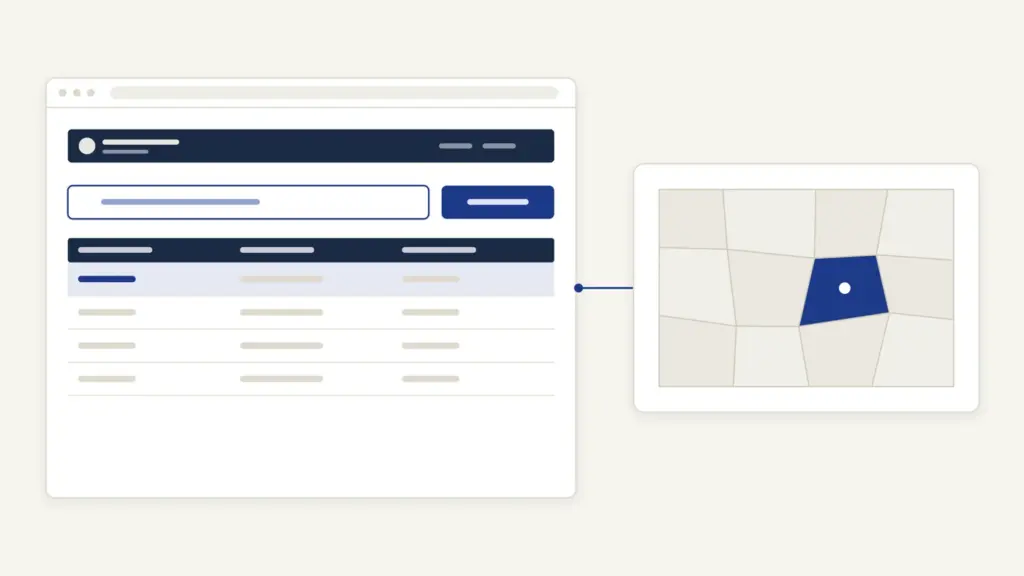
Bhu Naksha is the village map software that the National Informatics Centre (NIC) built for state revenue departments, and the name most states now use for their online cadastral map portals. A Bhu Naksha site shows the village (cadastral) map with every plot drawn and numbered. You pick district, tehsil and village, type a khasra or plot number, and the portal highlights the parcel with its shape, neighbors and recorded area. People use it to check a plot’s position before buying, to read its boundary against the record of rights, and to print a plot map.
The confusion is that there’s no single national Bhu Naksha website for the public. Each state runs its own copy on its own address, with its own labels, and a few states use different software altogether. The second confusion is legal: a Bhu Naksha screen is for viewing. Odisha’s portal says in so many words that its maps aren’t meant for any legal purpose. This guide lists the state addresses that open today, shows how to find a plot, and separates the free screen map from a copy that an office will accept.
Bhu Naksha at a Glance
Bhu Naksha is one piece of the national effort to digitize land records. The facts below come from NIC’s own Bhu-Naksha site and the state portals themselves.
| Fact | Detail |
|---|---|
| Built by | National Informatics Centre, Land Records Information Systems Division |
| Built for | Department of Land Resources (Ministry of Rural Development) directions; used by state revenue departments |
| National programme | Digital India Land Records Modernisation Programme (DILRMP) |
| What it holds | Digitized cadastral (village) maps, linked to plot numbers and the record of rights |
| Public view | Free village map and plot search on each state’s portal, usually without login |
| Search keys | District, tehsil or circle, village, then plot or khasra number; some states add a ULPIN (PNIU) box |
| Outputs | On-screen map, plot information and a printable plot report |
| Legal status | Viewing copy; certified or signed copies come from the state’s revenue office or its signed-copy service |
The wider programme, and why maps and registers had to be digitized together, is explained in the note on land records management in India.
What Bhu Naksha Is, and What It Isn’t
Bhu Naksha is first a tool for revenue officials. NIC describes it as software to meet the patwari’s needs in parcel map management: not just storing a scanned map but editing it when a mutation splits or merges plots. The public map portals are the read-only face of that working system.
NIC’s feature list explains what the software can do:
- run as a web, desktop or mobile client, on a central or tehsil-level server;
- divide a plot by several methods, including cutting a road through many parcels at once;
- build maps from field survey data, such as Field Measurement Book (FMB) sketches and electronic total station (ETS) readings;
- link each parcel to the textual record of rights (RoR);
- print a village map or plot map at any scale.
Three names are easy to mix up with it.
- NAKSHA (National Geospatial Knowledge-based Land Survey of Urban Habitations) is a separate urban survey pilot. PIB reported it running in 157 urban local bodies in its review dated 1 January 2026.
- ULPIN, or Bhu-Aadhaar, is a 14-digit alphanumeric parcel ID based on geo-coordinates. Some Bhu Naksha portals let you search by it.
- DILRMP is the funding programme; Bhu Naksha is software that states use under it.
State-wise Bhu Naksha Portals
NIC publishes an implementation list of state Bhu-Naksha addresses. Every address in this table was opened on 3 November 2026; where a state’s land records guide is live on this site, it’s linked in the last column.
| State | Map portal address | What you’ll see | Land records guide |
|---|---|---|---|
| Andhra Pradesh | bhunaksha.ap.gov.in | Survey, Settlements and Land Records portal with Citizen Login and online subdivision | Meebhoomi |
| Assam | bhunaksha.assam.gov.in | Bhunaksha map viewer | None yet |
| Bihar | bhunaksha.bihar.gov.in | Linked from the Bihar Bhumi home page; it returned a server error when checked | Bihar Bhumi |
| Chhattisgarh | bhunaksha.cg.nic.in | District, Tehsil, RI, Village, Plot No. and PNIU search | CG Bhuiyan |
| Goa | bhunaksha.goa.gov.in/bhunaksha/ | District, Taluka and Village selectors | None yet |
| Haryana | maps.revenueharyana.gov.in | Bhunaksha map viewer | None yet |
| Jammu and Kashmir | bhunaksha.jk.gov.in | Bhunaksha map viewer | None yet |
| Jharkhand | jharbhunaksha.jharkhand.gov.in | Plot No. and PNIU search, Bing or Google base map | Jharbhoomi |
| Kerala | emaps.kerala.gov.in | A landing page whose “Click to open BhuNaksha” link opens the map | None yet |
| Madhya Pradesh | webgis2.mpbhulekh.gov.in | Maps sit inside MP Bhulekh’s WebGIS 2.0 | MP Bhulekh |
| Maharashtra | mahabhunakasha.mahabhumi.gov.in | Mahabhunakasha map viewer | Mahabhulekh |
| Odisha | bhunakshaodisha.nic.in | Select district, then Proceed | Bhulekh Odisha |
| Punjab | gisbhunaksha.punjab.gov.in | District and Tehsil selectors | None yet |
| Rajasthan | bhunaksha.rajasthan.gov.in | Home, Viewmap, Contact and Login menus | Apna Khata |
| Tripura | bhunaksha.tripura.gov.in | MIS Dashboard, Bhunaksha Map and Land Bank | None yet |
| Uttar Pradesh | upbhunaksha.gov.in | District, Tehsil, Village and Plot No. | UP Bhulekh |
A few gaps are worth knowing. NIC’s list also names Himachal Pradesh, Lakshadweep and Sikkim, but those addresses didn’t open when checked, so they’re left out here. Tamil Nadu appears under CollabLand, a different NIC tool for digitizing FMB survey sketches, at collabland-tn.gov.in. West Bengal isn’t on the list at all: its plot and mouza maps come through the state’s own land records portal, Banglarbhumi, as signed plot map copies and paid mouza map sheets. Madhya Pradesh was an early user, and NIC’s news page records the launch of its Bhu-Naksha website on 11 September 2013; today its maps open through MP Bhulekh. For the full list of state record portals, check NIC’s Bhu-Naksha implementation status page, which it updates as states move.
How to Find Your Plot on Bhu Naksha
Most state portals follow the same NIC layout: selectors on the left, the map on the right. The labels change with the state’s revenue units, so read “tehsil” as circle, taluka or anchal where your state uses those terms.
- Open your state’s address from the table above. A desktop browser works best, because the map is heavy.
- Choose the district from the first drop-down.
- Choose the tehsil (or taluka, circle or anchal), and where asked the next level, such as the revenue inspector (RI) circle in Chhattisgarh or the halka in Jharkhand.
- Choose the village. The village map loads with every plot outlined.
- Type the plot or khasra number in the “Plot No.” box, or click the plot on the map.
- Read the plot details that open: plot number, area and, where the map is linked to the RoR, the recorded holders.
- Use the report or print option to save a plot report, if your state offers one.
Two habits save time. Keep a recent khatauni, khatian or RoR extract open beside the map, because it gives the exact village and plot number in the state’s format. And switch the base map (Bing or Google, where offered) only to get your bearings; the parcel lines are the record, not the satellite picture.
Bhu Naksha UP, Rajasthan, Bihar and CG
The four most searched states each have a quirk.
- Uttar Pradesh: upbhunaksha.gov.in asks for District, Tehsil, Village and Plot No. The plot number is the gata (khasra) number on the khatauni. The UP land records portal also shows a plot’s status, including its map entry, as the UP Bhulekh guide explains.
- Rajasthan: bhunaksha.rajasthan.gov.in opens to a home page; the map itself sits under “Viewmap”. The khasra number comes from the jamabandi on Apna Khata.
- Bihar: the map portal is linked from the Bihar Bhumi home page. If it doesn’t load, try later; the Bihar Bhumi guide covers the jamabandi and LPC side of the same plot.
- Chhattisgarh: bhunaksha.cg.nic.in adds an RI level between tehsil and village, and a PNIU box for searching by unique parcel number.
Screen Map, Plot Report or Certified Copy?
The free map answers “where is my plot and what shape is it?” It doesn’t settle ownership or boundaries in a dispute. Odisha’s portal carries the plainest disclaimer: its maps and data are for viewing only and not meant for any legal purpose.
NIC’s own description of the plot report explains its value and its limit. It is a printable map of the area around the plot, with location and owner information, generated at any scale. That makes it a strong working document for checking a purchase or planning a visit, but it’s still a printout from a public screen.
A copy that an office will accept comes through a different door:
- a digitally signed copy from the state’s signed-copy service, where the state offers one for maps;
- a certified copy of the map or field book from the tehsil, circle or survey office;
- for a boundary dispute, a measurement (demarcation) by the revenue staff, which compares the map with the ground.
PIB’s review dated 1 January 2026 says citizens in 19 states can now download digitally signed, legally valid land records from home. That covers records generally; whether your state signs map copies online is something to check on its land records portal before you pay for a counter copy.
Bhu Naksha and DILRMP: Where the Maps Stand
The national figures show how far map digitization has come and what remains. PIB’s Year-End Review for the Department of Land Resources, dated 1 January 2026, reported:
- cadastral maps digitized for 97.14% of the country;
- textual RoR linked with spatial cadastral maps in 84.89% of villages;
- ULPIN assigned to over 36 crore land parcels in 29 States and UTs, as of November 2025;
- a national glossary of revenue terms that maps state words such as khasra, dag and pula without replacing them.
The gap between the first two figures matters to a Bhu Naksha user. A digitized map that isn’t yet linked to the register will show the plot outline but not its holders. On 9 September 2026, PIB announced that the department would launch operational guidelines for DILRMP 3.0 with an outlay of Rs 565.50 crore, including complete digitization of cadastral maps with exact geographical coordinates and a universal Bhu-Aadhaar. That second goal is a reminder that not every village map is georeferenced yet.
Common Bhu Naksha Errors and Their Fixes
Most failed searches come from the selectors, not the server.
- Plot not found: the village or tehsil is wrong, often because the village was moved to a new tehsil or district. Check the current revenue unit on your khatauni or RoR, then search again.
- Subdivided plot numbers: a number with a slash or a letter suffix may be stored differently from how it’s printed. Click the parcel on the map instead of typing.
- Map shows, no owner details: the map isn’t yet linked to the RoR for that village. Use the state’s record portal for the holder’s name.
- Blank or frozen map: the map is large and needs JavaScript. Reload on a desktop browser, or try outside peak hours.
- Plot on screen doesn’t match the ground: the map is a record, not a measurement. Apply for demarcation at the tehsil or circle office.
- Portal not loading at all: the state may have moved the address. Recheck NIC’s implementation list or the state land records portal’s own map link.
Where to Complain About a Map Error
Bhu Naksha maps are maintained by the state’s revenue staff, so corrections start at the revenue office, not at NIC.
- Tehsil, circle or taluka office: wrong boundaries, a missing subdivision after mutation, or a plot drawn on the wrong number. Carry the RoR extract and your deed.
- Survey or land records office of the district: where the error lies in the original survey map rather than a later update.
- The state land records portal’s grievance route: most state guides on this site list the official contact and complaint channel for that state.
NIC’s Bhu-Naksha site is a product page for officials, with a login for authorized users, so it isn’t the place for a citizen complaint.
Frequently Asked Questions
What is Bhu Naksha?
Bhu Naksha is cadastral mapping software built by the National Informatics Centre under the direction of the Department of Land Resources. States use it to keep digitized village maps and to show them online, where anyone can find a plot by district, tehsil, village and plot number.
Is there one Bhu Naksha website for all of India?
No. Each state runs its own Bhu Naksha portal on its own address, such as upbhunaksha.gov.in for Uttar Pradesh or bhunaksha.rajasthan.gov.in for Rajasthan. NIC keeps a list of state addresses on its implementation status page.
How do I see my plot on Bhu Naksha UP?
Open upbhunaksha.gov.in, choose the district, tehsil and village, and type the gata or khasra number in the Plot No. box. The plot is highlighted on the village map. Take the number from a recent khatauni so it matches the record exactly.
Is a Bhu Naksha printout legally valid?
The screen map and plot report are viewing copies. Odisha’s portal states that its maps are for viewing only and not for legal use. For a court, bank or registrar, get a signed or certified map copy from the state’s land records service or the tehsil office.
Why does Bhu Naksha show my plot but not the owner’s name?
The village map has been digitized but not yet linked to the record of rights. PIB reported in January 2026 that 84.89 percent of villages had made that link, so some still show only outlines. Check the holder on your state’s land records portal instead.
What is the PNIU or ULPIN box on some Bhu Naksha portals?
It searches by the Unique Land Parcel Identification Number, the 14-digit alphanumeric code also called Bhu-Aadhaar. PIB reported that over 36 crore parcels had a ULPIN by November 2025. If your record shows one, it finds the plot without selecting the village.
Is Bhu Naksha the same as the NAKSHA programme?
No. Bhu Naksha is NIC’s map software for rural cadastral maps, used by states for years. NAKSHA is a separate urban land survey pilot of the Department of Land Resources, reported in 157 urban local bodies by January 2026.
What should I do if the Bhu Naksha map differs from the land on the ground?
Apply for demarcation, the official measurement of the plot, at the tehsil or circle office. The map is a record that the revenue staff can correct, and a measurement compares it with the ground before any change is made.
Tell Google you want more of this.
Add Anantam IAS as a preferred sourceOne tap, and this site shows up more often in your own Top Stories, AI Overviews and AI Mode. Remove it any time.